Tag Archives: Summits On The Air (SOTA)

Day 1: A SOTA Adventure To Remember (Part 1)

First of all, thank you so much Thomas Witherspoon (K4SWL) for allowing me the space to tell my recent story from my trip to Virginia. I hope you find it interesting. I certainly do not have Tom’s writing skills so I’ll do my best.

A quick introduction. I was licensed in 1983, call KA3LUW, as a Novice mostly a CW operator. I upgraded in 1992 to Extra with the 20 WPM code. I was mostly interested in DX and around 1996 went through some life changes and became inactive for several years until about 2003 when my Dad (N3FWI – now SK) gave me his Kenwood TS 450 to sell. I put up a temporary antenna and discovered PSK31. That actually got me back into ham radio as Dad let me keep the radio. At that point I changed my Extra call from WY3X to KN3A. Over the years my interest is still chasing DX and contesting. In 2015, I was chasing the W1AW year long event for the ARRL Centennial so I could confirm as many states on as many bands and modes as possible. When 2016 started, my ham friend, Mark, K3MRK told me I should get involved with NPOTA (National Parks on the Air) which was also celebrating their 100th anniversary. I was just so burned out from ARRL the prior year that I did not get involved. My interest in the hobby also started to wane as well, as I got into fitness due to health issues.

Fast forward to 2020. Mark continued to praise the now POTA program and all the fun he was having with it. It seemed to be something I would also enjoy as I could walk, hike and exercise as well as discover portable operations. On March 14, 2020, Mark convinced me to do a POTA activation with him at the local Sam Lewis State Park (K-1418) near my QTH. It was very cold and windy but we had a successful activation and I was hooked. Since then I’ve done 75 activations from 9 unique parks in 3 states. To say I am hooked is an understatement!

I have another good friend Mark, NK8Q, who is an avid Summits on the Air activator and chaser (SOTA). Mark lives about 2.5 hours west of me, and last summer we met and activated two Summits together. The first was a drive up summit and the second one required a little bit of hiking to reach the summit. I like the idea of walking, hiking and backpacking so SOTA is also something I enjoyed doing last year.

Two years in a row K3MRK and I have tried to get to Dayton, only to have them cancel due to the pandemic. I had scheduled a week off of work and decided to keep the time off and contacted Mark – NK8Q about possibly doing a backpacking SOTA adventure.

We talked about different places we could go to activate, and ultimately we decided to do several 10 point summits along the Blue Ridge Parkway, Skyline Drive and along the Appalachian Trail. For me, this was going to be not only a SOTA activation, but in some instances the activation also counts for POTA.  We both left our homes early morning on May 20 and meet in Natural Bridge, VA and we would spend the next 4 days heading north, while activating different summits. We actually realized about 100 miles north of Natural Bridge that Mark and I were only about a mile apart heading south on I-81, so we took advantage of 146.52 simplex the rest of the way to our starting point and we used FM simplex driving from summit to summit.

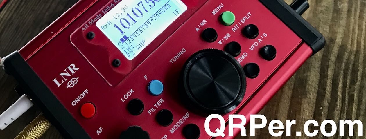
We arrived at Natural Bridge just before 10:00 a.m. and Mark asked if I wanted to activate K-3972 (Natural Bridge National Park). Sure, why not, it would be fun to do a quick activation. We found a nice spot to set up the antenna and radio. My equipment for this journey was a Sotabeams Bandspringer Midi and my ICOM 705. I put 11 QSO’s into the log the short time we were there and was a nice warm-up for what was ahead.

After the quick POTA activation, we started heading to our first summit, which was Apple Orchard Mountain (W4V/RA-001). This was along the Blue Ridge Parkway and the views heading there were spectacular. Once at the summit we explored the area and then found our operating spots. I made 20 QSO’s and 3 S2S (summit to summit).

Second summit was Cole Mountain. The parking area was about 700 feet below the summit of 4,020 ft. Most of this climb was along a private road that goes up to several towers and they were cutting the grass. They waved as we walked up and were also very close to the Appalachian Trail (AT). Cole Mountain yielded 27 QSO’s in a very short period of time.

We hiked back to the parking lot and proceeded to our next summit of the day at Petites Gap Trailhead where we went to Highcock Knob (W4V/RA-014) where we hiked about 700 feet in just over a mile. This was a fairly rocky and difficult climb and being tired from other summits and the drive down first thing in the morning, it was nice to be the last summit of the day. The elevation at the peak is 3,073. Mark and I had some issues getting our antennas through the trees at this summit and wasted a lot of time. Once the issue was resolved, I made 8 QSO’s. Mark and I decided it was time to start heading back to the parking area and call it a day. Since we were on the Appalachian Trail, we met many thru hikers heading from Georgia to their final destinations in May. Every one of them were really nice and eager to find out what we were doing at the summits and we made sure we had “trail magic” as they call it on the A.T. We carried extra water and snacks, and they were always much appreciated by the hikers. Just before we got back to the car, we met up with a hiker from Minnesota who was hanging his bear bag in a tree and he was preparing to camp for the night. When Mark and I got back to the car I thought, here I am with a cooler full of ice cold beer, I bet this man would appreciate a beer or two. I went back and he couldn’t get to the car fast enough! If you are ever hiking on the A.T. make sure you bring some trail magic as well. In the picture below, Mark was using my rig and we were right at the summit.

We left and went looking for a place to camp for the night. There were no campsites available so we stayed in a very old motel that I was afraid was going to be full of bed bugs or something. We survived and day 2 of the SOTA adventure was ready to begin.

(Part 2 is next)

Scott Lithgow (KN3A) is a contributor on QRPer.com. Click here to check out his previous posts.

Activating The Pinnacle: Amazing SOTA & POTA fun with the Elecraft KX2 and Chameleon MPAS Lite

Last Tuesday (April 20, 2021), I decided to make a detour to a park I had never visited before: Crowders Mountain State Park (K-2726).

It’s actually quite odd that I’ve never activated this park during the weekly trip to do a little caregiving for my folks: Crowder’s Mountain State Park is a reasonable detour especially compared to some of the more remote parks I’ve visited recently.

What’s really impressive about Crowders Mountain is that although it’s not as large as a national park and it’s very close to the city of Gastonia, it has no less than two unique summits that qualify for Summits On The Air: The Pinnacle and Crowders Mountain.

Both summits are accessible from the main park visitors’ center via a well-maintained trail network.

The propagation forecast looked pretty grim and after my last activation, I thought I might increase my chances of success by hiking to both summits in one visit. This made sense because I would only need 4 contacts per summit to have a valid SOTA activation and I could combine the contacts from each summit to hit 10 total contacts to activate the state park.

I decided to call the park and ask how long it would take to hike to both summits: the ranger told me “about 5 hours, or less if you’re fast.” That meant that once I added in my setup/pack up times and on-the-air time, I would be staring at a minimum of 7-8 total hours.

I (wisely) decided to pass on that opportunity. I simply didn’t have enough time in my schedule for that many hours at the park. That, and I didn’t want to feel rushed–I wanted to enjoy my outdoor time.

I decided instead to activate one summit and simply plan on spending more time on the air then plan to come back to the park for the second summit on a different day.

Before going to bed Monday night, I checked out the trail map and decided to activate The Pinnacle.

Crowders Mountain State Park (K-2726)

I arrived at Crowders Mountain State Park around 11:00 AM local–the weather was nearly ideal.

I had pre-packed all of the radio gear and supplies in my GoRuck GR1 rucksack, so once I arrived, I grabbed the pack, put on my hiking boots, a hat, and hit the trail.

I’ve read that Crowders Mountain State Park can get very busy and it’s no surprise as the park is within easy reach of Shelby, Gastonia, and the Charlotte Metro area. Fortunately, I was visiting on a Tuesday morning, and while I saw at least 30+ cars parked in the main parking lot, I passed other hikers only a few times on the Pinnacle trail. It’s a sizable park and can easily swallow 30 groups of day hikers!

I followed the orange-blazed trail to the summit of The Pinnacle.

The hike was very enjoyable and, frankly, not what I would consider strenuous, but it had enough elevation change to feel like a proper hike. I allowed an hour to reach the summit, but it only took about 40 minutes or less.

Near the summit, there’s a fork in the trail: if you take a right, it leads to the summit, if you take a left, it’ll lead you on a much longer Ridgeline Trail that will eventually take you into Kings Mountain State/National Park–you’d better believe I’ll try that one day in the future! It would be fun to activate two parks and a summit all on foot.

I took a right at the fork and the .2 mile long trail zig-zagged up the side of The Pinnacle.

I was a little surprised to be greeted by the sign above.  It’s true that the summit area is quite rocky and you have to watch your step, but this warning is a bit extreme in my opinion (especially since the SOTA activation I did with my daughter recently was orders of magnitude more dodgy!).

If you are activating The Pinnacle and don’t want to climb up the rocky path, no worries. I’m certain the area where the sign is located is well within the SOTA summit activation zone.

The Pinnacle (W4C/WP-010)

Although The Pinnacle is only a “one point” summit, when you reach the top you’re greeted by some impressive views.

The Pinnacle and Crowders Mountain are both outlying mountains so are the tallest points in the area offering beautiful, long-range vistas.

There were perhaps a half dozen hikers hanging out on the summit. I found a quite spot to set up on the side of the summit only a few meters from the top.

Gear:

On The Air

During the hike, my buddy Mike (K8RAT) sent a text noting that propagation on 40 meters was non existent. He suggested I play on 20 meters and above, possibly including 30 meters.

Later on, I found out that Mike was 100% correct. Several POTA activators that day mentioned on the POTA Facebook group that 40 meters was completely wiped-out.

I installed the Chameleon MPAS Lite vertical antenna next to me. I’ll admit that I was a little worried it might be too rocky to plunge the MPAS Lite’s stainless spike in the ground, but it turned out not to be the case.

The CHA MPAS Lite has really proven itself as an invaluable SOTA antenna. While the stainless spike adds weight to my pack, it’s less fussy than dealing with guy lines and telescoping fiberglass poles and much quicker to set up.  You do need enough ground to plunge that spike into, but if there are trees and bushes on the summit, it’s probably doable!

I started recording a video (see below) of the activation, spotted myself to the SOTA network (even though it would have likely auto-spotted me via the Reverse Beacon Network)  and hopped on 20 meters.

Solar Flare!

I had no idea at the time, but we were experiencing a solar flare which explained why 40 meters was completely wiped out.

The effect on 20 meters was simply epic.

I called CQ and was instantly rewarded with a long, continuous string of stations. Within 26 minutes, I had already worked 23 stations with 5 watts and the MPAS Lite vertical. A stark contrast to my previous POTA activation.

The view from my shack

And here’s the thing: the flare opened up 20 meters to local/regional stations as well. I worked stations as close as South Carolina, Georgia, and Tennessee–this is simply unheard of normally. Of course, stations on the west coast were also booming in.

I was a little surprised I didn’t log any European stations on 20 meters, but I suspect they were having a difficult time competing with the strong signals from North America during the flare.

I short: the band opening was amazing fun and even renewed my faith in our local star just a wee bit. (Ha ha!)

After playing on 20 meters, I decided to try 17 meters.

Wow! Without a doubt, I worked more stations on 17 meters in short order than I’ve ever worked during a field activation. In 10 minutes, I worked 12 stations. As with 20 meters, the flare opened up stations that would normally be in my 17 meter skip zone.

Here I was worried about logging the ten stations needed to validate my park activation!  After logging 35 total contacts, I decided to pack up.

Here’s a QSO Map of the activation (click to enlarge):

Video

Here’s one of my unedited real-time, real-life videos of the entire activation:

(Click here to view on YouTube)

Although the weather app on my phone wasn’t showing any afternoon thunderstorms nearby, there were some patchy dark clouds forming on the other side of the summit and the winds were shifting, so I decided to call it a day and enjoy the hike back down the mountain.

Fortunately, the clouds never amounted to anything but I don’t take my chances with spring weather–it’s fickle, especially along the North Carolina/South Carolina line. That, and frankly, I needed to stick to my travel schedule.

I took my time on the way back down and simply soaked up the outdoors.

I love doing field activations of all types, but I’ll admit that I’m becoming addicted to Summits On The Air because of the hiking opportunities it presents.

There are few things in the world I enjoy more than hiking.

When I’m on a trail, all of my concerns seem to dissolve.

Perspective

On the return hike, I passed by a group of three hikers. All of them were staring at their phones while hiking and one tripped on a tree root in the path. They caught themselves before hitting the ground.

I’ll admit I was thinking at the time that mother nature was saying, “Hey! Wake up, disconnect and enjoy the beauty around you! You need some perspective!” 🙂

I’m already looking forward to visiting Crowders Mountain State Park again.  I believe I’ll return within a month and hike to Crowders Mountain, activating both the summit and park.

Sometime, I’d like to hit the trails as soon as the park opens and, perhaps, activate both Crowders Mountain and Kings Mountain parks on foot. That would likely take an entire day when I include the time on the air, but it would also be a lot of fun.

I was telling my wife yesterday that I actually enjoy writing up the odd field report on QRPer. It hit me that there are a couple of reasons why…

For one, a number of readers have reached out and thanked me because they enjoy living vicariously through my field reports and videos.  I get it. My family and I enjoy watching YouTube videos of travelers around the world. We avoid the personality-driven channels and focus more on those that are less “produced.” It gives us an opportunity to travel to, say, Spain, France, Finland, or Turkey when we can’t presently do so. It pleases me to no end thinking that my reports and videos could, even in some very small way, offer a little vicarious travel to others.

Secondly, writing up these reports gives me an opportunity to re-experience some of my field time and sort through photos I might have taken along the way. Although it takes a few hours to write a report, I truly appreciate the experience.

Thank you, dear reader, for spending time with me during this outing!


Do you enjoy QRPer.com?

Please consider supporting us via Patreon or our Coffee Fund!

Your support makes articles like this one possible. Thank you!

My path to learning CW and activating parks and summits

One of the most common questions I receive on my YouTube Channel is on the topic of how I learned CW and started doing CW field activations.

I’ve often told new hams or those who want to learn CW that there is no “one path” to learning CW. Mine was certainly not a straight path, and I believe very few are.

I will state up-front that there are a number of resources out there for learning CW, including apps, programs, audio recordings, and clubs.

One resource with a loyal following is the Long Island CW Club.  I’ve heard so many rave about their program, it’s certainly worth exploring.

My Path to CW

I first learned about amateur radio in high school from a Curtis Mathis TV repairman house call. As he diagnosed an issue with our living room television, I held the flashlight and probably asked dozens of questions about the components inside. He eventually looked at me and said, “Have you ever heard about amateur radio?

After showing him the shortwave listening station I’d put together in my bedroom (all centered around a Zenith Transoceanic), he suggested I stop by a local RadioShack and pick up study material for the Novice license.

In 1988, the first steeping stone into amateur radio required learning enough CW/Morse Code to pass a simple five word per minute test along with a written exam.

I eventually purchased Gordon West’s exam prep package which included the book and cassette tapes to help with my studies.

I was in high school at the time, though, and involved in a lot of extracurricular activities including my high school marching band, scouts, I volunteered at our local community theatre, was in a brass quintet, played bass in the high school jazz band, and I even played Tuba for our local college band. I had too much on my plate already. Then, I did my undergraduate studies including a year in France and put off my license even longer.

After graduating college/university in 1996, I worked briefly at a RadioShack and found the time to start studying again. Through the encouragement of my good friends and Elmers Mike (K8RAT) and Eric (WD8RIF), I studied the written material for my Novice and Technician exams, and also the cassette tapes for my 5 word per minute CW exam.

In early 1997, I took and passed all three components to snag my (then) “Technician Plus” license.

I planned to learn 13 words per minute to pass my General class license, but the FCC actually dropped the code requirement altogether.  I passed my General in 1998 or 1999, and moved to Europe and the UK for a few years with my employer.

After moving back to the States, I tried to get back into CW, but again put it off thinking the learning curve would be too great.

Then in 2007, I had a break in employment and had free time at home. I pulled out those Gordon West tapes and worked through the entire course again.

The moment I could confidently copy all of the letters, all of the numbers, and a few abbreviations, I called my buddy Mike (K8RAT) and asked him to meet me on the air.

I was nervous, but I was communicating with a friend who was happy to slow down to 5 words per minute (not an easy task, mind you, when you’re used to 20WPM+!).

Mike and I had a daily morning QSO and that built my code speed up to 13-15 WPM in short order.

I learned that after your brain assimilates each Morse Code character, it’s then all about recognizing the sound of each character and abandoning any in-head translating of dits and dashes which slows you down. This is the ideal approach to any language: you need instant recognition to build speed. It’s not hard to do and, in fact, and our brains are wired to do this automatically.

After I started building confidence with code and doing 3 way 13 WPM ragchews with Mike and Eric on 80 meters, I started another huge project: building a house.

The house build took the better part of three years and it absorbed all of my time (that and my wife and I also had toddlers at home!).

We eventually moved into our house and I set up a permanent shack. I would occasionally hop on the CW bands, but usually just to test CW performance for transceiver and receiver reviews.   In other words, I let my CW skills slip again.

Parks On The Air

It wasn’t until last year (2020) during the pandemic that I decided to build my CW skills to a point that I could complete a Parks On The Air (POTA) CW activation.

What was the motivation?

1.) POTA and SOTA activators who schedule their activations can be automatically spotted via the Reverse Beacon Network (RBN). This means if you’re at a site that has no mobile phone coverage, the system may automatically spot and re-spot you from your CW CQ calls.  Since 60% of the sites I activate have no mobile phone or Internet coverage, this was a HUGE motivating factor.

2.) Let’s face it: CW is the ultimate mode for the portable operator. CW is simply more efficient and effective with your power output than voice modes like SSB, AM, or FM. Unlike modern digital modes, which are also more efficient than voice modes (think FT8/FT4), you need no special equipment or a computer as an interface.

3.) CW is a skill and, frankly, I wanted to improve that skill. I knew CW activations would be a wonderful motivator and excuse to practice.

Morse Runner

In May 2020, I started using a free program called Morse Runner to prepare for CW activation and potential pileups. Click here to read about my experience with Morse Runner.

Hunting

I also started hunting CW activators in the POTA program from home. The exchange is pretty simple, so it was easy to do. This also gave me the opportunity to learn common exchange communications and abbreviations.

Contests and DX

I started working DX stations in CW. As I mentioned in a previous post, the exchanges are very formulaic.

I also made a point of working CW stations in the 2020 ARRL Field Day and during the 2020 13 Colonies event.

My first CW activation

I’ll admit that I was nervous, but Hazel was pretty darn relaxed.

As I started to build a little confidence on the air–and before I had could talk myself out of it–on July 25, 2020, Hazel and I took my field radio kit to the Blue Ridge Parkway and I completed my first CW activation. Click here to read the details.

In short? It was actually a bit easier and more enjoyable than I had imagined.

Although I would get some butterflies at the start of the next few CW activations, CW quickly became my mode of choice. Why? For one thing, CW is a very narrow mode which means it’s super easy to find a clear frequency. CW also copes with QSB, QRN, and QRM much better than SSB. Frankly, there are also less LIDS on the CW bands.

There’s another reason that’s hard to explain, but I’ll try: when I operate in CW, I find that it takes my mind off of everything else going on in the world. When I’m listening to and sending code, it becomes my focus and somehow it’s very relaxing. I find it a bit of a refuge.

Finally, I have an appreciation of radio history and nostalgia so it’s fun to operate such a simple, early mode that’s still so incredibly effective.

What was your CW Path?

So there you go! CW is now my mode of choice. Even though I don’t even have one year of CW activations under my belt at time of posting, I operate it 95% of the time I’m in the field. I still love phone contacts–don’t get me wrong, I’m not a CW-only guy–but I prefer CW these days.

I would love to hear about your path to learning CW. What tools and resources did you use? Did you have any mentors that helped you along the way? Are you still learning CW? Please comment!

Rendezvous Mountain Field Report: Activating three individual sites on one summit!

Last Wednesday (April 7, 2021), I managed to block out most of the day to play a little radio in the field. When I have opportunities like this, I usually take one of two approaches: either make a multi-park and/or summit run, or go further afield and activate a site or two on my bucket list.

I chose the latter.

Two of the very few sites from my 2020 Park Bucket List that I hadn’t managed to activate were Rendezvous Mountain Educational State Forest and Rendevous Mountain State Game Land. When I created my bucket list, both of these parks were very rare: one was an all-time new one, the other had only been activated once. In 2021, they were still rare but both had activations logged.

When two park entities are this close together, I will do my at-home research in advance and search for a spot where the boundaries of the two parks might overlap opening an opportunity for a one activation two-fer.  Although there are exceptions (like Elk Knob)  when a park and a game land share a common name, there’s a decent chance their boundaries overlap, possibly even in an accessible area.

Fortunately, I discovered last spring that Rendezvous Mountain did indeed have an accessible spot where both the game land and state educational forest meet. I pinpointed it on Google Maps and embedded the URL in my park bucket list spreadsheet:

I can’t overstate how important one of these lists is to an activator who loves exploring different  sites. When the weather outside is horrible and activating isn’t a good option, spend your time indoors doing research for a day when you can hit the field!

Tuesday evening, I decided to finally hit this Rendezvous Mountain two-fer. Since the weather was forecast to be beautiful, I also wanted to fit in a proper hike, so I started searching for a nearby summit as well.

Click to enlarge

Turns out, there was a SOTA summit called “2543” (named after its height above sea level in feet) that was accessible from a Rendezvous Mountain Educational State Forest parking area. An easy four mile round-trip hike. Score!

Next, I found the 2543 summit on a topo map and compared it with the location I’d already plotted for my two-fer. Turns out, they were very close to each other–likely within 100 meters. I was able to confirm with confidence that the summit and game land could be activated at the same time. The state forest map was a little too vague to confirm its exact boundary.

I originally found this site using the NCWRC maps and topo/trail maps.

Here’s the interesting part: the game land parking area I planned to use was within 50-100 meters of the SOTA summit. If I wanted to, I could easily turn this summit into a drive-up activation. But again, I wanted to hike, so I plotted a trip to the parking area of Rendezvous Mountain Educational State Forest.

My plan was to hike to the summit, activate it and the game land as at the same time, then hike back to the Rendezvous Mountain Educational Forest’s parking area, grab a picnic table and activate the state forest separately.

I arrived on site around 11:30 and spent a few minutes confirming that I was hitting the correct trail (as there are multiple trails in this forest).

The trail head is at the last parking area, simply keep following the paved road which quickly turns into a gravel/logging road.

Turns out, it couldn’t be easier to find the summit trail (should you decide to make this same activation): simply drive to the last parking area in Rendezvous Mountain Educational State Forest, and continue walking up the road past the metal gate. This road will take you past the visitor’s center, turn into a gravel road, then pass the fire tower road on your right.

Simply continue following the main road for two miles. There are a few branches on this road and I did take one thinking I was sticking to the main road, but quickly discovered it was a dead end and had to back-track. In general, follow the most traveled road and you’ll be fine.

The summit is fairly nondescript since it’s lower in altitude and covered in trees. Look for a short spur road, two miles in, near the game land gate (where you could park if you wanted to do a drive-up activation).

As I hiked to the site, I realized that the logging/access road is actually the boundary between the game land and the state forest. A promising sign!

When I arrived at the short spur road that ended on the summit of 2543, I was very pleased to discover that the game land/forest boundary followed the spur road and was all well within the SOTA activation zone! Brilliant!

Rendezvous Mountain State Game Land (K-6941), Educational State Forest (K-4859), and
SOTA Summit 2543 (W4C/EM-082)

The game land, state forest, and summit all met on an old road bed that was flanked by tall trees.

This meant that I could activate all three sites in one go and–since there’d be no need to activate the state forest separately–still have enough time to perhaps activate Kerr Scott Game Land later in the afternoon on my way home.

You can see the state forest sign on the left, the game land sign on the right–both within the SOTA activation zone.

Point of clarification about park boundaries and “two-fers”

POTA is fairly clear about where park boundaries are in terms of counting a park in an activation, “The activator and all the equipment you use must be within the perimeters of the park, and on public property. […] If the park is part of a trail system or river, you need to be within 100 feet of the trail or river.”

In order to claim a two-fer, there needs to be park overlap. Technically,  you can’t straddle a map line between two (non-river/trail) park sites and activate them as a two-fer because you and your equipment can’t be in both places at the same time if there’s no property overlap. In POTA, there is no buffer area around a park unless it’s a trail or river.

SOTA is specific and gives you a 25 vertical meter activation zone which forms a contour line around the true summit (not a secondary, nearly as high area). Little room for interpretation here.

For Rendezvous Mountain, I decided it was a POTA two-fer because I activated on a road that is also a marked and blazed trail used for recreation/access for both the game land and forest–and both of these areas are a part of the over-arching Rendezvous Mountain State Forest.

Had this been a boundary defined by an imaginary (surveyed) line without a common trail or road, there would have been no point of overlap, thus no two-fer.

This was actually the first time I had been in this particular situation. All of the other multiples I’d activated in the past had vast areas of geographic overlap.

Again, no one but the POTA activator actually knows the truth, and it would be incredibly rare that anyone would ever question you after your logs have been submitted. There is no POTA Police and it’s not even a contest–it’s a group activity. It’s all about following the rules to the best of your ability, exercising due diligence,  and being honest with yourself.

Now where was I?

Gear:

At the site, I used my new compact arborist throw line bag.

It worked even better than I had expected.

I was concerned that the line wouldn’t deploy as smoothly as the line does from my larger arborist storage cube, but it deployed perfectly!

On the air

I deployed my Vibroplex EFT-MTR end-fed antenna across the road bed and connected it to my Elecraft KX2 with attached KXPD2 paddles.

This made for a very compact and simple setup: in situations like this, I love the compact size of the KX2 since it can easily fit on my clipboard where I also log on paper.

I also brought along my Google Pixel 3 and made a video of the entire activation (see below).

Propagation was very unstable, but I hoped that this site would be rare enough to attract SOTA, POTA, and WWFF chasers thus helping me log my needed 4 for SOTA and 10 for POTA/WWFF.

I first hopped on 20 meters CW where I quickly worked seven stations in eight minutes–from Utah and Arizona, to France, Spain and Germany. An excellent start!

I then hopped on 30 meters (using the KX2’s ATU instead of removing the SMA cap on the EFT-MTR), and worked one station in Missouri.

Next, on 40 meters CW, I logged another six stations in six minutes.

I then connected the microphone and worked a Summit-To-Summit contact on 20 meters SSB. I was very pleased to put K4AAE/P in the logs because I had difficultly working other stations on 20M SSB.

Finally, I moved to 40 meters SSB and worked a total of four stations in five minutes.

All-in-all, a total of 19 contacts logged in a total of 45 minutes on the air.  Not bad for QRP on a poor propagation day!

QSO Map

Video

I made one of my real-time, real life videos of the entire activation. Check it out below or via my YouTube channel:

Photos

As I hiked back to the car, I took my time and enjoyed the weather, the hike, and the solitude. Here are a  few extra photos from the camera roll:

Thank you for reading this field report!

If you ever pass by North Wilkesboro, North Carolina, I highly recommend this site. It’s very rare that you find a site that is a SOTA, POTA, and WWFF entity and that can be activated by a pleasant 4 mile RT hike, or as a drive-up.

I’ll plan to hit Rendezvous Mountain again next year!


Do you enjoy QRPer.com?

Please consider supporting us via Patreon or our Coffee Fund!

SOTA and POTA Field Report from Mount Jefferson State Natural Area

On Monday, March 22, 2021, I performed three QRP field activations in one day. I started off the day with a visit to Three Top Mountain Game Land, and then headed to Mount Jefferson State Natural Area for a POTA and SOTA activation before heading to New River State Park.

When plotting my multi-site activation day, I picked Mount Jefferson because it’s a SOTA entity (W4C/EM-021). I only realized later that it’s also a POTA entity (K-3846). I mistakenly assumed Mount Jefferson was a county park rather than an NC state park.  To do both a POTA and SOTA activation simultaneously is ideal!

Mount Jefferson (W4C/EM-021)

This was my first visit to Mount Jefferson and, frankly, I wasn’t sure what to expect in terms of hiking.

The park itself is amazing! North Carolina parks never let me down.

The entrance is near the base of the mountain and very close to the town of West Jefferson. The park road climbs up the side of Mount Jefferson –there are a number of spots to park, hike, and picnic.

I had not checked the trail map in advance, but I had read that the summit trail was accessible from the parking and picnic area at the end (top) of the park road.

I hopped out of my car, grabbed my SOTA pack, and very quickly found the trail head.

The trail is impeccably maintained and wide enough for vehicle use (no doubt these trails double as access for tower maintenance on the summit).

The hike to the summit from the parking are was incredibly short–about .3 miles. Normally, I’d want a much longer hike, but since I was trying to fit three site activations in a span of four hours, I didn’t complain.

On top of the summit, one is greeted by a typical cluster of transmission towers.

While I appreciate checking out antennas and towers, these are never a welcome site because they can generate serious QRM, making a SOTA activation difficult.

I also found a park weather station on the summit. Nice!

I searched around and found a spot to set up well within the activation zone but giving me a bit of distance from the towers.

Gear:

My Yaesu FT-817ND was desperate to get a little SOTA action, so I decided to pair it with the Chameleon CHA MPAS Lite using the Elecraft T1 ATU to find matches.

After putting the FT-817 on the air, I was very pleased to hear that the nearby transmission towers and power lines weren’t causing any noticeable interference.  This was a very good sign because, frankly, propagation was very unstable that day and I had real concerns about being able to work stations on 40 meters.

I hopped on the air and quickly realized I’d forgotten to hook my external battery up to the Yaesu FT-817ND. This meant I was running something closer to 2.5 watts as opposed to a full 5 watts. I decided to attempt the activation without the external battery and add it if needed.

I started operating on 20 meters and was very pleased to quickly rack up a number of contacts. I could tell that most of these contacts were via SOTA because I recognized the calls and primarily SOTA chasers.

Within 11 minutes, I worked 10 stations on 20 meters in CW. I was very pleased with how quickly those QSOs rolled in and how easily I logged the four needed for a valid SOTA and 10 needed for POTA activation–all on 20 meters.

Next, I moved to 40 meters where I worked two stations and 30 meters where I worked one. For sure, 20 meters was a much stronger band than 40 and 30 turned out to be.

After working 13 stations, I packed up.

Obviously, 2.5 watts was plenty for this activation!

I would have loved to stay longer, but frankly, I needed to stick to my schedule because I had one more park to fit in that day! (More on that in a future post and video!).

Here’s my QSOmap for the Mount Jefferson activation:

And here’s my full log:

Video

Even though I was a bit pressed for time, I still made one of my real-time, real-life videos of the entire activation. I hope you enjoy:

Next up will be an activation of New River State Park. I hope to post this early next week.

Thank you so much for reading this report!


Do you enjoy QRPer.com?

Please consider supporting us via Patreon or our Coffee Fund!

Your support makes articles like this one possible. Thank you!

Activating Elk Knob State Park for SOTA, POTA, and WWFF

On Monday, March 8, 2021, I had a very rare opportunity: nearly a full day to play radio!

I debated where to go the night before and I had a lot of ideas. Do a multi-park run?  Activate some new-to-me parks a little further afield? Hit a SOTA summit?

While it was very appealing to plan a multi-park run for POTA/WWFF, I really wanted to stretch my legs and activate a summit. The weather was glorious and it dawned upon me that we’ll soon be entering the season of afternoon thunderstorms which will, no doubt, have a negative impact on my summit plans for the next few months since afternoons are typically when I have time to do activations.

After examining the map, I decided to go to Elk Knob State Park. The summit of Elk Knob is a SOTA site and the park is in both the POTA and WWFF programs.

Last year, I activated Elk Knob State Park and really enjoyed the experience.

The round trip hike to the summit (adding in a little trail loop around the park) would amount to about 4 total miles and an elevation increase of roughly 1,000 feet.

Monday morning, I left the QTH around 9:00 and arrived at the park around 11:15–it was a proper scenic drive.

The 1.9 mile hike to the summit took me about 45 minutes. The path was amazingly well maintained: 4′ wide with crushed stone most of the way.

One of the nicest trails I’ve been on in ages–Elk Knob State Park is quickly becoming one of my favorite NC State Parks.

There aren’t any antenna-friendly trees on the summit, so I was happy that I packed the Chameleon MPAS 2.0.

At first, I planned to only bring the top section of the MPAS 2.0 vertical to save space, but the hike was so short, I brought the lower aluminum sections as well. I’m glad I did.

Deployment of the MPAS 2.0 was quick and I the Elecraft KX2‘s internal ATU found a match on 20 meters very quickly.

Elk Knob (W4C/EM-005)

I spotted myself using the SOTA Goat app and received quite a 20 meter CW pileup! As you’ll see in my video below, it was testing the limits of my CW skills for sure.

With 5 watts, I quickly worked stations to my east in France, Spain, and Germany, and to my west all over the west coast of North America. It was a hoot!

I eventually moved to 40 meters and operated a bit, but 40 was suffering from poor propagation so stations that are normally quite strong, were weak that day.

I needed four stations for a valid SOTA activation and 10 stations for a valid park activation. I logged a total of 38 stations in 56 minutes. 75% of those contacts were on 20 meters.

Video

Here’s one of my real-time, real-life videos of the entire activation (less a small amount I removed while eating a quick bite):

When people tell me running QRP is like “trying to play radio with both hands tied behind your back” I’ll show them this video. 🙂

AGN?

While the hike, the weather, and the signals were all in my favor, I’ll admit I wasn’t on my “A Game” that day. We all have days like this where we struggle to copy, to keep up with the flow of contacts, and to send correctly.

In recent weeks, I’ve gotten a number of emails from readers and viewers who said they had a less-than-smooth SOTA or POTA activation and felt a wee bit embarrassed on the air when they struggled copying.

But you know what?

No worries!!!

This is all about having radio fun in the field, enjoying a hike, taking in the views, and soaking up the beautiful weather! It’s not a contest and we have nothing to prove to anyone.

I can also promise you that any chaser/hunter who has ever activated a field site will completely understand if they have to send their call a couple extra times or if they (heaven forbid!) have to re-send their call after you incorrectly copy a character.

This is totally normal.

Be easy on yourself and enjoy the ride. Even on days when I don’t feel like I’m 100% in the groove, I find doing a summit or park activation clears my mind and resets my soul.

My policy? When a mistake is made laugh it off and move on!

Photos

Here are a few extra photos from the Elk Knob hike:


Do you enjoy QRPer?

Please consider supporting us via Patreon or our Coffee Fund!

Your support makes articles like this one possible. Thank you!

SOTA: “Inside the Summit-Obsessed World of Ham Radio”

Many thanks to Steve (WG0AT) who shares the following article which features him and some of his SOTA friends:

(Source: Outside Magazine)

Inside the Summit-Obsessed World of Ham Radio

It’s like biathlon, but for geeks

On a gray Friday afternoon last spring, Steve Galchutt sat high atop Chief Mountain, an 11,700-foot peak along Colorado’s Front Range. An epic panorama of pristine alpine landscape stretched in almost every direction, with Pikes Peak standing off to the south and Mount Evan towering just to the west.

It was an arresting view, and the perfect backdrop for a summit selfie. But instead of reaching for his smartphone, Galchutt was absorbed by another device: a portable transceiver. Sitting on a small patch of rock and snow, his head bent down and cocked to one side, he listened as it sent out a steady stream of staticky beeps: dah-dah-di-dah dah di-di-di-dit. “This is Scotty in Philadelphia,” Galchutt said, translating the Morse code. Then, tapping at two silver paddles attached to the side of the radio, he sent his own message, first with some details about his location, then his call sign, WG0AT.

At this point, a prying hiker could have been forgiven for wondering what, exactly, Galchutt was doing. But his answer—an enthusiastic “amateur radio, of course!”—would likely only have further compounded their confusion. After all, the popular image of an amateur-radio enthusiast is an aging, armchair-bound recluse, not some crampon-clad adventurer. And their natural habitat is usually a basement, or “ham shack,” not a windswept peak in the middle of the Rockies.

Galchutt fits part of this stereotype—he’s 75—but the similarities end there. An avid hiker and camper, his preferred shack is atop a mountain, and the higher the summit, the better.

Another rapid-fire burst of dits and dahs sprung from the radio. “Wow!” Galchutt said, “Spain!”

Nearby sat Brad Bylund (call sign WA6MM) and Bob and Joyce Witte (K0NR and K0JJW, respectively). Together, the four are part of a group called Summits on the Air (SOTA), an international, radio version of high pointing. […]

Continue reading the full article at Outside Magazine.

SOTA Field Report from Rocky Face (W4C/WP-006)

One of the things I love about POTA and now SOTA is that it gives me a reason to venture out and explore parks and other public lands that might have otherwise never shown up on my RADAR.

Rocky Face is a prime example.

On the morning of Wednesday, March 10, 2021, I would have never guessed that by noon I would be standing on the summit of Rocky Face. That morning, I had planned to activate the summit of Baker’s Mountain–a park and summit I know very well as I’ve hike the trails there almost monthly and the mountain is a stone’s throw from my parents’ home.

That morning, when I arrived at Baker’s Mountain Park and the gates were shut, I remembered that they are closed on Wednesdays.

Oops.

I was determined to hike to a summit, though, so I grabbed my iPhone and launched the SOTA Goat app, then searched for nearby summits.  That’s when I noticed Rocky Face which was *only* a 40 minute drive from Baker’s Mountain. I had heard of this 1 point summit and park, but had never been there, so why not take a little road trip and explore?

Rock Face (W4C/WP-006)

View of Rocky Face from the road.

It was a very pleasant drive which was made all the better by gorgeous sunny weather.

When I arrived on site, I was surprised to see just how well developed this park was. There were two different parking areas, a visitor’s center, picnic area, rock climbing face, playground, and numerous trails. There’s even a large area for outdoor events.

I took the “Vertical Mile Challenge” to the summit (which I would recommend) and was more of a workout that one might imagine for a 1 point 576 meter summit.

The trail was very well maintained. The ascent up the granite slope offered some welcome views of the surrounding area.

I was a little surprised to find some Nodding Trilliums blooming on the side of, and even on the path. A sure sign spring is on the way!

March 10th was also one of the warmest days of the year so far.

On the summit, there were actually a couple of picnic tables–a total surprise which made this SOTA operation feel somewhat luxurious!

On The Air

I set up the Elecraft KX2 and Chameleon MPAS 2.0 which were still packed from a SOTA activation two days earlier at Elk Knob (I’ll post a report of that activation in the near future).

I had not charged the Lithium Ion pack in the KX2 after the Elk Knob activation, but I assumed I’d still have enough “juice” to get me through the Rocky Face activation at 5 watts.

I started by calling CQ SOTA on 20 meters. A friend told me that propagation was very unstable, so I feared the worst. Fortunately, 20 meters was kicking (40 meters much less so).

Right off the bat, I worked stations in France, Germany, Slovenia, Quebec, Spain, and all of the west coast states of the US. It was so much fun and exactly why I love QRP and playing radio in the field.

As I switched from 20 meters to 40 meters, some hikers passed by. Turns out it was my cousin and her husband–what a surprise! Of course, they had no idea what I was up to, so I ended up explaining not only SOTA, but amateur radio and why I was using CW (yeah, I cut that bit from the activation video below).

They moved on and I hit 40 meters which was hit harder by the poor propagation. Many stations I regularly work were a good 2-3 S units lower in signal strength.

I am certainly looking forward to some stable propagation eventually! Still…very, very pleased with the 24 stations I worked and the QRP DX as well.

Here’s a QSOmap of my contacts–all from 5 watts and a vertical:

Video

Here’s a video of the entire activation:

Click here to view on YouTube.

Rocky Face turned out to be a fun little hike, productive activation, and a great opportunity to explore a new summit and park. I’ll certainly return!


Do you enjoy QRPer and the SWLing Post?

Please consider supporting us via Patreon or our Coffee Fund!

Your support makes articles like this one possible. Thank you!

SOTA Field Report: Activating Lane Pinnacle with the Elecraft KX2 and CHA MPAS Lite

I’ll let you in on a little secret. Don’t tell anyone, but I held off making my first Summits On The Air (SOTA) activation  until the stars aligned and I could activate one particular summit completely on foot from my QTH.

Last Thursday (February 25, 2021), my daughter and I hiked to Lane Pinnacle (W4C/CM-018) and performed my first Summits On The Air (SOTA) activation.

Why did I wait so long?

We live in the mountains of western North Carolina where (obviously) there are numerous SOTA summits to activate.

But I wanted Lane Pinnacle to be the first.

Why? Well, it’s the one summit I can hike to directly from my house with my daughter Geneva (K4TLI) and enjoy a proper father/daughter day hike.

I had planned to do this hike last year, but I injured my ankle and let’s just say that the hike to Pinnacle isn’t a beginner’s run.  I knew my ankle would need to properly heal before the journey.

This is also more of a late fall to very early spring hike due to the amount of thick foliage we knew we would have to mitigate. It’s so much easier to keep your bearings when there are no leaves on the trees nor on the green briar!

Last Thursday, I felt confident that my ankle was up to the task. We had a break in the weather as well with moderate temps and lots of sunshine (this, after several days of rain). We knew things could be muddy and slippery, but we also knew that with my busy schedule this might be our last chance to hit the summit before the mountains green up.

So we packed a lunch, plenty of water, radio gear, and (of course) emergency/first-aid kits while trying to keep our backpacks as light as possible.

Hitting the trail!

The first part of the hike requires trailblazing to a ridge line. The distance is short, but the ascent is steep (about 800 feet).  We hike this portion regularly, so knew how to pick our path and avoid the steeper, slippery bits.

K4TLI lead the way!

On the ridge line, we intersected an established single track trail and enjoyed the hike across a couple of smaller summits until we intersected the Blue Ridge Parkway.

If I’m being honest, I had some serious concerns that the trailhead to Lane Pinnacle would be closed. This portion of Blue Ridge Parkway is currently closed to motor vehicles (for the winter season) and I had noticed a number of “trail closed” signs on other portions of the parkway.

Guessing this may be a type of shelf fungus?

If the trail was closed, I planned to simply activate the parkway and Pisgah National Forest for the POTA program. I never hike on trails that have been closed by the park service because I like to obey the rules and I certainly don’t want to paint SOTA activators in a bad light.

When we crossed the parkway, we were incredibly pleased to see that the trailhead was open.

The ascent from the parkway to Lane Pinnacle is about 1,000 feet (305 meters) of elevation gain over a pretty short distance. The trail we were taking–turns out–was primitive. It basically lead us straight up the slope (no switch backs following lines of elevation, for example) and simply fizzled out about one third of the way up.  We could tell it isn’t traveled often at all (although we did find a massive fresh bear track in the mud on the trail!).

Obligatory SOTA report “foot in snow” photo. 🙂

I bushwhacked our way to the top–at times, the slope was about 45 degrees and slippery, but we easily found our way to the summit where our goat path intersected the Mountains To Sea trail.

We found an amazing overlook and took in views of the Bee Tree Reservoir as we ate our lunches.

Geneva grabbed her dual-band HT and made the first summit contact with our friend, Vlado (N3CZ) on 2 meters FM.

On the Air

I knew there would be short trees on the summit of Lane Pinnacle, but I also knew that I wanted to get on the air as soon as possible to allow extra time for our hike home.

I did pack a super compact wire antenna, but opted instead for the Chameleon CHA MPAS Lite vertical. I paired it with my Elecraft KX2.

Gear:

The great thing about the CHA MPAS Lite is how quick it is to deploy–it might have taken me all of three minutes.

Since it was noon, I decided to start on the 20 meter band. I found a clear frequency, started calling “CQ SOTA” with the KX2 memory keyer, and spotted myself to the SOTA network via the excellent SOTA Goat app on my phone.

I had also scheduled my activation on the POTA website in advance because Lane Pinnacle is in Pisgah National Forest (K-4510). My buddies Mike (K8RAT) and Eric (WD8RIF) were also helping to spot me in the unlikely event I wouldn’t have cell phone service on the summit.

Within 20 seconds of submitting the spot to the SOTA network I had a CW pileup.

In all of my hundreds of field activations, I can’t think of a single time that I generated a CW pileup on 20 meters in such short order with five watts and a vertical.

The first station I logged was N1AIA in Maine. The second station was F4WBN in France.  The race was on!

It took every bit of CW skill I had to pull apart the stations on 20 meters. It was so much fun!

I eventually worked Spain and all of the west coast states (WA, OR, and CA) and numerous stations throughout the Rockies and Midwest.

I then moved to 40 meters where I worked stations in the Mid-Atlantic, Ohio Valley, and in the Southeast.

In the end, I had to keep my total time on the air short because I wanted to take my time finding a path from the summit back down to the Blue Ridge Parkway.

In 30 minutes I worked 30 stations. I’m not a seasoned CW operator, so this was quite the accomplishment.

Here’s a QSOmap of my contacts:

I was chuffed! What a fabulous activation to kick off my SOTA adventures.

Video

This time, I did not make a video of the actual activation. For one thing, I didn’t want to carry a folding tripod for the camera and I didn’t want to ask my daughter to film it either. I wanted to keep things as simple as possible to make the most of the airtime I had.

I did, however, make a short video before and after. You can check it out on my YouTube channel:

Hiking home

I really wish we could have stayed on the summit for an hour longer making contacts, but I knew it would be wise to allow extra time to descend Lane Pinnacle especially since I knew a front was moving through later that day.

I decided it would be easier to do my own bushwhacking back down the mountain rather than try to retrace our previous steps. We took our time and I followed elevation lines to make it slightly less steep. Since I took a more south westerly descent, when we reached the parkway, we had to hike north to reach the original trailhead.

The rest of the hike was totally uneventful and incredibly fun. The weather held and we took in the views, the wildlife, and invaluable father/daughter time.

That was the first strenuous hike I had done in months due to my ankle, so let’s just say I was feeling “spent” after our 6.5 hour adventure taking in 2,000 feet (610 meters) of elevation to the summit.

I knew it was bad when I even dreaded walking upstairs to take a shower.  I think I remember telling my wife, “I’m never building a house with stairs again!”

More SOTA!

Now  that I’ve got Lane Pinnacle in the books, I’m ready to start hitting the summits! I’ve got a lot of pent up SOTA energy!

My goal is to activate a total of ten this year. That may sound like a modest number, but since at this point I’m less interested in “drive-up” summits, it’s more difficult to fit SOTA summits into my schedule than, say, typical POTA/WWFF parks.

In fact, I’ve already plotted my next SOTA activation and hope to do it within the next couple of weeks. It’s also a meaningful (to me) summit.

How about you?

Are you a SOTA activator or are you planning your first SOTA activation soon? Please comment!