Tag Archives: Crowders Mountain State Park (K-2726)

SOTA Activation Report: Crowders Mountain (W4C/WP-011)

“It’s not the heat. It’s the humidity.”

That’s what my grandpa used to say and he was right. It was certainly the theme on Tuesday, June 15, 2021, when I decided to activate Crowders Mountain (W4C/WP-011).

If memory serves, it was about 80F/27C that day–pretty reasonable for late spring in the Piedmont of North Carolina. But the humidity was quite high. I’m no meteorologist, but I’m guessing it was 7,400%. (That number may be a bit of an exaggeration.)

Still, I was eager to fit in a decent hike and I knew Crowders would be fun and easy in the sense that I wouldn’t need to carry a map or do bushwhacking to get to the summit. In fact, Crowders Mountain is possibly one of the busiest parks I ever visit; being so close to Shelby, Gastonia, and Charlotte, it can get crowded especially on weekends.

The amazing thing about Crowders Mountain State Park, to the amateur radio operator, is that it contains not one but two SOTA summits! And, of course, the park can be activated during the SOTA activation. Earlier this year, I activated The Pinnacle–it was amazing fun–and now I was ready to activate Crowders Mountain as well.

I arrived at the park visitor’s center around 11:30 AM local time and hit the trail.

I opted to take the longer trail to the summit which is about 6 miles round trip. There’s a shorter path to the summit via the Linwood Access, but I wanted a bit more trail time despite the humidity.

The hike was amazing and the trail very, very well-worn and marked.

The hike was overall what I would call moderate and very gentle. In fact, at about 2/3 into the trail, I was curious when I’d truly start gaining a bit of elevation. Turns out: all near the very end!

The final portion of the hike was pretty steep–mostly steps up to the summit. The humidity was thick enough, I took my time going up the steps.

In the end, you will put in a bit of effort to bag this one point SOTA summit if it’s hot and humid.

Crowders Mountain (W4C/WP-011)

Having been on the summit of The Pinnacle earlier this year, there was no mistaking the summit of Crowders Mountain, since it, too, has ominous warning signs!

I’m sure the sign is in response to people acting foolishly. Crowders Mountain is not a treacherous place, but like many summits, there’re ample opportunities to fall to your death, I reckon.

I’ve heard that even the summits of Crowders Mountain can get quite busy–this is why I chose a Tuesday to do the activation. Even then, I’m guessing there were anywhere from 8-12 other hikers on the summit with me at various times during the activation that day.

I was banking on the fact that Crowders Mountain had trees, so I only packed my short PackTenna random wire–no self-supporting vertical of any sort.

After a quick site search, I found an ideal spot to play radio just beneath the radio/TV towers on the summit.

Gear:

Deploying the PackTenna was incredibly easy with my arborist throw line. I meant to make a video showing the antenna deployment, but was distracted by some curious hikers who asked a load of questions as I launched the line. Somehow, I managed to snag the perfect tree branch despite an audience and a mild case of performance anxiety!

Next, I set up the Discovery TX-500 transceiver and paired it with my Elecraft T1 ATU since random wire antennas require matching and the TX-500 has no internal ATU.

I’ll admit here that each time I use the Elecraft T1 it reinforces why I like this ATU so much: it’s incredibly compact, runs for ages on a 9V cell, pairs with all of my transceivers, and it has a very wide matching range (although, in this case, the 9:1 UNUN doesn’t need a wide range ATU). The T1 gets the job done each and every time.

As with many of my activations, I made a real-time, real-life video and didn’t edit out a thing. If I had any self-respect, I would have edited out all of my keying errors that day, because I made numerous ones.  (For the record, I blame the humidity!) 🙂

Joking aside, I’m not ashamed of my keying mistakes. We all make them. No one is a perfect CW operator and, trust me, the op at the other end can sympathize. If I let my sloppy fist sessions prevent me from operating, I’d never get on the air.

On The Air

I hopped on the 20 meter band in CW and wow! I made 30 contacts in 39 minutes.

Since I had cell phone service, I also decided to spot myself to the SOTA network and do a little SSB on the 17 meter band. I made four contacts in four minutes.

Of course, this was not only a summit activation, but also a park activation (K-2726), so logs were submitted to both programs.

Here’s a QSO Map of my contacts (click to enlarge):


In truth, I would have liked to hang around on the summit a bit longer and work more stations, but I needed to start my hike back to the car.  I had a number of errands in the afternoon and also needed to be back in time for a live stream interview with Red Summit RF (click here to watch the archive of that show).

As I was packing up my radio gear, two young women stopped by and one asked, “Was that Morse Code we wear hearing earlier?” I confirmed this and she looked at her friend and said, “Yes, I knew it was!” I asked them if it was the first time they’d heard Morse Code “in the wild,” and they both nodded their heads. They then asked a load of questions that I was happy to answer.

Meeting Max

One of our readers, Max (W4GZ), had asked that I contact him next time I activated Crowders Mountain State Park as it’s not too far from his QTH. I sent him a message earlier in the day and when I got back to the car, I found Max set up with his IC-705 and vertical antenna next to my parking spot.

Max had just started his own park activation.

It was great meeting you, Max!
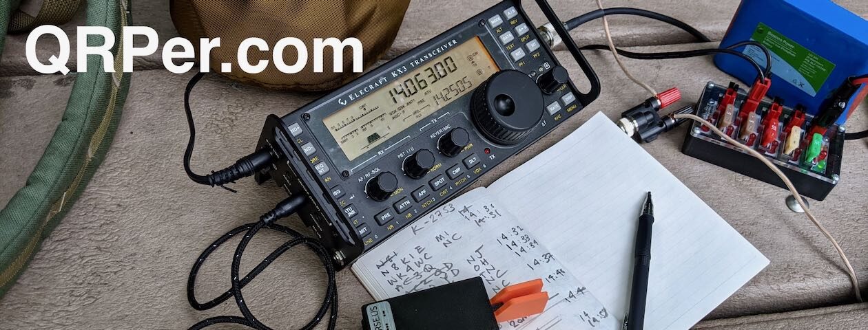
Photos

Of course, I snapped a few photos on the summit and the trail, so here they are in no particular order:

Thank you reading this field report! I hope you have an opportunity to play a little radio in the great outdoors this week!


Do you enjoy QRPer.com?

Please consider supporting us via Patreon or our Coffee Fund!

Your support makes articles like this one possible. Thank you!

Activating The Pinnacle: Amazing SOTA & POTA fun with the Elecraft KX2 and Chameleon MPAS Lite

Last Tuesday (April 20, 2021), I decided to make a detour to a park I had never visited before: Crowders Mountain State Park (K-2726).

It’s actually quite odd that I’ve never activated this park during the weekly trip to do a little caregiving for my folks: Crowder’s Mountain State Park is a reasonable detour especially compared to some of the more remote parks I’ve visited recently.

What’s really impressive about Crowders Mountain is that although it’s not as large as a national park and it’s very close to the city of Gastonia, it has no less than two unique summits that qualify for Summits On The Air: The Pinnacle and Crowders Mountain.

Both summits are accessible from the main park visitors’ center via a well-maintained trail network.

The propagation forecast looked pretty grim and after my last activation, I thought I might increase my chances of success by hiking to both summits in one visit. This made sense because I would only need 4 contacts per summit to have a valid SOTA activation and I could combine the contacts from each summit to hit 10 total contacts to activate the state park.

I decided to call the park and ask how long it would take to hike to both summits: the ranger told me “about 5 hours, or less if you’re fast.” That meant that once I added in my setup/pack up times and on-the-air time, I would be staring at a minimum of 7-8 total hours.

I (wisely) decided to pass on that opportunity. I simply didn’t have enough time in my schedule for that many hours at the park. That, and I didn’t want to feel rushed–I wanted to enjoy my outdoor time.

I decided instead to activate one summit and simply plan on spending more time on the air then plan to come back to the park for the second summit on a different day.

Before going to bed Monday night, I checked out the trail map and decided to activate The Pinnacle.

Crowders Mountain State Park (K-2726)

I arrived at Crowders Mountain State Park around 11:00 AM local–the weather was nearly ideal.

I had pre-packed all of the radio gear and supplies in my GoRuck GR1 rucksack, so once I arrived, I grabbed the pack, put on my hiking boots, a hat, and hit the trail.

I’ve read that Crowders Mountain State Park can get very busy and it’s no surprise as the park is within easy reach of Shelby, Gastonia, and the Charlotte Metro area. Fortunately, I was visiting on a Tuesday morning, and while I saw at least 30+ cars parked in the main parking lot, I passed other hikers only a few times on the Pinnacle trail. It’s a sizable park and can easily swallow 30 groups of day hikers!

I followed the orange-blazed trail to the summit of The Pinnacle.

The hike was very enjoyable and, frankly, not what I would consider strenuous, but it had enough elevation change to feel like a proper hike. I allowed an hour to reach the summit, but it only took about 40 minutes or less.

Near the summit, there’s a fork in the trail: if you take a right, it leads to the summit, if you take a left, it’ll lead you on a much longer Ridgeline Trail that will eventually take you into Kings Mountain State/National Park–you’d better believe I’ll try that one day in the future! It would be fun to activate two parks and a summit all on foot.

I took a right at the fork and the .2 mile long trail zig-zagged up the side of The Pinnacle.

I was a little surprised to be greeted by the sign above.  It’s true that the summit area is quite rocky and you have to watch your step, but this warning is a bit extreme in my opinion (especially since the SOTA activation I did with my daughter recently was orders of magnitude more dodgy!).

If you are activating The Pinnacle and don’t want to climb up the rocky path, no worries. I’m certain the area where the sign is located is well within the SOTA summit activation zone.

The Pinnacle (W4C/WP-010)

Although The Pinnacle is only a “one point” summit, when you reach the top you’re greeted by some impressive views.

The Pinnacle and Crowders Mountain are both outlying mountains so are the tallest points in the area offering beautiful, long-range vistas.

There were perhaps a half dozen hikers hanging out on the summit. I found a quite spot to set up on the side of the summit only a few meters from the top.

Gear:

On The Air

During the hike, my buddy Mike (K8RAT) sent a text noting that propagation on 40 meters was non existent. He suggested I play on 20 meters and above, possibly including 30 meters.

Later on, I found out that Mike was 100% correct. Several POTA activators that day mentioned on the POTA Facebook group that 40 meters was completely wiped-out.

I installed the Chameleon MPAS Lite vertical antenna next to me. I’ll admit that I was a little worried it might be too rocky to plunge the MPAS Lite’s stainless spike in the ground, but it turned out not to be the case.

The CHA MPAS Lite has really proven itself as an invaluable SOTA antenna. While the stainless spike adds weight to my pack, it’s less fussy than dealing with guy lines and telescoping fiberglass poles and much quicker to set up.  You do need enough ground to plunge that spike into, but if there are trees and bushes on the summit, it’s probably doable!

I started recording a video (see below) of the activation, spotted myself to the SOTA network (even though it would have likely auto-spotted me via the Reverse Beacon Network)  and hopped on 20 meters.

Solar Flare!

I had no idea at the time, but we were experiencing a solar flare which explained why 40 meters was completely wiped out.

The effect on 20 meters was simply epic.

I called CQ and was instantly rewarded with a long, continuous string of stations. Within 26 minutes, I had already worked 23 stations with 5 watts and the MPAS Lite vertical. A stark contrast to my previous POTA activation.

The view from my shack

And here’s the thing: the flare opened up 20 meters to local/regional stations as well. I worked stations as close as South Carolina, Georgia, and Tennessee–this is simply unheard of normally. Of course, stations on the west coast were also booming in.

I was a little surprised I didn’t log any European stations on 20 meters, but I suspect they were having a difficult time competing with the strong signals from North America during the flare.

I short: the band opening was amazing fun and even renewed my faith in our local star just a wee bit. (Ha ha!)

After playing on 20 meters, I decided to try 17 meters.

Wow! Without a doubt, I worked more stations on 17 meters in short order than I’ve ever worked during a field activation. In 10 minutes, I worked 12 stations. As with 20 meters, the flare opened up stations that would normally be in my 17 meter skip zone.

Here I was worried about logging the ten stations needed to validate my park activation!  After logging 35 total contacts, I decided to pack up.

Here’s a QSO Map of the activation (click to enlarge):

Video

Here’s one of my unedited real-time, real-life videos of the entire activation:

(Click here to view on YouTube)

Although the weather app on my phone wasn’t showing any afternoon thunderstorms nearby, there were some patchy dark clouds forming on the other side of the summit and the winds were shifting, so I decided to call it a day and enjoy the hike back down the mountain.

Fortunately, the clouds never amounted to anything but I don’t take my chances with spring weather–it’s fickle, especially along the North Carolina/South Carolina line. That, and frankly, I needed to stick to my travel schedule.

I took my time on the way back down and simply soaked up the outdoors.

I love doing field activations of all types, but I’ll admit that I’m becoming addicted to Summits On The Air because of the hiking opportunities it presents.

There are few things in the world I enjoy more than hiking.

When I’m on a trail, all of my concerns seem to dissolve.

Perspective

On the return hike, I passed by a group of three hikers. All of them were staring at their phones while hiking and one tripped on a tree root in the path. They caught themselves before hitting the ground.

I’ll admit I was thinking at the time that mother nature was saying, “Hey! Wake up, disconnect and enjoy the beauty around you! You need some perspective!” 🙂

I’m already looking forward to visiting Crowders Mountain State Park again.  I believe I’ll return within a month and hike to Crowders Mountain, activating both the summit and park.

Sometime, I’d like to hit the trails as soon as the park opens and, perhaps, activate both Crowders Mountain and Kings Mountain parks on foot. That would likely take an entire day when I include the time on the air, but it would also be a lot of fun.

I was telling my wife yesterday that I actually enjoy writing up the odd field report on QRPer. It hit me that there are a couple of reasons why…

For one, a number of readers have reached out and thanked me because they enjoy living vicariously through my field reports and videos.  I get it. My family and I enjoy watching YouTube videos of travelers around the world. We avoid the personality-driven channels and focus more on those that are less “produced.” It gives us an opportunity to travel to, say, Spain, France, Finland, or Turkey when we can’t presently do so. It pleases me to no end thinking that my reports and videos could, even in some very small way, offer a little vicarious travel to others.

Secondly, writing up these reports gives me an opportunity to re-experience some of my field time and sort through photos I might have taken along the way. Although it takes a few hours to write a report, I truly appreciate the experience.

Thank you, dear reader, for spending time with me during this outing!


Do you enjoy QRPer.com?

Please consider supporting us via Patreon or our Coffee Fund!

Your support makes articles like this one possible. Thank you!