Tag Archives: Summits On The Air (SOTA)

SOTA on Hibriten Mountain: Testing my new backpack and working a little QRP DX!

On Friday, April 28, 2023, the clouds lifted and I was eager to fit in a brisk hike.

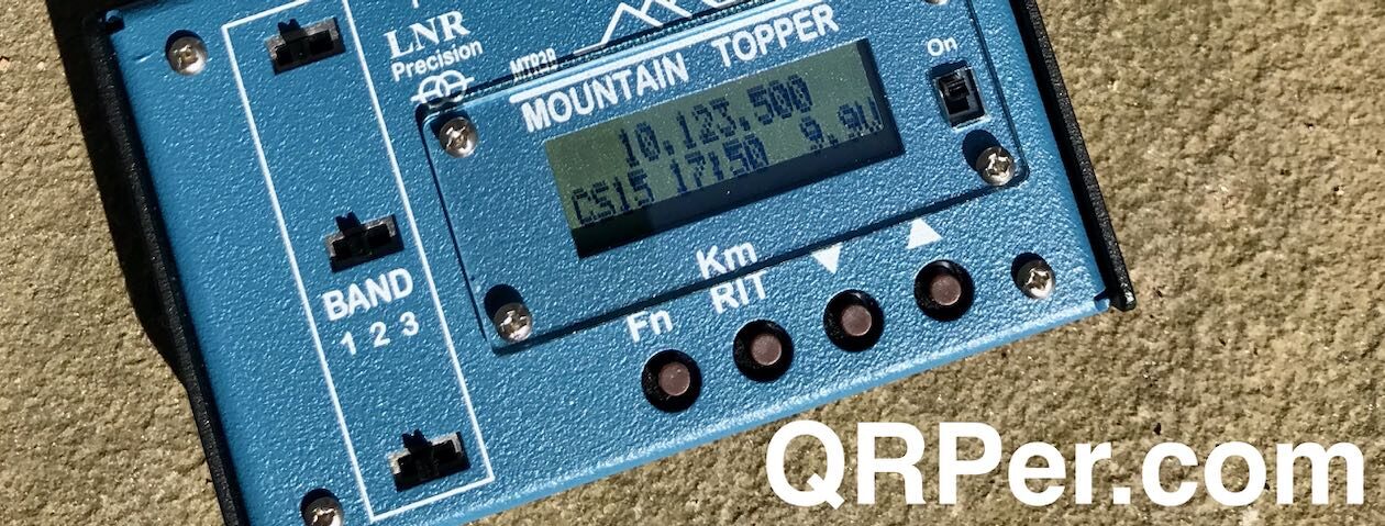
We’d had a few days of wet weather and, in fact, the previous day I performed a POTA activation with my entire station and antenna under the roof of a picnic shelter.

I was visiting my parents and didn’t want to venture too far afield, but still wanted to fit in a good summit activation. The goal was to stretch my legs and to test my Mystery Ranch Scree 32 backpack. Before taking this pack on a difficult summit hike, I thought it might make sense to check the pack’s suspension and fit with it loaded down a bit heavier than I normally would.

This would actually be my second SOTA activation with the Scree 32 pack (here’s the first) but on that first hike, the pack was so light, I barely noticed it was on my back.

Hibriten Mountain (W4C/EM-093)

Hibriten was an easy choice for the day. It’s only a 25 minute drive from my parents’ home and the trail has modest elevation change over the 5.6 mile round trip hike.

The trail is basically a wide, gravel access road for the crews who maintain the communication towers on Hibriten’s summit.

I remembered from my previous activation of Hibriten that the hike was very pleasant.

It certainly was that Friday!

It wasn’t a terribly hot day, but it was very humid as the sun burned off all of the rain we’d received over previous days.

I hiked at a brisk clip to make the most of my workout and, if I’m being honest, I was pretty darn happy to see the summit. Continue reading SOTA on Hibriten Mountain: Testing my new backpack and working a little QRP DX!

A Triple activation and why I switched from a KX3 to Icom’s IC-705

by Thomas (DM1TBE)

Intro

The last weekend was pretty nice and just like an invitation to operate outdoors. As I wrote in one of my previous posts, I often activate summits on the Swabian Alp, a high plateau, which falls with steep cliff-like edges and many SOTA summits to the northwest. If you approach it from the foothills where I live, the sharp edge is clearly visible.

On the way to the ascent, you came along old, picturesque villages. If you look closely, you can see the “Maibaum”.

The tradition of erecting a “Maibaum” (Maypole) is a long-standing custom in Germany, particularly in the southern regions. The Maibaum is a tall wooden pole that is decorated with colorful ribbons, wreaths, and symbols of the local community. It is usually erected on May Day or the night before and is a symbol of spring, fertility, and community spirit. In some regions, it is also accompanied by folk dances, music, and festivities.

It was my third activation of the summit Römerstein, and every time I used another transceiver.

My transceiver history

When I started with ham radio, I used an old Icom IC-706.

The lack of modern features such as DSP and filters, and the current consumption made it not the first choice for portable operators. I soon switched to an Icom IC-7300 at home and got used to a waterfall and spectrum display.  After two activations with the 706 I bought a Xiegu G90.

During the time of my first activation of the Römerstein, I operated only in SSB. So, I was happy with the G90. The display was small, but way better than my old 706. I was satisfied and used the G90 until I started with CW. In CW, I prefer using headphones until today. The sound of the G90 was uncomfortable for me. The lowest volume was too loud, a lot of loud cracks annoyed me, and I was never happy with the filters. Continue reading A Triple activation and why I switched from a KX3 to Icom’s IC-705

Getting To France With Detours: A SOTA/POTA/WWFF Triple Activation

by Thomas (DM1TBE)

As I have written in my activation report for Klínovec, a summit in the Czech Republic, I am trying to activate places outside my home region DM, Germany – Low Mountains in SOTA or DA in POTA. With the May 1st being a public holiday, the long weekend provided a perfect opportunity for an activation a bit further away.

After a while looking around, I chose Brissetish Kopf (FL/VO-126) in France. The summit was close to the German border, hasn’t received much love with only 8 SOTA activations and was also a POTA spot for F-1697 Vosges du Nord Regional Park and WWFF Parc Regional des Vosges du Nord, FFF-0035. That promised enough QSOs for me and provided chances for chasers.

The small cluster to which the arrow points are the Vosges, actually the northern Vosges (Vosges du Nord). The cluster south of it are the higher part of the Vosges. The Vosges are a range of low mountains in Eastern France, which continues as Palatinate Forest on the German side of the border, with the highest summit being 1,424 m / 4,672 ft.

I started my journey quite early, leaving around 8am. During the drive I could not help but had to tease Thomas (K4SWL), who spent quite some time in France and, as far as I know, enjoyed it.

The French region Alsace, through which I had to drive to the Vosges, is quite interesting. The region was disputed over several hundred years between Germany and France and changed back and forth between the two. Many place names are still German, or sometimes a mix of French and German. After the World War II, the region returned to France – hopefully the last change.

I used Google Maps to drive to a parking place close to the summit, but my first attempt ended here:

Not sure why Google meant to show me this – thanks for the 30 minutes detour.

Roughly a half hour later, I arrived at Climbach, the small village next to the summit. Based on findings, the area is populated since the Middle Stone Age, that ranged from 280,000 to 25,000 years ago.

Continue reading Getting To France With Detours: A SOTA/POTA/WWFF Triple Activation

Two SOTA activations in the Swabian Alb – And a broken JPC-7 antenna

by Thomas (DM1TBE)

Intro

I live very close to the Swabian Alb (also known as Swabian Jura or Schwäbische Alb in German). The Swabian Alb is a mountain range in German region Swabia. It ranges from Bavaria in the northeast 200 km / 140 mi to the Swiss border in the southwest.

Thomas Römer, CC BY-SA 3.0, via Wikimedia Commons

The Swabian Alb is a high plateau, which falls slowly to the southeast but with steep cliff-like edges to the northwest. You can follow the northwest edge of the Swabian Alb by looking at the map of the SOTA summits at sotl.as.

The topology limits the possibilities to cross the Swabian Alb, so the course of the routes are more or less unchanged since thousands of years. I live close to an old Roman road. And where an important road was, there isn’t a castle too far away, since the medieval noblemen were quite keen to get its share from passing people and goods.

During the Cold War, important passes received mechanisms to place explosive charges. In case of an advance of the Soviets and its allies, it was planned to blow these roads up, as there was usually no alternative way around.

First Activation: Plettenberg

The Plettenberg (DM/BW-046) is a summit at the edge of the mentioned Swabian Alb, about halfway between Stuttgart and the Swiss border. It’s 1002 m / 3287 ft tall and has a quarry on top.

The quarry uses a ropeway…..

… to transport the stones to the plant.

The way from the parking place to the activation zone was rather short with 300 m /  1000 ft. Continue reading Two SOTA activations in the Swabian Alb – And a broken JPC-7 antenna

SOTA in the Czech Republic – When everything goes wrong

by Thomas (DM1TBE)

As I have mentioned in my two previous posts, I have visited my family on the other side of Germany. On the way back, I wanted to make a “tiny detour” and activate a summit in the Czech Republic. I like all kinds of numbers and statistics, and that includes my SOTA stats. My goal is not being number one or be in the top region somewhere, but seeing it progressing and developing satisfies me. Until July last year, the upper right pie chart was only light blue, i.e. I had only activated summits in region DM, Germany – Low Mountains. So I use every chance to push the light blue back.

sotl.as

After some concessions, my family agreed and the way back increased from 6 hours and 583 km / 362 mi to 8:30 hours and 732 km / 455 mi.

Route on Google Maps

On the drive to visit my family, I noticed that I forgot my wallet, so I had neither an ID card nor my driving license. In many regions of the world, it would be probably very difficult to cross an international border two times without papers. However, many countries in Europe have signed the so-called Schengen-Treaty, which led to the creation of Europe’s Schengen Area.

Camoka4, CC BY-SA 3.0, via Wikimedia Commons

The Schengen Area consists of 27 European countries with a population of over 400 million, who have abolished border checks. However, random inspections still happen. The worst case would be a control in the Czech Republic and the official requirement to go to the German embassy in Prague for new papers.
As expected, the border crossing was easy and it could easily been overseen.

If you missed that sign in the photo, you only note that the town names have changed to Czech, as Czech names are quite different. After the border crossing, the summit is just minutes away, and you can drive up to the very top – pretty convenient for a 10+3 points summit.

Derived from User:Rdc, Public domain, via Wikimedia Commons

The summit Klínovec (OK/KA-001), also known as Keilberg, is the highest mountain in the Ore Mountains, located on the border between the Czech Republic and Germany. With a peak reaching 1,244 me / 4,081 ft above sea level, Klínovec has been a popular destination for outdoor enthusiasts and tourists, and is the most important winter sports area in the region. The mountain has a rich history that includes mining activities for silver, lead, and tin in the dating back to 2500 BC, and it has evolved into a popular skiing and hiking destination in recent years, attracting visitors from both countries. According to reports, the peak has attracted people for hundreds of years, with the earliest observation tower erected in 1817. Continue reading SOTA in the Czech Republic – When everything goes wrong

QRP DX: A beautiful day for SOTA on Flat Top Mountain!

The weather on the morning of April 4, 2023, was absolutely outstanding!

I woke up that morning, drank a cup of coffee, looked outside and knew what would be in store the day: a SOTA activation!

My schedule was actually open that fine Tuesday because my daughters were on spring break from school, so the only problem was deciding which summit to activate. A good problem, in other words!

After staring at the SOTL.AS map for a while, I decided to activate Flat Top Mountain (W4C/EM-026) near Blowing Rock, North Carolina. One of the main reasons I chose Flat Top was because the roughly five mile round-trip hike is such a pleasant, casual one. My left ankle was recuperating from a bit of a strain, so I knew Flat Top’s flat, wide carriage trails would fulfill my need for exercise without straining my ankle (which, by the way, is doing much better now).

The drive to Flat Top is a beautiful one–a good third of it is on the Blue Ridge Parkway including the Linn Cove Viaduct which offers up stunning long-range views. I made my way to Moses H. Cone Memorial Park, at BRP milepost 294, where I parked the car and put on my hiking boots.

The park was pretty active for early April, no doubt because the weather was so stunning.

I checked out the beautiful Flat Top Manor to see if renovations had been completed.

It looks very close to completion, I have to assume they’ll be open again soon. The old manor was looking beautiful against clear skies!

Flat Top Manor was built by in 1901 by Moses Cone who was a very successful local textile entrepreneur, conservationist and philanthropist. It’s so fitting that this beautiful bit of architecture and these expansive grounds (which includes no less than two SOTA summits) are now protected by the National Park Service for all to enjoy.

I started my hike by following one of the carriage trails in front of the manor. It leads past a farm building, then crosses under the Blue Ridge Parkway two-lane road. Continue reading QRP DX: A beautiful day for SOTA on Flat Top Mountain!

Steve tests the Gabil 7350T antenna, Gabil GRA-ULT01 tripod, and BaMaKeY TP-III paddles

Many thanks to Steve (MW0SAW) who shares the following field report:


Mini Field Report: Testing the Gabil 7350T and BaMaTech TP-III on a brisk SOTA activation!

by Steve (MW0SAW)

Went for an early walk/SOTA activation up Fan Fawr GW/SW-005 (734m) this morning (9/4/23). I think someone said it was supposed to be the hottest day of the year in the UK. It was about 5 deg celsius with a bitter wind chill of -2c on the summit! It’s very close to the highest peak in South Wales, Pen Y Fan (886m).

As I mentioned a couple of weeks ago in our emails, I wanted to test a new compact antenna I purchased recently, called the Gabil 7350T in the USA, and branded as the Sharman MD-3500 in the UK where I got mine. I also took the Gabil GRA-ULT01 MK2 tripod which I did purchase from the USA on Amazon.com.

The Gabil 7350T Compact Antenna and Gabil GRA-ULT01 MK2 tripod

Another first for the the activation was the Bamatech TP-III ultra compact paddle, Dinos were included 🙂

Starting my walk, the lovely view of the reservoir quickly disappeared and was the last view I would see ascending into the mist.

I took refuge in my Decathlon 1 man camping shelter, setting up the tripod and antenna close by.

The wind was howling and turning my back the antenna toppled over. This was quickly resolved with a tent peg on one of the tripod legs. Quick setting of the slider with the analyser got 1.2 SWR and so after a slurp of coffee, I started to call CQ on 20m CW. A nice stream of European qsos ensued with good reports (many 599), it was pleasing to hear with such a small antenna (about 8 ft). Just as the contacts were drying up, I was taken aback by a strong VK station! Always great feeling to get some dx like that but especially pleasing with this tiny antenna on its maiden voyage 🙂

I switched to 20m SSB for a few more QSOs but struggled with QRM on two frequencies. My allotted time was running low and my fingers were numb, so I packed up the HF and got the handie out to catch a few local VHF contacts.

So what can I summarise from this activation, well I can safely say I love the Gabil/Sharman antenna and Gabil tripod. They would make a really nice additional to a small go bag, they seemed to work almost as good as a full size 1/4 on 20m. Time was limited this trip and I was too cold to hang about to try more bands, but extremely pleased with the performance so far.

The Bamatech key is a pure work of art, beautifully made, sensitive and precise. Probably my best portable key to date in my collection.

Equipment:

(Note: Amazon links are QRPer.com  affiliate links.)

Thanks to all the chasers.
73
de MW0SAW/P

SOTA with two PAC-12 antennas in a JPC-7 dipole configuration on the Wasserberg

Berndm aus g, CC BY-SA 4.0, via Wikimedia Commons

by Thomas (DM1TBE)

Intro

Nearly a week has passed since my last activation and the AWS–the Activation Withdrawal Symptoms–started to kick in. Furthermore, I received an antenna during the week which I wanted to try. However, the weather was unsettled, and showers were forecasted over the whole weekend. This did not prevent me to try at least an activation with the new antenna.

So, I started to the Wasserberg (DM/BW-664) on an early Saturday morning. The summit has a height of 750 m / 2460 ft and a wooded peak. The parking place is already elevated, so there was only 1.6 km / 1 mi left to walk with an ascent of 166 m / 540 ft.

The peak is wooded, but you can enjoy the view at the beginning of your hike, just after parking.

The trail is well-developed and easy to walk, except for the high incline at the beginning.

You come along something that looks like an old wall, but it is probably a place where stones have been taken from in earlier times.

The forest still looks like winter, and you can see the landscape through the trees

But if you look close enough, you see that the spring is not too far anymore.

Although the way to the peak diverts from the well-developed trail half way, I followed the way to visit the Wasserberghaus (it basically means “house on the water hill”, with “water hill” being the name of the hill).

Europe has an extensive hiking network. It ranges from European long-distance paths, with trails up to 10,000 km / 6,200 mi, over national routes to small hiking path networks operated by local municipalities. This is a hiking guidepost at my trail to the summit. Continue reading SOTA with two PAC-12 antennas in a JPC-7 dipole configuration on the Wasserberg

A story about a gluttonous dragon, a princess, a knight, and many DX contacts to the US from a volcano in Germany

by Thomas (DM1TBE)

Intro

If you have read my previous activation reports, you may remember that the temperature was more often than not below 0° C / 32° F. I am tired of the winter. So I was very pleased when the weather forecast indicated 18° C / 64° F on a Saturday.

In one of my previous posts (How I found the best antenna for my SOTA/POTA activations) I have outlined, that I like using the 30-meter band for being reliable on short and medium distances – in my case, Central Europe. However, I wanted to try an activation with an antenna that is more appropriate for DX. The wire winder for my 30-meter antenna had plenty of space left, so I decided using a commercial 12/17-meter band wire antenna that I have discussed briefly in the report linked at the beginning of this paragraph.

The day before, I built a 20-meter end-fed with parts that I found in my basement and a tiny 1:49 transformer from K6ARK. I added a short coil, so the feed point wouldn’t be at or too close to the ground when using my 10 m / 33 ft fiberglass mast. I know it needs some polish.

The Limburg

The Limburg is a conical summit about a 30-minutes drive from my home. It can be activated for a couple of programs like SOTA (DM/BW-110), POTA (DA-0203), WWFF and COTA.

The Limburg is, or better was, a volcano; technically, a volcanic vent of the Swabian Volcano, a volcanic area of 50 km / 31 mi radius with over 350 volcano vents. Seventeen million years ago, it produced massive gas and dust explosions. Be careful when ramming your antenna groundspike into the ground ;-). So it became a steep summit, elevated around 200 m / 650 ft over its surrounding area.

Earliest traces of population around the summit date to 3000–1800 BC.

Around the year 1050 Duke Berthold I., picture below, built one of the oldest Romanesque castles on the top of the summit. It was the seat of the House of Zähringen, who were related to the House of Hohenstaufen, about whom I wrote in an activation report here earlier: DM1TBE Field Report: Shivering with 18 WPM on the ruins of the medieval Hohenstaufen Castle

Around 50 years later, his son Berthold II. built a new castle some 150 km / 90 mi away and moved the seat of the family. Shortly thereafter, the castle was destroyed (probably, nobody knows exactly). It was rebuilt and destroyed again in 1130 and rebuild again. After the year 1150 a new, larger castle was built not too far away and this castle lost its importance and, eventually, gave up. Continue reading A story about a gluttonous dragon, a princess, a knight, and many DX contacts to the US from a volcano in Germany

Huge 30 Meter Pileups: Beautiful day for a SOTA & POTA Activation at Hanging Rock State Park

There are a few reasons I love Summits On The Air (SOTA):

  1. I love hiking.
  2. I love going truly portable with my radio gear; packing an entire minimalist station in my backpack along with first aid supplies, water, and a bite to eat, then hitting the trail.
  3. I love the views.
  4. I love the sense of accomplishment (hiking to a summit doesn’t happen every day).
  5. I also love that post-hike feeling–my body telling me, “Hey, T, thanks for doing something today!

No kidding: If I could, I would do a SOTA activation at least twice a week. Maybe when I retire, I will.

Living in the mountains of western North Carolina, I have no shortage of summits to activate–indeed, one is within (strenuous) hiking distance of my QTH.

So why don’t I activate more summits?

It’s because they are much more difficult to fit in my active schedule.

You’ll notice that the bulk of my POTA activations take place within a one hour window of time. This includes set-up, on-the-air, and pack-up time. The brilliant thing about POTA sites is that they’re so accessible in my weekly travels. (Plus, I absolutely love POTA too!)

My average SOTA activation, on the other hand, requires at least a three hour window of time. In fact, it’s usually much closer to four or five hours.

The view from Dogback

Drive-up summits like Anderson Mountain and Dogback Mountain are the exceptions. There’s no hiking time involved, so they are pretty easy to fit into my schedule.

On Saturday, February 18, 2023, a rare thing happened: an entire day opened up for me to play radio. The only real obligation I had was to set-up and participate in a live stream with Josh (KI6NAZ) on the HRCC channel that evening.

At first, I thought about doing a five park POTA rove, hitting four parks and one game land all that eight hour window of time. It was very doable and I knew it would be fun.

But then again, park roves allow very little time for hiking–typically, they’re wham-bam style short activations.  It was also a gorgeous day weather-wise so I scrapped the idea of a POTA rove. (This time!)

Instead, I had a hankering to do a SOTA activation and hike. I took a quick look at SOTL.as and remembered how much I enjoyed my last activation of W4C/EP-001 (Moore’s Knob) at Hanging Rock State Park (K-2753). And hey! It’s both a SOTA and POTA site!

It’s been nearly two years since I’d visited Hanging Rock SP because it’s a two hour drive in a direction I rarely travel.

Hanging Rock  a beautiful park and I truly enjoyed the hike to Moore’s Knob.

As a bonus, Hanging Rock State Park is less than a 30 minute drive to Pilot Mountain State Park. I knew I’d have time in the schedule to do activate both sites! Score!

Hanging Rock State Park (K-2753)

I pulled into Hanging Rock that morning and made my way to the parking area by the lake.

Since it had been nearly two years, I consulted the hiking trail map at the trail head to confirm I was taking the correct loop (Moore’s Wall Loop). Continue reading Huge 30 Meter Pileups: Beautiful day for a SOTA & POTA Activation at Hanging Rock State Park