I love going truly portable with my radio gear; packing an entire minimalist station in my backpack along with first aid supplies, water, and a bite to eat, then hitting the trail.
I love the views.
I love the sense of accomplishment (hiking to a summit doesn’t happen every day).
I also love that post-hike feeling–my body telling me, “Hey, T, thanks for doing something today!“
No kidding: If I could, I would do a SOTA activation at least twice a week. Maybe when I retire, I will.
It’s because they are much more difficult to fit in my active schedule.
You’ll notice that the bulk of my POTA activations take place within a one hour window of time. This includes set-up, on-the-air, and pack-up time. The brilliant thing about POTA sites is that they’re so accessible in my weekly travels. (Plus, I absolutely love POTA too!)
My average SOTA activation, on the other hand, requires at least a three hour window of time. In fact, it’s usually much closer to four or five hours.
The view from Dogback
Drive-up summits like Anderson Mountain and Dogback Mountain are the exceptions. There’s no hiking time involved, so they are pretty easy to fit into my schedule.
On Saturday, February 18, 2023, a rare thing happened: an entire day opened up for me to play radio. The only real obligation I had was to set-up and participate in a live stream with Josh (KI6NAZ) on the HRCC channel that evening.
At first, I thought about doing a five park POTA rove, hitting four parks and one game land all that eight hour window of time. It was very doable and I knew it would be fun.
But then again, park roves allow very little time for hiking–typically, they’re wham-bam style short activations. It was also a gorgeous day weather-wise so I scrapped the idea of a POTA rove. (This time!)
It’s been nearly two years since I’d visited Hanging Rock SP because it’s a two hour drive in a direction I rarely travel.
Hanging Rock a beautiful park and I truly enjoyed the hike to Moore’s Knob.
As a bonus, Hanging Rock State Park is less than a 30 minute drive to Pilot Mountain State Park. I knew I’d have time in the schedule to do activate both sites! Score!
Hanging Rock State Park (K-2753)
I pulled into Hanging Rock that morning and made my way to the parking area by the lake.
I’m not a summer-heat-loving guy. Quite the opposite, in fact. Give me cold weather and I can hike and camp forever.
On Tuesday, July 13, 2021, it wasn’t cold outside, of course, but I still wanted to fit in a park activation and hike. Despite the forecast highs of 90F/32C. I had almost the entire day to play radio, too–a rarity.
When I have an entire day to devote to radio, I can either hit the road and try to hit multiple parks–perhaps as many as 5 or 6–or I can choose to venture further afield and hit a new-to-me park.
I tend to choose the latter and that Tuesday was no exception.
North and north by NW of Winston Salem, NC, are two parks I’ve always wanted to visit: Hanging Rock State Park and Pilot Mountain State Park.
I devised a plan to first visit Hanging Rock, then Pilot Mountain. Both parks are close together geographically, but a good 30 minutes drive apart.
A quick check of the SOTA database and I discovered that there are actually two summits on Hanging Rock State Park’s grounds. One is off the beaten path a bit and would require some light map work, and the other–Moore’s Knob–is on one of the park’s main trails. Since I was putting this whole plan together morning of, I opted for the “easy” summit as I didn’t have time to double-check topo maps, parking areas, etc.
Hanging Rock State Park (K-2735)
Travel time to Hanging Rock was about 1 hour 45 minutes. Once I arrived on site, I discovered that, like many state parks, the main visitor’s center is being renovated.
I easily found the parking area for the Moore’s Knob loop. It being a Tuesday, the parking lot only had a few cars.
Pro tip: with the visitor’s center out of commission, stop by the swimming area pavilion for some proper restrooms/washrooms!
I planned to take the full trail loop in a counter-clockwise direction.
I’m glad I did, too, as the bulk of the ascent was a long series of steps. I’m not a fan of steps, but I much prefer using them heading up a mountain rather than down.
Near the summit, there’s a very short spur trail to Balanced Rock which is worth a visit not only for the rock, but also the views.
It being a North Carolina state park, there are some obligatory warning signs about how falling off of cliffs can lead to injury or death. These warning signs aren’t as prominent as those at Crowders Mountain State Park, though!
Moores Knob (W4C/EP-001)
You can see my MPAS Lite vertical poking out of my pack. I brought it along in case I had no good tree options. In this case, I didn’t use it.
There’s no mistaking the summit as there’s a large observation tower on top that affords some spectacular views of the Blue Ridge Escarpment, the foothills, and Pilot Mountain (my next stop). There were a number of hikers on the summit of Moore’s Knob and it was actually pretty gusty up there, too. I searched and found a nice little spot to set up that was sheltered from the wind, shaded, and even had trees tall enough to hang my Packtenna 9:1 UNUN random wire antenna!
Note: I brought the CHA MPAS Lite in case there were no good tree options on the summit.
Set up was quick and easy on the radio side of things, but as with most SOTA activations, positioning my tripod to make a video was the tricky part. Since I’m sitting on the ground, it can be difficult to find the right angle so that the radio, key, and notepad are all in the frame. (See my video below).
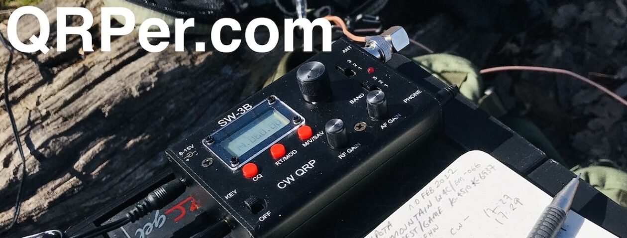
I started calling CQ at 16:00 UTC on 20 meters. I had a reasonable cell phone signal on the summit, so I was able to spot myself. Problem was, though, my hiking app seemed to be draining my iPhone’s battery very rapidly (that and my aging iPhone 7 probably needs a new battery at this point). After spotting myself, I shut down the phone to save power. I forgot to contact my buddy Mike (K8RAT) with a frequency, but he eventually saw me on the SOTA spots.
In a period of 29 minutes, I worked 20 stations on 20 meters.
Next, I moved up to 17 meters where I worked eight more stations in seven minutes.
I love effortless activations like this and part of me wanted to continue operating–even switching to SSB–but looking at the time, I knew I needed to hit the trail, make my way back to the car, and drive to Pilot Mountain.
I called QRT around 16:42 UTC and packed up my gear.
QSO Map
Not bad for 5 watts and a 31′ wire!
One highlight of this activation was meeting Jim (NA4J) who heard my CW from the summit and popped by to introduce himself. Although I trimmed out our conversation in the video (I’m not entirely sure he knew I was recording the activation), you’ll hear him in the first half of the activation.
Video
Here’s my real-time, real-life video of the entire activation:
The hike back to the car was very pleasant. It was a bit longer than the path I took to the summit, but the descent had no steps which made it a breeze.
I had a radio topic on my mind during that hike and actually pulled out the OSMO Action camera and made a bit of a “hike and talk” video. It’s on the topic of ATUs and resonant vs non-resonant antennas. I haven’t yet decided if I’ll post it–the shaky camera might make some viewers sea sick! 🙂 We’ll see–maybe I’ll brave up and post it anyway…
Next, I drove to Pilot Mountain State Park for a quick afternoon activation. Although Pilot Mountain is a SOTA summit, too, it’s yet to be activated because the actual summit would require proper rock climbing, I believe.
Thank you
As always, thank you for reading this field report! And thank you to everyone who has supported me through Patreon and the Coffee Fund. I truly appreciate it.
I hope you find time this week to take your radios outdoors to play, or to hunt some parks and summits from your shack, backyard or vacation spot!
And for those of you working on your CW skills, don’t give up and don’t stress about it. Take your time and allow your brain to absorb code by simply listening. When you feel you’re able to copy even some of the contacts in the videos of my activations, you’re ready to start hunting CW activators!
QRP radios, product announcements, reviews, news and more. Low power amateur radio fun!
Please support QRPer by adding us to your whitelist in your ad blocker. Ads are what helps us stay online. All of our ads are ham radio related--no junk, we promise! Thank you!
 There are a few reasons I love Summits On The Air (SOTA):


