Tag Archives: Germany

New POTA Location: From Proposal to Activation at Lightspeed

by Thomas (DM1TBE)

If you followed my activation reports, you may (or may not) remember that I have just started pursuing POTA this year with the program gaining popularity in Europe and hence resulting in sufficient chasers for activations. However, the number of parks is not that high in Germany when compared to other countries. So the local POTA admins asked to submit proposals to fill the gaps across Germany.

Last Friday, I was browsing through the area I live in and thought about areas that would suit POTA. I stumbled upon Spielburg. The upper part of the SOTA summit Hohenstaufen, which I have visited and written a report about earlier this year, was once higher, but about two million years ago, slid down and formed the present-day Spielburg.

Not much of it remains today, as it was used as a quarry until the 1950s. Today it is a protected nature area of 31 ha / 77 acres consisting of a unique biotope with distinctive white Jura limestone cliffs. Although not large, it is popular among the locals for hiking, as a viewing point, and – as I have spotted during my visit – a place for romantic picnics.

So I suggested the area to the local POTA admins on a Friday afternoon. The following day, late in the evening, I received an email from local POTA admin Heinrich, DO1HFS, telling me that my proposal has been accepted as DA-0514. What a great response time – Vielen Dank, Heinrich.

I have been there a couple of times without a radio but with family and kids, but I did not pay attention to possible locations for an activation. I checked some online maps and imagery, but it did not help me much further. So I took the SOTAbeams Band Hopper III and the vertical JPC-12 with me to be prepared for larger and smaller possibilities. I also want to have at least 36 QSOs after 7pm local time to complete my POTA Late Shift Activator award. Therefore, I thought using FT8, which I have never used before during an activation, would make it easier to achieve such a number.

So the following Sunday, I started the activation. This one and all my previous activations were “backpack” activations, i.e., all my equipment fitted into a backpack, and I walked at least the last meters, usually over a mile, carrying all the stuff. In this case, my place for the activation was just 1 km / 0.6 mi away from parking, but I walked through the whole area to find the best place. Eventually, I found a wooden bench with a nice view and a meadow behind, where there was sufficient space for the SOTAbeams Bandhopper linked dipole for the 20, 30, and 40-meter bands.

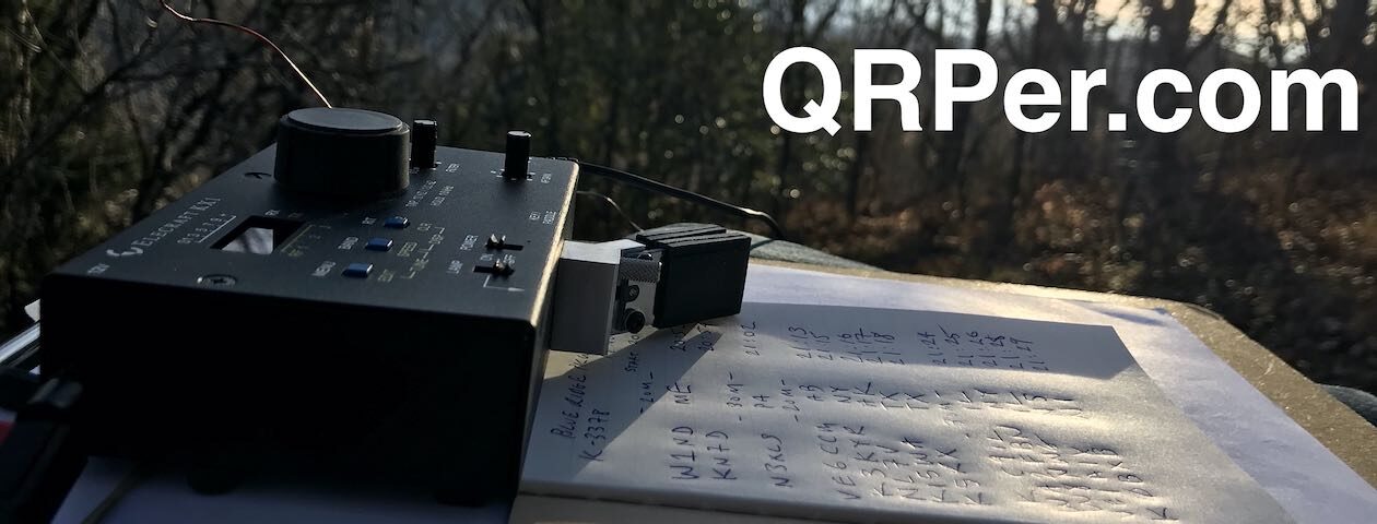
The equipment I used consisted of

plus some other utilities such as a Surface Laptop for WSJT-X, the PAC-12 vertical antenna, which I have not used, pen & paper… Continue reading New POTA Location: From Proposal to Activation at Lightspeed

The Beauty and the Boring: Two SOTA Summits in Southern Germany

Kreuzschnabel, CC BY-SA 3.0, via Wikimedia Commons
by Thomas (DM1TBE)

As you probably know, SOTA, unlike POTA, provides little to no motivation to activate a place more than once during a calendar year. However, I still activate nearby summits multiple times because I enjoy the location and the activity, even though the activations, or better the points are greyed out.

Therefore, as the calendar year progresses, the travel time to reach a SOTA mountain keeps increasing. When the travel time exceeds one hour one-way, I typically try to schedule two activations on the same day. This is what I did last weekend.

SUMMIT IPF

My first summit was called Ipf (DM/BW-131). The Ipf is a treeless free standing mountain with an elevation of 668 metres / 2,192 ft. At its peak, there is a prehistoric hill fort.

Reconstruction by Geak, CC BY-SA 4.0, via Wikimedia Commons

The flattened top of about 180 m / 590 ft shows evidence of settlement and fortification spanning almost a thousand years from 1200 BC – 300 BC. During its existence, the “princely seat” served as an important regional center of power and aristocratic residence with trade connections to Greece and Italy.

The oval summit plateau was once surrounded by a perimeter wall, which supported a wooden-reinforced wall about 5 m / 16ft wide. There is an information center at the foot of the mountain, where a part of the wall has been reconstructed.

On the flat eastern side, there is an additional intermediate wall trench that extends about 150 m / 490 ft from the main wall. Approximately 60 m / 197 ft to the east, a third fortified line features a wooden-reinforced stone wall. Below the summit plateau by 50-60 m / 164-197 ft, a fourth wall surrounds the south, east, and north sides, shielded by steep slopes on the west. This wall, along with a trench, extends northward to the mountain’s base, safeguarding three preserved well shafts. The ancient castle entrance led from the southeast to the elevated plateau. The old path remains the easiest route, providing scenic views of the trench system. Continue reading The Beauty and the Boring: Two SOTA Summits in Southern Germany

On Top of Germany: Activating the Highest Mountain with my KX3 and the PAC-12

by Thomas (DM1TBE)

During the past couple of months, I stumbled upon two or three documentaries about the mountain Zugspitze and the surrounding area. One day I thought, what it is that is preventing me from activating the Zugspitze (DL/WS-001) for the SOTA-program? The answer was rather short: a 3-hour drive. So, I waited for a good opportunity and accepted the challenge on a sunny and warm Saturday in June.

The Zugspitze, with an elevation of 2,962 m / 9,718 ft, is the highest peak in Germany and I think it is fair to say that it is also one of Europe’s highest mountains. Located in the Bavarian Alps near the German-Austrian border, the Zugspitze offers breathtaking panoramic views of the surrounding mountain ranges and picturesque landscapes. It is a popular destination for outdoor enthusiasts, attracting hikers, climbers, skiers, and snowboarders throughout the year. The Zugspitze is accessible via cogwheel train, cable car, and hiking trails. At the platforms on the summit, visitors can enjoy a range of facilities, including observation platforms, restaurants, a simple accommodation option, which specifically caters to hikers, and the international border between Austria and Germany across the platforms.

The lake in front of the mountain is called Eibsee. With its crystal-clear, but ice-cold waters, the lake is a popular destination for swimming, boating, and other water activities during the summer months.

Surrounded by majestic mountains and dense forests, like in a fairy tale, the Eibsee offers a picturesque and tranquil setting.

I started early in the morning on a nice Saturday. I must admit that a 3-hour drive for a SOTA summit might sound a bit extreme, but this is a special mountain for me, I have never been even close to such a high altitude – except in a plane. If you have ever been in the Alps, you probably remember the typical residential buildings that you see all around.

I arrived late in the morning at a parking place that is next to the cable car station.

Before going to the summit, I wanted to walk around the lake Eibsee. The hike around the lake is 7 km / 4.4 mi but took it longer than expected. The tour provides numerous opportunities to make incredible pictures.

Although I am a photographic noob and make pictures with the camera default settings, I quite like the results – all picture of this blog post are taken by me. Continue reading On Top of Germany: Activating the Highest Mountain with my KX3 and the PAC-12

Exploring History and POTA: My Second SOTAbeams Bandhopper III Adventure

by Thomas (DM1TBE)

As I mentioned in my recent activation report, I was very impressed with the SOTAbeams Bandhopper III antenna and was eager to test it again. While browsing through the maps of WWFF, SOTA, and POTA, I stumbled upon a new, unactivated POTA park that was not too far from my location – the Bucher Stausee Recreation Site (DA-0414). In the immediate vicinity of the new park, there are several archaeological sites containing the ruins of approximately 2000-year-old Roman buildings.

If you are not interested in the history part, just skip to the Activation section.

The world in Europe was relatively straightforward after 0 AD. From a political, military, and economic standpoint, there was the Roman Empire and then there was everything else.

The following map illustrates the Roman Empire at its greatest extent and the location of the Roman province of Raetia, which encompasses present-day southern Germany and parts of Switzerland and Austria—the very region where I live and where the park is located. This region shared borders with the former territories of Germanic tribes.

UNDP, CC BY-SA 3.0, via Wikimedia Commons

To the northeast, a wall called the “Limes” was constructed to separate from the unconquered territory of Germanic tribes. The Limes was a fortified border system of the Roman Empire, primarily constructed during the 1st and 2nd centuries AD. It served as a defensive line, marking the outer boundary of the Roman territories.

Interestingly, the Limes passed nearly through the POTA activation zone, adding a historical significance to the area.

One, maybe the main reason why the Roman Empire ceased further conquests in Germania and constructed defensive positions was the Battle of Teutoburg Forest.

The Battle of Teutoburg Forest, occurring in 9 AD, was a significant event in the Roman history. It resulted in a major defeat for the Roman Empire against an alliance of Germanic tribes led by Arminius. The battle led to the loss of three Roman legions, which constituted approximately an eighth of the entire Roman army. This defeat served as a turning point, prompting the Romans to recognize the challenges of conquering Germanic territories and shifting their strategy towards defense by constructing fortifications like the Limes.

Therefore, my journey began by visiting the ruins of a Castra, a Roman fort. The fort housed an infantry unit with a cavalry attachment, consisting of around 500 soldiers. The fort and neighboring civilian structures were eventually abandoned around 260 AD with the withdrawal of the Romans from this region.

The fort had a size of 140 m x 150 m / 460 ft x 490 ft. On an information panel, a reconstruction is displayed.

I walked around the perimeter and thought about the histories that this place could be telling me. Then I proceeded to visit the civilian structures. Continue reading Exploring History and POTA: My Second SOTAbeams Bandhopper III Adventure

Quick test of my new SOTAbeams Band Hopper III antenna at a POTA/SOTA location

by Thomas (DM1TBE)

Since I have seen the Band Hopper III antenna at the website of SOTAbeams, I have been thinking about it. Most of the time I have used end-fed half-wave (EFHW) antennas when operating portable – vertical attached to a fiberglass mast or in a sloper configuration with a tree.  Those EFHW antennas seemed to cause way less troubles than a dipole with its centerpiece and coax at the thin end of the fiberglass mast.  However, there was this “other” dipole from SOTAbeams. So I thought I could give it a try and ordered it.

Two days later -including customs procedure- the antenna arrived. The antenna is a linked dipole for the 20-, 30- and 40-meter band and weights less than 500 g / 18 oz. That includes the coax and guying material. I already had the Tactical Mini ultra, a 6 m / 19.6 ft fiberglass mast that is a perfect fit for the Band Hopper antenna.

The weather was fine, my manager at work was on vacation, so there was no reason for not leaving the home office early and go for a quick activation. I went to the SOTA location for Kaltes Feld (DM/BW-659), which is also POTA (DA-0410). I have been there a couple of times this year, but offering chaser points for both programs promised more QSOs, especially when conditions are difficult. The other advantage of this place is that you can drink cold beer if the antenna fails to work. 😉

You may, or more likely may not, remember this image from an activation report in March this year.

The place looks much more inviting now with kids playing, people enjoying barbecue and a cold beer, and operating a radio is much more pleasant.

Although I have been here a couple of times, I have never visited the ruins of Castle Granegg, just a mile away. While the SOTA activation zone is surrounded by trees, the walk to the castle satisfies with a nice viewpoint on the way. Continue reading Quick test of my new SOTAbeams Band Hopper III antenna at a POTA/SOTA location

My One Day Mini-DXpedition to Switzerland

View from the Swiss Radegg castle over the valley towards Germany

My wife and kids were with her parents for some days, the weather forecast 25° C / 77° F and the following Monday was a public holiday in Germany – perfect condition for an activation day trip during the weekend. With France and the Czech Republic already visited this year, there were two other neighbor countries waiting to be visited: Switzerland and Austria (the one without kangaroos).  Austria is on my schedule for the Ham Radio fair in Friedrichshafen, so it became Switzerland.

The area northwest of the Swiss town Schaffhausen was perfect.

The region has been inhabited for more than 10,000 years.  Schaffhausen started as an independent city-state around 1000 AD and became a Canton later. A canton is a type of administrative division similar to a state, but in European dimensions. The Swiss Confederation, as a whole, is smaller in size compared to West Virginia and has a slightly smaller population than New Jersey. Anyways, in 1330, the town lost all its lands and its independence, but regained its independence back in 1418. Schaffhausen joined the Swiss Confederation as the twelfth member in 1501. In 1944, Schaffhausen experienced a bombing raid by aircrafts from the US Air Forces, which misidentified the town in the neutral Switzerland as their target Ludwigshafen in Nazi-Germany.

The region is not too far from my home, it has a SOTA summit, which is in a POTA and WWFF area, is history-rich and has a second, although German, SOTA summit not too far away.

OpenTopoMap, OpenStreetMap CC-BY-SA, STRM

I started early on that Sunday morning at 8 a.m. The autobahn was nearly empty and just like an invitation to drive a bit faster. Since Corona, I haven’t been using my car very often, so I still had winter tires on, which are limited to 160 kmh / 100 mph.

Since 2008, Switzerland is in the European Schengen Area, so there are no regular border checks. Even before, it was a so-called “Green Border”, i.e. you could often pass it without checks. Without this old, unused border station, you would barely notice that you have crossed the line.

Some minutes later I approached the area, where the first summit is located.

The Wannenberg / Wannebärg (HB/SH-002) is a wooded mountain with an elevation of 661 m / 2168 ft. The peak is rather flat and also wooded. The way from the parking place at the foot of the mountain to the top is rather short and easy, with 2.1 km / 1.3 mi and an ascent of 140 m / 460 ft. Continue reading My One Day Mini-DXpedition to Switzerland

Park and Castle activation at the medieval Helfenstein castle

by Thomas (DM1TBE)

The last weekend was too rainy to operate outdoors. So I welcomed the public holiday on Thursday, which allowed me to take a day off on Friday and have four days off. We call such days “Bridge Day” in Germany, they “bridge” a public holiday to the weekend.

Some time ago, I have suggested a new protected area to the WWFF, the World Wide Flora and Fauna program. The nature reserve Eybtal covers an area of over 1331 hectares / 3300 acres and is the largest nature reserve in the Stuttgart administrative district. The nature reserve is on the edge of the Swabian Alb, and the ruins of the medieval castle Helfenstein are well within the WWFF activation zone.

The Helfenstein Castle is a historic fortress can be traced back to around 1100 AD when it was constructed as a strategic stronghold to protect the surrounding territories.

Coat of Arms

During the 13th and 14th century it was the seat of the Earls of Helfenstein. After a lost battle in 1372 things went south and in 1396 the family of Helfenstein had to sell a large part of its territory, including its family seat.

The new owners expanded the castle into a formidable fortress. They extended the castle walls to include a fortified tower and a second ring of walls.

Around the year 1400, a tower was built on the nearby rock. It served as a lookout and was intended to prevent the castle from being cannon-fired from that location.

During the Second Margrave War in the 16th century, Helfenstein Castle was besieged and heavily damaged. It was subsequently abandoned and fell into ruins.  In the 19th century, there was a renewed interest in medieval architecture, and efforts were made to preserve and restore Helfenstein Castle. The ruins were partially reconstructed, and today, visitors can explore the restored sections. Continue reading Park and Castle activation at the medieval Helfenstein castle

A Triple activation and why I switched from a KX3 to Icom’s IC-705

by Thomas (DM1TBE)

Intro

The last weekend was pretty nice and just like an invitation to operate outdoors. As I wrote in one of my previous posts, I often activate summits on the Swabian Alp, a high plateau, which falls with steep cliff-like edges and many SOTA summits to the northwest. If you approach it from the foothills where I live, the sharp edge is clearly visible.

On the way to the ascent, you came along old, picturesque villages. If you look closely, you can see the “Maibaum”.

The tradition of erecting a “Maibaum” (Maypole) is a long-standing custom in Germany, particularly in the southern regions. The Maibaum is a tall wooden pole that is decorated with colorful ribbons, wreaths, and symbols of the local community. It is usually erected on May Day or the night before and is a symbol of spring, fertility, and community spirit. In some regions, it is also accompanied by folk dances, music, and festivities.

It was my third activation of the summit Römerstein, and every time I used another transceiver.

My transceiver history

When I started with ham radio, I used an old Icom IC-706.

The lack of modern features such as DSP and filters, and the current consumption made it not the first choice for portable operators. I soon switched to an Icom IC-7300 at home and got used to a waterfall and spectrum display.  After two activations with the 706 I bought a Xiegu G90.

During the time of my first activation of the Römerstein, I operated only in SSB. So, I was happy with the G90. The display was small, but way better than my old 706. I was satisfied and used the G90 until I started with CW. In CW, I prefer using headphones until today. The sound of the G90 was uncomfortable for me. The lowest volume was too loud, a lot of loud cracks annoyed me, and I was never happy with the filters. Continue reading A Triple activation and why I switched from a KX3 to Icom’s IC-705

Two SOTA activations in the Swabian Alb – And a broken JPC-7 antenna

by Thomas (DM1TBE)

Intro

I live very close to the Swabian Alb (also known as Swabian Jura or Schwäbische Alb in German). The Swabian Alb is a mountain range in German region Swabia. It ranges from Bavaria in the northeast 200 km / 140 mi to the Swiss border in the southwest.

Thomas Römer, CC BY-SA 3.0, via Wikimedia Commons

The Swabian Alb is a high plateau, which falls slowly to the southeast but with steep cliff-like edges to the northwest. You can follow the northwest edge of the Swabian Alb by looking at the map of the SOTA summits at sotl.as.

The topology limits the possibilities to cross the Swabian Alb, so the course of the routes are more or less unchanged since thousands of years. I live close to an old Roman road. And where an important road was, there isn’t a castle too far away, since the medieval noblemen were quite keen to get its share from passing people and goods.

During the Cold War, important passes received mechanisms to place explosive charges. In case of an advance of the Soviets and its allies, it was planned to blow these roads up, as there was usually no alternative way around.

First Activation: Plettenberg

The Plettenberg (DM/BW-046) is a summit at the edge of the mentioned Swabian Alb, about halfway between Stuttgart and the Swiss border. It’s 1002 m / 3287 ft tall and has a quarry on top.

The quarry uses a ropeway…..

… to transport the stones to the plant.

The way from the parking place to the activation zone was rather short with 300 m /  1000 ft. Continue reading Two SOTA activations in the Swabian Alb – And a broken JPC-7 antenna

Another POTA activation close to the “Bridge of Spies”

by Thomas (DM1TBE)

Intro

The day after my activation of Park Babelsberg, I wanted to activate a second new POTA park. The new Park Sacrow is a picturesque park located on the River Havel in Potsdam, about which I have written a brief summary in the  QRPer activation report for Park Babelsberg.

One of the prominent landmarks in the Park Sacrow is the Heilandskirche, also known as the Church of the Redeemer.

This neo-Romanesque church, completed in 1844, is a striking sight with its red brick façade, white stone accents, and tall tower. The Heilandskirche is overlooking the Havel River and offers panoramic views of the surrounding park and river.

During the time of the Berlin Wall, the Heilandskirche in Sacrow was located near the border between East and West Germany. The church was in the “No Man’s Land”, i.e. behind all East German border barricades – see photo from 1972 below with the Berlin Wall –  preventing anyone from visiting.

Ulamm, CC BY 3.0, via Wikimedia Commons

After the years of decay, when the bad condition became too obvious from the West Berlin side, citizens of West Berlin tried to stop the further decay. After long negotiations between church authorities and the government of East Germany, the exterior of the church building was restored in 1984/85. Today, the church looks as beautiful inside as it looks outside.

With the border between East and West at the middle of the river, the whole area was a kind of border protection zone, only available to locals or those with a special permit.

The park is close to the Glienicker Bridge, also known as the “Bridge of Spies” from Steven Spielberg’s blockbuster, on the opposite of my position the day before.

Arne Krueger, CC BY-SA 2.0, via Wikimedia Commons

As mentioned in my previous report, I have grown up less than a mile away from this famous bridge, in Potsdam, i.e. Soviet controlled part of Germany.

In my opinion, Steven Spielberg told the wrong story. There is another, more interesting story related to this bridge. It is the story of the Military liaison missions. A few British, US and French army members were allowed to roam freely in the Soviet controlled part of Germany and, vice versa, a few Soviets in West-Germany. These members of the military liaison missions had immunity from all German authorities. Since East Germany was frontline to the western world, the Soviet army had their most advanced technology there and the mission members’ task was it to spy, for example with this US Military Liaison Mission vehicle – note the license plate.

US Army

The uniformed, but unarmed mission members drove military-green cars with a special license plates – here a British mission car on display in a museum. For me as a child, those cars looked like from another planet.

Von allen watkin from London, UK – flickr, CC BY-SA 2.0, via Wiki Commons

The Glienicker Bridge border crossing wasn’t open for public, but only for those mission members and diplomats. The French and British mission houses were close to this bridge in the Soviet controlled part, the one for the US was some miles away.

French Mission House today:

British Mission House today:

Just imagine these two buildings with a huge British and French flag on top, in proximity to Soviet military installations behind the Iron Curtain.

It did not always go as smoothly as it could. The image below shows the Soviets handing over the corpse of Major Arthur D. Nicholson to the US authorities on the Glienicker Bridge. Nicholson was shot down in 1985 by a Soviet sentry at a Soviet army base in East Germany.

Alliiertenmuseum /Allied Museum Berlin / USMLM

In 1984, Philippe Mariotti, a member of the French Mission Militaire Francaise de Liaison died after the East German Secret Service has set up a trap and rammed Mariotti’s car with an army truck.

The British BBC aired an interesting documentary about the British mission The British Commanders’-in-Chief Mission to the Soviet Forces in Germany (BRIXMIS)  called “The Brixmis story”.  If you find the topic interesting, there is a lot of stuff on YouTube when searching for Brixmis or USMLM.

The activation

The weather was significant better than the day before, with sun shining and warm spring temperatures. I also had more time available. Continue reading Another POTA activation close to the “Bridge of Spies”