Tag Archives: Elecraft KX2

POTA Postcard Field Report: Finally Snagging a Kilo on the Blue Ridge Parkway (K-3378)

It’s funny: I’ve met POTA activators who’ve been hitting the field for only a couple of months and have already obtained a “Kilo” award for confirming one thousand QSOs from the same Parks on the Air entity. Most of my active POTA friends have multiple Kilos.

Me? Until December 29, 2023, I had never obtained a Kilo at any POTA site!

Something you should know about me: I don’t check my POTA stats or awards frequently…as in maybe once or twice a year–?  I’m the same with my YouTube stats and even website stats. I’m just not a terribly numbers-motivated person.

That said, I fully recognize that numbers give us a snapshot of how and where we activate. Only recently, I checked my awards page to see if I’d ever snagged a Kilo and was surprised to find that no, I had not.

I say “I was surprised” but truth is, my activations tend to be really short. I think my average number of logged hunters per activation is probably 20-25.

I checked the POTA website and I had 48 activations in the books for the Blue Ridge Parkway (K-3378). My total number of contacts confirmed was 994.

Yeah, I was six contacts short of a Kilo. What!?! This needed to be remedied!

So technically…

The KX2 was my NPOTA companion (pictured here at the Carl Sandburg home during NPOTA).

In truth, I probably could have achieved a Kilo much earlier because POTA allows you to submit logs from 2016’s ARRL National Parks On The Air (NPOTA) event. During NPOTA, I activated the Blue Ridge Parkway (guessing here) about 50 times; it was my most accessible NPOTA park and I hit it several times a week. However, I have not submitted my NPOTA logs to POTA, so my POTA numbers do not reflect my NPOTA activities.

Postcard field report

I’m still catching up after a challenging first few weeks of 2024. In fact, since I made that post, so much more has happened. January 2024 has been a tough month.

I’m nearly a month behind on email, so if you’ve written to me with questions, you likely haven’t received a reply. I’ve simply needed a break during this time.

Speaking of busy, I have a pretty hectic day in store, but I’m eager to post one of my field reports (I enjoy this) so we’re going to do it “postcard” style. I’ll let my activation video and logs tell the story of this brilliant little activation on December 29, 2023.

Spoiler alert: I got my Kilo!
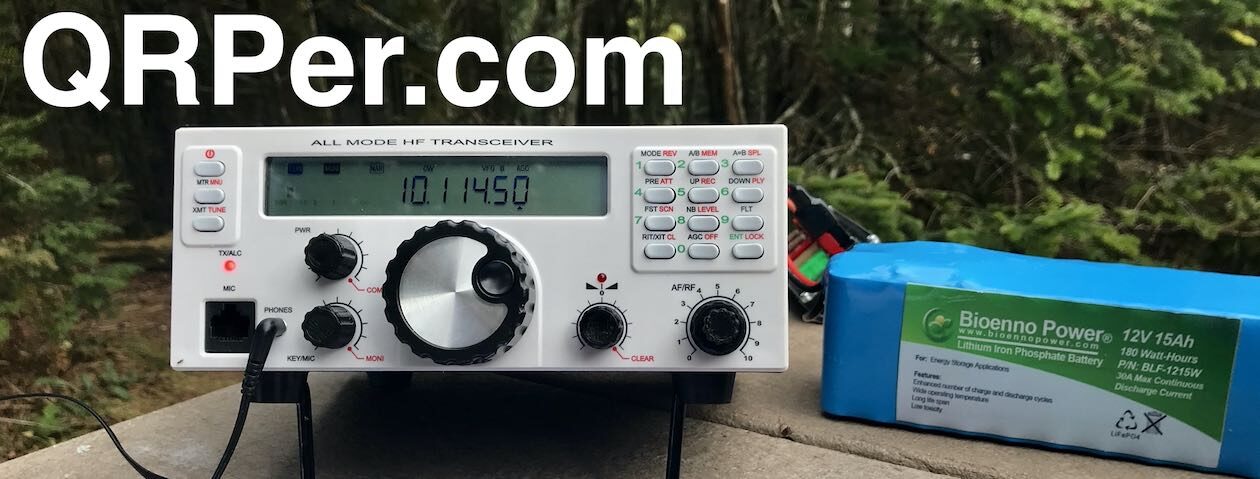
Gear:

Note: All Amazon, CW Morse, ABR, Chelegance, eBay, and Radioddity links are affiliate links that support QRPer.com at no cost to you.

QSO Map

Here’s what this five watt activation looked like when plotted out on a QSO Map:

Logs

Activation Video

Here’s my real-time, real-life video of the entire activation.  As with all of my videos, I don’t edit out any parts of the on-air activation time. In addition, I have monetization turned off on YouTube, although that doesn’t stop them from inserting ads before and after my videos.

Note that Patreon supporters can watch and even download this video 100% ad-free through Vimeo on my Patreon page:

Click here to view on YouTube.

Check it out!

Thank you

Thank you for joining me on this activation!

I hope you enjoyed the field report and my activation video as much as I enjoyed creating them.

Also, thank you for your patience while I’ve been offline and spending time with my sweet family. 

Of course, I’d also like to send a special thanks to those of you who have been supporting the site and channel through Patreon and the Coffee Fund. While certainly not a requirement as my content will always be free, I really appreciate the support.

As I mentioned before, the Patreon platform connected to Vimeo make it possible for me to share videos that are not only 100% ad-free, but also downloadable for offline viewing. The Vimeo account also serves as a third backup for my video files.

Thanks for spending part of your day with me! Have an amazing week ahead!

Cheers & 72,

Thomas (K4SWL)

The Final Fling in Florida

by Teri (KO4WFP)

It is Sunday, December 31st, the final day of 2023 and, coincidentally, my winter-break Florida POTA trip. Time to return home. But, as I promised at the end of my last article, the journey is not yet done. A POTA Babe is not going to squander the opportunity to fit in another activation or two on the way home.

Google Maps

Joseph and I loaded up the car one final time after our stay at an Airbnb in Umatilla. I found two parks at which to attempt activations – Lake George State Forest (K-4627) and Pellicer Creek State Conservation Area (K-8367). I chose Lake George because I had yet to activate a state forest and Pellicer because of its proximity to Interstate 95, my route back home.

Lake George State Forest is named (unironically) for Lake George, the second largest lake in Florida. The forest is formed from lands previously used for timber, production of naval stores, cattle grazing, and hunting. It consists of over 20,000 acres of land that offer trails for hiking, cycling, and horseback riding as well as access to hunting, fishing, and birding.

I was unclear as to where to easily access Lake George State Forest. We found the Dexter/Mary Farms Tract entrance at which is a checkpoint for hunters. I learned I needed to purchase a pass before accessing the property and could do so via an off-hours phone number. I really didn’t want to set up shop in proximity to hunting, partially because it seemed like a bad idea (duh) but also I didn’t bring my blaze orange vest on the trip.

We learned of another entrance for the forest and headed that direction. Along the way, we ran into the Barberville Yard Art Emporium who billed itself as offering the largest variety of unique handcrafted outdoor art. I believe it judging from what I saw. Anyone for a giant chicken?

After gawking at the sculptures, we headed to the Fawn Road entrance for Lake George State Forest. This entrance looked more like what I expected.

My brother Joseph donned his bright orange rain poncho and headed up the road for a hike. I, on the other hand, looked for a place to set up and get on the air. I’d need to stick to the road as it was flooded on both sides and I didn’t bring the footwear to tromp through water. Most of the trees were very tall pines. I didn’t think I could get a line on their lowest branches.

Thankfully, I found a few trees of lower height. Once the Tufteln EFRW was installed and my station set up in the road (it was closed to vehicular traffic), I commenced my activation.  I ran later than my original estimated start time but the RBN still picked me up.

As usual, I was tight on time. In 30 minutes, I had 20 contacts on 20 meters. Two days ago, I had a contact from Etor F6VMN in France. I figured why not hop onto 17 meters to see if he would hear me again today. Guess what? He did hear me and we logged another contact. The band gave me nine contacts in 10 minutes for a total of 29 contacts at this park.

QSO Map for Lake George State Park http://tools.adventureradio.de/analyzer/

By this time, Joseph had returned from his hike. We packed up and were off to our next destination – Pellicer Creek State Conservation Area. Continue reading The Final Fling in Florida

More Surprises in Florida

by Teri (KO4WFP)

It is Friday, December 29th and my winter-break POTA trip is drawing to a close. My brother Joseph and I are spending Friday and Saturday nights at an Airbnb after six days of camping. However, before we do that, I have two more parks to activate today – Green Swamp Wilderness Preserve (K-5330) and Lake Apopka North Shore (K-8353).

Google Maps

Overnight, a cold front began its march through Florida. We woke to temperatures in the low 50’s and a brief glimpse of the rising sun before clouds took over the sky again.

The drive to our first park – Green Swamp Wilderness Preserve – was a pleasant one. The preserve is divided into five management districts. We ended up in the West Tract as that is what I chose in Apple Maps. There are 65 miles of hiking trails though the tract is also used for hunting, canoeing, fishing, camping, and equestrian activities. There is a variety of habitats in the preserve – sandhills, flatwoods, oak hammocks, river swamp, and cypress ponds.

I chose an oak tree just inside the West Tract entrance perfect for the Tufteln EFRW antenna. A sunny location was necessary as the temperature was chilly in the breezy conditions. As I set up, two ladies rode in with their horses. Salty, a red roan, was unsure of Daisy and I at first. However, he eventually settled down enough to walk by and check out my POTA flag. Being a horse owner previously, I have a soft spot for these intelligent and sensitive creatures.

Salty and his owner

When Salty moseyed on, Daisy and I got down to business. I went straight to 20 meters which had no noise at all. In 35 minutes, I had 20 contacts. I needed to wrap up the activation soon to have sufficient time to fit in the second activation today but thought I’d check 17 meters for any DX contacts. I had four contacts on that band including Etor FH4MN in France!

QSO Map for Green Swamp Wilderness Preserve http://tools.adventureradio.de/analyzer/

In short order, I packed up my equipment and we headed to Lake Apopka with a stop at Costco for gas. On the drive, we saw five sandhill cranes. I had heard sandhill cranes at Little Manatee River State Park while walking Daisy one day. But I never spied them. These cranes were wary of me and the pictures I snapped weren’t great.

We finally arrived at Lake Apopka North Shore which features an 11-mile wildlife drive. The park reminded me of the Savannah National Wildlife Refuge back home in which I’ve spent some time. Lake Apopka is the headwaters of the Ocklawaha Chain of Lakes. The North Shore area consists of former farmlands that are now used to clean up Lake Apopka’s waters by circulating the lake water through restored wetlands thereby filtering it before it is returned to the lake. Those former farmlands polluted the lake with phosphorous which caused a host of problems. Continue reading More Surprises in Florida

The Fun Continues at Alafia River State Park

by Teri (KO4WFP)

It is Thursday, December 28th, the fifth day during my winter-break Florida POTA trip. The day began way too early. The rain was forecast to be a steady downpour where we camped. We woke at 3:30 AM to the light pitter-patter of rain on the tent fly and decided to get on the road before conditions worsened. Before heading to bed, we had put the bulk of our stuff already in the car. It wasn’t long before we had everything packed and were headed north.

Google Maps

I’ll admit it is an obsessive compulsive behavior that I like everything neatly organized. Because it was raining while we decamped, I had hurriedly bundled up the tent & fly and dumped them into the back of the car. That wet tent sitting back there really bothered me. About twenty minutes up the road, I found a shopping center with a covered area just begging to be used to repack that tent neatly as I desired. Now we could resume our trek northward.

Due to the early hour of our departure, we arrived at Alafia River State Park (K-1829) much earlier than time for check-ins. We found our tent site and while driving by, noted the two individuals in it were attempting to do what we did at 3:30 AM. We twiddled our thumbs in the car until 10 AM, grabbed our check-in tag, and headed to our site. Though it was still drizzling a bit, the tent was up and we were installed soon after checking in.

The rain was the harbinger of a cold front headed through Florida. With no sun to warm us, we bundled into our sleeping bags and Daisy into hers and fell asleep for an hour or so.

As I traveled through Florida, I asked myself, “Are there any of these parks to which I’d return?” Alafia River State Park is one for which I’d say “Yes.”

Alafia River State Park is a former phosphate mine, particularly for pebble phosphate.  Because phosphate is found relatively close to the surface in the state, Florida is a leader in phosphate mining.  The mining at Alafia River State Park created the topography making the park an awesome mountain biking destination with 17 miles of trails from beginner to advanced. The park also offers hiking and equestrian trails.

The campground in this park was the nicest we’d encountered. The sites were well spaced apart and, if so inclined, one could even glamp at this park. The bathrooms were sufficient though from our site, we had to walk the furthest to reach them. However, having that little bit of exercise was good for us and the walk pleasant. The park felt so open because of the topography but the high grasses characteristic of the area also gave the landscape a sense of privacy. The park was not crowded like other locations we had visited. Continue reading The Fun Continues at Alafia River State Park

An Awesome Day for Parks On The Air

by Teri (KO4WFP)

It is Wednesday, December 27th, the fourth day of my winter-break Florida POTA trip. The night before, we left the rainfly off the tent and were treated to a gorgeous view of the waxing gibbous moon. My brother Joseph was delighted and, while I worked on my article for that day, he lay back on his new Thermarest sleeping pad and took in the night sky.

Full moon through tent top: Collier-Seminole Photo by Joseph Leffek

I opted to sleep in until 8 AM enjoying the cooler morning air. Then it was time to get a shower and rid myself of four days of grunge. Breakfast was a leisurely affair. The mosquitos were less prevalent so I let Daisy relax on the tarp next to us and watch the comings and goings of our neighbors. But by 11 AM, I was getting antsy – time to head out and attempt two activations.

Google Maps

We drove east on the Tamiami Trail/US Highway 41 heading toward Big Cypress National Preserve (K-0659). The road is straight with guardrails on both sides as there is either wetlands or a canal on either side of it.  Occasionally there is a break in the foliage and the mangroves come into view.

Bird life is abundant in the area. We saw egrets, wood storks, cormorants, anhingas, and, my favorite bird, kingfishers. At my previous QTH in Savannah, I heard kingfishers at times but rarely saw them. On this drive, I saw eight or nine perched on the utility wires beside the road and gleefully noted each one.

We stopped at the Nathaniel P. Reed Visitor Center to pick up a map and figure out a place for my activation.

Big Cypress National Preserve Visitor Center

I chose the H.P. Williams Roadside Park as it was the closest place to the visitor center and had the opportunity for wildlife viewing. The parking lot was crowded and it was easy to see why. The site has a boardwalk from which one can view alligators and a nice picnic area in which several families ate lunch.

I found a tree away from the crowd and set-up the Tufteln EFRW. In the process of doing so, a little girl came up and peppered me with questions. Then her father and sister joined us. As soon as I was set up, I let them hear my callsign as well as the two girls’ names in Morse Code. It was nice to share my love of the hobby as well as Daisy, on whom they lavished some attention. What I think was a yellow-rumped warbler also paid Daisy and I a visit during the activation. Continue reading An Awesome Day for Parks On The Air

More of the Unexpected at Collier-Seminole State Park

by Teri (KO4WFP)

It was Tuesday, December 26th, the third day of my winter-break Florida POTA trip. As my brother Joseph and I were moving at a leisurely pace this morning, I decided to work in a quick activation at the campsite as the antenna was already in the trees from the prior night’s activation.

Even though this second activation at Little Manatee River wouldn’t count toward my 2024 goal, it was still a valid activation. POTA is like eating potato chips – You can’t do just one! I had five QSOs on 40 meters to begin and then 14 on 20 meters before calling QRT. We needed to get on the road and head south.

QSO Map for Little Manatee River SP Day Activation http://tools.adventureradio.de/analyzer/

My brother desperately needed a new Thermarest as the old one he brought on the trip was not working for his back. He had always wanted to visit an REI store. We found one in Sarasota-Springs and stopped by. He found a better sleeping pad and I found a few items I needed to add to my arsenal – a small brush for cleaning sand off items, a camp pillow so I didn’t have to lug my pillow from home in the future, more bug-repellant wipes, and a smaller quick-dry towel. Happy with our purchases, we resumed our journey southward.

We had lollygagged enough in the morning there wasn’t sufficient time for an activation on our way to the next camping destination – Collier-Seminole State Park (K-1847). The drive was nearly all interstate and not that exciting. It never ceases to amaze me how many people live in Florida!

Google Maps

Collier-Seminole State Park is located in southern Florida as you head toward the Big Cypress Wildlife Management Area and Everglades National Park. The Big Cypress Swamp was the last refuge of the Seminole Indians. Collier-Seminole State Park lies along the Tamiami Trail, a road from Tampa to Miami that was constructed in the early 1900’s and runs through the Big Cypress Swamp. An advertising mogul Baron Collier (for whom Collier County and Collier-Seminole State Park are named) was a significant investor in the Tamiami Trail and, in fact, bankrolled the completion of the east-west portion of the road.

After you enter Collier-Seminole State Park, on the right is the last existing Bay City Walking Dredge. This dredge was used to build the Tamiami Trail and would follow drilling and blasting rigs. The dredge dug a canal which provided rock fill for roadbed drainage of the completed road. It is a unique and huge piece of equipment.

Some parks are easier to activate than others. This was not one of the those. My first hint should have been when I was asked to read the rules when checking in. The first rule is nothing in the trees. I mentioned I am a ham radio operator and asked if it be ok to put an antenna up with an arborist line that won’t damage the tree. That request was met with an immediate and emphatic “No!” Rules are rules and, as I brought my hitch mount and SOTABeams mast on the trip, I could work around that restriction.

I planned to set up my antenna and get on the air in the comfort of my tent as I had at the previous park – Little Manatee River State Park. However, running right in front of our site and all through the campground were power poles. This campground was also much larger than our previous one. I wasn’t sure how much RFI I might get from the surrounding RVs and power lines as we appeared to be the only tent at this site. Continue reading More of the Unexpected at Collier-Seminole State Park

Expect the Unexpected with POTA

by Teri (KO4WFP)

It was Monday, December 25th, the second day of my POTA winter-break trip in Florida. I chose Florida for this trip to avoid bone-chilling temperatures. What I didn’t and couldn’t avoid, though, was rain. The weather forecast before I left Bloomingdale, Georgia promised rain off and on during the first part of the trip.

Google Maps

I had two park activations planned for Monday, December 25th – Dade Battlefield Park (K-3615) in the morning and Little Manatee River State Park (K-1898) in the afternoon. After breaking camp at Paynes Prairie State Park and getting on the road early, a steady rain began as I drove southward toward my first activation. Well, phooey. I scrapped the Dade activation and headed instead for Little Manatee River State Park, the location of our next campsite.

Little Manatee River State Park is named for the Little Manatee River which flows 40 miles from a swampy area near Fort Lonesome snaking through the landscape before emptying into Tampa Bay. It is one of the few Florida rivers that were never significantly dredged or altered therefore it is one of the most pristine blackwater rivers in Southwest Florida. Park visitors can fish along or paddle in the river. There are also hiking and horseback trails in the park.

We arrived early at the park and, as it rained off and on, killed time in the car (much to Daisy’s dismay) until our campsite was available. The weather forecast had promised rain all day; but by 1:30 PM the worst of the rain appeared behind us.

We are stuck in the car!

My brother wanted to hike in the park and I figured why not work in an unexpected activation to make up for the one I planned but scrapped earlier in the day. The closest park not requiring an entrance fee was Moody Branch Wildlife and Environmental Area (K-6317). Daisy and I loaded up and off we went.

The 960-acres of Moody Branch was formerly used for grazing cattle and farming. It was purchased as a gopher tortoise mitigation park when developers needed an off-site alternative to on-site protection of rare species being negatively impacted by development. The site features hiking and horseback trails for the public and is managed with gopher tortoises and the Florida scrub jay in mind.

The drive was a pleasant one. We passed fields and fields of strawberries as well as plant nurseries. By the time we arrived at Moody Branch, the sun played peek-a-boo from behind the clouds and the wind vigorously whipped across the open fields and pastures across from the preserve.

Next to the parking lot was a small covered pavilion with a picnic table, but that was exposed to the wind. Walking past it and around a large oak tree presented a sheltered area. I snagged a branch, set up the EFRW antenna, and put my Helinox chair near the feed-end with Daisy lying down nearby. By this time, the sun was out and removing my hoodie and donning my goofy hat for the sun was a necessity. Continue reading Expect the Unexpected with POTA

Field Report: Alan’s P2P POTA Activation Challenge!

Many thanks to Alan (W2AEW) who shares the following guest post:


A self-imposed POTA Park-to-Park Challenge…

by Alan (W2AEW)

One of the things I love about the Parks on the Air program is that every activation is a bit of small challenge.  What will the band be like?  What antenna will I be able to deploy when I get there?  Will I have a spot to setup?  Will my CW ‘ear’ be properly tuned up? You get the picture…

There are a few parks that I activate much more than others – call them my “home” parks.  These are the ones that are close to my home, easy to get to and setup.  One in particular,  Washington Rock State Park (K-1635), is certainly the closest. It has some interesting Revolutionary War History.

Not only is this park very close to my home, it also has pretty good elevation (about 500’) for this part of New Jersey.  In fact, the local fire department hangs a very large illuminated star during the Christmas season at their building that is adjacent to this park.

This star can be seen for miles to the South and East of the ridge.

It’s no wonder that I’ve activated this park more than 20 times in the last year and half.

My XYL Nancy was *very* generous to me this year at Christmas – gifting me a new Begali Adventure CW paddle!  She even had it engraved with my call:

I wanted to think of a unique way to celebrate my first POTA activation using this paddle. I would be going to K-1635, so the location would be very familiar.  Therefore, I thought of an interesting self-imposed challenge…   Attempt to complete an activation with ONLY Park to Park contacts!

As I thought about this, I figured my best chance of success would be to operate on the weekend (significantly more parks are active), and use my most efficient multi-band antenna (a 40m EFHW).

Being an engineer, I’m use to having goals.  I’m also used to having additional constraints imposed – let’s call them stretch-goals.  Possible stretch goals for this P2P Activation Challenge could be:

  • Operate QRP (all of my POTA activations are QRP, so not much of a stretch)
  • Operate only CW (nearly all of my activations are CW, and this helps with the QRP goal too)
  • Attempt this using a more compromised antenna
  • Attempt this during a weekday

It turns out I had a few free hours on Wednesday, December 27, 2023 to play radio…  It was kind of a dismal day weather-wise.  I figured it might be the day to attempt this challenge.  The wet weather had me thinking that I’d setup my SuperAntenna MP1 vertical instead of using the 40m EFHW (and having it and the throw line get all wet and muddy).  The stage was set for the challenge including the stretch goals.

I setup the MP1 on the bedrail of my truck, using an MFJ-1976 ten-foot whip on top.

The band conditions were in pretty good shape, so I figured I had a shot.  I setup the rig inside the truck because of the rain, and got the iPad going with the POTA spotting page to see who I could hunt.  I logged four P2P contacts in the first 20 minutes, so there was hope!

In the end, it took about 90 minutes to log 11 Park-to-Park contacts.  Well, actually 12, since one of them turned out to be a two-fer.  I logged a few “familiar” activators, including Teri KO4WFP – a frequent contributor of Field Reports here, and Jonathan KM4CFT – running a two-fer out of North Carolina.  There were a few that I noted in my paper log because I had a good copy on them, but ultimately couldn’t bust thru the pile ups there were getting (like K7SHR at K-10946 in WY and K0YY at K-4416 in TX).

A personal thanks to all of the activators in my log that helped me reach my P2P Challenge:

  • KL7NL at K-6945 in NC
  • KM4CFT at K-8313 and K-3378 in NC
  • WD4AWD at K-2982 in TN
  • KU8T at K-4208 in IN
  • KO4WFP at K-0659 in FL
  • W0ABE at K-10532 in CO
  • N4XTT at K-2982 in TN
  • NM1L at K-7475 in FL
  • KC1BDJ at K-7879 in FL
  • KI5GBQ at K-7687 in OK
  • NS1C at K-2420 in MA

All contacts were on 20m with the exception of NS1C on 40m.  All were CW.

This was a fun little challenge, one that I hope to repeat in the future.  Hope to see you all on the air – POTA-ON!

72 de W2AEW

KO4WFP: The Countdown Begins with Jack Hill State Park

Many thanks to Teri (KO4WFP) who shares the following guest post:


The Countdown Begins with Jack Hill State Park

by Teri (KO4WFP)

Having completed my kilo for Wormsloe State Historic Site (K-3725) and earned the Marathon Award for the Straight Key Century Club, I needed a new goal into which to sink my teeth. I’ve often set goals in my life as they motivate me to learn and step outside my comfort zone. So what better goal than to activate 60 parks new to me over the next year! I admit it is ambitious; however, goals should excite you as well as make you a little nervous because then you know you are stretching yourself.

How do I plan to accomplish activating 60 new parks? The weeks my son has a break from school offer the perfect opportunity to travel. I can also work in overnight trips to locations in Georgia or South Carolina throughout the year. To save money, I’ll drive on these trips and camp. Most state parks which offer camping are also a park on the POTA list, an easy win-win. For safety, my “POTA pooch” Daisy will accompany me if I am alone, offering an opportunity for the two of us to strengthen the bond we have and work on her training.

My first break-week trip is to Florida during the second week of winter break, December 24th through January 1st. I have nine to ten parks I plan to activate that week, depending on the weather. Daisy and my brother Joseph (no, he is not a ham) will accompany me. Joseph and I took a cross-country trip out west in my twenties and spent six weeks on the road. We mostly camped but also visited friends and relatives along the way.

However, before I leave on my Florida trip, I began my pursuit of 60 new parks with Jack Hill State Park, a park that is only an hour from my new QTH in Bloomingdale, Georgia.

Anyone who knows me knows that I am not a fan of winter. (Spot me this as I live in the Deep South.) However, I am determined to not miss out on POTA because of a little cold weather. Thinking the temperature would be warmer in the afternoon, my dog Daisy and I headed out later than usual on Wednesday, December 13th for our activation.

I enjoy driving in rural Georgia. You never know what you’ll see. Daisy and I went through the town of Bellville, a whistle stop in the middle of nowhere. The town was established in 1890 along the tracks of the Savannah & Western Railroad and was a regional transportation hub for agricultural and timber products. A mural in the town across from the old depot pays homage to the town’s railroad past.

Jack Hill State Park is located in the town of Reidsville, Georgia. It offers amenities that include boating and fishing on the park’s lake, accommodations in the form of camping as well as cottages to rent, a splash pad for kids, and even a free miniature golf course! The park was originally named Gordonia-Altamaha State Park as it is near the Altamaha River. However, it was renamed Jack Hill State Park in 2020 in honor of Senator Jack Hill who was instrumental in the local community. Continue reading KO4WFP: The Countdown Begins with Jack Hill State Park

POTA During a Beautiful Fall Afternoon at Tallulah Gorge State Park!

Sunday, October 15, 2023, was the final day of the W4 SOTA campout. That morning, Joshua (N5FY) and I packed up our tents/gear then played a little radio at our campsite (at Lake Rabun). We weren’t in a hurry because the morning was so enjoyable. In fact, I think we checked out not a minute before the dealine of 12:00 noon!

We both decided we wanted to squeeze in one more radio excursion before driving back to our QTHs.

Tallulah Gorge State Park (K-2202)

It wasn’t realistic to fit in another SOTA hike due to our schedules, but Tallulah Gorge SP was an easy detour for both of us.

We pulled into the park and queued up to to enter. The park was absolutely teeming with visitors that day. I would have expected nothing less on such a gorgeous Fall afternoon!

Joshua and I found a quiet picnic area–with a few picnic tables spaced apart from each other–near the lake shore. It turned out to be a perfect spot to play radio. We spaced our sites far enough apart so as not to easily interfere with each other while on different bands.

Joshua set up his KX1, a wire antenna, and used VK3IL pressure paddles.

Joshua deployed his KX1 next to the lake and I deployed my KX2 a bit further up the hill.

I paired my KX2 with my “no transformer” random wire antenna. Of course, I used a Tufteln antenna because, I mean, N5FY was standing right there! ?

This antenna consists of two 28.5′ 26AWG wires connected directly to a male BNC. Simplicity itself on the antenna side. It’s the KX2 internal ATU that does all of the matching (since there’s no transformer). I find that the KX2 can match this antenna from 40-10 meters with ease.

I think the magic of these simple random wire antennas is that they’re directly connected to the radio. There’s a bit of efficiency in having no line losses, etc. even if the ATU does soak up a bit of energy.

Time to hop on the air! Continue reading POTA During a Beautiful Fall Afternoon at Tallulah Gorge State Park!