Tag Archives: Tufteln 9:1 Random Wire Antenna

More of the Unexpected at Collier-Seminole State Park

by Teri (KO4WFP)

It was Tuesday, December 26th, the third day of my winter-break Florida POTA trip. As my brother Joseph and I were moving at a leisurely pace this morning, I decided to work in a quick activation at the campsite as the antenna was already in the trees from the prior night’s activation.

Even though this second activation at Little Manatee River wouldn’t count toward my 2024 goal, it was still a valid activation. POTA is like eating potato chips – You can’t do just one! I had five QSOs on 40 meters to begin and then 14 on 20 meters before calling QRT. We needed to get on the road and head south.

QSO Map for Little Manatee River SP Day Activation http://tools.adventureradio.de/analyzer/

My brother desperately needed a new Thermarest as the old one he brought on the trip was not working for his back. He had always wanted to visit an REI store. We found one in Sarasota-Springs and stopped by. He found a better sleeping pad and I found a few items I needed to add to my arsenal – a small brush for cleaning sand off items, a camp pillow so I didn’t have to lug my pillow from home in the future, more bug-repellant wipes, and a smaller quick-dry towel. Happy with our purchases, we resumed our journey southward.

We had lollygagged enough in the morning there wasn’t sufficient time for an activation on our way to the next camping destination – Collier-Seminole State Park (K-1847). The drive was nearly all interstate and not that exciting. It never ceases to amaze me how many people live in Florida!

Google Maps

Collier-Seminole State Park is located in southern Florida as you head toward the Big Cypress Wildlife Management Area and Everglades National Park. The Big Cypress Swamp was the last refuge of the Seminole Indians. Collier-Seminole State Park lies along the Tamiami Trail, a road from Tampa to Miami that was constructed in the early 1900’s and runs through the Big Cypress Swamp. An advertising mogul Baron Collier (for whom Collier County and Collier-Seminole State Park are named) was a significant investor in the Tamiami Trail and, in fact, bankrolled the completion of the east-west portion of the road.

After you enter Collier-Seminole State Park, on the right is the last existing Bay City Walking Dredge. This dredge was used to build the Tamiami Trail and would follow drilling and blasting rigs. The dredge dug a canal which provided rock fill for roadbed drainage of the completed road. It is a unique and huge piece of equipment.

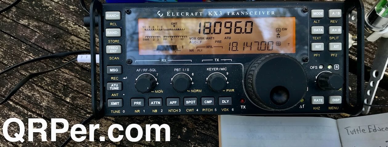
Some parks are easier to activate than others. This was not one of the those. My first hint should have been when I was asked to read the rules when checking in. The first rule is nothing in the trees. I mentioned I am a ham radio operator and asked if it be ok to put an antenna up with an arborist line that won’t damage the tree. That request was met with an immediate and emphatic “No!” Rules are rules and, as I brought my hitch mount and SOTABeams mast on the trip, I could work around that restriction.

I planned to set up my antenna and get on the air in the comfort of my tent as I had at the previous park – Little Manatee River State Park. However, running right in front of our site and all through the campground were power poles. This campground was also much larger than our previous one. I wasn’t sure how much RFI I might get from the surrounding RVs and power lines as we appeared to be the only tent at this site. Continue reading More of the Unexpected at Collier-Seminole State Park

Backcountry Drive and Beautiful Views: SOTA and POTA QRP combo on Dogback Mountain!

In the latter part of the morning on Thursday, June 15, 2023, I hopped in my car and started the drive back to my QTH after spending a couple of days helping my parents in Catawba County, NC.

I had a window of about three hours where I knew I could fit in a POTA activation or two.

I’m quite familiar with POTA landscape along this particular corridor of western North Carolina, so I starting considering my options. I could have easily hit South Mountains State Park, Lake James State Park, and/or Table Rock Fish Hatchery, but what I really wanted to do was a little SOTA (Summits On The Air).

The problem, that particular day, was that the AQI (Air Quality Index) wasn’t great–not ideal for a strenuous hike, so I quickly dismissed that idea. The skies, in fact, were a bit hazy from the forest fire smoke blowing down from northern Canada.

Then it dawned on my that I could drive to the summit of Dogback Mountain (W4C/EM-066) and perform not only a SOTA activation, but a POTA two-fer as well since the activation zone is also in Pisgah National Forest (K-4510) and Pisgah Game Lands (K-6937).

In truth, I don’t do a lot of drive-up summit activations because, typically, when I want to do SOTA, I also want to hike. But drive-up summits are ideal on days like this when either weather is questionable, or the AQI is high.

The drive

If you live near western North Carolina, Dogback Mountain is a must. It’s one of the few sites I go to that I enjoy the drive as much as the activation.

As I mentioned in my previous Dogback field report, the road to the summit is a Forest Service road that has a very backcountry feel to it. It’s not maintained regularly, so you can expect washboarding, deep ruts, large exposed stones, deep potholes and wide mud holes.

This isn’t a road I’d recommend for someone driving a sedan or minivan (that said, many years ago I did take a minivan up this road–made for a dodgy drive). Your vehicle would benefit from some proper ground clearance and, ideally, all-wheel drive or four-wheel drive.

Frankly, I absolutely love driving this road because it’s passable most of the year, offers up amazing views, and has a number of dispersed camping spots (or POTA activation sites–!) along the way.

I drive backcountry roads routinely, so this is pure fun for me.

Dogback Mountain (W4C/EM-066)

The summit of Dogback Mountain is pretty much right on the forest service road. There are two pull-off parking areas on either side of the summit and both are well within the activation zone. In theory, you could set up your portable station along the road and do the SOTA activation there.

Note: Unlike POTA, the SOTA program does not allow mobile activations. If you activate a drive-up summit, you still need to set up a portable station that in no way uses your vehicle for support. 

I parked my car (turned on my video camera for the activation video below) then walked the very short path to the true summit. Continue reading Backcountry Drive and Beautiful Views: SOTA and POTA QRP combo on Dogback Mountain!

Side trail POTA ATNO at Boisé des Compagnons-de-Cartier in Québec City

On July 4, 2022, I plotted a multiple park POTA run that included four urban parks all clustered in the Sainte-Foy region of Québec City.

The first park I activated that day was Parc de la Plage-Jacques-Cartier (VE-0970)–click here to check out my full field report and activation video. The second park was Parc Cartier-Roberval (VE-0964)–click here to check out that field report and activation video. The third park was Boisé de Marly Provincial Park–click here to check out that field report and activation video.

My fourth park was Boisé des Compagnons-de-Cartier which essentially adjoined the previous park I activated. As I mentioned in the previous field report, I could have simply walked through the trail system to this park from my previous site, but I needed to find a different parking spot for my car, so I simply drove to a large lot next to the secondary school I spotted on Google Maps.

Turns out even though that lot was nearly empty, it was a paid parking, so I reserved a parking spot for one hour.

Boisé des Compagnons-de-Cartier (VE-0958)

When I first parked, I wasn’t entirely sure where the park entrance was until I spotted a bench and park sign at the far corner of the lot.

This park, much like the previous one, seemed to be an urban park with trails for walking and running.

I walked the main path into the park and looked for a park bench like I found at the park entrance (above). I thought it might be nice to set up along the path and do a park bench activation much like I did at another urban park in Québec City.

I walked for a decent distance and couldn’t see a bench in sight.  The path was fairly busy with walkers and runners, so I was very pleased when I found a side trail cutting through the middle of the park.

I could tell that this path–while very well-worn and obvious–was not one maintained by the park admin. It looked more like a simple foot trail that local children have probably used in the past (I spotted a little wooden fort/lean-to in the woods.)

Keep in mind that this was my fourth park activation of the day and by this time, I was running behind–no surprise there. After the activation, I had two errands to run in QC before heading back to our condo and enjoying dinner and a movie with the family.

Continue reading Side trail POTA ATNO at Boisé des Compagnons-de-Cartier in Québec City

QRP DX! Pairing the Elecraft KX2 & Tufteln Random Wire at Parc Cartier-Roberval.

On July 4, 2022, I plotted a little multiple park POTA run that included four parks all clustered in the Sainte-Foy region of Québec City.

The first park I activated that day was Parc de la Plage-Jacques-Cartier (VE-0970)–click here to check out my full field report and activation video. I managed to complete that activation in record time, during poor band conditions with the Elecraft AX1 antenna. In short? It was a blast!

I knew, however, that band conditions would likely only deteriorate that day and each subsequent activation could become more difficult to complete (spoiler alert: it did).

I scheduled Parc Cartier-Roberval (VE-0964) to be the second park of the day and was prepared to slog it out, but fortunately, the bands had not collapsed yet and this activation had a few surprises in store!

Parc Cartier-Roberval (VE-0964)

This park practically adjoins the previous park I activated. Indeed, if I had the time in my schedule (I did not) I would have walked the St. Lawrence river trail to Parc Cartier-Roberval.

My family actually visited Parc Cartier-Roberval the previous week while in the Sainte-Foy area.

The park is chock-full of history as it is also associated with an archaeological site exploring the first French colonists to arrive in America by Jacques Cartier and Jean-François de La Rocque de Roberval from 1541 to 1543.

There are some beautiful and informative displays on the west side of the park, near the railroad tracks.

There’s also a beautiful, immersive display that ends with a stunning overlook.

I could have spent all day soaking in the history.

The suspended glass encasement containing figurines of the first colonists is not to be missed.

And, again, the views from the overlook are most impressive!

Since I was on a schedule, I left the overlook and walked to the eastern part of the park.

When I visited the park the previous week, I had no time to perform an activation–in fact, we were in the Sainte-Foy area to visit a CLSC (regional medical center) and didn’t want to miss our appointment time.

Side note: Why were we visiting a CLSC the previous week? My wife cut her finger a few days prior; it was severe enough to require a visit to the hospital and six stitches. Our CLSC visit was to have a nurse check out her finger and change the bandage. The medical care we got was first class–within a week (two days after this activation) the stitches were removed and we were given the green light to do some camping up the north coast of the St. Lawrence. She had to change her bandages frequently for a full month, but looking at her finger now, you’d never know she’d cut it. Turns out, Québec is a great place to have a medical emergency!

But back to the activation…

Continue reading QRP DX! Pairing the Elecraft KX2 & Tufteln Random Wire at Parc Cartier-Roberval.

Fighting mozzies and logging POTA hunters at Cap Touremente

One of our favorite national parks in the Côte-de-Beaupré region of Québec, Canada is Cap Tourenemente National Wildlife Area.

When my family spends the summer in Québec we typically visit it several times, especially since it’s never far from where we stay.

Thing is, each entry into Cap Touremente costs about $20 or so (unless we purchase an annual pass), but it’s worth it for the hikes, and the scenery. We also like supporting parks with our entry fee.

For a POTA activation–? I don’t need access to the main park, especially if the family isn’t with me. I did a little research and found a spot within the NWA on the “free” side of the park gates.

The spot is a basically a wildlife viewing area with a small grass road that is flanked by marsh land near the town of Saint-Joachim.

Of course…

Marsh Land = Mozzies

Before heading to Cap Touremente on Monday, June 27, 2022, I sprayed a “healthy” dose of insect repellent on my clothing. Having been to this spot several times in the past, I knew what awaited me: mosquitos. Lots of them.

We have mosquitos back home in the mountains of North Carolina, of course, but not in the quantities you find in marshy areas along the north shore of the St-Lawrence.

That Monday, though, it was very gusty. In the morning we had heavy rains, then a front pushed that through in the early afternoon opening up clear skies and very gusty winds. Mosquitos don’t do well in the wind, so my hope was the wind would offer an extra layer of protection.

Spoiler alert: The winds did help to some degree, but Canadian mosquitoes are heartier than our Carolina varieties.

Cap Tourmente National Wildlife Area (VE-0012)

I had been on the air earlier in the day and conditions were truly in the dumps–at least, at my latitude. I knew it wouldn’t be a quick activation, so I allowed myself extra time to complete the activation.

On the 10 minute drive to the site, I decided to pair the Elecraft KX2 with the TufetIn 9:1 random wire antenna that I configured with a 31′ radiator and a 17′ counterpoise. I found this combo very effective in the past and I love the frequency agility of random wire antennas especially when the bands are rough and it becomes a game of band hopping to see what portions might be open. Continue reading Fighting mozzies and logging POTA hunters at Cap Touremente