Tag Archives: Florida

The POTA Babe Goes Back to Florida – Day 3

Day 3 of my spring-break Florida POTA trip began well. Those of you who read my “A Confession from the POTA Babe” article know my personal life has been anything but settled as of late. Two weeks prior to the trip, I experienced a traumatic break with a close friend and partner. I hoped this trip would help me move past that event and began putting my life back together.  This was the first morning I woke in two and a half weeks feeling like myself and ready for whatever POTA adventures lay ahead of me.

Day 3 of my spring-break 2024 Florida trip

Participating in the pilot session of CW Innovation’s Comprehensive ICR course in October 2022 introduced me to the concept of a code buddy. A code buddy is someone with  whom you have regular CW QSOs, a trusted friend who keeps you active on the air and with whom you grow your skills. I have two code buddies currently – Caryn KD2GUT and Charles W4CLW. Charles and I usually meet Tuesday mornings at 8 AM EDT and I thought why not try to meet up during the trip.

As noted in my article about the first day of this trip, I had to take down the EFRW at my campsite as per park regulations. I pulled out the Chelegance MC-750 as I thought it might stand a better chance than the AX1 with any noise in the campground. As Charles’ QTH was only 232 miles from my campsite, I figured 40 meters would be the only option for us.

I turned on the KX2 and the noise was horrible. However, Charles cleared a frequency and called QRL. He was a 599 on my end but when it was my turn, he could not hear me at all. Oh well. We at least tried.

I figured since I already had my equipment up and running, why not have an impromptu activation?

I spotted myself on the POTA website and began calling CQ. Within 40 minutes, I had a valid activation. Thirty meters gave me four contacts and 20 meters eight contacts including Manuel WP4TZ in Puerto Rico, another member of the Comprehensive ICR course I am currently facilitating with CW Innovations.

I also had one park-to-park QSO with Dave KQ4CW who was activating US-0567 in Virginia. At this point, it was time to pack up my equipment and head south to Cedar Key Scrub Preserve (US-3611).

QSO Map for Manatee Springs 4-2-24 Activation Source: http://tools.adventureradio.de/analyzer/

On the drive southward, I noticed lots of yellow flowers (I think dandelions) along the road as well as wild verbena. I enjoyed the encounters with the natural world I had on this trip. The previous day, I had several different caterpillar species visit me during my activations. They ended up on my clothes as well as my equipment.

During today’s impromptu activation at the campsite, three deer walked  through the area. Nature galore!

a tussock moth caterpillar
a Tent caterpillar
possibly a salt marsh moth caterpillar

Daisy and I arrived at Cedar Key Scrub Preserve (US-3611) around 11:30 AM. It was fairly warm at this hour of the day so I set up in the shade generated by Kai and some overhead trees. I chose to work with the Chelegance MC-750 again.

This activation proved to be a busy one, all on twenty meters. Over the course of 50 minutes, I logged 32 contacts including one DX with Chris F6EAZ in France, a QSO with another team member in my class – Pat K2SCH, and one park-to-park QSO with Jeff KF4VE at US-4857 in Virginia.

At this point, the sun had overtaken Daisy and I. We were beginning to roast so it was time to call QRT.

QSO Map for Cedar Key Scrub Preserve Source: http://tools.adventureradio.de/analyzer/
USA Only QSO Map for Cedar Key Scrub Preserve Source: http://tools.adventureradio.de/analyzer/

I had planned to take a walk at Cedar Key Scrub Preserve but due to the warm temperatures and foliage that would not provide much shade, I scrubbed (yes, you can groan) that plan, packed up, and headed further south to Cedar Key.

The town of Cedar Key is made of small islands (called keys) linked together by bridges. We navigated over them to Cedar Key Museum State Park (US-3610).

Unfortunately, the museum was closed for maintenance. But, as I surveyed the site, I saw a shady bench beckoning me.

A QTH with potential!

I set up the Chelegance MC-750, Daisy sprawled out for a nap, and I got down to business.

This activation ran slower than the previous one. I ended up with 25 QSOs on 20 meters in an hour. However, it was pleasant to relax in the shade, enjoy the breeze, and not be in a rush. In fact, after the activation and everything was packed up, Daisy and I relaxed at this spot for a good thirty minutes, soaking in the experience.

On the drive back to my campsite, I received an unexpected call. It was the close friend and partner I thought I had lost several weeks ago.  I pulled off to the side of the road. The conversation was a heart-felt and cathartic one.

I had a choice to make. There were three days remaining in my trip and potentially four more parks I could activate toward my 60 new-to-me activation goal.  Or I could choose to step through the door that just opened. It didn’t take me long to decide.

This spring-break Florida trip was a productive one. I activated six parks toward my goal, used two antennas with which I was not very familiar, and camped on my own. I also did what I set out to do in my “A Confession from the POTA Babe” article – savor the beauty around me, think, reflect, and be. I cancelled the remainder of the trip to visit this cherished person with the joy of reconciliation.

It doesn’t matter if it is POTA or your personal life; relationships are what matter. This POTA Babe has learned her lesson and has her priorities in the correct order now. Thanks to all of you who continue to share my adventures. They are far from over.
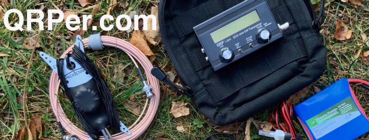
Equipment Used

[Note: All Amazon, CW Morse, ABR, Chelegance, eBay, and Radioddity links are affiliate links that support QRPer.com at no cost to you.]

The POTA Babe Goes Back to Florida – Day 2

Day 2 of my spring-break Florida POTA trip began well. The night before, I left the rain fly off one corner of the tent, the one out of which I could look when lying on my Thermarest pad listening to the bird song all around us. There must be something about being outside because I had the soundest and most sleep I’d experienced in several weeks.

someone is not ready to get out of bed yet
Day 2 of my April Florida trip

We headed to the Nature Coast State Trail first as I was concerned about the temperature due to the sunny forecast. We found the Old Town trailhead, parked, and walked toward the trail’s bridge over the Suwannee River. Not far from the bridge, I spied a bench with an overhang and thought it would make a great QTH.

Old Town trailhead parking area
the trail
flowers along the trail
potential QTH

I had left the Chelegance MC-750 in the car as I wished to work with the AX1 today. It wasn’t long before I had it installed on the Joby Gorillapod ready for 40 meters. I turned on the KX2, put on my earbuds, and was greeted by NOISE, S5-S7 noise.

Well, noise happens and I typically find it on 40 meters than any other band when I activate. Undaunted, I tweaked the AX1 and moved to 30 meters. I found less noise (S3-S4) but no one answered my CQ. Now I was getting worried.

I removed the 40 meter coil from the AX1 and tried 20 meters. Now 20 meters didn’t sound that noisy; however, I had no callers. I found the same on 17 meters. What the heck?

And then I noticed the power lines across the road. How they had escaped my notice I have no idea. They weren’t just your typical power lines but also high-voltage power lines. That had to be the source of the noise. I felt like an idiot not even noticing them. The AX1 is a compromised antenna to begin with and, in those conditions, I don’t think it stood a chance.  Note: I later learned the band conditions were not great that morning either.

Deflated, I packed everything up and walked a little ways up the trail to the bridge crossing the Suwanne River. After a few moments to enjoy the view, I headed toward my second park – Fanning Springs State Park. It was but a 5 minute drive from the Old Town trailhead. I began  looking for somewhere to set up. Good news – not many power lines.

Suwannee River

I found a grassy field/parking area off to the side and set up there. My riding instructor would always say “Set your horse up for success.” Well, this I thought was a more successful situation for the AX1 (at least I hoped it would be). Once the AX1 was installed on top of my car, I got down to business.

AX1 on top of the car on Joby Gorillapod

I didn’t do well on 40 meters (only one caller in Florida) or 30 meters (no response). I removed the 40 meter coil and set up shop on 20 meters. Would anyone hear me today? YES! Over the next 20 minutes, I logged eight contacts including Dan N0ZT who is in my current Comprehensive ICR class for CW Innovations.

At this point, I only had nine total contacts, not enough for a valid activation. Hearing no more responses to my CQ on 20 meters, I headed to 17. After a while, Craig KC3TRT responded to my CQ. Over the next ten minutes, nine ops had a QSO with me including Raffaele IK4IDF in Italy. Whew – a valid activation.

QSO Map for Fanning Springs State Park
QSO Map (USA contacts) for Fanning Springs State Park
The springs (as close as we could get as dogs are not allowed near them)

By now I was worn out and decided to regroup back at the campsite. I felt kicked in the keister over the failed activation in the morning. There are five trailheads for the Nature Coast State Trail. Maybe I could find a section without power lines (not likely) and maybe the conditions in the late afternoon/early evening would be better.

After an early supper and a few minutes to read, Daisy and I headed back to the trail for another attempt. Yes, there were power lines (but not high voltage ones) near the trailhead I chose in Chiefland. It was peaceful on this section of the trail. We ambled along until I found another bench like I saw that morning.

AX1 with radials

I opted to sit instead in my Helinox chair on the ground with Daisy to my right and the AX1 to my left. There was thick foliage in front of me as well as a park area that I hoped would provide a buffer from any RFI from the businesses on that side of the trail. I took a breath and called QRL. I picked 20 meters thinking that might be my best bet this time of day, around 6 PM.

Guess what? The AX1 delivered!

I had 18 contacts in 30 minutes including a QRP-to-QRP QSO with Karl K5KHK in New York. I also had one park-to-park QSO with David WN1E at US-0897. I practically floated back to the car and then celebrated with a chocolate-dipped ice cream cone from Dairy Queen.

QSO Map for Nature Coast State Trail
Way more ice cream than I needed but it was good!

People don’t talk about the emotional component that comes with morse code. My life has been an emotional rollercoaster as of late and that failed activation felt like another punch in the gut.

You know the ops that I see make the most progress, in general and in the class I facilitate with CW Innovations? Those with determination.

They don’t give up but persevere despite their struggles. Life is really tough for me right now but I have to hang in there as I did with this activation. You never know when success or for what you are waiting will be around the corner.

For day 3, I’ll head south toward Cedar Key. What antenna will I choose to use and how will those activations go? Stay tuned…

Equipment Used

[Note: All Amazon, CW Morse, ABR, Chelegance, eBay, and Radioddity links are affiliate links that support QRPer.com at no cost to you.]

The POTA Babe Goes Back to Florida – Day 1

In pursuit of my 60 new-to-me park activations, I headed back to Florida for six days the first week of April. The weather forecast looked promising – high temps in the upper 70s falling to the upper 60s by the end of the week. Rain might dampen my spirits on Wednesday but otherwise, the sun was likely to shine during my journey.

Day 1 of my April 2024 Florida Trip

Daisy and I packed up the car and headed out early Sunday, May 31st. It was an easy journey – three and a half hours south down I-95 and then southwest across Florida. Of course, we stopped at the Florida welcome center and got our picture snapped, this time just the two of us.

Here we again in Florida!

We arrived in Branford which actually did look like a nice place to live. Lafayette Forest Wildlife & Environmental Area (US-6315) is just outside the town. Unlike the wildlife management areas in Georgia I’ve visited, this one looked more manicured. The road into the park could have been the entrance into some genteel Southern plantation.

Not far inside, we found a fenced-in parking area and kiosk. I figured this would be the easiest place to set up. Checking the kiosk, I confirmed we were out of hunting season though we would still wear our blaze orange items for our walk after the activation. (Before we arrived at the park, we actually saw a turkey crossing the road.)

Map of Lafayette WMA

I opted to use the Chelegance MC-750 on the tripod mount because I need more practice with it. That proved to be a good choice as I had to re-read the instructions to set it up – hi hi. This is what happens when you don’t use equipment on a regular basis.  Continue reading The POTA Babe Goes Back to Florida – Day 1

Planning a POTA Babe Trip – Part 3

(Note: As many of you know, I cut my spring-break Florida POTA trip short for personal reasons. However, I did not change this article and opted to leave the original itinerary intact as that was the intent of the trip.)

Having two POTA trips under my belt, I thought I’d share how I plan my trips in hope it will inspire others to undertake the same endeavor. After I explain my process, I’ll walk through the process using my spring-break POTA trip as an example.

The first questions to answer are where do I want to explore and how am I going to get there?

So far, I’ve traveled to Nova Scotia and Florida. Air travel was a necessity for the Nova Scotia trip but not my preference for travel in general. I loved to fly as a child but as an adult, it has lost its appeal. We live in a gorgeous country and have at our disposal a wonderful interstate system such that my transportation preference for a POTA trip is to drive. For a short trip (five to six days), I try to stay within 250 miles of my home QTH. For a trip longer than a week, I’m willing to drive 500 miles or more.

Google Maps

The next step is to decide where I’ll stay. Now that I am single, I need to watch my expenses closely. Camping is a great accommodation option if one is willing to put up with some inconveniences. So far I’ve found the campgrounds in the state parks to which I’ve traveled more than adequate. One has to be willing to walk to the bathhouse, accept whatever conditions the weather provides, and be less connected than we typically are in our modern society. Camping also requires certain equipment which I addressed in my first article.

Once I’ve nailed down my accommodations, it is time to begin choosing which parks to activate. For the past two trips, I chose parks based on their proximity to the roads I drove between accommodations, whether I needed to pay for access to the park, and how easily I could ensure I’m within the parks boundaries. My priority was to fit in as many park activations as I could during the trip.

Going forward, my criteria is the same but my focus is not. I want to spend more time in the parks I activate, choosing parks based on the scenery and/or other activities they offer so I may learn about the ecology and/or history of the location. I also want to savor the parks I visit, taking time to slow down and enjoy the experience.

So let’s walk through this process as to how I planned my spring-break POTA trip in April.

Choose a destination and how to get there

As I mentioned earlier, I prefer to drive. I’ll be gone six days for my April POTA trip, so I need to find a destination within 250 miles from Bloomingdale, GA. I chose to visit the state of Florida as I enjoyed my trip this past December and think the weather during the first week of April will still be comfortable that time of year.

Choose accommodations

For the Florida winter-break trip, I stayed in a different campground nearly every night. The advantage of that arrangement is I could cover more ground and experience more places. However, taking down and setting up camp every day eats up time and, depending on the weather, can be a pain. For the spring-break trip, I thought I might stay at the same campground the entire trip.

Itinerary for December 2023 POTA Trip Source: My Google Map

I searched for and found a map of all the Florida state parks with camping. There were several state parks within the 250-mile radius from my home; however, I also wanted a park that had lots of potential POTA sites nearby. After looking at my options, I chose Manatee Springs State Park at which I will stay three nights. Not far away is Suwannee River State Park which had availability for two nights. Bingo – accommodations done!

Source: https://www.floridastateparks.org/statewide-map
Source: pota.app
Choose which parks to activate

Now that I’ve chosen the parks at which I’ll stay, I need to figure out what POTA sites nearby are of interest. As I stated earlier, I want to choose activation sites based on what they can offer me in addition to the activation itself. Two prime activities at parks are wildlife viewing and hiking.

When I think of wildlife, I immediately think of national wildlife refuges. I Googled “best national wildlife refuges to visit in Florida” and found the following map. The refuge closest to the areas I plan to visit is St. Mark’s National Wildlife Refuge and, given what I read about that refuge, there is so much to see there that it may fill up an entire day.

Source: https://www.floridarambler.com/florida-parks-forests-wildlife-refuges/national-wildlife-refuges-in-florida/

 As for hiking, I googled “best hiking trails in Florida” and found  floridahikes.com. There were a fair amount of trails from which to choose though several were eliminated because dogs are not allowed due to the presence of alligators or ticks are a major problem. I took my time exploring the site finding trails close to or in the Manatee Springs and Suwanee River State Parks.

Now that I have my accommodations nailed down and some ideas for wildlife viewing and hiking, I need to fill in my itinerary. Continue reading Planning a POTA Babe Trip – Part 3

The Final Fling in Florida

by Teri (KO4WFP)

It is Sunday, December 31st, the final day of 2023 and, coincidentally, my winter-break Florida POTA trip. Time to return home. But, as I promised at the end of my last article, the journey is not yet done. A POTA Babe is not going to squander the opportunity to fit in another activation or two on the way home.

Google Maps

Joseph and I loaded up the car one final time after our stay at an Airbnb in Umatilla. I found two parks at which to attempt activations – Lake George State Forest (K-4627) and Pellicer Creek State Conservation Area (K-8367). I chose Lake George because I had yet to activate a state forest and Pellicer because of its proximity to Interstate 95, my route back home.

Lake George State Forest is named (unironically) for Lake George, the second largest lake in Florida. The forest is formed from lands previously used for timber, production of naval stores, cattle grazing, and hunting. It consists of over 20,000 acres of land that offer trails for hiking, cycling, and horseback riding as well as access to hunting, fishing, and birding.

I was unclear as to where to easily access Lake George State Forest. We found the Dexter/Mary Farms Tract entrance at which is a checkpoint for hunters. I learned I needed to purchase a pass before accessing the property and could do so via an off-hours phone number. I really didn’t want to set up shop in proximity to hunting, partially because it seemed like a bad idea (duh) but also I didn’t bring my blaze orange vest on the trip.

We learned of another entrance for the forest and headed that direction. Along the way, we ran into the Barberville Yard Art Emporium who billed itself as offering the largest variety of unique handcrafted outdoor art. I believe it judging from what I saw. Anyone for a giant chicken?

After gawking at the sculptures, we headed to the Fawn Road entrance for Lake George State Forest. This entrance looked more like what I expected.

My brother Joseph donned his bright orange rain poncho and headed up the road for a hike. I, on the other hand, looked for a place to set up and get on the air. I’d need to stick to the road as it was flooded on both sides and I didn’t bring the footwear to tromp through water. Most of the trees were very tall pines. I didn’t think I could get a line on their lowest branches.

Thankfully, I found a few trees of lower height. Once the Tufteln EFRW was installed and my station set up in the road (it was closed to vehicular traffic), I commenced my activation.  I ran later than my original estimated start time but the RBN still picked me up.

As usual, I was tight on time. In 30 minutes, I had 20 contacts on 20 meters. Two days ago, I had a contact from Etor F6VMN in France. I figured why not hop onto 17 meters to see if he would hear me again today. Guess what? He did hear me and we logged another contact. The band gave me nine contacts in 10 minutes for a total of 29 contacts at this park.

QSO Map for Lake George State Park http://tools.adventureradio.de/analyzer/

By this time, Joseph had returned from his hike. We packed up and were off to our next destination – Pellicer Creek State Conservation Area. Continue reading The Final Fling in Florida

More Surprises in Florida

by Teri (KO4WFP)

It is Friday, December 29th and my winter-break POTA trip is drawing to a close. My brother Joseph and I are spending Friday and Saturday nights at an Airbnb after six days of camping. However, before we do that, I have two more parks to activate today – Green Swamp Wilderness Preserve (K-5330) and Lake Apopka North Shore (K-8353).

Google Maps

Overnight, a cold front began its march through Florida. We woke to temperatures in the low 50’s and a brief glimpse of the rising sun before clouds took over the sky again.

The drive to our first park – Green Swamp Wilderness Preserve – was a pleasant one. The preserve is divided into five management districts. We ended up in the West Tract as that is what I chose in Apple Maps. There are 65 miles of hiking trails though the tract is also used for hunting, canoeing, fishing, camping, and equestrian activities. There is a variety of habitats in the preserve – sandhills, flatwoods, oak hammocks, river swamp, and cypress ponds.

I chose an oak tree just inside the West Tract entrance perfect for the Tufteln EFRW antenna. A sunny location was necessary as the temperature was chilly in the breezy conditions. As I set up, two ladies rode in with their horses. Salty, a red roan, was unsure of Daisy and I at first. However, he eventually settled down enough to walk by and check out my POTA flag. Being a horse owner previously, I have a soft spot for these intelligent and sensitive creatures.

Salty and his owner

When Salty moseyed on, Daisy and I got down to business. I went straight to 20 meters which had no noise at all. In 35 minutes, I had 20 contacts. I needed to wrap up the activation soon to have sufficient time to fit in the second activation today but thought I’d check 17 meters for any DX contacts. I had four contacts on that band including Etor FH4MN in France!

QSO Map for Green Swamp Wilderness Preserve http://tools.adventureradio.de/analyzer/

In short order, I packed up my equipment and we headed to Lake Apopka with a stop at Costco for gas. On the drive, we saw five sandhill cranes. I had heard sandhill cranes at Little Manatee River State Park while walking Daisy one day. But I never spied them. These cranes were wary of me and the pictures I snapped weren’t great.

We finally arrived at Lake Apopka North Shore which features an 11-mile wildlife drive. The park reminded me of the Savannah National Wildlife Refuge back home in which I’ve spent some time. Lake Apopka is the headwaters of the Ocklawaha Chain of Lakes. The North Shore area consists of former farmlands that are now used to clean up Lake Apopka’s waters by circulating the lake water through restored wetlands thereby filtering it before it is returned to the lake. Those former farmlands polluted the lake with phosphorous which caused a host of problems. Continue reading More Surprises in Florida

The Fun Continues at Alafia River State Park

by Teri (KO4WFP)

It is Thursday, December 28th, the fifth day during my winter-break Florida POTA trip. The day began way too early. The rain was forecast to be a steady downpour where we camped. We woke at 3:30 AM to the light pitter-patter of rain on the tent fly and decided to get on the road before conditions worsened. Before heading to bed, we had put the bulk of our stuff already in the car. It wasn’t long before we had everything packed and were headed north.

Google Maps

I’ll admit it is an obsessive compulsive behavior that I like everything neatly organized. Because it was raining while we decamped, I had hurriedly bundled up the tent & fly and dumped them into the back of the car. That wet tent sitting back there really bothered me. About twenty minutes up the road, I found a shopping center with a covered area just begging to be used to repack that tent neatly as I desired. Now we could resume our trek northward.

Due to the early hour of our departure, we arrived at Alafia River State Park (K-1829) much earlier than time for check-ins. We found our tent site and while driving by, noted the two individuals in it were attempting to do what we did at 3:30 AM. We twiddled our thumbs in the car until 10 AM, grabbed our check-in tag, and headed to our site. Though it was still drizzling a bit, the tent was up and we were installed soon after checking in.

The rain was the harbinger of a cold front headed through Florida. With no sun to warm us, we bundled into our sleeping bags and Daisy into hers and fell asleep for an hour or so.

As I traveled through Florida, I asked myself, “Are there any of these parks to which I’d return?” Alafia River State Park is one for which I’d say “Yes.”

Alafia River State Park is a former phosphate mine, particularly for pebble phosphate.  Because phosphate is found relatively close to the surface in the state, Florida is a leader in phosphate mining.  The mining at Alafia River State Park created the topography making the park an awesome mountain biking destination with 17 miles of trails from beginner to advanced. The park also offers hiking and equestrian trails.

The campground in this park was the nicest we’d encountered. The sites were well spaced apart and, if so inclined, one could even glamp at this park. The bathrooms were sufficient though from our site, we had to walk the furthest to reach them. However, having that little bit of exercise was good for us and the walk pleasant. The park felt so open because of the topography but the high grasses characteristic of the area also gave the landscape a sense of privacy. The park was not crowded like other locations we had visited. Continue reading The Fun Continues at Alafia River State Park

An Awesome Day for Parks On The Air

by Teri (KO4WFP)

It is Wednesday, December 27th, the fourth day of my winter-break Florida POTA trip. The night before, we left the rainfly off the tent and were treated to a gorgeous view of the waxing gibbous moon. My brother Joseph was delighted and, while I worked on my article for that day, he lay back on his new Thermarest sleeping pad and took in the night sky.

Full moon through tent top: Collier-Seminole Photo by Joseph Leffek

I opted to sleep in until 8 AM enjoying the cooler morning air. Then it was time to get a shower and rid myself of four days of grunge. Breakfast was a leisurely affair. The mosquitos were less prevalent so I let Daisy relax on the tarp next to us and watch the comings and goings of our neighbors. But by 11 AM, I was getting antsy – time to head out and attempt two activations.

Google Maps

We drove east on the Tamiami Trail/US Highway 41 heading toward Big Cypress National Preserve (K-0659). The road is straight with guardrails on both sides as there is either wetlands or a canal on either side of it.  Occasionally there is a break in the foliage and the mangroves come into view.

Bird life is abundant in the area. We saw egrets, wood storks, cormorants, anhingas, and, my favorite bird, kingfishers. At my previous QTH in Savannah, I heard kingfishers at times but rarely saw them. On this drive, I saw eight or nine perched on the utility wires beside the road and gleefully noted each one.

We stopped at the Nathaniel P. Reed Visitor Center to pick up a map and figure out a place for my activation.

Big Cypress National Preserve Visitor Center

I chose the H.P. Williams Roadside Park as it was the closest place to the visitor center and had the opportunity for wildlife viewing. The parking lot was crowded and it was easy to see why. The site has a boardwalk from which one can view alligators and a nice picnic area in which several families ate lunch.

I found a tree away from the crowd and set-up the Tufteln EFRW. In the process of doing so, a little girl came up and peppered me with questions. Then her father and sister joined us. As soon as I was set up, I let them hear my callsign as well as the two girls’ names in Morse Code. It was nice to share my love of the hobby as well as Daisy, on whom they lavished some attention. What I think was a yellow-rumped warbler also paid Daisy and I a visit during the activation. Continue reading An Awesome Day for Parks On The Air

More of the Unexpected at Collier-Seminole State Park

by Teri (KO4WFP)

It was Tuesday, December 26th, the third day of my winter-break Florida POTA trip. As my brother Joseph and I were moving at a leisurely pace this morning, I decided to work in a quick activation at the campsite as the antenna was already in the trees from the prior night’s activation.

Even though this second activation at Little Manatee River wouldn’t count toward my 2024 goal, it was still a valid activation. POTA is like eating potato chips – You can’t do just one! I had five QSOs on 40 meters to begin and then 14 on 20 meters before calling QRT. We needed to get on the road and head south.

QSO Map for Little Manatee River SP Day Activation http://tools.adventureradio.de/analyzer/

My brother desperately needed a new Thermarest as the old one he brought on the trip was not working for his back. He had always wanted to visit an REI store. We found one in Sarasota-Springs and stopped by. He found a better sleeping pad and I found a few items I needed to add to my arsenal – a small brush for cleaning sand off items, a camp pillow so I didn’t have to lug my pillow from home in the future, more bug-repellant wipes, and a smaller quick-dry towel. Happy with our purchases, we resumed our journey southward.

We had lollygagged enough in the morning there wasn’t sufficient time for an activation on our way to the next camping destination – Collier-Seminole State Park (K-1847). The drive was nearly all interstate and not that exciting. It never ceases to amaze me how many people live in Florida!

Google Maps

Collier-Seminole State Park is located in southern Florida as you head toward the Big Cypress Wildlife Management Area and Everglades National Park. The Big Cypress Swamp was the last refuge of the Seminole Indians. Collier-Seminole State Park lies along the Tamiami Trail, a road from Tampa to Miami that was constructed in the early 1900’s and runs through the Big Cypress Swamp. An advertising mogul Baron Collier (for whom Collier County and Collier-Seminole State Park are named) was a significant investor in the Tamiami Trail and, in fact, bankrolled the completion of the east-west portion of the road.

After you enter Collier-Seminole State Park, on the right is the last existing Bay City Walking Dredge. This dredge was used to build the Tamiami Trail and would follow drilling and blasting rigs. The dredge dug a canal which provided rock fill for roadbed drainage of the completed road. It is a unique and huge piece of equipment.

Some parks are easier to activate than others. This was not one of the those. My first hint should have been when I was asked to read the rules when checking in. The first rule is nothing in the trees. I mentioned I am a ham radio operator and asked if it be ok to put an antenna up with an arborist line that won’t damage the tree. That request was met with an immediate and emphatic “No!” Rules are rules and, as I brought my hitch mount and SOTABeams mast on the trip, I could work around that restriction.

I planned to set up my antenna and get on the air in the comfort of my tent as I had at the previous park – Little Manatee River State Park. However, running right in front of our site and all through the campground were power poles. This campground was also much larger than our previous one. I wasn’t sure how much RFI I might get from the surrounding RVs and power lines as we appeared to be the only tent at this site. Continue reading More of the Unexpected at Collier-Seminole State Park

Expect the Unexpected with POTA

by Teri (KO4WFP)

It was Monday, December 25th, the second day of my POTA winter-break trip in Florida. I chose Florida for this trip to avoid bone-chilling temperatures. What I didn’t and couldn’t avoid, though, was rain. The weather forecast before I left Bloomingdale, Georgia promised rain off and on during the first part of the trip.

Google Maps

I had two park activations planned for Monday, December 25th – Dade Battlefield Park (K-3615) in the morning and Little Manatee River State Park (K-1898) in the afternoon. After breaking camp at Paynes Prairie State Park and getting on the road early, a steady rain began as I drove southward toward my first activation. Well, phooey. I scrapped the Dade activation and headed instead for Little Manatee River State Park, the location of our next campsite.

Little Manatee River State Park is named for the Little Manatee River which flows 40 miles from a swampy area near Fort Lonesome snaking through the landscape before emptying into Tampa Bay. It is one of the few Florida rivers that were never significantly dredged or altered therefore it is one of the most pristine blackwater rivers in Southwest Florida. Park visitors can fish along or paddle in the river. There are also hiking and horseback trails in the park.

We arrived early at the park and, as it rained off and on, killed time in the car (much to Daisy’s dismay) until our campsite was available. The weather forecast had promised rain all day; but by 1:30 PM the worst of the rain appeared behind us.

We are stuck in the car!

My brother wanted to hike in the park and I figured why not work in an unexpected activation to make up for the one I planned but scrapped earlier in the day. The closest park not requiring an entrance fee was Moody Branch Wildlife and Environmental Area (K-6317). Daisy and I loaded up and off we went.

The 960-acres of Moody Branch was formerly used for grazing cattle and farming. It was purchased as a gopher tortoise mitigation park when developers needed an off-site alternative to on-site protection of rare species being negatively impacted by development. The site features hiking and horseback trails for the public and is managed with gopher tortoises and the Florida scrub jay in mind.

The drive was a pleasant one. We passed fields and fields of strawberries as well as plant nurseries. By the time we arrived at Moody Branch, the sun played peek-a-boo from behind the clouds and the wind vigorously whipped across the open fields and pastures across from the preserve.

Next to the parking lot was a small covered pavilion with a picnic table, but that was exposed to the wind. Walking past it and around a large oak tree presented a sheltered area. I snagged a branch, set up the EFRW antenna, and put my Helinox chair near the feed-end with Daisy lying down nearby. By this time, the sun was out and removing my hoodie and donning my goofy hat for the sun was a necessity. Continue reading Expect the Unexpected with POTA