
As always there are lots of links within the article. Click one! Click them all! Learn all the things!
You can see a full video of this activation on YouTube. Use it for CW practice as the footnotes follow the callsigns but only once I’ve gotten it correctly and have transmitted it back.
Our local club runs a repeater network with a dozen repeaters connected hub and spoke style on UHF links. It covers an area approximately 42,000 square kilometers (16,200 square miles) in Southern Alberta. I help to maintain that network and am constantly learning from the smart people that put it together and fix it when it goes awry.
On a Sunday afternoon, in mid-March, I discovered that our club’s VE6HRL repeater at Longview Alberta wasn’t passing audio back to the network, only carrier and some white noise. Local audio was passing along just fine, so the issue is either with the controller or the linking radio. A plan was struck for a service call and to activate this summit at the same time.
Given the repeater is located on Longview Hill, SOTA entity VE6/RA-174, and it is on private land, this summit cannot be activated unless we have reason to be there. Performing repeater maintenance gave us that reason, and so I enlisted the help of Canada’s first double GOAT, VE6VID, to come along with me as it’s a 2 person job to remove a repeater from the rack. We’d activate the summit after the work was complete.
So, on a Sunday morning late in March, the two of us set out in our respective 4x4s to crawl up the road to the summit. In the event you’ve disremembered, I’m in shape -round- and, as a result, my favourite type of SOTA to do is a drive-up. For our repeater sites that are on top of summits, we always bring along two vehicles in case one has mechanical difficulty or gets stuck in the snow. Yes, we have used snowmobiles to do service calls in the past!
The road on the north side of the hill runs up through small valley and does not catch much sun, so the recent snowpack proved to be a small nuisance as we crawled forward. That small nuisance became medium-grade once I got stuck due to lack of forward momentum. A couple of backside-puckering moments later I backed down the hill to take a run at it with more speed and more potty-mouth. Success and no digging with snow shovels was involved.

We arrived at the summit and the view was breathtaking! There were only a few clouds in an otherwise vibrant blue sky, and with the 4″ of snow on the ground it was simply VERY BRIGHT OUT making both of us wish we had darker sunglasses! We entered the repeater building and performed some simple testing in situ and then I powered off the repeater and we removed the gear from the rack and put our tools away a half hour after we arrived. Now we can do SOTA!
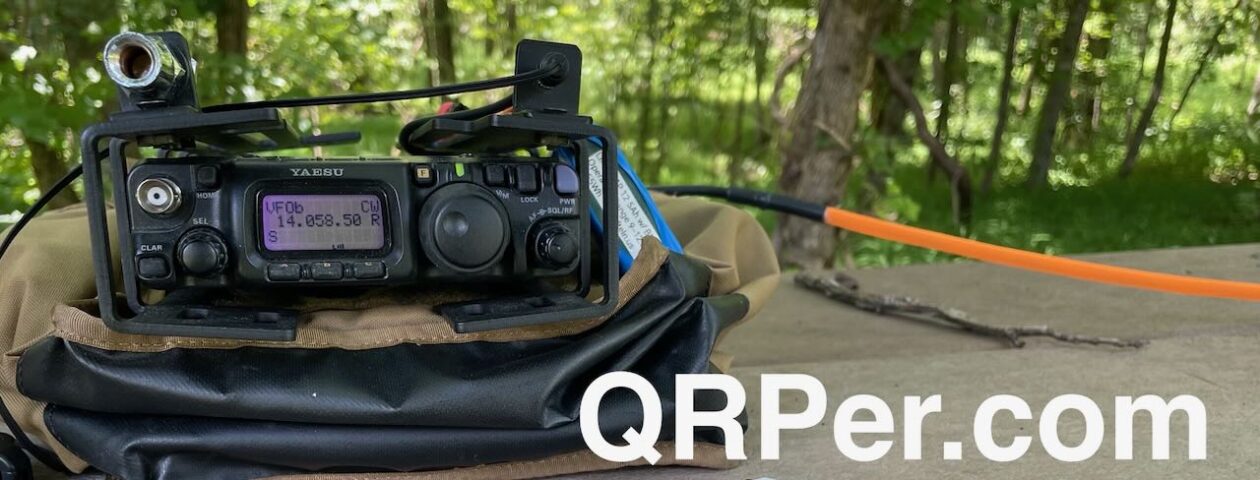
The activation zone is quite large at this site and Malen drove a few hundred metres away to set up, providing needed separation between us. He set about to do his thing and I did the same. I brought out my crappie fishing rod/mast and propped it up along the barbed wire fence and set about putting out my VE6VID 66′ EFHW. The folding lawn chair would serve as a table, and a nearby metal cabinet that houses phone lines would hold my Contigo mug and two video cameras.

With the antenna oriented to the west and sloping downwards and parallel to the very old barbed wire fencing (I call it Tetanus fencing given it’s age and your need for a booster shot if it should puncture your skin), I was uncertain how it would perform. As it turns out I had no cause for concern as I was able to make contacts without too much trouble. I trudged back up the hill to the now-placed lawn chair and finished my set-up.

I evaluated the bands by listening briefly on the FT8 frequency for 10, 15 and 20m. For me it’s a quick measure of how active the bands are, and dialing off a few kHz or so will reveal how noisy the conditions are. I settled on 20m. Aaand right about then, as if I needed another distraction besides the Canadian Rockies staring me in the face, my HamAlert went off on my phone; regrettably I was unable to hear my friend N4JAW at his activation. As it was too cold to handle my cellphone for typing and spotting, I set about getting spotted via SOTAmat and got on the air. Continue reading SOTA: First activation of VE6/RA-174


