Tag Archives: Elecraft KX2

The POTA Babe Becomes a SOTA Babe – Part 2

by Teri (KO4WFP)

Monday, July 15, after my “botched” SOTA activation of Black Balsam, the POTA Babe headed to Richland Balsam. Richland Balsam proved to be a nice hike and activation. The mountain is further up the parkway and the highest point on it. You access the trail to the summit via an overlook just southeast of the mountain.

Trailhead for Richland Balsam

When I researched what summits to choose, one nice feature about this one is a bench at its top. Yes, the park service provides you a seat for your activation! Given the gain in elevation to reach that bench, you are grateful for it by the time you reach the summit!

Foliage encroaching on the trail to Richland Summit
Yes, more ferns!!

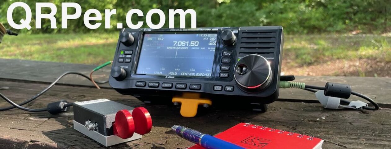
By this point in the day, the sun had burned off the clouds and both Daisy and I appreciate sitting beneath the tree canopy shaded from the heat. While I set up my KX2 and AX1 (it has performed well enough at Black Balsam Knob, I figured it would do well here, too.), Daisy sprawled out on the forest floor at my feet.

View from the bench

I was a little nervous at going through all this effort with an ongoing solar flare. However, you never know what the bands are going to give unless you try.

QTH (bench) provided by park service

As per Gary’s recommendation in the last article, I began with 40 meters and, in addition to working Gary, worked three other ops in short order. After ten minutes with no further callers, I moved to 20 meters. I still needed six more QSOs for a valid POTA activation at this site. They gradually trickled in over the course of an hour and a half. I had internet access at this location, too, and was able to hunt Douglas AA0AW at US-11150 in Minnesota. At this point I called QRT and reflected on the day.

QSO Map for Richland Balsam/Blue Ridge Pkwy/Nantahala National Forest source: http://tools.adventureradio.de/analyzer/

The thought of not having a valid SOTA activation in the morning REALLY bothered me. It was fairly late in the day now. Would there be time to go back (yes, go back) and make a second attempt? By now those lovely cloudy skies were long gone so our second hike would be a much warmer one. If you haven’t already figured out by now, POTA Babes are tenacious and don’t give up easily. Besides, I felt the need to redeem myself.

We arrived back at the Black Balsam Knob parking area with plenty of parking now. In fact, there were only a handful of cars left. As we walked toward the trailhead, a pair of men were leaving the trail for their car. I asked them how far of a hike it is to Black Balsam Knob to which they responded about 30 minutes. Well, it was about 30 minutes I hiked that morning. Hmmm.

A gorgeous and sunnier view than previously that morning

When we reached the same area I had that morning, I asked two different parties where the Black Balsam Knob summit was. They both responded right where I was standing! (It had taken a little over 30 minutes, partially to give Daisy a rest due to the temperature.) But where was the plaque? One gentleman confirmed there was indeed a plaque at this site and yes, this was the summit.

The plaque I missed earlier

Well, how do you like that?! I DID have a valid SOTA activation here after all. Whew! What a relief (though I could have done without that hike a second time). I figured since we were already up here, why not try to finish the POTA activation now?

First things first, though, was to find Daisy some shade and the only way to do that was to set up the new Mountain Laurel Designs tarp I purchased for the trip. I couldn’t get the height I saw Patrick WW4D have on his tarp but it was a start. I gave Daisy the shade and sat in front of it shielding my KX2 from the sun.

First time using the Mountain Laurel Designs tarp
A simple setup

I went back to 20 meters and thanks to three hunters – Keith K7MOA, Gerald N5KT, and Ken K5ENS – I had my valid POTA activation! Woo-hoo! What a day!

At this point, I heard thunder and saw lightning from a raincloud I’d been watching. It was time to get the you-know-what out of Dodge! I hurriedly threw everything into my pack and Daisy and I huffed it down the summit.

Approaching storm

As I reflected on how the day played out, I was pleased with what I accomplished.

A successful SOTA activation is a big deal to me, to a great extent because I’ve had no one to Elmer me. There are those who’ve answered my questions and there are Youtube videos that were helpful. But the endeavor still seemed overwhelming at times, especially since I often set the bar high for myself. There are still additional skills I need for further pursuit of SOTA, especially if hiking to a summit that isn’t as easy to find as the two today were. But today was a good start. For those of you considering your first SOTA activation, if I can do it, so can you! So do your research, gather your skills, and get out there.

A happy POTA Babe and her POTA pup

The track record for the trip is going well – four POTA and two SOTA activations and it is only day two! Will I keep up the pace and where will I head next? Stay tuned…

Equipment Used

[Note: All Amazon, CW Morse, ABR, Chelegance, eBay, and Radioddity links are affiliate links that support QRPer.com at no cost to you.]

The POTA Babe Becomes a SOTA Babe – Part 1

by Teri (KO4WFP)

Monday, July 15, the second day of my North Carolina camping trip for POTA and SOTA, started chilly with overcast skies. Today I would attempt my first SOTA activations. I chose two easy summits – Black Balsam Knob and Richland  Balsam.

map source: blueridgepark.org
map source: bluedridgeparkway.org

Daisy and I headed out after a simple breakfast up US Highway 276 through the Pisgah National Forest toward the Blue Ridge Parkway. Along the route, we encountered Looking Glass waterfall. The last time I visited this waterfall, it was packed with spectators. Today, I shared it with only one other person. It was a nice way to begin what turned out to be a very long day (spoiler alert).

Looking Glass Waterfall

If you haven’t driven the Blue Ridge Parkway, put it on your bucket list! I’ve been on the parkway more times than I can remember. I relish driving it. Surprisingly, I encountered very little traffic this day so I could move at my own pace along the banked turns and stunning vistas.

The parking area for Black Balsam was already full when I arrived; however, several other cars were making use of the side of the road and I pulled in behind a couple who were suiting up for their hike. It turns out the husband of the couple had a father who was a ham and learned CW during World War II. It is a small world indeed.

Lots of cars already at parking area.

The hike to Black Balsam Knob  is not one I’d consider easy, especially scrambling over the rocky surfaces. Before the trip, I was concerned as to how Daisy would handle hiking given she’s done nothing like this before. It became obvious why she is a POTA pup – the terrain didn’t bother her in the least!

Part of the trail to Black Balsam summit

On the hike up, we saw Carolina lilies growing wild along the trail. There were also bees everywhere, especially in some yellow wildflowers I could not identify.

Carolina Lilly
Yellow flowers in which the bees were active

I was grateful the skies were overcast and the temps on the cooler side (upper 60s). There was a light breeze when we arrived at what I thought was the summit and the tall grasses stirred in it. You could see for miles! The hike was worth the view.

Overcast skies from the top of Black Balsam

I originally thought I would use my EFRW mounted on a fishing pole for my SOTA activations. However, cleaning, stripping, and re-waterproofing the tent/rainfly took so much time, I didn’t follow through with a solution to support it on a summit with no woody vegetation. I opted to use the AX1 instead with the configuration Thomas has had the most success – mounted to the side of the KX2. I also took with me the counterpoises (20 and 40 meters) that came with the antenna.

Once on the air, I called CQ SOTA to make sure I worked those ops first given they are fewer in number than POTA hunters. Since the activation would count for both SOTA (Black Balsam Knob W4C/CM-003) and POTA (Pisgah National Forest US-4510), I gave my location (NC) for all exchanges. (I think SOTA just requires an RST.) I worked seven stations in ten minutes, a good rate.

Operating

I moved down one Hertz as I began faintly hearing someone else on the frequency. (Yes, I cleared it first; however, given I was operating QRP, fighting for the frequency was probably a losing battle.) It was at this point I began calling CQ POTA and the callers dried up. I did have cell service here and worked one park-to-park with Kenneth NS1C at US-11632 in Massachusetts. I continued to call CQ both on 20 and 17 meters with no luck. I didn’t opt to try 40 meters as I figured it wouldn’t be any better.

QSO map for Black Balsam Knob/Pisgah Nat’l Forest source: http://tools.adventureradio.de/analyzer/

About the time I had packed up my gear, Gary W5GDW contacted me asking about 40 meters. I was loathe to pull my equipment back out. He also advised me there was a solar flare. (Maybe that was why I suddenly didn’t hear anyone.)

At this point, I had a valid SOTA activation but not for POTA. I figured the campground at which I was staying – Davidson River Campground – is in Pisgah National Forest so I could finish my activation at my campsite later in the afternoon.

As I headed down the mountain, I began questioning whether I had actually reached the summit. Something didn’t feel right. I checked the map at the trailhead and noticed Black Balsam Knob has a plaque honoring Art Loeb and I didn’t recall seeing any such thing. Uh oh. Maybe I hadn’t had my first SOTA activation. My heart sank.

Map at trailhead for Black Balsam Knob

First of all, it was demoralizing I had botched my very first SOTA. Second, how humiliating because of how public it would be. Honesty is one of my values and I’d have to admit the mistake. I almost scrapped the remainder of the day I was so bummed. However, I didn’t drive all the way to North Carolina to scrap activations so onward I went to the next one – Richland Balsam – which would give me a SOTA activation and two POTA parks. Did I redeem myself? Stay tuned…

Equipment Used

[Note: All Amazon, CW Morse, ABR, Chelegance, eBay, and Radioddity links are affiliate links that support QRPer.com at no cost to you.]

The POTA Babe Goes North – Day 1

by Teri (KO4WFP)

Sunday, July 14 finally arrived, a day for which I prepared the past five weeks. It was time for Daisy and the POTA Babe to head to North Carolina for a week of POTA, SOTA, and camping. The drive was straight-forward and easy – Interstate 95 to Interstate 26.

About four hours after leaving Savannah, we arrived at my first POTA location: the Carl Sandburg National Historic Site (US-0804) in Flat Rock, NC.

map source: GIS Geography

I LOVE visiting North Carolina. Nearly everywhere you look in the countryside you see green, green, GREEN. There are ferns (one of my favorite plants) in the understory. There are wildflowers in the fields I don’t see back home. There is a certain earthy smell when one walks trails. And the roads! Don’t get me started on how much fun I have driving the winding mountain roads with their banked curves! (Can you tell I love visiting North Carolina?)

Ferns in the woods of the Carl Sandburg site

Back to the story at hand, the Carl Sandburg National Historic Site is 264 acres and contains the home of Carl Sandburg, a Pulitzer Prize-winning author and poet. He and his family moved to the site in 1945. It suited his need for seclusion and his wife’s needs for raising her prize-winning goats. In fact, the park service actually maintains roughly fifteen goats in a historic herd on site today.

Property map with my notes

The Sandburg home sits atop a hill and one gets glimpses of the house as you walk along the lengthy driveway winding up the hill toward it. The drive is shaded and benches dot the pathway beckoning one to sit and enjoy the quiet. I longingly looked at them as an activation site but the intermittent presence of pedestrians nixed that idea.

Daisy is ready to go!
The trail around the lake was necessary as a pedestrian bridge was under construction
View of the house from the driveway looking up the hill
Path along the driveway

Both Daisy and I were surprised by the heat of the day. The temperature was 91 degrees! Thankfully, outside the house I spied some trees with shade beneath them. Their orientation would allow me to run my antenna toward the northwest and their shade was a welcome respite from the heat.

The Sandburg home
Our QTH in the shade

Given I saw no restrictions on antennas in the trees when reading the rules of using the property, I promptly set about getting the EFRW up. Trust this hobby to keep you humble, though. On my last activation at Tuckahoe Wildlife Management Area, it took just one perfect throw to snag the branch I wanted. Today, it took four! Some days you have it and others you don’t.

Creatively displaying the POTA flag!

The activation proceeded slowly, I think mostly due to the inconsistent band conditions. It took an hour to log twelve stations. There were several stations I heard but they were too faint or they disappeared on me. Continue reading The POTA Babe Goes North – Day 1

Beautiful POTA activation at Brunswick Town/Fort Anderson and Afternoon in Southport!

On Wednesday, July 10, 2024, my wife and I were in the middle of a week-long stay in Wilmington, North Carolina, while our daughters attended residential programs at NCSU and UNCW.

That particular day, we couldn’t decide what to do because the weather was fickle! Temperatures and humidity were high, fueling a constant string of isolated thunderstorms rolling over Wilmington and the Cape Fear River area. Every hour or so, a new storm would roll past.

Heather suggested I fit in a POTA activation, and, of course, I loved the idea. I just didn’t want to play radio anywhere near thunderstorms.

We decided to drive south to one of my favorite coastal towns in North Carolina: Southport. Based on the weather radar, it looked like we could drive to Southport on the west side of the river, then return via the Fort Fisher Ferry on the east side, potentially avoiding most of the isolated thunderstorms moving north along the coast.

After stopping in Leland for supplies, we made our way to Brunswick Town/Ft. Anderson State Historic Site, directly across the Cape Fear River from where I’d activated the previous day at Carolina Beach State Park (US-2722).

En route, we drove into a thundershower with rain so intense that most cars on the road turned on their hazard lights and slowed to a crawl. Visibility was nil.

Fortunately, the heaviest rain only lasted 10 or so minutes, and by the time we were two minutes from the park entrance, it had slowed to a drizzle. As we parked at the visitor’s center, it had all but cleared up.

Brunswick Town/Ft. Anderson State Historic Site (US-6834)

Brunswick Town/Fort Anderson State Historic Site is unique in that it offers a blend of colonial and Civil War history along the beautiful Cape Fear River.

Founded in 1726, Brunswick quickly grew into a bustling port town known for exporting naval stores. However, the town was burned by British troops in 1776 and never rebuilt, leaving behind ruins for visitors to explore today.

During the Civil War, Confederate forces constructed Fort Anderson atop the remnants of Brunswick. The fort’s earthen walls and impressive gun emplacements now stand as a reminder of the region’s strategic importance during this turbulent period.

Visitors can explore the colonial foundations and Civil War earthworks, while enjoying the river waterfront.

There’s also a visitor’s center with exhibits detailing the area’s rich history.

I was pleased to spot a picnic area on the opposite side of the parking lot from the visitors’ center. This would allow me to set up close enough to the car that if another storm approached, I could pack up quickly.

First, I introduced myself to the staff and asked for permission to activate. I was confident they would grant it, as this site had been activated 39 times already (mine would be the 40th).

The two park rangers inside were incredibly kind and accommodating. My wife and I ended up speaking with them about history for nearly 30 minutes. I also gave them more insight into the POTA program and asked if activators were following their rules. Fortunately, they gave a very positive report. NC State Historic Sites protect both the archaeology of the site and the natural resources, so I always ask for permission to activate because some sites have restrictions about putting lines in trees or stakes/spikes in the ground. Fortunately, this was not an issue at the picnic area.

Setting up

Since weather was iffy and since Heather and I wanted to spend the rest of the afternoon in nearby Southport, I decided to pair my Elecraft KX2 with my AX1 antenna.

This also gave me a chance to try out a new 3D-printed bipod that my friend Mike (KE8PTX) sent me.

This Bipod consists of a 3D-printed clip and knob designed by Adam (K6ARK) and two legs designed by Mike.

I was really amazed at 1.) how easy it was to attach the clip to the antenna’s BNC base and 2.) how incredibly stable this Bipod felt even compared with the OEM bipod.

Thank you, Mike (and Adam)!

With the radio set up, I was ready to activate!

Gear

Note: All Amazon, CW Morse, ABR, Chelegance, eBay, and Radioddity links are affiliate links that support QRPer.com at no cost to you.

On The Air

I assumed 20 meters would be the best place to start and, frankly, I hoped it would be productive enough to cap off my activation in short order so that my wife and I could continue our travels.

Unfortunately, propagation was not compliant. Continue reading Beautiful POTA activation at Brunswick Town/Fort Anderson and Afternoon in Southport!

Carolina Beach State Park: A QRP Oasis Amidst the Summer Heat and Activities

Tuesday, July 9, 2024, was a very radio-active day!

I was in Wilmington, North Carolina, and that morning, I had the privilege of activating the Battleship North Carolina from inside the battleship. Click here to read the field report and watch the video.

In short? It was amazing and certainly a fabulous way to start the day.

We were in Wilmington because one of my daughters was attending a week-long program at NC State University, and the other was attending a similar program at UNC Wilmington.

That Tuesday afternoon, after dropping my daughter off on the campus of UNC Wilmington, my wife suggested we hit Carolina Beach State Park for a POTA activation. It didn’t take me a microsecond to agree to that plan!

Carolina Beach State Park (US-2722)

Carolina Beach State Park, located just south of Wilmington, is a unique spot full of natural wonders. The park covers over 760 acres of Pleasure Island, with diverse habitats ranging from the impressive 50-foot Sugarloaf Dune (which used to be used as a navigational aid) to the fascinating limesink ponds, each with its own special plant community.

The park is also home to the Venus flytrap, a rare carnivorous plant found only in a small part of the Carolinas. You can explore the park’s trails, winding through maritime forests and maybe even catching a glimpse of these fascinating plants in action. The park also has a marina for easy access to the Cape Fear River and the Intracoastal Waterway, making it a great spot for boating and fishing.

We arrived at the park a little before 4:00 PM local time. Had it not been so hot and humid, we would have hit one of the park’s trails before finding a spot to do POTA, but the weather being what it was, both of us were happy to spend time in the shade.

We pulled into the main picnic area and quickly found a spot to set up. As I pulled out my radio and camera gear, my wife, Heather, pulled out her travel watercolor kit, all packed in a Tom Bihn HLT1 (we’re a pack geek family!).

When Heather joins me on POTA activations, she almost always sets up somewhere and paints while I activate. I love the fact that we both enjoy the experience in different ways.

In fact, my buddy Steve (KC5F), who is also an avid POTA activator, performs almost all of his activations with his wife, who also paints while he activates. He told me that she likes a good couple of hours of painting, so he typically racks up a lot of contacts in that amount of time.

Setting Up

The first thing I did was set up my Thermacell mosquito repeller–it needs a few minutes to do its thing and clear out the mozzies. The model I carry, the “backpacker,” fits a standard backpacking stove canister. I’ve recommended this one to many other POTA ops who operate in areas with mosquitoes–so far, it’s never let me down!

Also, I want to send a big shout-out to Alanna (K4AAC) and Bob (K4RLC) for making this activation even more civilized.

After watching an activation earlier this year at Tuttle Educational State Forest, where I placed my KX2 and logbook on a wet and dirty picnic table–covered in pollen and other tree bits–Alanna ordered a blue Gingham picnic tablecloth and whisk and had it sent to me.

I’ve had this tablecloth packed in the go-box I keep in the Subaru, and this activation was the perfect time to put it to use because the table I chose needed cleaning!

Thanks, Bob and Alanna!

Next, I deployed my PackTenna 9:1 End-Fed Random Wire antenna and paired it with my Elecraft KX2.

New paddle mount!

I did (finally) get to try out a new piece of kit in the field: a newly-designed paddle mount from Steve (KB3SII) at QRPworks.

Steve handed this prototype mount to me at Hamvention this year. It’s an updated design of one we tested last year.

You basically attach the mount to the front of the KX2 (or KX3) and place a paddle like the Bamakey TP-III that has strong rare earth magnets. The paddle locks onto the metal pad and makes for a rock-solid, ergonomic keying experience.

Steve also sent me two short 3.5mm angled cords to connect the key to the radio, but I forgot to pack them for the trip. My standard paddle cable worked fine, although I had to angle the TP-III slightly.

Note that Steve plans to have these paddle mounts in production and available on the QRPworks website in the coming weeks. When they’re available, I’ll post a direct link.

With the KX2 set up and ready to go, it was time to hit the air!

Gear

Note: All Amazon, CW Morse, ABR, Chelegance, eBay, and Radioddity links are affiliate links that support QRPer.com at no cost to you.

On The Air

I started calling CQ POTA on 17M and discovered that it was a fairly quiet band. Nonetheless, I worked two stations in about six minutes. Secretly, I was hoping there might be a 17M path into Europe, but then again, it was a bit late in the day for that (and it seemed 17M wasn’t terribly energized). Continue reading Carolina Beach State Park: A QRP Oasis Amidst the Summer Heat and Activities

Do I make videos of all of my field activations?

This past weekend, I attended the WCARS hamfest in Waynesville, North Carolina. My buddy Vlado (N3CZ) and I purchased a few indoor tables to sell some gear we no longer needed.

I also gave a short presentation about the ins and outs of going QRP. It was a lot of fun!

When I go to a hamfest, I spend a great deal of time salivating over the vintage stuff. This R-388 would look brilliant in my radio room! Wish I had the space.

I was surprised at how many people introduced themselves as readers, subscribers, and supporters. It blew my mind since this is a smaller regional hamfest—not Hamvention or Huntsville!

One reader asked a question I get a lot: Do you film all of your activations?

The answer is no, but I probably film 80% or more. I enjoy making activation videos. When I do a real-time video, I feel like you’re there with me, and I really enjoy that.

Even though I’ve simplified my camera gear, filming still adds time to my activations. I have to plan the setup so you can easily follow along as I log, and I need to ensure the audio is acceptable. When I’m really pressed for time, I skip making a video.

In addition, each activation video and field report takes me at least four hours to prepare. Unlike most YouTubers, the video editing time is minimal, but the field report takes time: preparing the text, photos, layout, links, etc. It’s a labor of love, though, and I enjoy the process.

Speaking of offline activations…

Lunch with Vlado isn’t complete without Baklava.

After the hamfest, Vlado and I enjoyed lunch (at this brilliant Italian restaurant), then I drove to Sylva to pick up Hazel (who had been staying with my brother-in-law).

On the way home, I passed the Blue Ridge Parkway, so I did an impromptu POTA activation at the Balsam Gap Overlook (which is overgrown and not much of an overlook anymore, but still a great spot for POTA).

I decided to make a short video for YouTube answering the reader’s question.

There’s some irony in making a video stating that I don’t always make videos of activations!

Click here to watch on YouTube.

It was a fun and quick activation: ten contacts in thirteen minutes. I used my Elecraft KX2 and PackTenna 20M EFHW—always an effective combo.

Hazel enjoyed laying on the grass next to me.

All in all, a fun little activation! I was in and out of there in 22 minutes. Had I filmed this, it would have taken more than 30 minutes.

Here’s my log sheet:

Here’s the QSO Map:

Screenshot

I’ve got some great activations in the pipeline and look forward to publishing them this month!

Thank you for coming along on the journey!

Cheers & 72,
Thomas (K4SWL)

Back in the Game for the POTA Babe

by Teri (KO4WFP)

After a five week break from POTA, it was time to get back in the game! I leave for my North Carolina camping/POTA trip Sunday, July 14th and frankly miss being out on an activation. To remedy that situation, Monday, July 8th, I headed to Tuckahoe Wildlife Management Area (WMA), POTA park US-1603.

source: Google maps

Tuckahoe WMA consists of 15,000 acres purchased by the State of Georgia in 1990. Hunting for deer, turkey, and coyotes is allowed on the property in season. The property has over 10 small ponds for fishing and three designated camping areas. It is located in Screven county and its eastern border is the Savannah River.

When researching Tuckahoe WMA for this article, I came across information regarding the Battle of Briar Creek which was fought on March 3, 1779. Much of the battle site lies within the boundaries of Tuckahoe WMA.

The attack that day in 1779 by the British was a surprise and 150 Americans lost their lives. The aftermath proved especially bloody because the British were enraged over the death of one of their sergeants – Hugh McAllister – whose body was found hacked to pieces. As a result, the American wounded were hunted down and bayonetted. According to an article in the Athens Banner-Herald, “the British victory was so decisive scholars believe it prolonged the American Revolution by a year, changing the course of U.S. history.”

Back in the present day, Daisy and I left Savannah early under grey and sprinkling skies. The drive to Tuckahoe was pleasant and took us through Sylvania, Georgia again. Along the route, I spied a rainbow with a slight double-bow on its left-hand side. I hoped that was a good omen.

Downtown Sylvania, Georgia

The map on the Georgia Department of Natural Resources website showed what looked like several entrances for the property. I opted to take the second entrance I found but that proved to be a mistake as a tree blocked the road. I backtracked to the first entrance (where the battlefield sign is) and found myself on a wide, gravel road.

Access denied!

The woods I encountered on the property were open, mostly pine, and, I think, managed for wildlife and hunting as evidenced by several turkeys I watched crossing the road in front of me. It wasn’t far before I saw the memorial for the Battle of Briar Creek.

Originally, I intended to reach one of the boat ramps on the Savannah River, deep inside the WMA, as my activation site. However, given the limited time I had for an activation and the availability of low branches in an open area, I opted for a place just past the memorial as my QTH. I set up the hitching system for Daisy so she could enjoy the outdoors while I worked with my equipment. I oriented the EFHW antenna toward the north running the coax back underneath it hoping that orientation would push my signal to the north and west. (The orientation worked as per my QSO map below.) It wasn’t long before I was ready to call CQ. I went to spot myself and discovered there was…

Hitch system set up between Kai’s roof rack and large pine tree

NO CELL COVERAGE! (A POTA activators worst nightmare!) Ugh. I couldn’t even text anyone asking them to spot me. Continue reading Back in the Game for the POTA Babe

A QRP Morse Code Exchange with a Monk

How I worked the #19 most wanted CW DXCC as a pedestrian mobile station

by Leo (DL2COM)

A couple of months ago, I started using the app HamAlert to keep track of interesting DXpeditions and rare call signs just to check if I would be able to copy their signal on my home-made WebSDR at a location outside of the city. This helped me a great deal in understanding propagation and pile-up dynamics as I began to develop a strong interest for expedition-like operating from exotic regions.

Mount Athos and monastery
Mount Athos (2027m abt. 6650 feet high) and one of the monasteries (courtesy of Dave Proffer, CC-BY 2.0)

One of the stations I had tracked for a while is Monk Iakovos Kutlumusian SV2RSG/A – the only licensed operator in Mount Athos which is currently #19 most wanted CW DXCC according to Clublog. Mount Athos is an autonomous orthodox monk republic under Greek sovereignty and located on a peninsula in the North-East of Greece (locator KN20CG). More info on Mount Athos can be found here (Wikipedia) and a trailer for an upcoming documentary here (Youtube).

Koutloumousiou Holy Monastery (courtesy of  Στάθης Κουτσιαύτης , CC BY-SA 4.0, Wikimedia commons)

The priorities of the community in Mount Athos understandably lie on their theological work. So I think it is a big commitment that Monk Iakovos (QTH: Koutloumousiou Monastery one of 20 monasteries in Mount Athos) is able to make some contacts in his free time outside his monastic duties as he writes on his QRZ page.

Very experienced DXers from Berlin once told me how they worked Mount Athos many moons ago on 80m in the middle of the night only by chance and that it is almost impossible to log this super rare DXCC.

Impossible? Hold my beer.

I had noticed that during May and June 2024 Monk Iakovos was on the air more frequently but each time only working 4-5 stations in a couple of minutes before disappearing again for days. The only two consistencies I found was that he was active on 20m CW and most of the time during local evening hours.

Garmin Instinct 2 Tactical Watch
Whoops there he is again – Hamalert notification on the Garmin Instinct 2 watch

I took the photo above a couple of days before to inform a friend that SV2RSG/A was active again (btw the HamAlert notification feature on my watch comes in very handy).

Then on Sunday, June 16th 2024, I was sitting on the couch reading when my watch vibrated and showed his call sign again on RBN at about 20:56 UTC (22:56 local time, 23:56 DX time).

I was in absolutely no position to make a QSO as I live in a very urban neighborhood in central Berlin City and I cannot have antennas at my QTH. Also the location brings along a high degree of man-made QRM and all the tall townhouses act as blockers for any kind of RF. Far from ideal for HF operation which is the reason 100% of me operating is portable or from the car.

In addition, we had just returned from a weekend trip to the countryside and I was enjoying the fact that our kids were sound asleep. So I only took out my phone and checked if I could hear this station again online.

To my surprise, this time it wasn’t the immediate and very intense “red ocean” simplex pile-up that I had witnessed multiple times during the weeks before. Maybe it was due to the fact that a big DX contest was coming to an end or most tired OPs were just off the air already on a late Sunday evening. Who knows? Or maybe it was just plain luck…..

Should I? Or should I not? I knew that I needed to be outside if I wanted to have the slightest chance to work this station. There is also a tiny park about 200 meters from our house which would improve my situation a little due to better “sky access” and takeoff angels towards Greece. But I thought by the time I could be set up the pile-up would already be too big for my QRP signal or the station would already be gone as it was the case each time before.

Still I ran over to our utility room, ripped open my backpack and got the KX-2 pouch out. I took the transceiver, slapped the AX-1 whip on, grabbed a key and dumped the counterpoise wire in my pocket.

Don’t let the shoe situation mess up your TTQ stats (time-to-QRV)

Have you ever wanted to take out the trash and then ran into a “shoe situation” at the front door with your hands full?

With my wife’s sneakers slipped half on I staggered out on the street all while trying to secure the end of the counterpoise to one of the bottom screws on the KX-2’s case and nearly falling down the stairs. Time-to-QRV (TTQ is that an official metric? if not it should be imho) maybe 80-100 seconds….no kidding.

Outside I dialed in 14.004 and immediately heard SV2RSG/A still calling CQ at a relaxed pace and then working a station. The signal in my “street canyon” was weak but a 100% copy.

Elecraft KX-2 and AX-1 whip antenna
Elecraft KX-2 and AX-1 whip antenna got me on the air in no time (I need to set the internal clock again)

I quickly send my call sign only to get a “QRZ?” back. OMG did he really just hear my signal? Apparently my field strength was too weak on his end because he started calling CQ again.

So I sprinted towards the park (dragging along the counterpoise behind me) and I noticed that his signal was coming on stronger and stronger. After about 100 meters I stopped and again called “DL2COM”. This time I heard “DL2?” but then a very loud OP blasting his signal right on top of me.

I repeated my call another two times and couldn’t believe my ears when SV2RSG/A came back with my true full call and a 599 report. With shaking hands I somehow managed to reply R 599 TU and then we exchanged 73s. I simply couldn’t believe what had just happened.

When I walked back to the front door one of my neighbors was standing there looking somewhat irritated. He paused his phone call for a second and asked “ARE WE SAFE?”.

Oh yes! For now, very safe!” I told him that I had just communicated with a monk in Greece in morse code (“you know the stuff they used on ships back in the day”) and that this story probably needed more context over a beer.

I then noticed that I had pulled the counterpoise wire through a pile of dog droppings with everything happening so quickly. Of course I did! How can this not happen on the streets of Berlin. A sacrifice I was happy to make for this very special contact and btw cleaned easily in under 2 minutes.

Beer bottle and glass

Gear used:

Thanks to QSL manager SV1GRM I did not have to wait long for this card

How did this work? Being on the air so quickly and the fact that 20m was on fire that night certainly helped. But then again is it also the idea to just dare and get out there operating. If you don’t cast a line there won’t be any fish…right?

You never know which exciting DX station might be just around the corner during a special band opening.

While Greece isn’t particularly hard to reach from Germany it was more the overall circumstances (very rare, short and erratic operating times of this station, usage of callsign by pirates, urban QTH, compromised antenna, simplex pile-up with QRP signal) that made this contact highly unlikely but as I now know also totally possible. Blessings to Mt. Athos and their ongoing work for the DX-community! I am very grateful that I got the chance to log them.

– vy 73 de Leo DL2COM

p.s. as of the day of publishing this article, Monk Iakovos has not been active since I worked him on June 16th (according to RBN).

The POTA Babe Reaches the Halfway Mark!

by Teri (KO4WFP)

It is said that all good things must come to an end and a POTA trip is no exception. Packing up camp at Reed Bingham State Park the morning of June 3rd was an easy endeavor.  Daisy and I were soon headed toward Savannah with a POTA planned along the way at Alapaha River Wildlife Management Area (US-7881). We passed through the communities of Tifton and Ocilla, Georgia.

As one travels through Georgia, you see a variety of crops along the road – cotton, peanuts, corn, pecans, blueberries, soybeans, etc. – as well as cattle in fields and poultry houses. As I worked my way toward Alapaha River Wildlife Management Area (WMA), I came across a processing plant for peanuts in Tifton, Georgia.

Peanuts are big business in Georgia. According to the Georgia Peanut Commission, the state of Georgia produces 52% of the peanuts grown in the United States which translated to 1.45 million tons in 2022. That is a boatload of peanuts!

Peanuts are planted April through June and then harvested about five months later in the fall. One fact I did not know is there is a “peanut belt” in Georgia, an area south of the fall line but omitting the coastal counties, where peanuts are planted in the state. I was driving inside this belt.

Peanut crop in the field. source: georgiagrown.com
source: Georgia Peanut Commission

Nuts aside, it wasn’t long before Daisy and I arrived at Alapaha River WMA. This WMA opened in 2016 and contains nearly 7,000 acres. According to a Georgia DNR article, the site has an estimated 2,000 gopher tortoises, the most for any state-owned tract of land in Georgia. This is not surprising given the density of sandhills on the property, a habitat in which gopher tortoises thrive.

The dirt road into the property was nicely groomed. I drove past areas of young planted pines as well as more mature pine stands. However, neither of these areas were conducive to an activation, partially because the trees offered no shade and partially because the branches were either too low or too high for me to install my EFRW antenna.

Entrance into Alapaha River WMA
Young pines

I continued on Jacks Creek Road and headed toward a dove field (the brown area on the map down below) at the point the road dead-ends. I  figured there may be trees along the edge of the field offering what I needed. I turned left onto North Bugle Trail and, off to the right hand side, saw an area with both shade and trees I could use.

source: Georgia Department of Natural Resources
The shady area for my activation QTH
Trees with good branch options

After donning my blaze orange attire and installing the Tufteln EFRW, I attached the new hitch system to the hubcap of one of Kai’s front wheels and the rope to the clip on Daisy’s harness so she could make herself at home along with me in the shade.

While checking out the shady area, I noticed several things – dandelions with their sunny, yellow faces and animal tracks in the sand. The set of tracks for deer were easy to identify. However, another set, not so. I think the second set belonged to a raccoon.

Deer track
Raccoon track (I think)

Today’s activation would be short as I had a three-hour drive ahead of me and needed to be home in time for my son’s evening driving class. (Yes, we’ve reached that stage of life in the POTA Babe household.) In 45 minutes, I logged 19 contacts including one park-to-park with Charles AB9CA at US-2275 and a QSO with Ronald N7WPO in Washington state! That QSO on 5 watts and a wire is part of the magic I mentioned near the end of my previous article.

QSO Map for Alapha River WMA Activation

During the activation I had watched the sun creep closer and closer to Daisy and me. When the time reached 11:15 AM, we were nearly out of shade. It was time to call QRT and head home.

This overnight POTA trip turned out well. I learned more about my camping set-up and the beautiful state in which I live. I had time to do what I love – ham radio in the outdoors. And, with these three activations, I now have 30 parks toward my 60 new-to-me park activation goal for 2024!

I am halfway there.

Thank you to all of you who have supported me thus far. However, my journey is far from over and the fun will continue. Where will I activate next as I work toward 30 more new parks? Stay tuned…

Equipment Used

[Note: All Amazon, CW Morse, ABR, Chelegance, eBay, and Radioddity links are affiliate links that support QRPer.com at no cost to you.]

Overnight at Reed Bingham State Park for the POTA Babe

After a valid activation and exploration of Bullard Creek Wildlife Management Area, Daisy and I headed to Reed Bingham State Park (US-2195), roughly a two hour drive. Along the way, we passed a huge lumber mill and drove through the communities of Douglas, Nashville, and Willacoochee.

Lumber mill
Train Depot in Willacoochee, Georgia

Courthouse in Nashville, Georgia

Reed Bingham State Park, located in southwest Georgia, is named after Amos Reed Bingham, who envisioned a dam on the Little River to provide electricity to the rural community. Even though the flow of the river was not sufficient for that purpose, Colquit and Cook counties purchased 1,600 acres along the Little River and deeded the land to the state of Georgia, creating the park. A 400-acre lake was created in 1970 by the current dam and provides recreational opportunities for park visitors.

source: Google maps
The lake at Reed Bingham State Park
Overflow from the dam into the Little River

Besides working toward my 60 new-to-me park activation goal, the trip to Reed Bingham served another purpose – refining my camping set-up and routines before my twelve-day POTA trip this summer. I made quite a few notes about equipment that would make camping life better and realized I need to think through where to keep certain items so I can lay my hands on them more easily and quickly.

The tent at the campsite

A new item I purchased for hiking and camping  trips is a hitching system for Daisy. I want her to be able to “free range” while I set up camp, make meals, or visit the bathhouse but still be contained. Ruffwear makes a hitch system with a daisy-chain (aptly named, don’t you think?) on one end and a kermantle rope on the other.

I ran the daisy-chain around a large pine and then, as there was not another tree close enough, the kermantle rope to the rails on the top of Kai. A large carabiner slides up and down the rope and Daisy’s six-foot leash attaches it to a clip on the back of her new harness. The system worked well and eliminated her getting tangled in a lead line while in camp.

After setting up camp and eating supper, it was time to fit in an activation. There were two trees near the campsite – a large oak and shorter-than-usual pine tree. I opted for the pine tree as it was closer to my tent. (I longed to sit in the comfort of my tent on my Thermarest chair for the activation.) Continue reading Overnight at Reed Bingham State Park for the POTA Babe