 In the latter part of the morning on Thursday, June 15, 2023, I hopped in my car and started the drive back to my QTH after spending a couple of days helping my parents in Catawba County, NC.
I had a window of about three hours where I knew I could fit in a POTA activation or two.
I’m quite familiar with POTA landscape along this particular corridor of western North Carolina, so I starting considering my options. I could have easily hit South Mountains State Park, Lake James State Park, and/or Table Rock Fish Hatchery, but what I really wanted to do was a little SOTA (Summits On The Air).
The problem, that particular day, was that the AQI (Air Quality Index) wasn’t great–not ideal for a strenuous hike, so I quickly dismissed that idea. The skies, in fact, were a bit hazy from the forest fire smoke blowing down from northern Canada.

Then it dawned on my that I could drive to the summit of Dogback Mountain (W4C/EM-066) and perform not only a SOTA activation, but a POTA two-fer as well since the activation zone is also in Pisgah National Forest (K-4510) and Pisgah Game Lands (K-6937).
In truth, I don’t do a lot of drive-up summit activations because, typically, when I want to do SOTA, I also want to hike. But drive-up summits are ideal on days like this when either weather is questionable, or the AQI is high.
The drive
 If you live near western North Carolina, Dogback Mountain is a must. It’s one of the few sites I go to that I enjoy the drive as much as the activation.
As I mentioned in my previous Dogback field report, the road to the summit is a Forest Service road that has a very backcountry feel to it. It’s not maintained regularly, so you can expect washboarding, deep ruts, large exposed stones, deep potholes and wide mud holes.
This isn’t a road I’d recommend for someone driving a sedan or minivan (that said, many years ago I did take a minivan up this road–made for a dodgy drive). Your vehicle would benefit from some proper ground clearance and, ideally, all-wheel drive or four-wheel drive.
Frankly, I absolutely love driving this road because it’s passable most of the year, offers up amazing views, and has a number of dispersed camping spots (or POTA activation sites–!) along the way.
I drive backcountry roads routinely, so this is pure fun for me.
Dogback Mountain (W4C/EM-066)
 The summit of Dogback Mountain is pretty much right on the forest service road. There are two pull-off parking areas on either side of the summit and both are well within the activation zone. In theory, you could set up your portable station along the road and do the SOTA activation there.
Note: Unlike POTA, the SOTA program does not allow mobile activations. If you activate a drive-up summit, you still need to set up a portable station that in no way uses your vehicle for support.

I parked my car (turned on my video camera for the activation video below) then walked the very short path to the true summit.

The path takes maybe one minute to walk…if you walk slowly.
On top of the summit, there’s a nice little clearing, a fire ring and some spectacular views. I give a little tour of the views in my activation video.
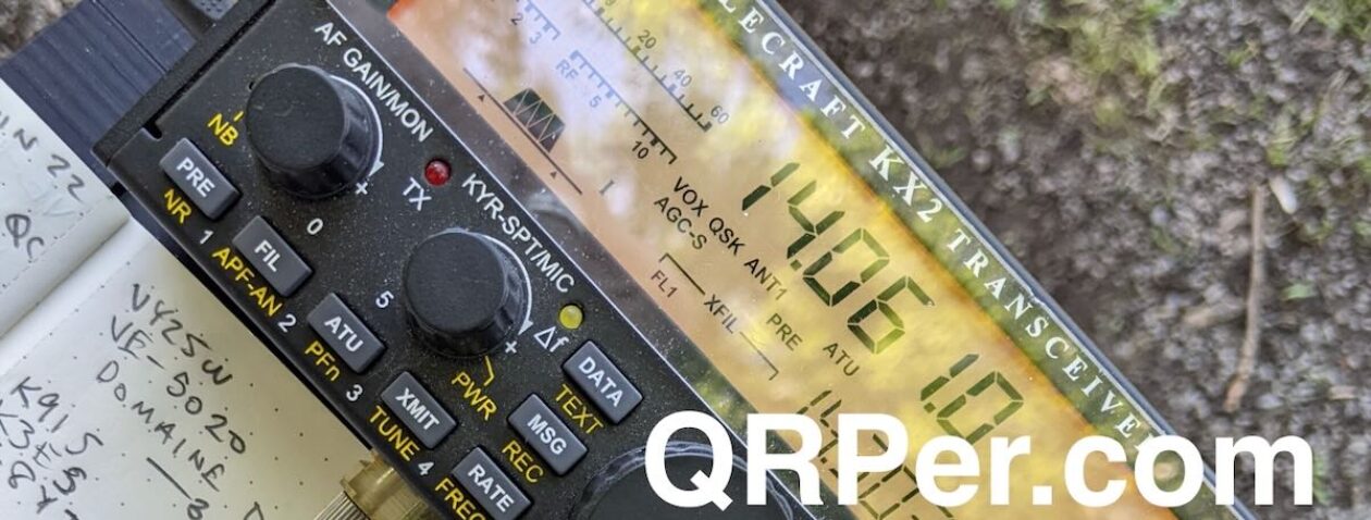
For this activation, I chose to pair my Elecraft KX2 and Tufteln EFRW antenna: it’s a potent SOTA combo!
Gear:
 Note: All Amazon, CW Morse, Chelegance, eBay, and Radioddity links are affiliate links that support the QRPer.com at no cost to you.
- Elecraft KX2 and KXPD2 Paddles
- Elecraft ES60 Pack (Note that mine is a discontinued LowePro CS60 pack, the ES60 is identical and Elecraft branded)
- TufteIn EFRW QRP Antenna Long Wire
- GoRuck GR1 USA
- Elecraft KXBT2 Li-Ion Battery Pack
- Mini Arborist throw line kit: Tom Bihn Small Travel Tray, Marlow KF1050 Excel 2mm Throwline, and Weaver 8 or 10oz weight
- Rite In The Rain Top Spiral Notebook
- Rite in the Rain Weatherproof Black Metal Clicker Pen
- Camera: original OSMO Action Camera (the OSMO 3 is the current version) with Sensyne Phone Tripod
Spotting SOTA
 In instances where I’m activating both a summit and a park at the same time, if the park is not a rare one (in this case, neither K-4510 nor K-6937 are rare), I often only announce and spot myself on the SOTA network. This is what I did at Dogback Mountain that day.
Why? Even though SOTA has been around since 2002 and is very international, it’s a much smaller program than POTA is these days. The number of SOTA chasers is tiny compared with the number of POTA hunters (even though some, like me, do both). In addition, the total number of SOTA activations on any given day is also much smaller than that of POTA.

For these reasons, when I make an effort to activate a summit, I want to make sure SOTA chasers get first dibs on the summit. Else, as I’ve experienced in the past, SOTA chasers (especially the DX ones) struggle to punch through the pileups.
If I happen to be activating a summit and a rare park, then I’ll spot myself on both networks simultaneously. That’s not a common occurrence, though!
On The Air
 I started by calling CQ SOTA on 17 meters.
Within three minutes, I logged four contacts from three different countries: the US, Slovenia, and France. These four contacts validated my SOTA activation.
For the POTA side of things, though, I still needed to log an additional six contacts.
In five minutes, I added five more stations on 17 meters, then the band became quiet. I decided to QSY to the 15 meter band.

On 15 meters, I logged an additional four stations in five minutes, giving me a total of 13 contacts logged.

Unfortunately, I was on a schedule, so I called QRT. I could have easily spent two more hours there making contacts because it was such a beautiful day and I was having so much fun.

Still, I’m grateful anytime I can fit a SOTA or POTA activation in my day, even if it’s a quickie!
QSO Map
Here’s what this five watt SOTA activation looked like when plotted out on a QSO Map (click to enlarge).

Activation Video
Here’s my real-time, real-life video of the entire activation. As with all of my videos, I don’t edit out any parts of the on-air activation time. In addition, I have monetization turned off on YouTube, although that doesn’t stop them from inserting ads before and after my videos.
Note that Patreon supporters can watch and even download this video 100% ad-free through Vimeo on my Patreon page:
Click here to view on YouTube.
Heading home
 Even though time was limited, on the drive down the mountain, I did something I’ve been meaning to do for a while: I mapped out all of the nicest dispersed camping sites along the forest service road.

Later this year, I plan to go camping here, likely with a few buddies, and wanted to mark these spots on the GPS and attach photos.
It’ll be so much easier now to pick a good camp site and play radio!
Thank you
 Thank you for joining me on this beautiful activation! To me, there’s hardly anything more fun that taking my radio to a remote spot with gorgeous views and simply enjoying the experience.
Thank you for coming along for the ride.
I hope you enjoyed the field report and my activation video as much as I enjoyed creating them.
 Of course, I’d also like to send a special thanks to those of you who have been supporting the site and channel through Patreon and the Coffee Fund. While certainly not a requirement as my content will always be free, I really appreciate the support.
As I mentioned before, the Patreon platform connected to Vimeo make it possible for me to share videos that are not only 100% ad-free, but also downloadable for offline viewing. The Vimeo account also serves as a third backup for my video files.
Thanks for spending part of your day with me! Have an amazing weekend!
Cheers & 72,
Thomas (K4SWL)
Hello Thomas,
thanks for for allowing me to travel vicariously.
Have a nice day to you!
73
Didier – F4JYT
Outstanding activation my friend!??
73 de N1XV
I’m still learning Morse code so your emails are a great incentive to keep on keepin’ on!
73 de KM6MQR
Hello Franz,
I am also in Morse learning and Tom’s articles are encouragement to persevere.
73 de F4JYT
We have been to Pisgah! A beautiful area of North Carolina. We stayed in Bryson City, but commuted daily to Sylva/Dilsboro, where we would meet our guide (driving an old school bus that ran on used cooking oil…It smelled like French fries when running). We did a three-day mountain biking trip, all in the Pisgah mountains. I thought at one time we would move to the area, but I couldn’t work it out with work. Envy you your trip.
73 Pat N0SHU