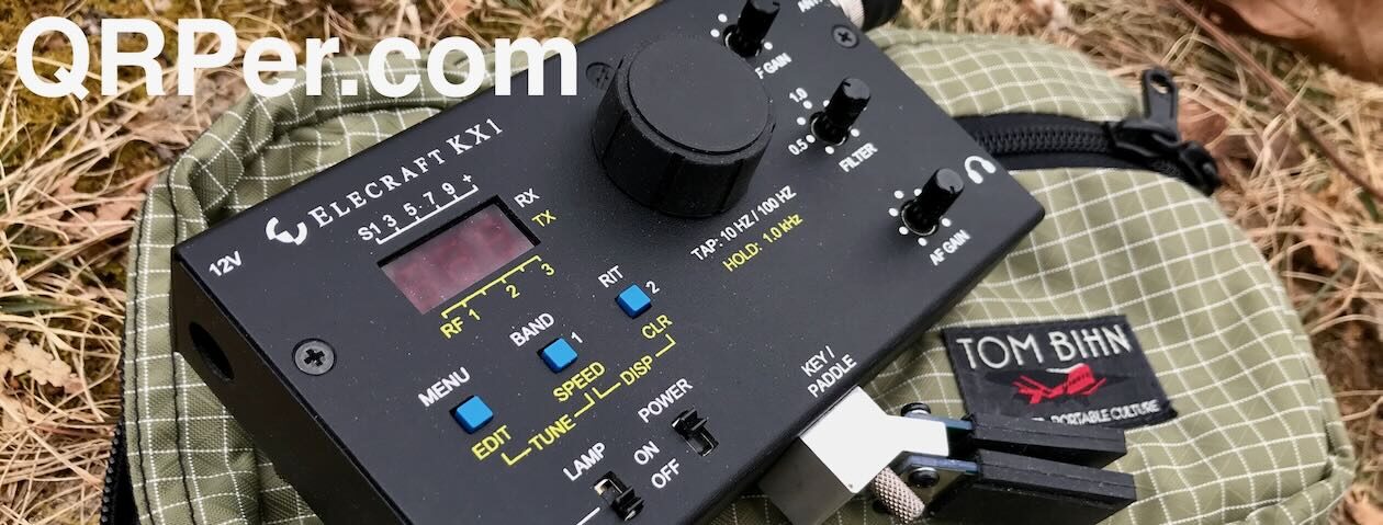
Jonathan KM4CFT reached out to me recently to inquire if I was interested in trying his CFT1 QRP transceiver. The inquiry both surprised and delighted me as I’ve never had such an opportunity.
I nearly said no because I am no antenna expert and, as this rig has no internal antenna tuner, I’d need to learn more about antennas, SWR, and resonance.
My limited antenna experience dates back to when I first entered the hobby. I had ZERO antennas and no idea where to start. An acquaintance suggested I make a home-brew linked dipole and gave me a few pointers in doing so. I vividly remember limping through learning how to trim an antenna. That project taught me that I want as low a SWR as possible and to cut the antenna for the portion of the band on which I want to operate.
homebrew linked dipole
Those of you who read my articles here on QRPer know that I use an Elecraft KX2 for my field operations. I’m very happy with this radio and love that it has an internal antenna tuner. But the CTF1 does not. Here is where my hesitation and trepidation at trying this unit entered the picture. I figured the antennas I use on a regular basis might not play nice with the CFT1 and hence my reluctance to say “yes” to this opportunity.
“Craig”, my KX2
But this is ham radio, right? In ham radio, we relish challenges because they are opportunities to learn. This was my opportunity to learn not only about antennas in general but also to be more thoughtful as to how I deploy them in the field. This was an opportunity for growth.
I dug out the RigExpert Stick antenna analyzer I purchased nearly three years ago and tested each of the antennas I currently have, just for jollies. I understand that many factors impact SWR – height of the antenna, coax length, proximity of other objects, etc. For the purpose of this exercise, I just wanted a ball park idea as to what antennas I could or could not use with this rig without a tuner.
I found both the home-brew linked dipole and the Chelegance MC-750 would work fine. Out were the EFRW and AX1. As I’d been hankering for an EFHW in my kit, I purchased the Sparkplug EFHW and trimmed it. These kinds of projects intimidate me because I do not have much experience with them; however, one cannot learn what one does not attempt.
I used the CFT1 on three activations: April 25th at the Savannah National Wildlife Refuge (NWR) (US-0522) with the Chelegance MC-750, April 30th at the refuge again but this time with the Sparkplug EFHW, and Thursday, May 1st at George L. Smith State Park (US-2179) with the Chelegance again.
It was a warm day at the refuge on April 25th. I selected an open area in which I had set up in the past. There were wild blackberries growing directly under the oaks in the shade. The view was lovely and, when not engaged with the activation, the red-wing blackbirds, coots, and other birds kept me entertained. Unfortunately for me, the sun moved out behind the oak trees not long after I arrived and I soon called QRT to avoid being baked.
the field in which I set upwild blackberriescooter out sunning itselfwater lillies in the impoundmentswhat is not to love about that view!?
I was pleased with the QSO map for this activation – 27 contacts on 40, 20, and 17 meters over the course of an hour and a half.
QSO Map for Savannah NWR 4-25-2025 Source: qsomap.com
My second experience with the CFT1 was on April 30th, again at the Savannah NWR, however, this time using the Sparkplug EFHW. I found a different spot, one I passed up before but was usable today as it was freshly mowed. There were wonderful, tall oak trees at this location which afforded shade and high, unencumbered branches for installing an antenna aloft. Continue reading The POTA Babe Tries the CFT1→
Glenn W4YES and I headed to Camden, SC the first week of April for some much needed rest and relaxation. Usually when I travel, I schedule a POTA activation or two. However, this trip I decided to try something new – getting on the air QRP at our Airbnb.
Camden is the oldest inland community in South Carolina. According to the town’s website, the earliest permanent settlers arrived in 1750. They experienced a crushing defeat during the Revolutionary War when the Patriots were defeated in the Battle of Camden. After the Civil War, the town “evolved into a tourist mecca for Northeners and Midwesterners seeking a warmer winter climate.” Those tourists brought money and an equine culture developed around racing and polo.
Our first day in Camden, we visited the Revolutionary War Museum. Though small in size, the museum’s exhibits are of excellent quality. They do a great job explaining who lived in the area, the quandary they faced as to whether to be a Loyalist or Patriot (it wasn’t as easy a choice as it might appear), and battles fought there.
Our second day, we explored the National Steeplechase Museum. This museum explores the history of steeplechasing and the personalities involved – owners, trainers, jockeys as well as those who care for the horses. The museum pays homage to Marion duPont Scott who developed the Springdale Race Course where the museum is located. This race course hosts two prominent annual competitions – the Carolina Cup and the Colonial Cup.
National Steeplechase Museum
an old scale used to weigh jockeystrophy room
We also spent some time driving through and walking in the historic neighborhoods of the city. The weather was gorgeous! Everywhere we looked, there were flowers – azaleas, wisteria, viburnum, and dogwoods (including the pink variety we do not see in Savannah).
a dogwood in full splendorazaleas at the corner of a homeviburnumpink dogwood
After exploring the area, it was time to explore the airwaves QRP at our Airbnb. To do this, I brought Craig, my KX2, and a home-brew linked dipole antenna. This is an antenna I built three years ago, when I first got into ham radio. At that time, I had no home station but wanted to get on the air portable for POTA. Despite knowing almost nothing about antennas, I built a usable dipole that became my main POTA antenna for quite a while.
the homebrew linked dipole (photo from GA State Parks on the Air event)
Why did I bring this antenna to Camden? I have the opportunity this month to try the CFT1, a QRP transceiver, by Jonathan KM4CFT. Because the rig does not have an internal antenna tuner, I am reacquainting myself with the subject of resonance and why it matters in antennas.
I set up a home-brew linked dipole Wednesday evening under some trees in a space between the Airbnb and a small lake on the property. The antenna was roughly 20 feet in the air.
the lake from the Airbnb2nd location for antenna by lake
My RigExpert Stick analyzer gave me 2.1 at 7.040 –
Thinking I could do better, I moved the antenna (a real pain to do with a dipole) to a different tree with a limb 30 feet high. (Frankly, Glenn and I were amazed I could snag that limb.) This setup generated better a SWR reading – 1.61 at 7.040 MHz.
Now the true test – how well would I be heard?
the bench at which I operated Wednesday eveningRBN picking me up Wednesday evening
CW nets are a great place to get on-the-air experience with morse code. It was my code buddy Caryn KD2GUT who first introduced me to the OMIK net. I found those who participate in this CW net to be welcoming and accepting of CW operators of all levels of proficiency. Over the past several years, the ops in this net have watched my skills grow and become friends.
Dennis NT4U and Steve W0SJS split net control station (NCS) duties. This evening, it was Dennis’ turn as NCS. As he is located in northern Georgia, I figured he would hear my QRP signal. He did and checked me into the net with a RST of 589. The icing on the cake was that I heard a station he was unable to hear – Charles AI4OT in Virginia – due to the S9 noise at Dennis’ location this evening. I notified Dennis of Charles’ check in so he was added to the check-in list for that evening. Way to go homebrew linked dipole and Craig!
The next day, Glenn did some exploring and found a better location on the property – a hill behind the Airbnb and some sheds. Several large oaks in this relatively open area offered prime limbs to snag with an arbor line. I installed the antenna on a limb roughly 25 feet up in the air.
open area at back of Airbnb propertylooking up into canopy at limb I used Thursday evening
Before attempting to check into another net, I spotted myself on QSO Finder, a new website and spotting tool by Mike N4FFF and Becky N4BKY of Ham Radio Duo. I had three exchanges, one each with Joel KE8WIC, Tom NG4S, and James KJ3D.
Spotting myself on CW QSO Finder
On Thursday evenings I check into the Sideswiper Net, a wonderful group of guys who meet on 40 or 30 meters (depending on propagation). Most of those who check in use a sideswiper (also known as a cootie) key but, like the OMIK CW net, they are welcoming of anyone who wants to participate no matter the level of proficiency or key. I’ve asked lots of questions of the members and appreciate their patience schooling me about CW nets.
The NCS this evening was Darrell AA7FV who is located in Arizona. The noise on 40 meters was rough but Darrel did copy me with a RST of 349. Two other stations – Bill WA4FAT in Alabama and Steve W1SFR – also copied me at 559 on this band.
When the net moved to 30 meters, my signal was worse. However, I expected that, as by this time it was dark and I didn’t want to mess with lowering the antenna to disconnect the link between the 40 and 30 meter wires. Darrel in Arizona could barely hear me (he gave me a RST of 129) but Bill could still copy me and acted as relay between our signals. I was thrilled that I had now checked into both nets QRP this week!
the RBN picked me up again
Even better, after the Sideswiper net, my code buddy Caryn KD2GUT and I were able to have our weekly code buddy QSO. We managed a 20 minute QSO on 40 meters before being swallowed up by noise and QRN on her end. Caryn is located on Long Island, NY. The previous night in the OMIK net, my signal was a 229 at her QTH. But tonight, we were both 599 and rocking it on the airwaves.
operating in the dark
During the Sideswiper net and my code buddy QSO, I sat head copying in the dark under the moon and thought, “It doesn’t get any better than this, right?”
Before we left the Airbnb Friday morning, Glenn spied several pitchforks sitting by the sheds. We picked one up and decided to have some fun, with our version of the famous piece “American Gothic” by Grant Wood. I had a difficult time keeping a straight face (watch the video linked down below) but eventually we got the shot.
“American Gothic” by Grant Wood source: Wikipediaus goofing off creating a version of the piece before checking out
QRP has its limits; however, I was sufficiently impressed by my experience on this trip that I will travel with a rig from now on. I’d like a better antenna and have ordered an EFHW as that is probably my best bet for a resonant antenna. This hobby NEVER becomes boring because there is always something to learn.
I look forward to trying the CFT1 and my new EFHW antenna when it arrives. How will that turn out? Stay tuned…
Equipment Used
[Note: All Amazon, CW Morse, ABR, Chelegance, eBay, and Radioddity links are affiliate links that support QRPer.com at no cost to you.]
Saturday, May 10th, 2025, 09:30 am until 02:30 pm, at the Heyward Park on Savvany Hunt Club Rd in Sandy Run Calhoun County. (Just off Exit 119 of Interstate I-26.) Come rain or shine… Event is in a covered pavilion! [Click here for Map.]
Sponsored by The South Carolina QRP Club. Co-sponsors: Calhoun County Amateur Radio Group, Dutch Fork Amateur Radio Club, Edisto Amateur Radio Society
Things to see and do!
Free admission and parking
All hams, new hams and want to be hams are welcome
Prize Drawings every 30 minutes
Free food
Our famous “QRP Dogs”, Chips and Soft Drinks will be served from 10:30am to 02:00pm
QRP On-The-Air!
There will be two QRP stations set up for on the air demonstration. New hams are especially invited to make contacts (Elmers will be present to assist!)
Show and Tell
Bring your QRP equipment, kits and home brew rigs to show and share with others.
Come and get it Parts Bonanza!
Thousands of electronic parts free for the taking… transistors, diodes, capacitors, inductors, resistors, knobs, hardware and more!
Kit Building Sessions
Three different kits will be available to build at the park. All tools, soldering equipment and supplies will be provided, As well as experienced builders to provide guidance.
Kits will take between 15 to 30 minutes to build. We will stay longer if needed! The price of each kit is $10.00 each (cash only)
Kit Choices:
1. Ham Radio 24 Hour Clock (easy build) (bring a kid)
2. Endfed Random Wire Antenna (9:1 unun)(only 5 solder connections)
Fall weather has finally returned to Savannah, Georgia so it is time to get out for more Parks on the Air. Monday, November 18, I headed to a park I had yet to activate – the Savannah National Wildlife Refuge (US-0522).
This park and I have history together prior to my involvement in ham radio. In my 20’s, I volunteered for the U.S. Fish and Wildlife Service and spent time at this refuge in various capacities. I was also employed by a gentleman who owned Fife Plantation, property adjoining this refuge. I was his “eyes and ears” at meetings held to discuss deepening the Savannah harbor and study/assess the environmental impacts of that effort. Those meetings taught me much about the refuge and its relationship with industry across the Savannah River. To return to this park as a ham added yet another chapter for the refuge and me.
refuge map. Source: US Fish & Wildlife Servicethe impoundments & the Laurel Hill Wildlife Drive (noted in purple). I set up on the oak hammock with the Cistern Trail/Photo Blind
As much of the refuge is wetland accessible only by boat, the easiest way to experience this park is to drive the Laurel Hill Wildlife Drive, accessible from SC Highway 170. This drive is a loop through the southern impoundments that are managed for resident as well as migratory bird populations.
egrets feeding
After you turn onto the wildlife drive, there is an information kiosk to the left with maps and an informative display regarding the history of the site.
wildlife drive entranceinformation kiosk with mapsLaurel Hill Wildlife Drive
The land on which the refuge sits was originally occupied by the Yamacraw Indians. Later it was used for rice cultivation, being built and maintained by enslaved African Americans as well as immigrant Irish laborers. The rice culture in the area collapsed after the end of slavery and increasing competition. The 2,352 acre refuge was established by President Calvin Coolidge in 1927. Today, the land is managed to provide habitat for waterfowl and other wildlife and is the largest federally protected tract of land on the Georgia coast.
Tomochichi, chief of the Yamacraw Indians. source: New Georgia Encyclopediarice trunk used to control flow of water in and out of impoundments
This particular morning, the air was crisp (in the lower 50’s) and I had the park (for the time-being) to myself. As I prefer to use a wire antenna and had brought with me the Tufteln EFRW, I needed to find a tree in which to install that antenna. As you can see from the photos, there are not many trees to be found here. However, dotting the wildlife drive are what are known as oak hammocks.
spider web bejeweled with water droplets
Oak hammocks are little islands of high ground amongst the wetlands and they are populated by hardwoods such as oaks. There are quite a few along the western section of the wildlife drive. I decided to use the first sizable one I encountered. Utilizing this as my QTH allowed me to park and set up well off the drive. At most parks I visit for POTA, I rarely see anyone. That is not the case here since the park is located not far from downtown Savannah, a popular tourist destination, and it is easily accessible by car.
an oak hammock aheadparking at an oak hammock. The tree I used is the oak leaning to the right of my car.
Even though my Marlow arbor line typically doesn’t hang up in trees, I think oak trees present lots of opportunity for that to happen with their myriad twisty twigs and Spanish moss so I prefer to avoid them. But, if I want to put a wire up in this park, oak trees are about my only option. The particular tree I considered would allow me to run my antenna northwest and away from the drive. That location would also provide shade from the sun through most of the morning.
antenna and arbor line in oak
Once my antenna was installed and I was comfortably settled, I got down to business – the reason I was here: an activation!
Forty meters was not an option due to RFI. That was not surprising given the industry across the river and the presence of monitoring equipment, etc. in the refuge. So I began with 30 meters. Not long after I called CQ, Sean N3RTW answered and the fun began! Continue reading The POTA Babe Reconnects With Her Past→
In my last article, I activated Hanging Rock Battleground State Historic Site and then Glenn and I spent the evening at an Airbnb in Camden, South Carolina. Monday, October 14th was the last day of our trip. There was no way this POTA Babe was missing out on an activation on the trip home.
Sunday evening, after the Hanging Rock activation, I searched for a nearby park on the POTA website and settled on Wateree River Heritage Preserve Wildlife Management Area (WMA) (US-10414) as it looked interesting and was on the drive home. However, I didn’t pay attention to the fact a lottery deer hunt would be held on Monday and the park closed to anyone not involved in the hunt. I discovered this fact that morning upon arriving at the site. It was time for a Plan B ASAP.
entrance to Wateree Heritage Preserve WMA
Looking on the POTA website, both Congaree National Park (US-0017) and Congaree Bluffs Heritage Preserve WMA (US-3916) were nearby. I recall reading that some of the boardwalks/trails in the national park were impacted from Hurricane Helene. So I opted to visit Congaree Bluffs instead.
Congaree Bluffs Heritage Preserve is owned by the State of South Carolina. The property was purchased in 2001 with the express purpose of protecting the bluffs and flood plain on the south side of the Congaree River. The high bluffs in this area are not common because central South Carolina is mostly flat. The 201 acres of the park contain significant stands of American beech, oak-hickory, and bottomland hardwood forest. There were also stands of loblolly pines at the time of purchase that management planned to convert to longleaf pine stands over time.
The road into Congaree Bluffs is dirt but appears well maintained. There is a kiosk and signage just as you enter the park.
dirt access road – Turkey Track Lane (what a great name!)
We drove to the parking lot just down the road from the education center. I didn’t have much familiarity with this park since it was a last minute choice. A hasty glance at hiking sites showed the Bluff-River Walk that left from this parking lot down to the Congaree River. How difficult could that be?
entrance for Bluff-River Walk
Glenn and I walked around the trail gate and began our descent. The first thing we noticed was how many trees were down across the trail as well as vines and other foliage making passage difficult. As we continued our descent, we began to notice the mosquitos. I was wearing long sleeves and pants and had brought bug spray but these mosquitos were not easily deterred. By the time we reached the river, it was obvious we’d be nothing but blood donors there and an activation needed to happen elsewhere.
a tree downed across the trailon the hike to the riverneat lichens on one of the downed treesour quick view of the Congaree River
Arriving back at the car, I opted to activate in the parking lot. A stand of pines nearby provided shade (though I augmented that with my Mountain Laurel Designs tarp) and a fairly steady breeze kept the bugs at bay.
a pine stand near the car providing shadethe tarp lazily draped to provide extra shade
As both Glenn and I had CW Innovations classes to coach later that evening, I didn’t have much time for an activation. I opted for the Chelegance MC-750 and, once it was set up, hopped onto 20 meters figuring that band would give me the best chance at a successful activation in a short time-frame. It did! I had 23 QSOs with two park-to-park QSOs in 30 minutes. (Note: One park-to-park didn’t count after the fact as I entered it incorrectly in my log.)
The only fly in the ointment for my time on 20 meters was the QSB and noise which increased later in the activation. Usually I encounter noise on 40 meters, not 20, but the KX2 filters were a huge help in countering that issue. (I love that little rig!) As for the QSB, well, the best counter for that is plenty of time on the air to gain experience in dealing with it.
If you’d like to see footage of the park as well as get Glenn’s and my take as to whether or not we’d return to Congaree Bluffs Heritage Preserve, check out the video on my Youtube channel.
This activation places me at 44 activations toward my goal of 60 new, valid park activations for 2024. I’m not sure I’ll be able to complete this goal; however, I will see how far I can get. Where will I show up for park #45? Stay tuned…
Equipment Used
[Note: All Amazon, CW Morse, ABR, Chelegance, eBay, and Radioddity links are affiliate links that support QRPer.com at no cost to you.]
In my last article, I activated Uwharrie National Forest in North Carolina at the Buck Mountain Fire Tower. After that activation, Glenn W4YES and I drove to Charlotte to visit college friends – Jennifer and Mike. So far, the day had been wonderful. However, it was far from over.
Our final night of our getaway trip would be spent at an Airbnb in Camden, South Carolina. I chose to activate Hanging Rock Battleground State Historical Park (US-10470), several miles south of Heath Springs, South Carolina. The park is remote and not well marked. All there was to signify its existance from the road we traveled was space large enough to accommodate two cars and a row of pilings. On one of the pilings was a white sign and, behind it, what looked like a trail.
the trail into the park
The park has historical signifance. An outpost was established at Hanging Rock by the British in the 1700s because of its strategic location on the road from Camden to Charlotte. According to the American Battlefield Trust, a three-hour battle was fought on August 6, 1780 on the site as a “part of a Patriot drive to reclaim the southern colonies after the siege of Charleston, South Carolina”. Fifty-three Americans and two hundred British soldiers lost their lives in this encounter.
Nothing about the site today brings to mind a battle. It is a short hike into the property before one finds giant boulders, some of which appear to be hanging (hence the name, right?).
See how big the boulders are?
We hiked a little further into this property which looked like a little slice of North Carolina in South Carolina. Spots of pincushion moss dotted the ground and leaves crunched under our feet. Sunlight filtered through the foliage. A small creek ran and burbled below the giant boulders above not far from a monument marking the battle.
I think this is pincushion mosswalking beneath the forest canopy
We decided to set up atop the highest and largest of the boulders. On its top, the tree canopy parted, giving my antenna just what it needed. I figured the Chelegance MC-750 would work best here and, given I had a tripod to mount it, it would work fine despite a rocky base.
Glenn atop the boulder on which we setupcloseup of lichens on the bouldersthe view from the top down into the forest below
It was still early enough that 20 meters was an option so I secured 14.048. It wasn’t long after I spotted myself that calls began arriving. Over the next 30 minutes, the calls were steady – 24 to be exact. At 6:00 PM, I called QRT because we had yet to check into our Airbnb and needed to be out of the park by dark.
setting up Chelegance tripodgetting ready to run coaxon the air!QSO Map Hanging Rock Battleground State Historical Park (US-10470) USA 10-13-2024 source: http://tools.adventureradio.de/analyzer/QSO Map Hanging Rock Battleground State Historical Park (US-10470) 10-13-2024 source: http://tools.adventureradio.de/analyzer/
I was especially pleased to have one DX at this activation – Ignacio EA2BD. (Thank you, Ignacio!) I rarely get DX as I don’t chase it. This exchange was a nice surprise.
Tomorrow, Monday, October 14, it was time to head home back to Savannah, Georgia. However, this POTA Babe was not finished! Of course, I would find a park to activate on the drive home. Which park would I choose and would it be successful? Stay tuned…
If you’d like to see the park up close and personal as well as watch Glenn “interview” me afterwards, check out the video on my YouTube channel:
Equipment Used
[Note: All Amazon, CW Morse, ABR, Chelegance, eBay, and Radioddity links are affiliate links that support QRPer.com at no cost to you.]
Friday, September 13th, I headed to Pinckney Island National Wildlife Refuge (US-0265) for a POTA activation and was without Daisy as dogs are not allowed at this refuge. Pinckney Island is a 4,000+ acre wildlife refuge off Highway US 278 on the way to Hilton Head Island, South Carolina. The refuge consists of four islands and numerous small hammocks with Pinckney Island being the largest of the islands and the only one open to the public.
The refuge is named after Major General Charles Cotesworth Pinckney and is one of seven refuges managed by the Savannah Coastal Refuges Complex in Savannah, Georgia. Prior to my time as a ham radio operator, I volunteered for the US Fish and Wildlife Service and spent time at four – Savannah, Harris Neck, Wassaw Island, and Blackbeard Island – out of the seven refuges they manage. I never made it to Pinckney Island so I was excited to finally see this property.
Portrait by James Earl. Source: Wikipedia
Most of Pinckney Island is accessible by foot or bicycle only. After parking my car in the designated lot, I began hiking to my destination – Ibis Pond, a large pond for waterfowl about a mile from the parking lot.
Just before I reached the information kiosk, I got a great look at an armadillo doing what most gardeners and lawn aficionados hate – tearing up the ground in search of food. This mammal eats mostly invertebrates including insects and especially likes grubs. They have horrible eyesight but keen hearing and I was surprised this guy or gal let me get as close as he or she did.
information kiosk
Pinckney island is an important link in the chain of wildlife refuges along the Atlantic Flyway and attracts thousands of migratory birds each year, according to the US Fish and Wildlife Service. The Atlantic Flyway is a major north-south route for migratory birds and it generally follows the Atlantic Coast of the US.
source: North Dakota Fish & Game Department
I saw and heard many birds while visiting the refuge including a flock of White Ibis feeding in the marsh and tidal flats, a Great Blue Heron fishing with a Snowy Egret walking nearby, American Coots, a molting male Painted Bunting, crows flying overhead, and I swear I heard a pair of Sandhill Cranes calling to one another at Ibis Pond. I could have spent all day watching the comings and goings of the refuge inhabitants let alone do a POTA activation.
White Ibis feeding in the marshAmerican Coots at Ibis PondWhite Ibis in the trees at the pond during my activationTrail into Pinckney Island
However, I was here for POTA and, in short order, arrived at Ibis Pond. It is one of five manmade ponds on the island and exists to preserve feeding and nesting areas for birds. The pond has cattails around its edges and much of the water is covered by duckweed.I figured I would be less likely to have any human visitors if I followed the trail around the pond to the far side. But I was wrong. Ten to twelve people walked by my station while there, more than I usually encounter at any park. Continue reading The POTA Babe Spreads Her Wings at Pinckney Island→
After a one-month hiatus, it was time for the POTA Babe to get back in the saddle. Tuesday, August 13, Daisy and I dropped off my son and headed out for an adventure. Tillman Sand Ridge Heritage Preserve (US-3913), across the Savannah River in South Carolina, is a 45 minute drive from my son’s high school.
source: freeworldmaps.net
The drive is a simple one from Savannah: take US Highway 17 across the Savannah River to Hardeeville, SC where one turns onto US Highway 321. This road cuts a straight line from Hardeeville to Tillman, a small town in the middle of nowhere. Though the day was sunny, shortly after turning onto Highway 321, I hit fog which I assume was due to the proximity to the Savannah River. Canals run along both sides of the road most of this stretch of 321 and they were full of water lillies.
foggy conditions
In Tillman, one takes Sand Hill Road/SC Route 119 to the park. The preserve is on the left side of this road when heading north but if you don’t have a map as I did, you would miss the information kiosk which is hidden behind some trees.
For POTA, I usually like to operate out of or close to my car. In the summer heat (yes, it is hot and humid here even at 9 AM), I am not interested in hiking any distance. However, the access road to this preserve was gated so driving into the preserve was not an option. Time to rethink my game plan.
To the left of the kiosk is a parking area. Just past it inside the preserve is a dirt road which is not accessible due to wood posts. I parked my car Kai and walked to the road, looking to the left and right. Hmmm. To the right, I found an opening in the tree canopy a little ways up the road. Not being far from the car, this spot would make a suitable QTH.
looking to the left on the dirt road in the parklooking to the right on the dirt road in the park – note the opening in the canopy
Y’all know I enjoy using my arbor line and EFRW antenna; however, today I brought the Chelegance MC-750 for several reasons. A short activation is optimal in this heat and humidity and the Chelegance might be quicker to install than the EFRW, especially if it takes me multiple throws to snag the branch I want with the arbor line. (Some days I do a better job than others.) I also feel I should branch out and use different antennas on occasion. Last but not least, I just felt lazy given the weather. (Even POTA Babes have their lazy days.)
the radials extending across field vegetationthe vertical taking advantage of open canopy
I found a spot on the dirt road nicely shaded by trees. Given the sun’s position, I figured we would have one and a half to two hours of respite from it. I threw a tarp on the road, my stuff on top of it, and finished setting up. Daisy, spurning the tarp, dug her own little cool place in the dirt.
our setup on the dirt road
the sun is well behind the trees shading us
I started with 40 meters, given the early hour. I found the band noisy due to RFI from either the nearby power lines or the residence across the street. I then discovered the cell coverage here was spotty. I’d be able to text for five minutes and then there’d be no service for ten minutes. Right when I was ready to text my partner Glenn the frequency to spot me on the POTA page, I lost service. (Great.)
Given the noise on 40 meters, I didn’t linger there long and moved to 20 meters, looking for a station to set up near and hope ops might run across me. Given how often I was calling CQ, this was the first activation I used the pre-recorded CQ POTA message on my KX2.
Finally, after calling CQ for 25 minutes, Steve N2YLO responded to my CQ. But then I lost him due to propagation. I went back to calling CQ and three minutes later I heard from a regular, Bob AB3GB in Pennsylvania. I gave him a 599 and he gave me a 579. YES! I was finally off and running. Continue reading The POTA Babe Gets Skunked→
Connecting an international community through low-power field radio adventures.
Please support QRPer by adding us to your whitelist in your ad blocker. Ads are what helps us stay online. All of our ads are ham radio related--no junk, we promise! Thank you!