by Thomas (DM1TBE)
As you probably know, SOTA, unlike POTA, provides little to no motivation to activate a place more than once during a calendar year. However, I still activate nearby summits multiple times because I enjoy the location and the activity, even though the activations, or better the points are greyed out.
Therefore, as the calendar year progresses, the travel time to reach a SOTA mountain keeps increasing. When the travel time exceeds one hour one-way, I typically try to schedule two activations on the same day. This is what I did last weekend.
SUMMIT IPF
My first summit was called Ipf (DM/BW-131). The Ipf is a treeless free standing mountain with an elevation of 668 metres / 2,192 ft. At its peak, there is a prehistoric hill fort.

The flattened top of about 180 m / 590 ft shows evidence of settlement and fortification spanning almost a thousand years from 1200 BC – 300 BC. During its existence, the “princely seat” served as an important regional center of power and aristocratic residence with trade connections to Greece and Italy.
The oval summit plateau was once surrounded by a perimeter wall, which supported a wooden-reinforced wall about 5 m / 16ft wide. There is an information center at the foot of the mountain, where a part of the wall has been reconstructed.
On the flat eastern side, there is an additional intermediate wall trench that extends about 150 m / 490 ft from the main wall. Approximately 60 m / 197 ft to the east, a third fortified line features a wooden-reinforced stone wall. Below the summit plateau by 50-60 m / 164-197 ft, a fourth wall surrounds the south, east, and north sides, shielded by steep slopes on the west. This wall, along with a trench, extends northward to the mountain’s base, safeguarding three preserved well shafts. The ancient castle entrance led from the southeast to the elevated plateau. The old path remains the easiest route, providing scenic views of the trench system.
The fortifications are clearly visible, even 2000 – 3000 years later.
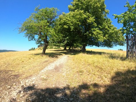
The ascent was quite pleasant along a trail shaded by trees, creating a serene and idyllic atmosphere.
When I reached the top, I realized that the plateau was indeed completely treeless. But there was one single small patch of scrub, which offered me a bit of shade as the sun relentlessly burned down. The temperatures were about to exceed 30°C / 86°F for the day.
Before I positioned myself in the shadow of the scrub, I took a moment to appreciate the panoramic view that the standalone mountain offered. It came as no surprise to me that there was a castle on the neighboring mountain, one that I had never seen before. Southern Germany is known for its abundance of castles, making it almost impossible not to come across one within a stone’s throw.

I tried a new guying kit in combination with the 10-meter / 33 ft fiberglass mast. I think I need to use it more often and become familiar with it. I came close to tying myself up more than once. Eventually, I managed to raise the mast with an end-fed half-wave antenna attached for the 20-meter band.
The antenna based on a design from DG1JAN, which is available on GitHub. I have used the antenna frequently during my last activations, and I am quite satisfied with it.
My other equipment consisted of my Icom IC-705, a 4Ah LiFePo battery, and the BaMaKeY TP-III ultra-compact twin paddle. So, I settled comfortably under the tree and operated on the 20-meter band in CW and SSB until the demand dwindled.
After half an hour, I stopped with 15 QSOs in my log, including two summit-to-summit QSOs. I didn’t want to switch bands since I had another summit on my list.

During my operation, I was kindly asked about my activity twice. Recently, I have thought how I would react to unfriendly encounters or encounters with officials after reading an article from John (VA3KOT) on his homepage. Perhaps I was fortunate, but thus far, all the people I have encountered have been friendly. Nevertheless, I make an effort to keep my distance from people whenever possible, although that is not always feasible.
SUMMIT GRÜNENBERG
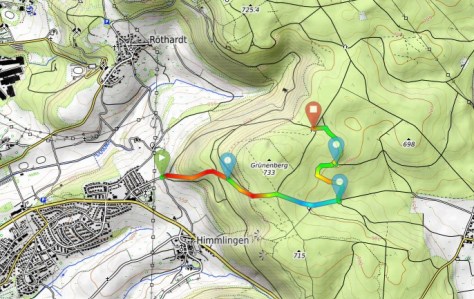
The next SOTA summit was called Grünenberg (DM/BW-653), which roughly translates to Green Mountain in English. The mountain is located in a wooded area to the west of the town Aalen, and the local residents frequently utilize the area for recreational activities. The hiking and biking trails are well-established, and walking beneath the trees on a hot day is truly enjoyable.
The summit itself is pretty boring. It’s located in the middle of a forest with no route to the actual summit, and there isn’t anything particularly notable about it. In fact, I believe most people are unaware of its existence.
This was my third time activating the summit, and I decided to try a different trail to reach the activation zone. However, as is often the case when I attempt shortcuts, things didn’t go as planned. Instead of a 1.5 km / 1 mi, half-hour walk, I ended up doubling the distance and time due to losing mobile phone coverage and struggling to find the right path. :/
The activation zone has a shelter with a wooden bench and table, which makes the operation quite comfortable.
A mast mount guidepost pole is conveniently positioned next to the shelter, making it easy to set up the fiberglass mast. I attached a dual-band end-fed half-wave antenna for the 15- and 30-meter bands to it.
After 6 QSOs, a family with two children, around 4-5 years old, came along. The kids were curious about what I was doing there. I impressed them by showcasing my knowledge of the secret language of CW. When they left, I made the decision to end the activation as well. The temperature had risen significantly, making it uncomfortably hot. My water had already reached lukewarm temperature, and I was eagerly looking forward to enjoying something ice-cold to drink.
With 22 QSOs it was not the most successful day in terms of QSOs, but it was a nice one.


Great report and history lesson as always, Thomas!
Bold and stealthy. Yes, that is how I like to operate. I actually have a post in my drafts folder on this very topic. The catalyst was a recent encounter I had at a state park.
There are parks I visit where I know the staff very well and I could probably erect a 50′ tower and they wouldn’t care. There are others where I know I’m allowed to operate, but they’re busy park and I don’t know the staff. In those cases, I try to deploy in a stealthy way, but also do so with confidence. There is a balance there between “sticking out” and looking like you’re concealing something.
Someday, I’ll finish that post–and will certainly link to VA3KOT. Great points there!
Thomas
K4SWL