
by Teri KO4WFP
As much as I enjoy the pursuit of my 2024 goal of 60 new parks, this Wednesday, August 21, I suspended my pursuit of that goal and headed to George L. Smith State Park, a park I activated last fall. Why? I did so in support of K2D and International Dog Day. (See the QRZ page here: https://www.qrz.com/db/K2D)

International Dog Day is observed annually on August 26th. The goal is to raise awareness of the world’s abused, abandoned, homeless, and shelter dogs. Hans YL3JD in Latvia operated the past several years with a special event in honor of the day. This year, for the first time, Hans is joined by stations in Great Britain, Canada, and the United States. The US team is organized by Caryn KD2GUT under the call K2D.
There are eight operators here in the US that will be on the air from Wednesday, August 21 through Monday, August 26. Three of us will do at least one of our shifts from a POTA site. I chose George L. Smith State Park (US-2179) as my site for two reasons. First, for this activation I need good cell service for spotting on the POTA website but also DXSummit. I recall this state park having good cell service during my previous visit. Second, I’ve been hankering for a return to this park given how scenic it is. K2D is a great excuse to return.


Daisy (of course she has to come along for K2D!) and I arrived early, around 9 AM. We had the park to ourselves. The temperature actually felt cool, probably due to the presence of the lake and a stiff breeze blowing off of it.

Last time I visited here, I operated from a hill next to the park office. However, I recall a fair amount of noise on 40 meters at that location. I had another QTH in mind.

When you enter the park, to the right is the old grist mill through which one may walk. On the other side is a trail. It was along that trail I intended to set up.

I parked at the park office, grabbed my gear, and walked to the old mill house. We continued out to the trail on the other side. I found a spot just past some hanging foliage which I thought would prevent anyone from walking into me. (It turns out we didn’t see a single person walking though we did see several kayakers on the lake.) There was a tall wall of foliage behind me which should shield Daisy and I from the summer sun during the entire activation.

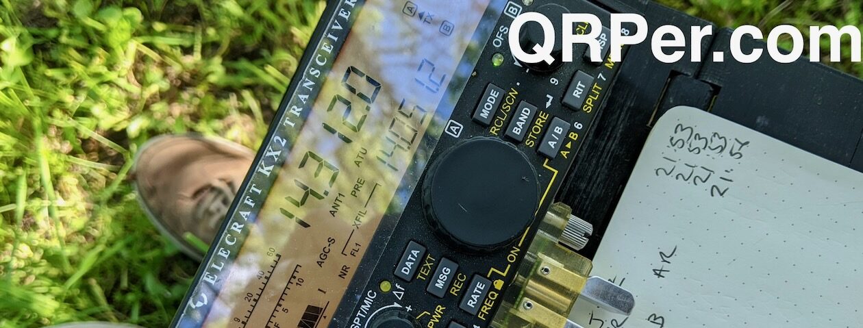
Given I would operate as a special station, I wanted my trusty Tufteln EFRW. I found a branch high in the canopy and aimed. It took me several throws but I finally snagged a branch close by. I didn’t want to block the trail and needed a branch high enough for a steep angle in my antenna.


Around 1400 UTC, I began calling CQ K2D or CQ POTA ES K2D. I opted for 20 meters given I’d likely reach a wider range of hams. The bands today did not disappoint (as you’ll see on my QSO map below) for the two hours I operated. I did try 40 meters near the end of the activation but had no callers for the 15 minutes I tried. Finally around noon, I called QRT.


I was thrilled to find at noon that Daisy and I still sat in shade. This is a big deal in Georgia in August! In fact, we felt a breeze off the lake the entire activation. Can you say “ahhh”? So next time I visit this park, I’ll set up in this spot.


I appreciate everyone who hunted me today.
I hope QRPer readers will consider supporting K2D over the next five days. As this is the first year of the event here in the US, there is not a schedule for when the eight of us are on the air. We will be on when we can for both CW and SSB, though since most of us are CW ops, I suspect you will mostly find us operating that mode. We will stick close to the frequencies of 7.045, 14.050, 21.030, and 28.050 as printed in QST magazine. However, check for us on DXHeat and DXSummit in case we need to move due to inference.
I’ve posted a short video to YouTube about the activation if you are interested:
Next week, I’ll resume my 60 new-to-me POTA activations for 2024 quest. Where will I show up and will I succeed in bagging park #38? Stay tuned…
Equipment Used
[Note: All Amazon, CW Morse, ABR, Chelegance, eBay, and Radioddity links are affiliate links that support QRPer.com at no cost to you.]


