
Last year, I mentioned—either in a field report or video—that I carry a full Elecraft KH1 field kit in my everyday backpack, my EDC (Everyday Carry) pack.
That led to a great question from Terry, a reader who was studying for his ham radio license at the time. He wrote:
“Thomas, thank you so much for the field report. I had never guessed a complete HF radio field kit [like the KH1] could be so small that it would qualify as a bonafide EDC.
I’m very curious—what other EDC items would you recommend, not just as a radio operator but in general? I suspect you’ve put some thought into this in the past.”
Great question, Terry! And my apologies for taking, well… several months to respond. Your message got lost in the shuffle when Hurricane Helene hit, effectively dropping an atom bomb on my inbox and free time.
To make up for it, I thought I’d turn your question into a proper post.
I Love EDC

Yes, I do put a lot of thought into my EDC items. I’m constantly on the go, and since I never know when I’ll have time to write a field report, review, or even catch up on emails, I take my work with me. My laptop (a MacBook Pro) is a key part of my EDC.
 And, as you noted, so is my KH1 field kit. It’s safely packed inside a Pelican Micro M40, so I don’t have to worry about damage if I drop my pack or something heavy lands on it.
But if I understand your question correctly, you’re asking about the other non-radio-related EDC items I carry.
Another reader/subscriber recently (as in a few months ago) asked for a full video tour of my EDC backpack, and I do plan to make one soon. That said, I’ll need time to prepare because—frankly—I carry a lot of stuff!
For now, though, here are ten items that are always in my EDC pack. Most of these aren’t directly related to radio, but they’ve proven their worth time and time again.
(Note: Some of the links below are affiliate links that support QRPer.com at no cost to you.)
Item 1: Leatherman Signal Multitool
 This is my go-to multitool. It features pliers, screwdrivers (with a bit collection), a knife, a saw blade, a whistle, a fire-starting flint, a bottle opener, and more.
 I firmly believe every field operator should carry some sort of multitool—it’s indispensable for quick antenna repairs.
Item 2: Rechargeable Nitecore Headlamp
 I’ve said it before: a good headlamp is as essential as a first-aid kit, especially if you hike to your radio sites. This is my favorite headlamp for EDC, though I have many others. The one in my SOTA pack has a beefier battery and a brighter beam, but this Nitecore is perfect for everyday use.
Item 3: First Aid Kit
 I always keep a compact first-aid kit in my EDC pack. I typically build my own, focusing on cuts, scrapes, tick removal, headaches, stomach aches, and allergies. I keep a more advanced trauma kit in my car and a separate field first-aid kit in my SOTA/POTA packs.
Item 4: PD Battery Pack
 This Anker power bank charges everything from my phone to my laptop. With a Tufteln converter, I can even power a radio in a pinch. It’s a must-have for keeping my gear running.
Item 5: Light My Fire Spork
 This is one of the most useful things I carry. It’s lightweight, insanely durable, and much better than disposable plastic cutlery when eating a salad or soup on the go. Such a simple item, but incredibly handy. There are numerous options like this on the market (many in durable plastic) but I like this particular one so much, I bought a second for my wife. Makes for a great stocking stuffer.
Item 6: RF Connector/Radio Accessories Pouch
 This small pouch holds an assortment of RF connectors—essential backups in case something in my POTA field kit fails. Because let’s be honest… something always fails at some point.
Item 7: Commando Precision Screwdriver Set
 This little kit has saved the day more times than I can count. Unfortunately, I don’t think my particular model is still made because the company appears to have closed shop. Very unfortunate because it’s super high-quality and was made in the U.S.
 You might still find them on eBay. I wrote this review on the SWLing Post five years ago.
Item 8: PackTowel
 A compact, absorbent, quick-drying towel is endlessly useful—whether for cleaning up a spill, washing up, or drying off gear after a sudden rain shower. I carry this 14×10″ size.

Item 9: Victorinox Nail Clippers
 This little Swiss Army tool is a gem. It has excellent nail clippers, plus tweezers, a toothpick, small scissors, and a tiny knife.
 Small, simple, and super useful.
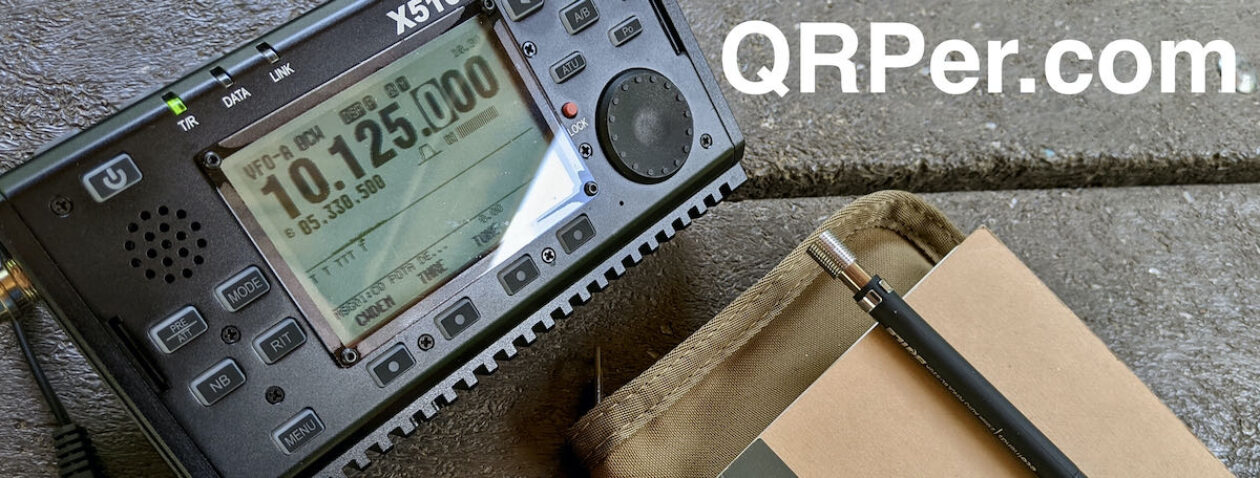
Item 10: Notepad and Pen/Pencil
 I like taking notes, and this combo–a small Rite in the Rain pad and Graphgear mechanical pencil–is always within reach. It’s also my backup logbook when operating the KH1 in tabletop mode.
Bonus Item: Loop Ear Plugs
 As I pulled items from my pack for photos, I realized one more essential: Loop Ear Plugs. A friend recommended them, and I got pairs for my daughters and me this Christmas. I’m easily distracted by loud noises when working, so I often use white noise or instrumental music for focus. I’ve also used cheap foam earplugs, but they aren’t comfortable long-term—especially for sleep.
 These Loop Ear Plugs, however, are low-profile, lightweight, and so comfortable I forget I’m wearing them. They don’t block all sound, but they take the edge off loud, percussive noise while still allowing conversations. A game-changer for noisy spaces, for me at least!
So much more…
Honestly, it was tough picking just ten (okay, eleven) items. When I look in my EDC pack, I see so many things I wouldn’t want to be without. Most of them are compact, lightweight, and boringly practical—but they make life easier.
I’m setting a goal to film a proper EDC backpack tour within the next month. It’ll be a long video, but I think it’ll be fun to go through everything I carry.
Of course, I’d love to hear from you—what do you keep in your EDC?


