Tag Archives: Teri (KO4WFP)

KO4WFP: The Countdown Begins with Jack Hill State Park

Many thanks to Teri (KO4WFP) who shares the following guest post:


The Countdown Begins with Jack Hill State Park

by Teri (KO4WFP)

Having completed my kilo for Wormsloe State Historic Site (K-3725) and earned the Marathon Award for the Straight Key Century Club, I needed a new goal into which to sink my teeth. I’ve often set goals in my life as they motivate me to learn and step outside my comfort zone. So what better goal than to activate 60 parks new to me over the next year! I admit it is ambitious; however, goals should excite you as well as make you a little nervous because then you know you are stretching yourself.

How do I plan to accomplish activating 60 new parks? The weeks my son has a break from school offer the perfect opportunity to travel. I can also work in overnight trips to locations in Georgia or South Carolina throughout the year. To save money, I’ll drive on these trips and camp. Most state parks which offer camping are also a park on the POTA list, an easy win-win. For safety, my “POTA pooch” Daisy will accompany me if I am alone, offering an opportunity for the two of us to strengthen the bond we have and work on her training.

My first break-week trip is to Florida during the second week of winter break, December 24th through January 1st. I have nine to ten parks I plan to activate that week, depending on the weather. Daisy and my brother Joseph (no, he is not a ham) will accompany me. Joseph and I took a cross-country trip out west in my twenties and spent six weeks on the road. We mostly camped but also visited friends and relatives along the way.

However, before I leave on my Florida trip, I began my pursuit of 60 new parks with Jack Hill State Park, a park that is only an hour from my new QTH in Bloomingdale, Georgia.

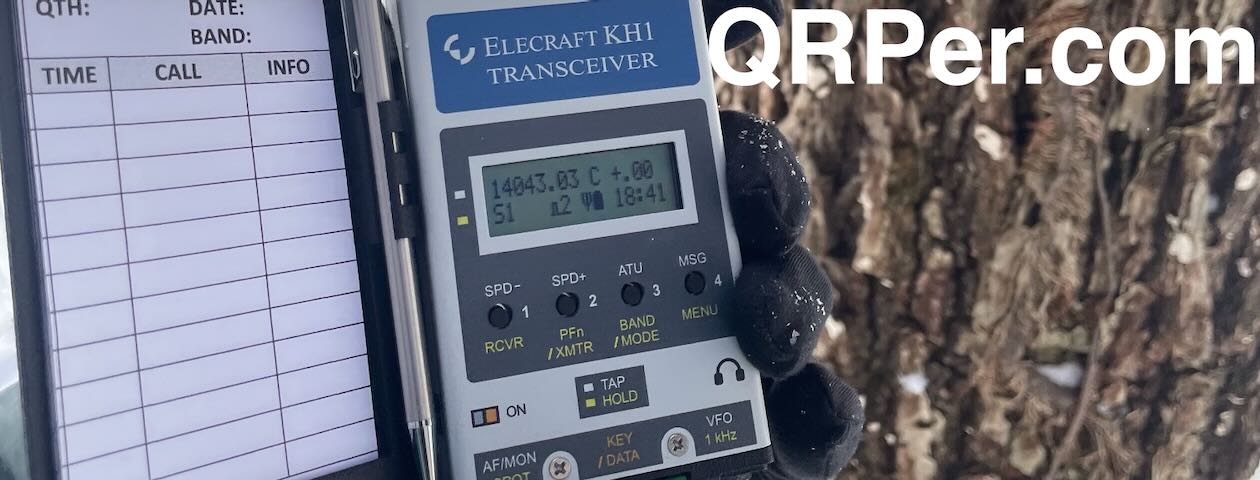
Anyone who knows me knows that I am not a fan of winter. (Spot me this as I live in the Deep South.) However, I am determined to not miss out on POTA because of a little cold weather. Thinking the temperature would be warmer in the afternoon, my dog Daisy and I headed out later than usual on Wednesday, December 13th for our activation.

I enjoy driving in rural Georgia. You never know what you’ll see. Daisy and I went through the town of Bellville, a whistle stop in the middle of nowhere. The town was established in 1890 along the tracks of the Savannah & Western Railroad and was a regional transportation hub for agricultural and timber products. A mural in the town across from the old depot pays homage to the town’s railroad past.

Jack Hill State Park is located in the town of Reidsville, Georgia. It offers amenities that include boating and fishing on the park’s lake, accommodations in the form of camping as well as cottages to rent, a splash pad for kids, and even a free miniature golf course! The park was originally named Gordonia-Altamaha State Park as it is near the Altamaha River. However, it was renamed Jack Hill State Park in 2020 in honor of Senator Jack Hill who was instrumental in the local community. Continue reading KO4WFP: The Countdown Begins with Jack Hill State Park

The Lifeline of CW and POTA

Many thanks to Teri (KO4WFP) who shares the following guest post:


The Lifeline of CW and POTA

by Teri (KO4WFP)

The past five months have been tumultuous. I am now divorced and my son and I are making a new life for ourselves with my family. Those of you who’ve been through a divorce know how stressful and difficult a process it is, especially when navigating it for the first time. You are undoing relationships and patterns of behavior and figuring out how to move forward and what that looks like.

Why do I tell you this? Partially because I want those of you who’ve said “where the heck have you been?” to know why I’ve been absent from QRPer. However, I also want to thank all of you in the ham community because it is this community that saw me through my difficulties. Hams are some of the kindest and most wonderful people, especially CW and POTA hams. This community has rallied to my side and given me a reason to keep moving forward.

As Thomas noted in his September 17 post of this year, CW is indeed “radio therapy.” After I relocated, it was six weeks before I had a home station again. Six LONG weeks without seeing my code buddies – Caryn KD2GUT, Glenn W4YES, and Charles W4CLW – on the air. I felt cut off not having those QSOs, not being able to get on the air when I desired, like someone had removed my legs! The absence reinforced how much CW and POTA mean to me.

While working to get a home station again, I latched onto POTA. I vividly recall driving home from my first POTA activation after leaving my ex-husband and, for the first time in several weeks, the stress temporarily melted away. Life, for a few hours, felt normal. I felt like my old self.

CW and POTA were indeed therapy as I put my life back together. Getting out and activating was good for my mind and body. Ham radio for me is about relationships and seeing ops who hunt me regularly was like reconnecting with friends saying “hi”.

POTA became an integral part of my healing process and I pursued activations at George L. Smith State Park and, my old stomping ground, Butter Bean Beach, part of Wormsloe State Historic Site.

George L. Smith State Park is a pretty site for POTA. The park’s focal point is Mill Pond Lake which was created by the damming of 15-Mile Creek in 1880. Visitors can rent kayaks or canoes to explore three paddling trails in the 412-acre lake and its wetlands but are warned against swimming due to the presence of alligators. The land adjacent to the lake has seven miles of nature trails through sand-bottomed forest with hardwoods and longleaf pine.

The old mill at the site still exists. The original floodgates are used to control the water level in the lake with the addition of an electric hoist to open and close the gates. The mill, known as Watson Mill, is housed in a bridge which was open to motor traffic until 1984 and is one of only two mills operated by the State of Georgia. Watson Mill housed a sawmill for lumber as well as a gristmill, the latter which remains operational for demonstration purposes.

After a quick drive through the park, I chose to set up on the hill next to the park office which offered an open area without adjacent power lines. It wasn’t long before my EFRW was installed in a tree and I was on the air. Continue reading The Lifeline of CW and POTA

KO4WFP: An Unexpected, Speedy Activation at Tuscumbia WMA in Mississippi

Many thanks to Teri (KO4WFP) for the following guest post:


An Unexpected, Speedy Activation at Tuscumbia WMA in Mississippi

by Teri (KO4WFP)

Some of the best things in life are unexpected.

My family, after spending two days in Dallas, Texas visiting in-laws, headed back east on Wednesday, July 26. We originally planned to drive Interstate 20 through Louisiana and Mississippi with a stop in Alabama to visit with friends. However, early Wednesday morning, I Googled our route and realized a shorter route through Arkansas and Mississippi would save us thirty minutes. That doesn’t sound like much but when you spend nearly all day driving in a car, thirty fewer minutes feels like a big deal.

Before the trip, I planned an activation in and purchased a permit for Louisiana’s Russell Sage WMA (K-4076). Well, now I wouldn’t even go through Louisiana on our way back. I was loathe to not activate a park at all on the drive home. (Those who know me well, know I don’t give up easily at anything.) So I looked at the new route and the POTA website and endeavored to find a park that would work as well as we’d reach later in the day due to the hot weather. I settled on Tuscumbia Wildlife Management Area (K-7092) in Mississippi along US Route 72.

The 2,600 acre Wildlife Management Area (WMA) is located just outside Corinth, Mississippi and divided into two sections, one on either side of US 72. The section to the north of the highway is primarily swamp bottomland but the northeast corner of it is accessible to the public. The WMA is a great place for birding and I noted 104 species have been observed according to the website eBird. It was this northeast corner at which I would attempt my activation.

The weather during the day was hot! At the Arkansas welcome center, I noted the boat-tailed grackles in the parking lot panting to cool off in the heat. I planned to reach Tuscumbia WMA  near the end of the day but whether it would still be too hot or not, I had no idea. Thankfully, as we reached the Mississippi state line out of Memphis, cloud cover appeared and I watched the temperature on the dashboard slowly descend from 99 degrees earlier in the day to a manageable 86 degrees.

The other potential wrinkle in my last-minute decision was whether accessing the park required a fee or not. I couldn’t tell from the Mississippi Department of Wildlife, Fisheries and Parks website. When we reached Memphis and had better cell service, I called one of their offices and spoke to a helpful employee who confirmed that yes, I would need a permit which I could purchase using their app. I also needed to use a second app to check in and out when actually at the park. Somehow I managed to get the apps downloaded, my account set up, and a one-year non-resident permit purchased during my husband’s turn at the wheel. Whew! One more hurdle surmounted.

Everything seemed to be falling into place. The last remaining wildcards were if I would arrive early enough before sunset and would I be able to find a place to set-up.

We arrived at the site a little before 7 PM. The most obvious place to activate, on the gravel pad next to the highway, had power lines running right above it as I had feared. There was no way to set up there. And I could not drive the car further into the property as gates prevented auto access. My only other option, with daylight running out, was to walk into the property, find a spot, and sit on the ground. To make space for our trip luggage, though, I left behind the bin in which I usually keep a tarp and other emergency supplies. (Note to self – next time keep at least a tarp in the car.) The only thing I could find for me to sit on was the windshield sunshade – not ideal but it would work.

I checked into the app, grabbed my POTA backpack, liberally applied bug spray for the gathering mosquitos, and headed past the gate to see with what I had to work. By the way, I’ve never seen mosquitos so large in size! They were at least three times bigger than the ones we have in Savannah, GA. Continue reading KO4WFP: An Unexpected, Speedy Activation at Tuscumbia WMA in Mississippi

KO4WFP: Braving the Heat at Spring Creek Forest Preserve in Texas

Many thanks to Teri (KO4WFP) for the following guest post:


Braving the Heat at Spring Creek Forest Preserve in Texas

by Teri (KO4WFP)

The last week of July, my family and I visited my husband’s sister and brother-in-law who live in the Dallas, Texas area. Of course, as soon as the decision was made to make the trip, I immediately checked to see if there were any POTA sites nearby. And wouldn’t you know, there is one roughly 12 miles away – Spring Creek Forest Preserve (K-4423). This would be my chance to activate my first Texas park.

Spring Creek Forest Preserve is a city-owned nature preserve in Garland, Texas. The forest contains old growth trees and several rare and unique plants. Seven miles (four dirt and three paved) of trails traverse the property. The park is named for the creek that runs through it. Today, the creek was deceptively quiet and the water level low. However, given the sculpted chalk cliffs that run above the creek and the flood stage signage, the waterway obviously has its wilder moments.

The morning of July 25th, I headed out early for the easy forty-minute drive from my in-laws to the preserve. The weather forecast predicted a high of 101 degrees, easy to imagine as by the time I arrived at the park, around 8 AM, the temperature was already 80 degrees.

I scoped out the parking lot. It was mostly empty on this day. Having no idea how busy the park might become, I looked for a place less likely for people to encounter my antenna. At first I chose a tree on the edge of the parking lot. However, there was nowhere to park my car close by and I wanted to sit inside the car during the activation.

In the middle of the circular parking lot was a tree surrounded by weedy growth. I figured no one would choose to wander through those weeds and thus my antenna would be safe and not need to be flagged.

I soon discovered why no one would want to wander through the weeds – they were full of little oval-shaped stickers! Thankfully they didn’t have long needle-like spikes on them and instead of being painful, were just annoying. They ended up all over my socks, shoelaces, and the hem of my shorts.

It took several tries to get my arbor line successfully in the tree as its branches were mostly aimed upward rather than outward. But on the third throw, I successfully snagged a branch of sufficient height for my EFRW antenna to slope toward my car. Just as it took several tries to snag the right branch, it took several adjustments to get the right amount of tension in the antenna. Rather than retie the arbor line every time I adjusted it, I just tied another slip knot and as such it ended up looking a mess. But I finally got the amount of tension and height I wanted. (By the way, the weeds made for a mess untangling my arbor line after the activation, too!) Continue reading KO4WFP: Braving the Heat at Spring Creek Forest Preserve in Texas

KO4WFP: A Return to Butter Bean Beach

Many thanks to Teri (KO4WFP) for the following guest post:


A Return to Butter Bean Beach

by Teri (KO4WFP)

Given the trip to Nova Scotia and then getting a cold upon my return to Savannah, Georgia, it had been awhile since catching up with the guys in my local club – Coastal Area Radio Club (CARS). They have a No Work Wednesday club that meets weekly, activating either Butter Bean Beach at the Wormsloe State Historic Site (K-3725) or Fort Pulaski National Monument (K-0930). This Wednesday, July 19th, they opted for Butter Bean Beach, hoping for a maritime breeze given the hot and humid weather.

I always arrive early at Butter Bean Beach on Wednesdays to get my CW activation out of the way as my local guys use SSB. I rolled into the parking lot around 7:30 AM and saw stuff already piled up on one of the picnic tables in the pavilion. Uh-oh.

I, then, saw people I recognized – Garret Jones and Lisa Goodman. Garret volunteers with Wilderness Southeast and Lisa is the organization’s Executive Director. Wilderness Southeast offers eco trips and group programs to connect people with the environment. On one of my past activations, they were at Butter Bean Beach with a group of ninth graders for their Fish Gotta Swim program. Also assisting Lisa and Garret today was Sierra Abbasi. They warned me that around 9 AM a group of kids would arrive for their kayaking camp. Good thing I had my noise-cancelling headphones!

Last time I activated this site, I used the EFRW antenna in a tree but I thought to try something different today. Frankly, I figured my SOTAbeams travel mast looked a bit lonely, especially since I had lugged it all over Nova Scotia but not deploying it once while there.

It didn’t take long to get the mast deployed and the antenna where I wanted it. Now how to deal with the feed-end? The night before, I recalled a recent conversation with a friend who suggested using gallon water jugs to hold the ends of an inverted V. I figured that might work just fine for attaching the feed-end and keeping it taut. It did!

As for the counterpoise, even though I received a comment on a previous trip report that the counterpoise does not need to be elevated, I thought “let’s just gild the lily and elevate it anyway.” So I put out my water bottle and attached the end of the counterpoise to that. Besides, I wanted to be prepared for kids possibly walking around my antennas. A black, thin wire lying on the ground would not be easily noticed. But one slightly elevated with neon pink flagging tape might.

It wasn’t long before I was on the air. When at Butter Bean Beach, I almost always start first on 40 meters due to the early hour. (Note: I did not check the band conditions before heading out that morning but good thing I didn’t because 40 meters obviously didn’t read that report either.) Continue reading KO4WFP: A Return to Butter Bean Beach

KO4WFP: The Final Fling at Grand-Pré National Historic Site

Many thanks to Teri (KO4WFP) for the following guest post:


The Final Fling at Grand-Pré National Historic Site

by Teri (KO4WFP)

If you read my four previous articles, you know my family and I went to Nova Scotia for eight days. At this point in my trip, I had three successful POTA activations and three unsuccessful. Tomorrow, July 6th, my family and I would head back to the States. I hankered to attempt one more QRP POTA activation before that happened.

For our final day in Nova Scotia, we opted to drive back from our Airbnb in Middleton on Highway 101 to Halifax. The night before, I looked at the POTA website for parks along the route to activate. I had learned to avoid urban parks if possible due to the noise level and limited space for the EFRW antenna which I preferred to deploy. One park seemed to fit the bill – Grand-Pré National Historic Site (VE-4839).

The morning of Wednesday, July 5th was overcast and rainy. Despite the dreary and less-than-optimal conditions, we drove toward Grand Pré. To buy myself a bit more time in hope the showers might abate, we grabbed a bite to eat at the Just Us Roastery and Café outside the town.

After a quick breakfast, we arrived at the site around 12:45 PM. Given the rainy conditions, I would need to stay in the car. Too bad because the site looked inviting and I would have enjoyed setting up on my jacket like I did at Fort Anne.

The limitation of operating out of my car meant staying close to the parking lot. The trees in the main parking lot were all shorter than I preferred. And, as I learned at other sites, the main lot didn’t give me any buffer from people walking into my antennas. However, at one side of the property was a separate small lot for two or three RVs. Two trees on the far side of it were tall enough for my antenna and, better yet, no one would be walking into them. We pulled into this lot parking on the grass at its edge so I would be out of the way of any RVs. Continue reading KO4WFP: The Final Fling at Grand-Pré National Historic Site

KO4WFP: Two Parks in One Day – Fort Anne NHS and Lake Midway Provincial Park

Many thanks to Teri (KO4WFP) for the following guest post:


Two Parks in One Day – Fort Anne NHS and Lake Midway Provincial Park

by Teri (KO4WFP)

If you read my three previous articles, you know my family and I went to Nova Scotia for eight days. You also know that the first three parks I attempted to activate in Nova Scotia provided challenges galore! I was unable to secure 10 contacts at either the Halifax Citadel National Historic Site (VE-4841) or the Alexander Graham Bell National Historic Site (VE-4826). However, the third time was the charm and I secured 10 contacts (just barely) at Cape Breton Highlands National Park (VE-0013).

Feeling confident after the Cape Breton activation, I decided to attempt two QRP POTA activations in one day. I already planned to activate Fort Anne National Historic Site (VE-4832) in the morning. My husband and son had a whale-watching trip scheduled for the afternoon giving me three hours to kill. What better way to pass the time than with POTA! (They did ask if I wanted to accompany them; however, there was no contest in choosing between being on a boat for three hours, whales or not, and an activation!) I chose to attempt activating Lake Midway Provincial Park (VE-0922), a fifteen-minute drive from their launching point.

The day prior it rained nearly all day. This was not typical summer weather for Nova Scotia. In fact, one of the Canadian airport security officers, while searching my backpack and ham equipment, apologized for the rainy weather we experienced during our visit. The forecast for Tuesday, July 4th, called for possible showers in the morning but clear weather for the afternoon.

Source: hamradiofornontechies.com

We arrived at Fort Anne around 9:45 AM. The earthen-walled fort was built to protect the harbor of Annapolis Royal. A museum exists in the renovated Officer’s Quarters on the site, though I did not have time to visit it.

There were no trees near the visitor center but I spied trees past an earthen embankment with an opening in it and headed in that direction. As I walked through the opening at the base of the embankment, an bowl-like area among the trees with picnic tables appeared. At the top of it’s far side was what I considered the ideal tree for my activation. I would set up on top of the bowl’s far side embankment wall and use that tree for my EFRW antenna.

It didn’t take me long to snag the branch I wanted and put up my antenna. Now how to deal with the feed-end and counterpoise? Continue reading KO4WFP: Two Parks in One Day – Fort Anne NHS and Lake Midway Provincial Park

KO4WFP: Was the Third Time the Charm at Cape Breton National Park (VE-0013)?

Many thanks to Teri (KO4WFP) for the following guest post:


Was the Third Time the Charm at Cape Breton Highlands National Park (VE-0013)?

by Teri (KO4WFP)

If you read my previous articles, you know my family and I went to Nova Scotia for a week. You also know that my first two attempts at activating parks in Canada did not go well. At the Halifax Citadel National Historic Site (VE-4841), I was sidelined by weather and site issues. At the Alexander Graham Bell National Historic Site (VE-4826), extremely poor band conditions and site issues prevented a successful activation. But those who know me well, also know I do not give up easily.

The morning of Friday, June 30th, my family and I headed to Cape Breton Highlands National Park (VE-0013) which occupies 950 kilometers of Cape Breton Island. One-third of the Cabot Trail, a world-famous scenic highway, runs through the park. Talk about amazing scenery! The highway runs along a shoreline reminiscent of the rugged California coast, then moves upward and inland on top of the highlands, a wild landscape with scrubby firs and moose crossing signs, and then descends back toward the coastline with steep ravines and valleys off the side of the road.

We arrived at the Cheticamp park entrance a little before 11 AM. Looking around the information center parking lot, I spied a tree and nearby picnic table perfect for my activation. This arrangement would allow me to watch for people who might walk toward my antennas and provide the use of a table to which I was more accustomed.

I immediately set about picking out a branch (located in the upper part of the photo below) and pulled out my arborist line and weight. Though I know I am not, I am beginning to feel like a pro putting antennas up in trees. I snagged the branch for which I was aiming on my first try. Hooyah!

One thing I have not learned yet is to accurately judge how much distance I need between my tree and my station. My antenna had too much slack so I hiked it up a bit higher in the tree and moved the picnic table about 5 feet. Continue reading KO4WFP: Was the Third Time the Charm at Cape Breton National Park (VE-0013)?

KO4WFP: Part Two of Teri’s Nova Scotia POTA adventure!

Many thanks to Teri (KO4WFP) for the following guest post:


Getting My Butt Kicked in POTA Yet Again

by Teri (KO4WFP)

If you read my previous article, you know my family and I went to Nova Scotia for a week. You also know that my first attempt at an activation in Canada did not go well. So, being a glutton for punishment, I attempted a second activation, this time at the Alexander Graham Bell National Historic Site (VE-4826) on Thursday, June 29th.

I learned several “takeaways” from the failed activation at the Halifax Citadel:

  1. look at the site in advance if at all possible,
  2. remember to check band conditions BEFORE the activation, and
  3. take all photos as the activation progresses because weather conditions may prevent you from doing so afterward.

After we departed the Halifax Citadel, we drove northward toward Baddeck, the town in which our next Airbnb and the Alexander Graham Bell site is located. Rain dogged us on and off until we reached Cape Breton Island. On the way, we stopped at Murphy’s in Truro for some of the best fish and chips and then The Farmer’s Daughter for ice cream, the consolation prize for my failed activation.

Being mindful of my first takeaway, we stopped into the Alexander Graham Bell site for reconnaissance before heading to our Airbnb. To my delight, there were trees present in the parking lot, though not many open branches over which to easily throw my line. I left for our Airbnb with the sun coming out from behind the clouds and an optimistic feeling about the next day’s activation.

My second takeaway from the Halifax Citadel was to check band conditions before the activation. Well, Thursday morning’s report was not promising. I didn’t see any mention of a geomagnetic storm (though one was forecast for Saturday), but the numbers were not good. What I didn’t realize was they were actually horrible.

Source: hamradiofornontechies.com

We arrived around 10:10 AM and I began setting up the EFRW. It took me several throws to get the line in the chosen tree. Kudos to Thomas for recommending the arborist line. It never got stuck on any of the little twigs over which my line ran. The antenna was not as elevated as I would have liked but it was better than at yesterday’s activation and would work well enough. Continue reading KO4WFP: Part Two of Teri’s Nova Scotia POTA adventure!

KO4WFP: A Difficult But Productive Learning Experience at the Halifax Citadel (VE-4841)

Many thanks to Teri (KO4WFP) for the following guest post:


A Difficult But Productive Learning Experience at the Halifax Citadel (VE-4841)

by Teri (KO4WFP)

Life is full of interesting experiences and my attempted activation at the Halifax Citadel National Historic Site (VE-4841) proved to be one of them.

Source: Halifax Military Heritage

For those of you unfamiliar, my family and I planned a trip to Halifax, Nova Scotia this summer. I decided while there, I would activate six or seven parks. I had never attempted such a feat in a foreign country under the limitations of what I could carry on a flight and using a rental car with which I would be unfamiliar. The previous month and a half, I acquired equipment and skills to (at least in theory) adequately prepare for this undertaking.

The morning of Wednesday, June 28th, we headed to the Citadel.

We arrived in Canada the previous day much later than the anticipated arrival time so there was no time to check out the site beforehand. Before my trip, I queried a Canadian op who had activated the site and his response was helpful though it did give me pause since I would not have as hefty a vertical as he uses for his activations.

The weather forecast was not promising. The previous night, fog pervaded the drive from the airport to our airbnb. It felt like we had indeed landed in a foreign land. Gone were the live oaks and Spanish moss replaced with firs and what looked like aspens or birch trees. The day’s forecast called for more of the same – fog with a chance of showers later in the day.

My husband and son decided to check out the fortifications while I did my activation. I dropped them off at the main gate and headed to a spot on the side closer to the bay which I hoped would be a better spot for my signals to reach into the United States.

I decided to start with the AX1 on 20 meters, figuring I’d reach more ops on that band and knock out the activation in short order. Also, the counterpoise for 20 meters is shorter than the one for 40 meters and I didn’t have much room to play with at the site.

Boy, was I wrong about a quick activation! First of all, I had to figure out how to support the antenna without it blowing over in the wind. My Subaru Crosstrek back home has rails on the top to which I can bungee my gorillapod. No such luck with the Ford SUV we were assigned. Continue reading KO4WFP: A Difficult But Productive Learning Experience at the Halifax Citadel (VE-4841)