A Surprise for the POTA Babe

Sometimes you need a break.  My sweetie Glenn W4YES booked two Airbnbs, one in North Carolina and one in South Carolina, the second weekend in October as my son’s school was on break for four days. Anyone who knows me will tell you I am a planner. However, it was a nice surprise for me to NOT plan this trip. Glenn picked out the places to stay as well as scouted nearby potential POTA sites. My job was to show up and enjoy the surprise.

Our first two nights were at a property between Uwharrie and Troy, North Carolina. This property borders the Uwharrie National Forest (US-4511). All I had to do for a POTA activation was walk out our front door to the road on the mountain and continue a short distance uphill where the national forest property begins. The road continues past a locked gate to the Buck Mountain Fire Tower, the highest point in the area.

source: https://icoat.de/pocketmaps/nc/map/nc-usfs-uwha-01
our Airbnb

Saturday is my day off from everything including ham radio. However,  Glenn and I took a leisurely paced walk to the fire tower just to check it out.

road up to the tower

The Buck Mountain Fire Tower was built in 1936 and is likely the work of the Civilian Conservation Corps. Given the narrowness of the stairs, it is obvious the structure was not built in modern times. The tower base is covered in chain-link fencing but the metal door into the tower base area to access the tower stairs, is not locked.

We returned to the tower at sunset to climb it . You cannot access the top floor as it is padlocked. But one can see for miles from the stair platform below the top floor. The sliver of color on the horizon as the sun dipped below was worth the climb to the top.

red oak acorns with my hand in the photo for comparison
nuts also covered the ground near the Airbnb

Not being one to squander an opportunity for POTA, the next morning I woke at 6 AM and was out the door at 6:45. Light was just beginning to show in the sky. The walk up to the fire tower was not that difficult despite having a backpack of POTA and camera gear and gaining 152 feet in elevation. This is why I walk the stairs at a local parking garage two days a week – so I am not unprepared for some elevation change.

I arrived at the fire tower right before sunrise and had the site to myself! As I figured out where to set up, I thought to myself no one was likely to hear me due to the tall, large metal structure with antennas in front me. In fact, I didn’t bother setting up any video equipment.

fire tower at first light

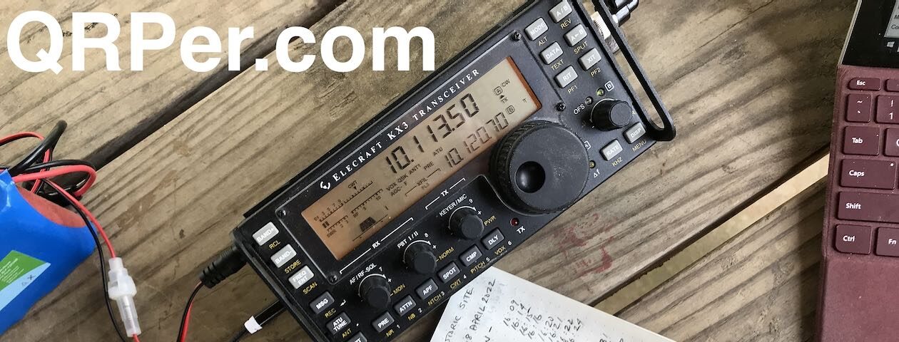
I chose a spot off to the side of the tower with my back to the woods so I could see anyone coming up the access road . (When you are a woman alone in the woods, you have to think of such stuff.) I opted for the Chelegance MC-750 as there was not much time to operate. I set the Chelegance for 40 meters. The sun was just beginning to rise (7:24 AM) so I figured 40 would be a better band given the early hour.

Chelegance MC-750
woods behind me

I settled into my Helinox chair with a blanket wrapped around my legs (the temp was 49 degrees – cold for this Georgia girl), spotted myself (cell service at a POTA site is always a plus!), and steeled myself for a failed activation. If I encounter noise when I do POTA, it is almost always on 40 meters. I figured with the antennas on site and the large metal object in front of me, no one would hear my QRP signal and there would be too much noise for me to hear anyone who did happen to respond to my CQ. I couldn’t have been more wrong!

operating with blanket wrapped around my legs & wool shirt on for warmth

There was noise on the band but not nearly as bad as I anticipated, partially due to the great filters on the KX2. There was a pulsing noise at 7.056 and some sort of signal on 7.054, but 7.049 was clear. It wasn’t long after spotting myself that Ronny WB2MQQ answered my CQ. That began a steady stream of calls over the next hour. The signal I heard originally on 7.054 moved to 7.049 about 25 minutes into the activation so I switched to 7.054 when it vacated that frequency.

set-up

At 8:27 AM, I called QRT because Glenn and I had plans to meet old college friends in Charlotte later that morning. I had 39 contacts at a location I was certain would result in none! It just goes to show you never know what the bands or a location will give you. Better to set up and try than quit before you start, right?

QSO Map for Uwharrie National Forest (US-4511) 10-13-2024

We had a pleasant drive to Charlotte. Glenn met his friend Mike and I, my friend Jennifer. (I call her Jennaboo and she calls me Teridactl.) Afterwards, satiated from lunch, conversation, and laughter, we headed southward into South Carolina for my next activation. Where? Stay tuned…

Jennaboo & Teridactl!

P.S. Want to get to know Glenn and I a little better? Check out my video from our stay near Uwharrie National Forest on YouTube:

Equipment Used

[Note: All Amazon, CW Morse, ABR, Chelegance, eBay, and Radioddity links are affiliate links that support QRPer.com at no cost to you.]

64-Contacts Spanning 6-Bands, 8-Countries, 3-Continents Using A 17m Coaxial-Sleeve Vertical Dipole

Gee, the title almost tells the whole story.  But not really.  The title is where I ended up; how I got there, is the story.

Here’s the story.

Today, I hope to activate Fintry Protected Area CA-3505 in southern British Columbia.

One of my objectives since I started POTA last year is to try to activate as many parks as I can in the Okanagan region of BC that have not yet been activated by anyone.  Nothing like a good challenge.  I expect that most of them haven’t been activated because they are quite remote and difficult to access unless one has a true off-road all-terrain vehicle.  Even at that, sometimes it still requires backpacking-in, to boot (no pun intended).  This is in part because many of the Protected Areas and Ecological Reserves are not always directly accessible by vehicle.  The roads often do not enter the park boundaries at all.  They get you close, and then you need to hoof-it in to be POTA legit inside the park boundaries.

Fintry Protected Area has never been activated before, by anyone. I’m wondering why?  Compared to many of my past activations, it isn’t nearly as difficult to access as some others I’ve been to.

The location in Fintry CA-3505 that I will be activating today is located about a 1-hour drive north of Kelowna, BC (where I live) via West Kelowna.  The last section of travel is via rough gravel roads.

Continue reading 64-Contacts Spanning 6-Bands, 8-Countries, 3-Continents Using A 17m Coaxial-Sleeve Vertical Dipole

Helene Aftermath Update: Adopting an Off-Grid Community Radio Network (Thursday, October 24, 2024)

Good Morning, Friends,

For those who haven’t followed my previous posts, we live in a rural mountain community in Swannanoa, NC, and were hit hard by the unprecedented destruction caused by Hurricane (later Tropical Storm) Helene. I’ve been sharing regular updates to chronicle our recovery efforts and, naturally, to highlight the vital role amateur radio has played throughout.


Since things have stabilized on our road, we’ve shifted focus to the administrative side of disaster recovery—insurance, FEMA, and contractors for repairs. I’ll dive into that in a future post.

Community Radio Update

It’s been a busy week. As I mentioned in my last post, I’ve been evaluating options for the best off-grid communications network for our rural community. My VHF handy talkies were incredibly useful after the storm—when we had no other way to communicate between households—so much so that our neighbors want a permanent solution that everyone can access.

I truly appreciate all the helpful feedback from my last post.

Meshtastic

Some of you suggested Meshtastic as a great option, and I agree. Here’s why:

1. It requires no license.
2. It’s effective if enough nodes are deployed in the neighborhood.
3. It’s affordable.

Meshtastic is an off-grid, text-based communications network. I first experimented with it during Hamvention 2024, where hundreds of nodes were deployed across the Dayton, Ohio area. (Thanks again, N5FY, for the Meshtastic device!) I plan to introduce it to our community by setting up a few test nodes.

While Meshtastic is a great supplement to our off-grid communications, our neighbors prefer portable radios and voice communication. This allows us to run nets and pass traffic more easily while on the move.

Although Meshtastic is relatively simple for electronics hobbyists and makers, it’s still a bit quirky for the average person and not entirely user-friendly yet. I’m confident the system will evolve, but for now, I’ll hand-pick a few neighbors to experiment with it.

Other radio services

Many of you suggested MURS (Multi-Use Radio Service) as a good alternative, and I agree it’s better than FRS (Family Radio Service) for several reasons. However, our valley has significant elevation changes and is heavily forested. We need a system that supports higher-powered mobile/base units and external antennas, plus the option for a repeater, which MURS doesn’t allow.

CB Radio is also a great option except that the CB bands are a bit crowded and unruly here. I think it could be difficult finding a clear channel to run a neighborhood check-in net, for example. Still a good back-up comms option for any household.

Why Not Ham Radio?

Of course, many of you encouraged me to consider getting the neighborhood licensed with Technician class licenses. While I’d love for everyone to become ham radio operators, it’s a big ask, especially in the aftermath of Helene, when most people are focused on rebuilding their lives. That said, I’m thrilled that two neighbors have already expressed an interest in studying for their exams!

However, we need a more accessible radio solution that can be deployed immediately, and that’s where GMRS (General Mobile Radio Service) and PLMRS (Private Land Mobile Radio Services) come in.

The two contenders

I’ve been weighing the pros and cons of both GMRS (General Mobile Radio Service) and PLMRS (Private Land Mobile Radio Services). Both allow for a repeater, mobile/base stations, and external antennas with power levels up to 50 watts if needed. A well-placed repeater would ensure reliable communication throughout our valley, even with the 1,000-1,200 foot elevation changes, and allow us to expand the system to more households.

I was about to submit the paperwork for PLMRS frequency coordination when I realized I should consult with our local fire department first. If they had a strong preference, I needed to know before investing.

I put out a call on the Mount Mitchell (N2GE) repeater for Dennis (N4DIN) who is typically stationed at our main Swannanoa Fire Department. I couldn’t reach him, but I did get a call back from Dan (N2DMG) who just so happened to be in the Swannanoa area for the day.

Dan was the primary net control during the critical first 10 days after Helene, so you may recognize his voice if you listened to the Mitchell repeater on Broadcastify.

We arranged to meet at our mutual friend Ed’s (N4EDX) home. Ed has been a key figure in our community’s recovery efforts, and Dan also invited Randy (N2GE), the owner of the Mount Mitchell repeater.

Our community relied on all three of these fine hams post-Helene. It was pure serendipity that we were all able to meet on short notice yesterday morning.

A compelling case for GMRS

Here’s the funny part: Dan and I arrived at Ed’s house first and after catching up a bit, I asked for his advice about using either GMRS or PLMRS. He agreed that PLMRS might have a slight advantage over GMRS, but both were good options.

Then Randy arrived.

Dan asked him what he was up to that day and Randy said, “I’m going to install a new GMRS repeater on a summit here in Swannanoa.

I asked Randy if the repeater would cover our valley and he replied, “Oh yeah. Easily. It’s an ideal location.

Dan and I looked at each other and said, “Well, that settles it.

I mean, what are the chances that I’d wake up yesterday morning and meet with the Mount Mitchell repeater owner, who just happens to be installing a new GMRS repeater to cover our community? Crazy, right?

From L to R: Thomas (K4SWL), Dan (K2DMG), Ed (N4EDX), and Randy (N2GE)

On top of that, Randy is the reason the Mount Mitchell repeater is so reliable and effective. If he’s installing a GMRS repeater, we know it’ll be done right.

So GMRS it is!

Randy mentioned the repeater would be up and running by Friday (!!!), and just like that, the burden of sourcing a repeater, a site, and licensing was lifted.

Thank you, Randy!

GMRS Radios

Now, here’s where I could use your help.

I’ve been researching GMRS radios, but the market is flooded with options, and reviews (websites and YouTube) are often unhelpful—many are just glorified product brochures based on free product. I’d love to hear from those of you who have actual experience with GMRS radios, especially handheld models that are:

• Easy to use and program (via USB or Bluetooth)
• USB-C rechargeable
• Rugged, possibly water-resistant or waterproof
• Have a standard antenna connector
• Well-reviewed by users

While I know some in our community already have GMRS radios, I’d like to standardize on a single model that I can recommend to neighbors. This way, I can program them consistently (via USB or Bluetooth), ensuring they all function the same. It will also make it much easier to teach everyone how to change channels and use the repeater effectively.

I’ve ordered a pair of Baofeng UV-5G Plus GMRS radios (this pair from Amazon–affiliate link) and plan to order a Tidradio TD-H8 based on Randy’s advice. I’d appreciate any additional suggestions!

Once I’ve selected a radio model, I’ll set up a series of community meetings/classes to teach everyone how to use the radios and how to participate in a community net.

Final thoughts…

As always, I’m deeply grateful for the kindness and support we’ve received. If I haven’t had a chance to reply to your emails or comments, please know it’s because I’ve been focused on helping my family and neighbors during this challenging time.

A huge thank you to Vince (VE6LK) and all the amazing contributors on QRPer.com! I’ve been enjoying all the guest field reports—it’s been a wonderful escape.

Thank you all for being such an incredible community and support network!

Wishing you the very best this week!

Cheers & 72,
Thomas (K4SWL)

Five Park POTA Rove by Bicycle

Many thanks to Rod VA3MZD who shares this five park POTA bicycle rove report with us.  If you have an article in your head and want to have it posted here, let’s keep this community going while our friend Thomas continues to help his neighbours in the wake of Hurricane Helene in Western North Carolina. Draft up your story in an email with reference points to the pictures you want embedded and their captions, attach photos to the note and send it my way to vincedeon at gmail dot com and note QRPer in the subject line to get my attention.

By Rod Murray VA3MZD

Last year I reported, in a guest post here on QRPer, on the five POTA parks near my QTH that are linked by the Elora-Cataract Trailway, a rail trail that runs east from the quaint tourist village of Elora, Ontario, through the town of Fergus, where I live, through Belwood Lake Conservation Area and continues for approximately 45 km to the village of Cataract, on the Niagara Escarpment, well to the east. The trail passes through or near four POTA parks in my immediate vicinity, made easily accessible by foot, bicycle or vehicle, as one chooses. The Trailway is also part of the Great Trail of Canada CA-5082. In one of these nearby parks, Belwood Lake, it’s a 2-fer, making 5 parks in total.

POTA Map showing the location of the four nearby POTA parks near my QTH
The All Trails Map of the Elora-Cataract Trail/Great Trail of Canada from Elora to Belwood Lake

In my original report I had also set a goal of one day activating the one nearby park I had yet to visit, and also to activate all five local parks in one day. With the summer quickly coming to a close here in South Western Ontario, and the fact that the one park I had yet to visit would close for the season in just a few days, it was time to attack my two goals with a rove! So I made plans to rise early, hope for cooperative weather and complete my 5 park cycle trip. Could I do it?

Continue reading Five Park POTA Rove by Bicycle

Helene Aftermath Update: Vast Impact and POTA/SOTA Activation Complications (Monday, October 21, 2024)

Good Morning, Friends,

For those who haven’t followed my previous posts, we live in a rural mountain community in Swannanoa, NC, and were hit hard by the unprecedented destruction caused by Hurricane (later Tropical Storm) Helene. I’ve been sharing regular updates to chronicle our recovery efforts and, naturally, to highlight the vital role amateur radio has played throughout.


As I mentioned in my last update, now that we have a road open to all vehicular traffic and our community has been reconnected to the grid, we’re all looking toward the future—our new “normal”—focusing on returning to work (those of us who have work to return to), repairing our property, and helping those in our community who are still in need.

The Vast Impact of Helene in WNC

Over the past three days, we’ve ventured further from home, and we’ve seen the broader impact of the storm in our county.

Many local businesses we relied on are simply gone. Grocery stores are still struggling to replenish refrigerated and frozen items, which means we must drive 35-40 minutes (one way) to find these essentials. Due to damaged or wiped-out bridges and road closures, the trip is longer than it used to be. All traffic is now concentrated on the functional roads, so driving times are extended even more.

Two local grocery stores, our pharmacy, post office, hardware store, produce store, and numerous restaurants were all flooded. Some have announced they will not re-open.

A woodworking shop my wife and I visited the day before Helene—where they were making a sign for us—was completely washed away. Only part of their cinder block walls remain.

The tire shop where we bought tires the day before the storm was severely damaged by flooding, as were the dozens of shops and stores nearby, including two grocery stores. Even our local Lowe’s in east Asheville was severely damaged by floodwaters. See photos here.

On Friday, I took my car to the dealership for a safety inspection follow-up and alignment. They were also flooded by about two feet of water, but were able to continue most operations. Their building had been stripped from the floor up to two feet for future repairs.

Unfortunately, they couldn’t perform the alignment because that machine was damaged. Fortunately, the general manager moved their entire inventory of cars to higher ground.

While driving through north Asheville a few days ago, I saw numerous historic homes split in half by large, old-growth trees.

The storm was selective. Areas within a 500-year floodplain were devastated. Some communities, like ours, faced tornadoes and high winds that downed many trees. Yet just a few miles away, there might be little sign of wind damage. Isolated communities along rivers—Chimney Rock, for example—were completely wiped out. Simply erased from the face of the planet.

Everyone I know has friends or family who lost their homes or businesses. Some even know those who lost their lives. The stories are heartbreaking and hard to process.

Our Booth Fairy in downtown Swannanoa. She was located opposite our World Central Kitchen center and offering free advice, compliments, hugs, slow claps, thumb wars, and more!

Despite everything, the community here is strong and resilient. I haven’t spoken to anyone who plans to leave permanently. Frankly, there are few places where you can be sure you’ll never face a natural disaster. Meteorologists believe big storm systems like Helene will become more frequent.

Back to (Some) Normalcy

At home, my daughters will return to their community college classes (they’re dual-enrolled as high school seniors) next Monday. It will have been a full month since they’ve been in class. One of my daughters’ Shakespeare classes resumed rehearsals last Friday after ensuring everyone could travel to the venue safely.

A few friends have pointed out that I’m starting to relax a bit, noting that I wrote an email that was all about radio. A good sign.

POTA and SOTA Plans?

This weekend, I told my wife, “You know? Maybe I could fit in a POTA activation this week. I think I’m ready.

Of course, she fully endorses the idea.

There’s a small issue, though: to activate a POTA park, I’ll need to drive at least an hour away.

I checked this weekend, and all my local POTA sites are temporarily closed. This includes national parks, state parks, and historic sites. Even some trails I often activate, like the Mountains to Sea Trail, are only accessible via the Blue Ridge Parkway, which is also closed.

Pisgah National Forest is vast—tens of thousands of acres—so I might be able to find an accessible spot that isn’t barricaded. But I’m hesitant to activate a site that’s technically closed due to Helene–no matter how accessible.

One possibility is to combine a POTA activation with visiting my father in Hickory, NC. Most of the parks east of Hickory are open, as storm damage was minimal in those areas.

Someone recently suggested I take this time for a little SOTA, but that’s even more complicated than POTA. Many of the local summits I enjoy activating are either accessed via the closed Blue Ridge Parkway or trailheads on rural roads that have been damaged.

Even if I could reach a trailhead, most trails are likely littered with blowdowns, making the trek slow. Later this year, I hope to help with trail clean-up crews once more trailheads are accessible and my right shoulder has fully-recovered.

That said, I can reach some of the smaller summits in the foothills of NC when visiting my father. While there will likely be some blowdowns, I expect fewer than in the high country. If timing works out, I might be able to hit one!

If all goes well, I plan to make a video this week regardless—perhaps something from my property as I hunt stations. Who knows?

One thing’s for sure: I could use some proper radio therapy. Although I’ve been using radio heavily these past three weeks, it’s been all about emcomm and community organization. It’ll be nice to play radio just for the fun of it again!

Four Words…

Thank you so much!

Last night, we met with some of our amazing neighbors and did a little astronomy. My daughter Neva (K4TLI) took this photo of Comet Tsuchinshan-ATLAS with my iPhone.

As always, we are deeply grateful for the kindness and support we’ve received. If I haven’t had a chance to respond to your emails or comments, please know it’s because I’ve been focused on helping my family and neighbors during this challenging time.

A huge thank you to Vince (VE6LK) and all the fantastic contributors on QRPer.com! I’ve read every comment and message, though I haven’t had the time to respond to each one.

I’ve been thoroughly enjoying all of the guest field reports! What a wonderful escape! Thank you!

You are an amazing community and support network. Thank you so much!

Wishing you all the very best this week!

Cheers & 72,

Thomas (K4SWL)

Pushing My 2016 Subaru Forester to its Off-Road Limits to Activate Buse Hill in CA-3287

It’s another beautiful cloudless day in southern British Columbia (16 Sept, 2024).  My goal for today is to activate Buse Hill Lookout, located in Buse Lake Protected Area CA-3287, before the weather turns too cold and wet to venture into the area.

Buse Hill is about a 2.5-hour drive NW from Kelowna, BC where I live.  The last ¾ hour of the drive is on gravel range roads.  My wife Alexis (VE7LXE) is accompanying me on this trip, as always.

While planning for the activation, I closely studied Google Maps Satellite view, as well as Garmin GPS Birds Eye views of the activation area.  This helps me evaluate the terrain and access routes.  I also study the Gov’t of BC Mineral Titles online maps which give both satellite views and topographic views (before POTA, gold panning was my summer hobby and the BC Mineral Titles online maps were essential for knowing where to legally pan).

Access to Buse Hill Lookout, CA-3287. Ecological Reserve south-end access route. Tip: Click on images to enlarge view.

From these maps I can see that the last 1.5 Km is an undefined off-road access route.  From the satellite views, it’s very difficult to assess the viability of a route that my Forester can handle.  So, I knew there was a 50-50 chance I may be able to drive all the way up that last 1.5 Km.  With this in mind, we came prepared for two eventualities:  4-wheel it up, or backpack it up if necessary.

That means having two prepared POTA back packs; one with the KX3 for near car activations, and my KX2 backpack for hiking situations.

Continue reading Pushing My 2016 Subaru Forester to its Off-Road Limits to Activate Buse Hill in CA-3287

Helene Aftermath Update: Tree Removal, Road Improvements, and a Community Radio Network (Saturday, October 19, 2024)

Good Saturday Morning, Friends,

For those who haven’t followed my previous posts, we live in a rural mountain community in Swannanoa, NC, and were hit hard by the unprecedented destruction caused by Hurricane (later Tropical Storm) Helene. I’ve been sharing regular updates to chronicle our recovery efforts and, naturally, to highlight the vital role amateur radio has played throughout.


Let me say that it’s a comforting feeling to no longer have a tree leaning against and pinned to the roof of our home. It’s nice not to hear the creaking sounds of it rubbing against the metal roof every time the wind blows.

I’m incredibly grateful to the arborist crew that removed the trees from our vacation rental house and QTH. I mentioned that earlier this week the original arborist team we’d scheduled had informed us that they couldn’t remove the tree because they couldn’t bring a crane up our dodgy road.

Our new crew worked without a crane— which, of course, took more time— but they skillfully removed the tree using ropes, pulleys, and a solid understanding of physics. True pros!

We’re so thankful for their efforts.

This same crew ended up removing trees from several other homes on our road. They’re doing incredible work.

More Road Improvements

Our two-mile-long, steep, and curvy road has been getting a lot of attention from the Kentucky Department of Transportation this week. Even though Kentucky is two states away, crews from all over the country have come to help. This particular road crew has been amazing.

The road is now mostly two lanes again. While it’s not paved— and likely won’t be anytime soon— it’s passable by nearly any vehicle. We are all so grateful, and it looks like these improvements might even hold up against future weather challenges.

Improvements and Challenges

Now that our mountain community has electricity (and water), a stable and safer road, and access to every home (except one with a particularly long and mud slide-damaged driveway), life is beginning to normalize.

We’re feeling stable enough here to plan a visit to my father in Hickory this weekend. We’ve postponed visiting him for three weeks because of how unstable things were here, and we’ve kept all our travel within half an hour of the QTH.

After speaking with many neighbors, I feel like their experiences are reflective of everyone in WNC right now. Some are back to work, especially those who can work from home with satellite internet. Some want to work, but their employers— many in the tourism industry— were hit hard by Helene. One friend who works as a solar installer said that literally all of his company’s inventory was destroyed in the flooding along the Swannanoa River.

Tourism, the biggest industry in the mountains, has ground to a halt. A friend mentioned that many people he knows under 30 are now unemployed. For instance, the Grove Park Inn, one of our largest resorts, laid off all of its employees. They hope to reopen soon, but I imagine many guests have canceled for the rest of the year.

Helene couldn’t have come at a worse time, as the fall leaf-peeping season is upon us. Many businesses (including our vacation rental)  make the bulk of their income during this period.

The counties shaded in red are discouraging tourism while the ones in green are welcoming them.

While some WNC counties are still open for business, others— like Buncombe County— are discouraging tourism. I can’t imagine tourists descending on the area right now, as they would only get in the way of recovery.

A Neighborhood Radio Network

In the background, I’ve been exploring the idea of creating a robust off-grid radio communications network for our rural, remote community.

As mentioned in previous posts, we’ve been using amateur radio (VHF) to communicate within our community. While most operators aren’t licensed amateurs, in times of emergency, that’s not an issue.

As things return to normal and our mobile phone network is fully restored, I want to find a long-term, off-grid communications solution.

In an upcoming episode of the Ham Radio Workbench Podcast, I’ll be discussing this in more detail.

I recently spoke with my friend George (KJ6VU), who has gone through this process in his own neighborhood. He provided insight based on experience and I’m most grateful.

While I’d love for everyone in my community to become licensed hams, I know that’s not realistic. That said, I think we’ll gain a couple of new hams after my evangelizing! For now, we need off-grid communication options that are more accessible and use something more akin to channelized radios. Here are some options I’m considering:

  • FRS (Family Radio Service): These radios are surprisingly effective but have low power output, and you can’t replace the built-in antenna. This won’t work across our entire two-mile road, especially with the 900-1,000 foot elevation change. This is really the option of last resort for us.
  • GMRS (General Mobile Radio Service): This is a more viable option. GMRS radios are more robust, you can replace the antennas, and there are even 50-watt mobile/base options. The downside is that each family would need to apply for an FCC license ($35) and use the same family callsign. There’s also a lot of GMRS traffic, so even if we standardize on tone and channel settings, interference could be an issue. We could install a repeater for better coverage.
  • PLMRS (Private Land Mobile Radio Service): This option would require more paperwork and upfront costs, but it has benefits. A frequency coordinator would find unused frequencies for our region, and if enough households sign up, the cost per household would drop. We could standardize on channelized DMR units, and interference from outside users would be minimal. Households wouldn’t need individual callsigns, and we could opt for a repeater if necessary.

I’ll be sorting through these options in the coming weeks and reaching out to neighbors to gauge interest. There are already enough people interested to make this a reality—it’s just a matter of deciding which service to use. At this point, I’m leaning toward PLMRS. If you have any experience or advice, feel free to comment!

Thank You

99.9 FM has been a local channel completely devoted to community information and news post-Helene. A part of my morning routine was to turn on this C.Crane radio and listen in the mornings.

As always, we are deeply grateful for the kindness and support we’ve received. If I haven’t had a chance to respond to your emails or comments, please know it’s because I’ve been focused on helping my family and neighbors during this challenging time.

A huge thank you to Vince (VE6LK) and all the fantastic contributors on QRPer.com! I’ve read every comment and message but haven’t had the time to respond to each one. My time on the internet is limited, as most of my energy is going into normalizing life.

You are an amazing community and support network. Thank you so much!

Wishing you all the very best!

Cheers & 72,

Thomas (K4SWL)

The Design Philosophy of the CFT1: From concept to product

Many thanks to Jonathan KM4CFT who shares this article with us.  If you have an article in your head and want to have it posted here, let’s keep this community going while our friend Thomas continues to help his neighbours. Draft up your story in an email with reference points to the pictures you want embedded and their captions, attach photos to the note and send it my way to vincedeon at gmail dot com and note QRPer in the subject line to get my attention.

By: Jonathan Kayne, KM4CFT

About 10 months ago, I took the plunge to design my own Morse Code transceiver. It was a crazy idea, and this was certainly a massive undertaking, but somehow, I managed to pull off this monumental task. The result of the project was the CFT1, a 5 Band CW Field Transceiver specifically tailored for POTA and SOTA operations. Doing this project was a great learning experience and despite the monumental effort and work I put into it, I really enjoyed getting to design a new product. There is something special when you see something you love and put effort into appear in the hands of others and seeing them enjoy using said product.

The purpose of this article is to outline some of the thoughts I put into when I designed the CFT1. It is not meant to go into the meat and potatoes of RF design work as there are plenty of resources out there that go over that stuff. I have yet to see much discussed on design philosophy of a transceiver so I thought it prudent to document these things. That is; what I took into consideration when putting together the radio. And as I learned in this project, when pulled off correctly, can result in a great product.

Continue reading The Design Philosophy of the CFT1: From concept to product

QRPer Notes: Foldable Stands for Small Radios, ’79 Okino Tori-Shima DXpedition, Another Watertight Case for the KH1, and Demystifying SWR!

Because I receive so many tips from readers here on QRPer, I wanted way to share them in a concise newsletter format.  To that end, welcome to QRPer Notes, a collection of links to interesting stories and tips making waves in the world of radio!


Foldable feet for small radios

Many thanks to Randall (K8UFM) who shares the following tip:

Thomas,

I found these on Amazon and they work great for small radios.

PONICOR 2PCS Zinc Alloy Mini Foldable Laptop Stand, Portable Computer Keyboard Riser with 2 Adjustable Angles, Self-Adhesive Invisible Notebook Stand and Keyboard Lift for Desk (Black)

https://amzn.to/4ewds8n [QRPer affiliate link]

Randall K8UFM


Video: OKINO TORI-SHIMA DXpedition

Many thanks to Wlod (US7IGN) who shares this 1979 film about the Japanese DXpedition to Okino Tori-Shima:

Click here to view on YouTube.


Apache case for the KH1

Many thanks to Tom (WW8D) who writes:

Hey Thomas,

This is Tom WW8D in Salem Va. I sure do enjoy your videos on youtube. I received a new KH1 yesterday and I just wanted to tell you that I have a clear waterproof case like the one you but its a slight bigger fromHarbor Freight. Its an Apache 550 and everything fits perfect in it.

Click here to check it out.

Note from K4SWL:

I purchased the Apache 550 a few days prior to Helene hitting our area. I intend to make a post or video soon showing how this apache case compares size-wise with my Pelican cases. It is, in general, a much larger case than the M40 I currently use with the KH1. See photo below. 


Video: Demystifying SWR

Many thanks to Vince (VE6LK) who writes:

Here is an EXCELLENT video explaining return loss, why lossy coax hides SWR issues and many other things:

Click here to view on YouTube.

Breaking the Speed Barrier at 1.8 Contacts Per Hour via CA-3459

Editor note – Please enjoy this guest post from Jeff Bourgeois VE7EFF.

Sometimes the elements just aren’t in my favor.  I knew activating Echo Lake Provincial Park CA-3459 would be a propagation challenge.  This POTA Park has never been fully activated before.  Last year one operator attempted it and was only able to log four contacts. Today, I not only had mountains to contend with, but apparently significant solar storms in action as well.

What initially made this activation so challenging is that Echo Lake is located on a valley floor and that it is surrounded by mountains on almost all sides.  I picked this particular spot to operate because it is the only location in the park that has a small window of opening to the South or South-South-East.  I was hoping I could hit enough stations in the USA to make a successful activation of 10 contacts.

Echo Lakes is about a 2-hour drive NE from my home in Kelowna, BC, and about 45 minutes ESE of Lumby, BC.  The last half-hour or so is on gravel roads. Now that we have arrived, my wife Alexis, VE7LXE, helps with unloading the gear,

This photo shows my narrow window of opportunity for southerly HF propagation.  Mountains on the left, mountains on the right, and mountains behind me.

As you can see below, the eastern direction is mostly blocked by a mountain and SE is the direction where I typically have the best success of traversing the USA.  I generally can’t rely on NVIS propagation; there just aren’t enough Canadian POTA chasers within NVIS range for me to make a successful activation.

Today,  I’m using my recently acquired Chameleon CHA Porta-Mount to support the 34’ (really only ~ 32’) carbon fiber telescopic mast.

Once again, I’m also testing my homebrew coaxial sleeve dipole, now cut for the 17m band.  I constructed it with RG-8X coax and terminated with a Fair Rite #31, 2.5” core as the RF block choke. My KX3 antenna tuner will take care of any SWR issues on all bands that I operate on.

Because I’m using a carbon fiber telescopic mast, I’ve previously noted that the mast has “significant” detuning effect on the antenna.  Thus, I operate it as a slanted coaxial sleeve dipole. This moves the antenna away from much of the mast influence.  The slant should also help with raising the propagation angle to hopefully clear the mountain tops (but not enough to make it NVIS).

The weather report was supposed to be mostly sunny.  However, it turned out to be just the opposite and was cloudy, threatening to rain, and somewhat cold. It’s colder outside than I care for and the fact that it is threatening to rain, I decide to operate from inside my 2016 Subaru Forester.  I only operate from inside my car when it isn’t viable to operate outside. Besides, I don’t want to risk getting wet today.

Now that my KX3 is fired-up and connected to the Bioenno 4.5 Ah battery and the antenna, I’m all set to see if anyone can hear me.  I should mention that I’m operating at 10W today so I guess that disqualifies me as a QRP operator. 😊

Here is the play-by-play report:

I started calling CQ on 20m at 16:55 UTC (09:55 PDT). My first contact came 15 minutes later with KN7D in Utah.  It took another 15 minutes to snag my next contact with WM2V in Arizona.

There’s not much happening for me on 20m, so I switch up to 17m.  At 17:40 UTC I log N5RLH in NM.  That’s it for 17m. Moving up to 15m, I snag a contact in NC with N4EX at 17:52. That was my only 15m contact of the day.

I went on to try 12m, 10m, and even 30m.  Absolutely nothing over the next hour of calling CQ on those 3-bands. Back down to 20m.  One contact with KE4KE in Minnesota. It took an hour and 15 minutes more to land just one more contact on 17m with KB6FPW/P in California at 21:00.

I’m definitely not breaking any speed records today. A tortoise could probably log more contacts than this.

Another hour passes until I land a contact with K0SX in Colorado on 20m.  Suddenly, 20m picks-up steam and I land 4 more contacts on 20m – two in California and two in Colorado between 22:00 and 22:47. I’m almost at the end of the POTA UTC day for this park, but I’m determined to try to pick up more contacts before 00:00 UTC.

Last crack at 17m band.  At 23:13 I land KJ7BS in Arizona. As my final contact of the UTC day, I snag KD7DUG in California at 23:15. I keep calling CQ for the next 45 minutes with no more results.  It is now 00:00 UTC and the POTA day is over.

But something drives me on to keep calling CQ. I keep thinking propagation will get better.

At 00:05 I log my last contact of the day on 20m – a P2P QSO with AF0E in Colorado.  I realize that this contact will have to go into the next day’s POTA log, but a contact is a contact. At the end of the day, I logged 13 valid POTA contacts, plus 1 into the next UTC day.


Tip:  Click on the map for a larger image view.

The Contacts Map above does seem to confirm that my narrow corridor of propagation was primarily due-south or SSE – squeezing through the mountains opening.  Some magic of propagation handed me North Carolina and Minnesota.

This is by far the hardest I’ve ever had to work to get sufficient contacts to activate a new park.  I was determined to get this park activated, though.  It took 7 hours of calling CQ to log 13 contacts. That’s a record 1.8 contacts/hour!

I don’t think the antenna is the real culprit for today’s weak results, especially considering that 6-days earlier I logged 68 contacts including 8 DX stations in Europe via Inonoaklin Provincial Park CA-3626 using this same antenna configuration. I wont get any awards for logging the most contacts per hour – but perhaps I qualify for an award for the least number of contacts per hour!  They could call it the Snail Award.  😊

Between being surrounded by mountains and muffled by solar storms, it was a challenging day. Time to pack-up and make the 2-hour drive back home before it gets dark.

Equipment list:
Elecraft KX3 with internal antenna tuner
Elecraft KXPD2 paddle
Bioenno 4Ah battery
Gigaparts 32ft carbon fiber telescopic mast
Home brew ½ λ 17m experimental coaxial sleeve vertical dipole made with RG-8X and Fair Rite #31 2.5” core.

73 de Jeff, VE7EFF

Connecting an international community through low-power field radio adventures.