 You may have noticed a common theme in my field reports: basically, it’s rare that I plan out an activation more than 24 hours in advance.
Indeed, due to my “dynamic” (I think that’s a good word for it?) family schedule, I often don’t plan an activation more than one to two hours in advance.
But last month, I saw an opportunity open on Wednesday, January 26, 2022. Basically, I had from early morning until late afternoon to play radio.
Making plans
At first, I thought about striking out early and hitting some of the parks that are a little further afield–parks I hadn’t visited in a couple years, or some new-to-me parks.
Then, I hatched an idea to activate two SOTA summits. Both would qualify for bonus winter points and both were technically doable in the time I had allotted. It would involve about 9-10 miles of hiking in addition to 3 hours of driving plus allotting for the time I’d actually spend on the air. It would equate to a very early departure and some steady hiking.
That Tuesday evening, I started putting the plan together, downloading all of the maps, preparing my SOTA alerts, and packing my SOTA pack. I spent the better part of an hour plotting and planning these activations.
Then the realization hit me: the trails I’d be hiking were likely covered in snow and ice which would slow me down considerably especially since my Yaktrax Traction Chains hadn’t yet been delivered. I realized the schedule was just a little too tight. There’s be no room for mishaps and if I made the trip I really wanted to hit both summits in the same day. So, I saved all of my maps, links, and notes to do this multiple SOTA run in the near future.
Back to the drawing board!
 I decided that I did like the idea of doing multiple activations in a day, so why not fit in a RaDAR run?
RaDAR (Rapid Deployment Amateur Radio) is basically an activity that can be combined with summits and/or park activations and the idea is simple: you complete multiple rapid field deployments within 24 hours.
If you’d like more information about RaDAR, check out this webpage. Parks On The Air even has a few awards for RaDAR runs–it would be fun to apply for one of them (thanks, WD8RIF, for the heads-up!).
I so rarely have enough time to consider more than two or three activations in a day that the idea of fitting in four or possibly five activations was very appealing.
I looked at the POTA map and sorted out a route between park entities that were all in western North Carolina. I was familiar with all of the locations save one which had the potential to be both a POTA and SOTA activation.
RaDAR Route

I put the following plan together with approximate on-the-air times:
- Lake James State Park (K-2739) – 14:00 UTC
- Dogback Mountain (W4C/EM-066) & Pisgah Game Land (K-6937) 15:40 UTC
- Table Rock Fish Hatchery (K-8012) 17:25 UTC
- Optional: Johns River State Game Land (K-6915) 19:30 UTC
- Tuttle Educational State Forest (K-4861) 21:00 UTC
I shared these plans with my buddies Mike (K8RAT) and Eric (WD8RIF).
Side note: Activation support team
If you’re doing POTA–especially SSB activations where the Reverse Beacon Network can’t auto-spot you–it’s important to have a group of friends who can watch your back as you venture out. Not only can they spot you if you find you have no means to spot yourself, but if you’re venturing into a remote area and go missing–say, on a long and lonely SOTA hike–these are the people who call in the troops to find you.
Mike, Eric, and I all watch out for each other.
Why do I do this to myself?
It would have been a cinch to pack for this POTA run. All I really needed was my Elecraft KX2 and the Chameleon MPAS Lite antenna.

This is one of my fastest-to-deploy combos and it has never let me down. I can set up the MPAS Lite in thirty seconds if I have the whip, matching unit, and stainless spike already assembled with the counterpoise and coax attached. It all collapses within one minute and fits in the back of my car, ready for the next site. It’s insanely easy to deploy.
But as I was packing, I got an idea in my head: “Wouldn’t it be more fun if I used a different antenna at each location?”
Argh! Once I get an idea like this, I can’t easily let go of it so I started packing antennas and more radios because, you know, if I’m using different antennas, why not use different radios too!?!
This added to the complexity by orders of magnitude because I also needed to make sure I had a portable ATU, adapters, throw lines, batteries, cables, and, of course, multiple packs.
Park #1 Lake James State Park (K-2739)
 Wednesday morning, I packed the car and headed to my first park in the RaDAR run: Lake James State Park.
It being chilly and still very early in the morning on Wednesday, I had the whole park to myself.

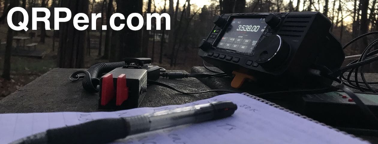
I picked a picnic table not too far from the parking area and set up my station which consisted of the Xiegu X5105 and my speaker wire antenna.
Gear:
- Xiegu X5105
- Muji A6 Notepad and Koh-I-Noor .9 mm Mechanical Pencil (affiliate link)
- 28.5 foot speaker wire antenna using one BNC Binding Post Adapter (affiliate link)
- CW Morse “Pocket Paddle”
- Red Oxx Hound EDC Pack
- Mini Arborist throw line kit: Tom Bihn Small Travel Tray, Marlow KF1050 Excel 2mm Throwline, and Weaver 8 or 10oz weight
- GoRuck GR1 USA
- Tom Bihn Large Travel Tray
- Rite In The Rain Weatherproof Cover/Pouch (affiliate link)
- Camera: OSMO Action Camera (affiliate links)
 I should note that out of all of my wire antennas, the 28.5 foot speaker wire antenna is one of the easiest to deploy because it’s so short and so simple. I don’t even use a winder to hold it, I just do figure eight windings on my hands and bundle them together.
On The Air
 I hit the air about 20 minutes ahead of schedule and logged my first contact (N5PU) at 14:43 UTC.
Then, much to my surprise–it being a Wednesday morning–the stations started rolling in.
Within ten minutes, I logged ten stations which meant I had already achieved a valid activation.

I was on the air a total of 25 minutes and logged 23 stations.
To my knowledge, this might have been the first time I’ve worked California (veteran park activator/chaser W6LEN) on 40 meters. This is what can happen, though, when you’re hitting 40M shortly after sunrise. My activation was likely happening as the 40 meter band was starting to shorten. It was also great to pick up Colorado (KT0DX) and Puerto Rico (KP4M).
QSO Map
Here’s what 5 watts and $4 worth of speaker wire can do in 25 minutes:

Activation video
Here’s my realtime, real-life activation video which includes a bit of driving time as I explain the multi-park run I’d planned for the day. As always, my videos have ads and monetization disabled, so there won’t be any interruptions:
Click here to view on YouTube.
After the activation, I quickly packed up and headed to my second activation site in the Linville Gorge area of Pisgah National Forest! I look forward to writing up this report and sharing the video soon.
Thank you!
 Thank you so much for reading this report and coming along with me on the activation.
As always, I’d like to send a special thanks to those of you who have been supporting the site and channel through Patreon and the Coffee Fund. While certainly not a requirement as my content will always be free, I truly appreciate the support.
I hope you have some time this week to play a little radio!
72/73,
Thomas (K4SWL)
I read that title and thought at first you had headed north to do an activation in my backyard. K-0001.
Thomas, wonderful and exciting. Nice to be able to explore with you on your blog. The most I have ever done is 2 parks in one day. So as you said heading out early, and planning your drive, sounds like something fun to put in the sked soon. Looking forward to your other park posts.
73
wb8yxf
I wonder if you went “down” in frequency and tried a certain “antenna hack”
waiting for the next part
Can I ask what your counterpoise length or lengths are and how you lay them out, I’ve been trying that exact adapter and speaker wire setup and have been really struggling to get it to tune
So both my radiator and counterpoise are exactly 28.5 feet in length. The counterpoise can be as short as 17 feet and work perfectly fine.
What ATU are you using? This does require a fairly capable ATU.
Cheers,
Thomas
Thanks for the reply Thomas, it’s the same setup as this deployment, X5105 internal ATU with the binding post adapter. I might experiment with some better heights/steeper angles of the radiator too as the last couple trips I only had a 10 foot telescopic pole.
Okay, yes. I would definitely raise the radiator higher. I’ve only deployed it nearly vertically in trees. My buddy, WD8RIF, uses a telescoping pole which can handle that height. If he’s checking comments, perhaps he can point you to the setup (it’s on his website, I just can find it at the moment!).
Cheers,
Thomas