Tag Archives: QRP

Two in One Day for the POTA Babe

by Teri KO4WFP

After striking out at Pinckney Island National Wildlife Refuge, it was time for this POTA Babe to get back on track with my goal of 60 new valid park activations for 2024. As much as I enjoyed the historic sites and the refuge I recently visited, I needed to return to activating wildlife management areas.

Wildlife management areas (WMAs), properties set aside for conservation as well as hunting and fishing, are plentiful in the state of Georgia. Georgia has 163 WMAs and 38 are located within 75 miles of my home QTH. So it makes sense I would include those in my 60 new activations pursuit.

I set my sights on Morgan Lake WMA (US-9791) and Griffin Ridge WMA (US-3752) because  they are an hour’s drive from my home and across the road from one another. Talk about convenient!

map source: worldatlas.com

Daisy and I set out early Tuesday, October 1st. During the drive, I encountered two groups of ambulances moving north on Interstate 95. At a rest stop, several EMTs from one group were taking a quick break and wore t-shirts with “Disaster Relief” on them. It was a reminder of the recent events due to Hurricane Helene.

I chose to activate Morgan Lake WMA first.  According to the map, most of the property appeared to be wetlands but there is a boat landing for fisherman to access Morgan Lake. In fact, the road you use to reach the landing is built up a good 10-12 feet, I assume, to provide access even when the area experiences flooding.

boat landing and train trestle bridge

WMAs vary in their presentation. Some are nicer than others with shooting ranges and gravel roads. Morgan Lake was, frankly, on the dumpier side. This was not the place to come to commune with nature. But no matter. I was here to do an activation, so I set about getting my equipment up and running.

Map for Morgan Lake WMA. source: GA DNR

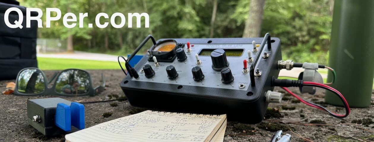
I opted for the Chelegance MC-750 today. Attempting two parks in one day meant I needed a quick and easy set up and a vertical would provide that.

Chelegance MC-750 with a train in the background
setting up on the gravel parking lot

Despite poor band conditions at some of my past activations, today the bands were great! (You’d really want that on a day you are attempting back-to-back activations.) Even better, I had internet access at this park, though it was on the slow side. I could spot myself (always a plus) and it wasn’t long before calls began coming in once I was spotted on the POTA website.

Forty meters gave me 15 contacts in 20 minutes – not bad! It was good to hear so many from the southeast, some I hadn’t heard from in a while. Given I had a second activation to attempt and I wasn’t thrilled with the site conditions at Morgan Lake, I called QRT after contact #15, packed up, and headed across the road to Griffin Ridge WMA.

QSO Map for Morgan Lake WMA (by home QTH) source: http://tools.adventureradio.de/analyzer/

Griffin Ridge is a much larger WMA than Morgan Lake. The park has two access points from the road and I chose the one farther to the north as it looked the more inviting of the two.

Map for Griffin Lake WMA. source: GA DNR

Again, given I was short on time today, I found a little area off to the side near the information kiosk by the road. If I visit this WMA again, I’ll drive further in and find a place away from the road noise.

entrance to Griffin Ridge WMA

The little place I found was somewhat shaded which Daisy and I needed given the warm weather. The day had been mostly overcast; however, I’ve learned to not trust that will persist. Nothing like being in the middle of an activation and the sun comes out from the behind the clouds to roast you.

the spot I found just perfect for parking Kai

For the North Carolina trip this past July, I purchased a Mountain Laurel Designs shelter. It was handy for my SOTA activation at Black Balsam Knob. I figured it would also be useful for POTA activations in the heat. Since I can activate next to my car for POTA, I used the front and rear wiper blades as well as the roof rack to attach three sides of the tent and the surrounding foliage to which to attach the other two. My hiking pole was not tall enough to support the center, so I used the outer rear door handle on the car to elevate the bottom of the pole to give me enough height so I could sit in my Helinox chair under the tent. It was not the best setup but good enough for today. I need to give more thought how to better support and use the tent as a shelter with my car.

Daisy relaxing

We all know band conditions fluctuate throughout the day and I hoped they would hold up for my second activation. Guess what? They did!!!

I opted for 20 meters given it was nearly noon and had 39 contacts in a little over an hour. I was thrilled! That is a “good” thing about bad band conditions. When the bands behave, you really, REALLY appreciate it.

QSO Map for Griffin Ridge WAM (by home QTH) source: http://tools.adventureradio.de/analyzer/
view from under the tent at my QTH

As I packed up my equipment, I reflected on the two activations. Of the two, I would return to Griffin Ridge. The foliage and landscape reminded me of Canoochee Sandhills WMA; however, it was nicer than Canoochee and not nearly as remote, which could be considered bad or good, depending on your perspective. I would definitely set up farther inside the property to avoid the road noise unless it had rained a lot prior to my visit. The road into the property was quite sandy and soft and deep in some spots. My car might not be able to navigate those conditions after a heavy rain.

A valid activation at these two parks put me at 41 out of the 60 new park activations for which I am aiming in 2024. There are only three more months of this year so I am running out of time to reach my goal. It would be easy to accomplish my goal if life didn’t keep getting in the way, right?

There are still plenty of wildlife management areas to consider as well as properties closer to the coast as I continue my pursuit. Where will I show up next? Stay tuned…

For those interested, visit my YouTube channel for a video about this activation.

Equipment Used

[Note: All Amazon, CW Morse, ABR, Chelegance, eBay, and Radioddity links are affiliate links that support QRPer.com at no cost to you.]

Sailboats at a lakeside activation

As always there are lots of links within the article. Click one! Click them all! Learn all the things! ?

by Vince (VE6LK)

In August and September 2024 I was travelling around Southern Ontario for some family matters and naturally I brought my radio kit with me to squeeze in some radio therapy stops along the way. This is the report of my stop at CA-5362 Fifty Point Conservation Area.

It’s my second to last day here in Ontario and, as I wasn’t needed for other things, it was time to do a POTA rove and make the best of my last full day. I’m always on the lookout for a park that is within striking distance of wherever I am that I have not activated before and/or has not been activated before in either SSB or CW. So I planned a route to get to 9 parks and managed to get to 7 and activate 5 before other matters called for my attention. All were planned to be drive-up activations given the area and time constraints I was working within.

In my day job, I’m a Project Manager in IT, thus my style is that I plan before I arrive. You’ve already seen evidence of this with my POTA and Checklist tools that I’ve spoken about before. I usually do an in-depth study of a site before I depart, including reviewing linked webpages from the pota.app site, a satellite view and street view of the entrance on maps.google.com, and if it’s available, a 3D view of the area from maps.google.com. Let me know in the comments about the other ways you review a park before your arrival.

However I was pleasantly surprised when I found picnic tables with a view of the water at more than one of them! Balancing the good with the not-so-good, there were also some frustrations… I could not locate one of my planned stops despite driving up and down the road with two different GPSs blaring at me. My experience has shown that the smaller the park, the harder it is to find mapping, and this one from the Conservation Authority was no exception, and thus I abandoned it and drove onwards. Another site was right beside the roadway and high-voltage lines, and I didn’t have time to do a walk-in and get away from the noise floor. I always have a back-up site in my list for situations like this.

The Hamilton/Burlington/Niagara area is very pretty and, with a late summer happening around the time of a harvest moon, I didn’t mind the extra driving. For those of you who have been to Hamvention at Xenia it will be somewhat familiar as the area is full of gently rolling hills and lush green pastures. The humidity is also familiar, ugh, and one of the main reasons I moved away from this area in 1997. But nothing beats the view of sailboats out on the water; I have always found serenity in this -even knowing I get boatsick if I get on board!

The view from my “shack” at Fifty Point Conservation Area looking northwards onto Lake Ontario. On a clear day Toronto can  be seen in the distance. Today wasn’t a clear day, but still quite serene.

Fifty Point is a sprawling 80 Hectare (198 acre) area located on the southern shore of Lake Ontario at Winona. It has a top-tier restaurant, multiple beaches, pavilions and 330 slips for boaters, along with a camping area. It truly is a multi-use area! You can read all about it here (.pdf warning).

After locating the day use/beach area, I found a table overlooking the lake. As it was a mid-week day, there were plenty to choose from. The view was quiet with a few boaters enjoying the beach in the small bay directly in front of me.

A slip loop style bungee holds the feedpoint in place on the picnic table. My new-to-me Tiger-Cats hat proudly on display.

I set up my 40-30-20m trapped EFHW given the solar conditions. I’m so very pleased with the performance of this antenna and it has become the one I reach for the most when activating on this trip. It is about half the length of a conventional 40m wire and is resonant on 3 bands. It has me musing about adding 17m and 15m to it… perhaps N7KOM will offer such a kit?

When I built this antenna, I tuned it so that best resonance was in the middle of the CW portion of each band, and with the feedpoint located just a few feet off the ground and then sloped upwards at the endpoint. That’s how I deployed it this time around. As you see in the prior photo, my newly acquired Fishing Butler bungee strap held the entire thing firmly in place without any movement once I set up the mast. You can get them at Fishing World in Hamilton as they ship around North America. They stock multiple sizes so a phone call may be needed as their online store shows only one size. Ask for the assorted pack.

Trapped 20-30-40m EFHW to my Goture mast and spiral rod holder

Because I never was a Boy Scout and able to know where north is based on the position of the sun and time of day or how many chirps the cricket is giving <grin>, I consulted the compass on my smartphone. I unfurled my antenna and clipped it to the stop of the mast, walked the mast out to the length of the antenna and anchored it into the ground beside some Sumac bushes. With enough repetition, I’ve gotten pretty good at estimating where the far end of my antenna will be. It comes in helpful for parking lot activation and operating out of the trunk or your vehicle with a mast supporting the far end.

For these activations, and when I can, I’ve been orienting my antenna east and west so that it radiates broadside north and south so that I can capture the most number of hunters in North America. This is a contrast to how I normally operate from Alberta when my antenna is oriented to be broadside from southeast to northwest.

The activation itself was pleasant and I was surprised with visits from QRPer.com comment regulars KQ4CW and K5KHK – and I appreciate hearing from them often! 45 minutes after arriving I was packed up and on the road to my next stop.

List of gear used for these activations:

Note: All Amazon links are affiliate links that support QRPer.com at no cost to you.

Summary

We do POTA (and other programs) for various reasons. On this trip, it’s a break from life’s stresses. As I reflect upon my visits with various people, I realize that I’m quite blessed to know so many friendly hams no matter where I am travelling.

72 and dit dit,
…Vince

First introduced to the magic of radio by a family member in 1969, Vince has been active in the hobby since 2002. He is an Accredited examiner in Canada and the USA, operates on almost all of the modes, and is continually working on making his CW proficiency suck less. He participates in public service events around Western Canada and is active on the air while glamping, mobile, at home or doing a POTA activation. You can hear him on the Ham Radio Workbench podcast, follow him on Twitter @VE6LK, check out his YouTube channel, and view the projects and articles on his website.

Big ships and 78GHz by chance!

As always there are lots of links within the article. Click one! Click them all! Learn all the things!

by Vince (VE6LK)

In August and September 2024, I was travelling around Southern Ontario for some family matters and naturally I brought my radio kit with me to squeeze in some radio therapy stops along the way. This is the report of my stop at CA-6341 Welland Canal System National Historic Site along with CA-6096 Battle of Beaverdams National Historic Site.

This activation took a bit of research to figure out the intersection of the two given that the landscape had been dramatically altered from the time of the Battle of Beaver Dams in 1813. For example, at that time, the Welland Canal did not exist! So the town of Thorold has a park located at the west end of the battle site, and I was able to locate a monument at the east end, thus I was able to extrapolate and see that Lock 7 was in a direct path between the two. Thus I settled at Lock 7 for the activation.

A borrowed grocery cart serves as a mast support given the hard soil. Antenna runs off to the vehicle on the right.

This activation was done later in the day after my “Cross-Border Activation between Friends” and I was pleased to note the conditions had improved a fair bit.

I started off on CW, hunting other friends that were activating (shout-out to Ed W4EMB!) and then switched to SSB QRP where Steve KO4AFL found me and we had a brief chat before we both moved on. I stayed on 20m for this activation.

A quick drive-up activation means operating from the trunk

The Welland Canal is an engineering marvel that allows lake freighters to traverse the 100m/326′ height difference between Lake Erie and Lake Ontario.

Opened in 1833, it sees an average of 3,275 freighters during the shipping season which runs about 9 months of the year. With that sort of traffic, you can be reasonably assured that you’ll see one of these huge freighters on the day and time that you visit the area.

List of gear used for these activations:

Note: All Amazon links are affiliate links that support QRPer.com at no cost to you.

Summary

After my earlier activation with N2MAK, we drove down the Niagara Parkway past Niagara Falls and Niagara-on-the-Lake before arriving at the Welland Canal. It was a pleasant day and not terribly humid.

VA3ELE, Peter, with an attempt to set a new distance record on 78GHz

One last ham radio related story to the day was running into Peter (VA3ELE) about 1km from our home-away-from-home as he was attempting to set a new distance record with a friend who was well over 100km away.

Peter explained to me that his radio was 3W and the dish yielded 47dB of gain thus his ERP was around 14,000W see below. Needless to say that I did not stand in front of the dish.

[EDIT Sept 26] with gracious thanks to the math wizardry of David VE7EZM, the result of 47dB of gain with 3W of input is approximately 150,356W ERP.

All in all, labour day 2024 was full of beautiful scenery and lots of Ham Radio – exactly how a vacation day should be in my books.

72 and dit dit,
…Vince

First introduced to the magic of radio by a family member in 1969, Vince has been active in the hobby since 2002. He is an Accredited examiner in Canada and the USA, operates on almost all of the modes, and is continually working on making his CW proficiency suck less. He participates in public service events around Western Canada and is active on the air while glamping, mobile, at home or doing a POTA activation. You can hear him on the Ham Radio Workbench podcast, follow him on Twitter @VE6LK, check out his YouTube channel, and view the projects and articles on his website.

The POTA Babe Spreads Her Wings at Pinckney Island

by Teri KO4WFP

Friday, September 13th, I headed to Pinckney Island National Wildlife Refuge (US-0265) for a POTA activation and was without Daisy as dogs are not allowed at this refuge. Pinckney Island is a 4,000+ acre wildlife refuge off Highway US 278 on the way to Hilton Head Island, South Carolina. The refuge consists of four islands and numerous small hammocks with Pinckney Island being the largest of the islands and the only one open to the public.

The refuge is named after Major General Charles Cotesworth Pinckney and is one of seven refuges managed by the Savannah Coastal Refuges Complex in Savannah, Georgia. Prior to my time as a ham radio operator, I volunteered for the US Fish and Wildlife Service and spent time at four – Savannah, Harris Neck, Wassaw Island, and Blackbeard Island – out of the seven refuges they manage. I never made it to Pinckney Island so I was excited to finally see this property.

Portrait by James Earl. Source: Wikipedia

Most of Pinckney Island is accessible by foot or bicycle only. After parking my car in the designated lot, I began hiking to my destination – Ibis Pond, a large pond for waterfowl about a mile from the parking lot.

Just before I reached the information kiosk, I got a great look at an armadillo doing what most gardeners and lawn aficionados hate – tearing up the ground in search of food. This mammal eats mostly invertebrates including insects and especially likes grubs. They have horrible eyesight but keen hearing and I was surprised this guy or gal let me get as close as he or she did.

information kiosk

Pinckney island is an important link in the chain of wildlife refuges along the Atlantic Flyway and attracts thousands of migratory birds each year, according to the US Fish and Wildlife Service. The Atlantic Flyway is a major north-south route for migratory birds and it generally follows the Atlantic Coast of the US.

source: North Dakota Fish & Game Department

I saw and heard many birds while visiting the refuge including a flock of White Ibis feeding in the marsh and tidal flats, a Great Blue Heron fishing with a Snowy Egret walking nearby, American Coots, a molting male Painted Bunting, crows flying overhead, and I swear I heard a pair of Sandhill Cranes calling to one another at Ibis Pond. I could have spent all day watching the comings and goings of the refuge inhabitants let alone do a POTA activation.

White Ibis feeding in the marsh
American Coots at Ibis Pond
White Ibis in the trees at the pond during my activation
Trail into Pinckney Island

However, I was here for POTA and, in short order, arrived at Ibis Pond. It is one of five manmade ponds on the island and exists to preserve feeding and nesting areas for birds. The pond has cattails around its edges and much of the water is covered by duckweed.  I figured I would be less likely to have any human visitors if I followed the trail around the pond to the far side. But I was wrong. Ten to twelve people walked by my station while there, more than I usually encounter at any park. Continue reading The POTA Babe Spreads Her Wings at Pinckney Island

Xiegu X6200: Does version 1.0.1 firmware fix CW keyer timing?

I’ve had a production unit of the Xiegu X6200 since June of this year and have made several field reports using it for both SSB and CW.

You may have noticed, though, that I haven’t used it much in the field since June.

The reason? I’m primarily a CW operator, and the original firmware had some frustrating CW keyer timing issues.

These keying issues are most noticeable when operating in iambic mode, especially when trying to form letters like C, R, or K by squeezing the paddles. Often, when I try to send a “C,” as in “CQ,” the keyer produces a “B” instead. If you’ve watched any of my previous X6200 videos, you might have seen this happen a few times.

After some time using the radio, I can adapt and reduce the miskeying, but it still happens occasionally. I suspect part of the issue is related to the keyer timing in relation to the transmit/receive switching.

While these keyer issues aren’t severe enough to prevent me from completing an activation, they are certainly annoying.

As I’m reviewing the X6200 (thanks to Radioddity for the extended loan!), I reported the issue to Xiegu back in May and hoped the first firmware update would address it.

The first firmware update, Version 1.0.1, was released in early August. There was an earlier release, but it was retracted due to other issues.

I checked the release notes and didn’t see anything specific about CW keyer timing in the long list of fixes. I had hoped another update would follow soon, but none has been issued yet. Meanwhile, several readers and subscribers have asked me if the keyer issue was resolved.

I decided to update the firmware and take the X6200 out for another field test.

If you follow QRPer.com daily, you may have already seen the spoiler alert: unfortunately, the keyer timing issue was not fixed in this release.

Still, I had a great time squeezing in a quick activation with the X6200, and I thought I’d share the video and a mini field report with you now!

Pisgah National Forest (US-4510)

My wife and I were out while one of our daughters was in Shakespeare rehearsals in Mills River, NC on Friday September 6, 2024. We had a number of errands to run, but my wife kindly worked with me to carve out 30 minutes for a quick activation.

The most convenient POTA location was the Sycamore Flats Picnic Area in Pisgah National Forest.

By mid-afternoon, the park was busy, but most of the picnic areas were open, giving me plenty of options for setting up.

With limited time, I turned on the camera to start my real-time, real-life activation video and got straight to work.

Since the X6200 has a built-in ATU, I decided to use my PackTenna End-Fed Random Wire, as it’s quick to deploy with its 31’ long radiator—any nearby tree would do.

Next, I paired the X6200 with my BaMaKeY TP-III, plugged in the antenna, and found a spot on the band to start operating!

Time to POTA!

Gear

Note: All Amazon, CW Morse, ABR, Chelegance, eBay, and Radioddity links are affiliate links that support QRPer.com at no cost to you.

On The Air

After tuning up on the 20-meter band, I spotted myself and started calling CQ POTA. Fortunately, hunters quickly responded.

In just twelve minutes, I logged thirteen contacts. Thanks to all the hunters!

My activation was brief, and I was so focused on making contacts and packing up that I forgot to take any photos of the radio in action. I’ve included some screen captures from the video instead.

I did manage to take photos of the logs:

QSO Map

Here’s what this five-watt activation looked like when plotted out on a QSO Map:

Activation Video

Here’s my real-time, real-life video of the entire activation.  As with all of my videos, I don’t edit out any parts of the on-air activation time. In addition, I have monetization turned off on YouTube, although that doesn’t stop them from inserting ads before and after my videos.

Note that Patreon supporters can watch and even download this video 100% ad-free through Vimeo on my Patreon page:

Click here to view on YouTube.

CW Keyer Timing

As I discovered during this activation, the CW keyer timing issue has not yet been addressed in the firmware update.

After returning home, I made some notes and reached out to Xiegu to confirm that the CW keyer timing is still on their radar. They assured me that it will be addressed in the next firmware update. I’ll definitely test it and let you know once it’s resolved, so stay tuned!

If you’ve already purchased an X6200, I’d love to hear your thoughts about this all-in-one radio in the comments!

Thank you

Thank you for joining me during this short activation!

I hope you enjoyed the field report and my activation video as much as I enjoyed creating them!

Of course, I’d also like to send a special thanks to those of you who have been supporting the site and channel through Patreon, and the Coffee Fund. While not a requirement, as my content will always be free, I really appreciate the support.

As I mentioned before, the Patreon platform connected to Vimeo makes it possible for me to share videos that are not only 100% ad-free but also downloadable for offline viewing. The Vimeo account also serves as a third backup for my video files.

Thanks for spending part of your day with me! Have a brilliant weekend!

Cheers & 72,
Thomas (K4SWL)

When three contacts equals a successful activation

As always there are lots of links within the article. Click one! Click them all! Learn all the things! ?

by Vince (VE6LK)

In August and September 2024 I was travelling around Southern Ontario for some family matters and naturally I brought my radio kit with me to squeeze in some radio therapy stops along the way. This is the report of my stop at CA-5367, McQuesten House / Whitehern National Historic Site.

View from the rear of Whitehern showing nearby office tower

This site is located in downtown Hamilton and among the tall building and features a walled rear garden. It is open to all visitors and there is no fee to visit the facility. This two-storey neoclassical house was the home of a prominent family, the McQuestens, and retains many of its original Victorian and Edwardian fittings and furnishings. It is now a museum open to the public.

This activation was strictly by chance and I had less than an hour before I was due to be someplace else. I did not check the solar conditions in advance nor anything about the site. Sometimes just showing up is fun in and of itself, am I right? So I found my way around to the rear garden and found a bench in an out-of-the-way corner and set up for a low impact activation.

I deployed my AX1 on it’s small tripod and placed it on the ground and ran out a 20m counterpoise wire beside the walking path. I set myself and the radio gear on a park bench along the path. It truly felt like a small enclave!

After calling for 10 minutes with zero replies I checked the solar conditions and see that a small flare had just hit. That might explain the soft conditions, and combined with the compromised antenna and its close proximity to me. I moved the antenna away from me as far as the feedline would allow. Only then was I able to log just a few contacts and those were hard-fought. Then I ran out of time.

The author in his temporary enclave
A partial log. Contacts were not obtained by calling out, but by hunting others.

List of gear used for these activations:

Note: All Amazon links are affiliate links that support QRPer.com at no cost to you.

Summary

I’ve spoken before about “getting to 10” with a POTA activation. For me, that’s always one of my goals. But it isn’t the only goal. I also enjoy the new scenery, the journey, the research and the challenge. This visit was high on the scenery and the challenge end of the scale for sure.

72 and dit dit,
…Vince

First introduced to the magic of radio by a family member in 1969, Vince has been active in the hobby since 2002. He is an Accredited examiner in Canada and the USA, operates on almost all of the modes, and is continually working on making his CW proficiency suck less. He participates in public service events around Western Canada and is active on the air while glamping, mobile, at home or doing a POTA activation. You can hear him on the Ham Radio Workbench podcast, follow him on Twitter @VE6LK, check out his YouTube channel, and view the projects and articles on his website.

CFT1 QRP: Labor Day Morning POTA with Vlado at Lake James State Park!

Labor Day weekend turned out to be full of labor here at QTH K4SWL. My wife and I had numerous projects to tackle, and my daughters had various activities scheduled as well. By Sunday, my wife looked at me and said, “You need a break. Why not spend tomorrow catching up on POTA?

That was music to my ears.

I messaged my buddy, Vlado, to see if he might be interested in joining me, and he quickly replied, “Of course!

So on Monday, September 2, 2024, Vlado packed his radio gear in my car, and we discussed where we should go. We had most of the day for radio, but we needed to decide if we’d head north, south, east, or west. In the end, we chose to travel east, as it offered the most options, including one site Vlado had never activated.

We decided to start at Lake James State Park. Since Vlado had only activated Lake James for the first time the previous day at the Paddy’s Creek Access, we opted for the Catawba River Access.

Lake James State Park (US-2739)

It was Labor Day, so we knew Lake James would get busy around lunchtime, which is why we hit it early. I also knew Paddy’s Creek Access would be much busier today because it has the beach, and I remembered how full the parking lot was during my Labor Day activation in 2023!

At 9:00 AM, when Vlado and I arrived at the Catawba River access, we were among the few people there, so we had our pick of spots to set up the POTA station.

For convenience—especially since there had been a deluge of rain the night before—we chose a spot close to the car, where I’ve activated a number of times in the past.

I also took this opportunity to show Vlado how to use an arborist throw line.

While I didn’t record the antenna deployment—frankly, I didn’t think about it at the time—I wish I had. Vlado was a natural!

On his second-ever throw, he snagged the perfect branch to deploy a 40-meter end-fed half-wave antenna.

CFT1 Time!

The CFT1 with Tufteln cover/stand, audio cable and pack with battery.

I knew exactly which radio I wanted to operate during this activation: the CFT1 by Jonathan (KM4CFT).

I had only recently swapped out my Beta unit for a production CFT1. As a thank-you to Beta testers, Jonathan let us keep the units we tested. I worked with Jonathan and Dan to return the Beta unit and compensate them for the difference.

In truth, there were only a few changes, mostly cosmetic, between the Beta and production units. The biggest improvement for me was that the Beta unit lacked a way to adjust the sidetone level independently from the AF gain. The production unit has this feature, which was my primary motivation for upgrading.

In addition, I prefer using radios that match what my readers and subscribers have. When I use a Beta unit, even if the changes are purely cosmetic, it generates more questions.

Interestingly, this wouldn’t be Vlado’s first time using the CFT1. He must have been one of the first people outside the Beta testing team to try it because we used it on Field Day alongside the TR-45L and X6200 (although you won’t see it in my report since it was still somewhat of a secret project at the time).

We paired my MW0SAW 40-meter EFHW and Bamakey TP-III with the CFT1. I also used my Anker Soundcore Mini speaker for audio.

Time to POTA!

Gear:

Note: All Amazon, CW Morse, ABR, Chelegance, eBay, and Radioddity links are affiliate links that support QRPer.com at no cost to you.

On The Air

Beforehand, Vlado and I decided to set up just one station and take turns activating.

Vlado went first! He called CQ POTA, and hunters started replying. Continue reading CFT1 QRP: Labor Day Morning POTA with Vlado at Lake James State Park!

Jeff’s Backcountry POTA Adventure: Campbell-Brown Ecological Reserve Activation

Many thanks to Jeff (VE7EFF) who shares the following guest post:


Off The Beaten Path – Campbell-Brown Ecological Reserve, CA-3925

by Jeff (VE7EFF)

This is the 2nd backpacked-in POTA activation outing that my wife and I have done this summer.  I’m the 2nd person to have ever activated the Campbell-Brown Ecological Reserve (CA-3925).  Last year was the first time I activated this eco reserve and that was also my first ever backpacked-in POTA activation.

After studying my GPS and Google Maps/Satellite view of the area, my goal this time is to trek about twice as far and twice as high as last year’s outing.  There are no documented trails here.  Access is a mixture of old overgrown and abandoned forestry road (or fire break, not sure which) and some crisscrossing animal game trails.  The actual mileage/Km’s isn’t really that far, but it’s all uphill and a mixture of bushwhacking and scaling slippery grassy slopes.

The reserve borders along the busy highway 97, between the cities of Vernon and Kelowna, BC.  The area overlooks the beautiful Kalamalka Lake, as you will see in some of the photos.  There’s no actual parking lot, just a small gravel pull-over spot just off the highway.  There is no formal pathway into the reserve either, so we had to scale the gated fence to start our journey.

I’m a little bit familiar with the route we took last year, but I heavily rely on my Garmin 66sr GPS and Google Maps/Satellite view on my Pixel phone.

My wife Alexis (VE7LXE), accompanies me on all my POTA outings.  She packs the food and water while I pack the ham gear and other outdoor essentials.  We both carry IC-V80 VHF handhelds for comms in the event we ever get separated.  And of course we always carry bear spray when doing backcountry treks.

We do have some relatively flat areas in sections, but there are also a lot of deadfall trees to either step over, climb over, or go around.

This grassy meadow is where I activated last year.  Actually at the top end of the meadow.  But today’s goal is to find another open grassy meadow higher up the mountain.  Higher usually means better radio propagation, not to mention spectacular views.

Beyond the grassy meadow, we followed some semblance of a trail.  But it wasn’t long before I realized that it wasn’t taking me where I really needed to go. So, according to my GPS and Google Satellite, we needed to head straight up-hill.

This was actually a real slog uphill (especially for us 73 and 72 year olds). 🙂

We decided that we have gone high enough.  Time to off-load our packs. Continue reading Jeff’s Backcountry POTA Adventure: Campbell-Brown Ecological Reserve Activation

Navigating Quetico: Rod’s POTA Adventure with the (tr)uSDX

Many thanks to Rod (VA3MZD) for sharing the following guest post:


Operating POTA from the interior of Quetico Provincial Park CA-0359 with a (tr)uSDX

By Rod Murray (VA3MZD)

In a previous guest post here on QRPer I gave a brief history of my introduction to Ham radio and specifically POTA and my experiences activating local parks by bicycle. My initial excitement about POTA was inspired by the YouTube channels of some noteworthy field operators, Tracy VE3TWM, Julian OH8STN, Adam K6ARK, Stuart VE9CF, and Thomas K4SWL of course, just to name a few.

Tracy VE3TWM’s experiences on a canoe trip to Algonquin Provincial Park, Ontario, a place he and I know well (although we’ve never met) were particularly inspirational. In this video from 2021 Tracey activated Algonquin Provincial Park CA-0138 from a lake that I’d previously paddled to on a canoe trip. I wanted to do that too! But it would take quite a while. Let me tell you.

In 2022, with my regular paddling buddy Tom, we planned to take our wives to one of the premier canoe tripping parks in North America that we’d never visited.  We’ve been paddling together since we were teenagers at an Ontario summer camp and had been taking our partners along on canoe trips for over 30 years.

Quetico Provincial Park in North Western Ontario, Canada, one of the province’s crown jewels, stands as a legendary wilderness area that can only be accessed by canoe or kayak in summer and ski or snowshoe in winter, with one exception. There is one road accessible campground and visitor centre in the park’s northeast corner. The Park, which is over 4700 square kilometres, is also surrounded by thousands more square kilometres of wilderness public land, known in Canada as “Crown land.” Numerous First Nation communities are also adjacent to the Park.

To the south is the equally famous Boundary Waters Canoe Area in Minnesota, USA. Indeed, one can start a canoe trip in one country and finish in another, or paddle a route along the International Boundary (hence the name!), crossing the border numerous times as you go, with the required documentation of course.

Location of Quetico Park, Ontario,The Boundary Waters, MN, and Algonquin Park, Ontario in North America from ottertooth.com

We had a successful trip to Quetico in 2022 and I vowed to return when the opportunity arose. Meanwhile, I’d since become very active in POTA, and was more determined to complete a POTA activation from a wilderness park while on a canoe trip.

Quetico Park close up map from the Ontario Parks Master Plan

That determination was finally put in motion in early 2024 when another Quetico canoe trip was planned for August. But the challenge would be to put together a radio, an antenna and battery light enough and compact enough to pack in a canoe trip barrel.

Canoe Trip Barrels and Waterproof Eureka Pack ready to go!

Our plan was to enter the Park at one of the north east access points, travel south across immense Pickerel Lake, then paddle and portage our way as far as Fern or Olifaunt Lakes, depending on our progress and the weather, and return via the same route. Or, if we were feeling adventurous, to complete the circle route made possible by the historic Deux Rivière and Pine Portages. See Map below:

Canoe Route across Pickerel Lake into Bud and Fern Lakes with Start, Campsites and Portages marked and possible Circle Route

Either way would require 8 portages totalling more than 7 km. Everything has to be small and light because a portage is a rugged trail between lakes where you must carry everything on your back.

Because my wife and I have four packs in total for a 10 day trip, plus the canoe, each portage must be walked 3 or more times, back and forth, until all the gear is carried over. Incoming History lesson: From my university days as a researcher for the Kanawa Canoe Museum, now the Canadian Canoe Museum in Peterborough, Ontario, I learned that “portager” is a French verb that translates “to carry” and has its origins with the French Voyageurs who paddled the continent trading furs. Therefore “portage” should always be pronounced in French.

At 67 years young, I now own a Swift Kevlar canoe that weighs under 14 kg, about 30 pounds. The food and equipment barrels are about 20kg each. I wasn’t about to pack or portage much more in the form of radio equipment. It had to be light!

It so happened that a new member of my club, the Elmira Radio Club of Ontario, Hagen VE3QVY, had recently built a (tr)uSDX radio. The radio is a masterpiece of miniature hardware and brilliant software thanks to Manuel DL2MAN and Guido PE1NNZ.

Hagen is an electronics whiz, to say the least, and he knew of my interest in this radio (I was on the original list for the Canada group kit build). He lent me his (tr)uSDX back in April and after making an easy trans-Atlantic QSO with it on 5W, I immediately ordered a Classic band kit. I was already thinking about activating Quetico from the park’s interior when I started my build.

My (tr)uSDX build in progress

Hagen offered considerable help with my (tr)uSDX since the last time I built a kit was in 1970 when I worked on a Heathkit SW receiver I got for Christmas. Hagen installed some improved MOSFETS, precisely rewound all the toroids, tested and improved the radio’s performance and measured all the specifications, to the point where the radio was transmitting a minimum 5W on all bands with very high efficiency. And it only weighed 150 grams, perfect for my needs!

It was time to gather the necessary accessories to complete this rig keeping it lightweight and portable. I added a short length of thin RJ-316 BNC coax to my kit and included the high performance Tim Ortiz N9SAB Nano QRP 20m dipole that I’d been using for POTA with my FT-818. At only 100 grams and a reliable performer, it would fit the bill, but limit my operation to 20m.

I already had a small Bioenno 3Ah battery that could power the radio through more than a few activations, which added another 400 grams. With a few extra accessories and cables and a N6ARA mini paddle, just in case (I’ve never made a CW contact but might try if needed) my lightweight kit was well under 1 kg and complete. The rig and accessories easily fit inside the soft pouch with my fishing reels, so no extra space was required.

I started to think about how I could get spotted while in the wilderness far away from any cell towers. Perhaps, I thought, if I could add a few FT8 contacts while in the Park I could surely make 10 QSOs to confirm an activation without a spot on POTA.app. I solved the spotting quandary for an SSB activation after much deliberation.

I also tested a number of mobile phone apps that run FT8. I tried both iOS and Android apps and settled on FT8CN for Android. After updating the (tr)uSDX firmware to run CAT and audio through a single USB cable to an Android phone, I gathered a few of the USB micro to USB-C cables needed to connect the radio to a phone running the FT8CN App. Eventually, after considerable trial and error, it all worked! To be clear, the FT8CN software has a bit of a learning curve, but that is another story. It works well with some practice.

In early August, the barrels were packed and ready to go. After two full days of driving north and west 1500 km on the Trans-Canada Highway from our QTH in South Western Ontario, we arrived at Quetico Provincial Park. Yes, the province of Ontario is that big!

Map of Ontario showing the 1500 km driving route to Quetico from SW Ontario

We camped overnight at the Park’s Dawson Trail campground and set off on our canoe trip the following morning crossing the expanse of Pickerel Lake in breezy, warm, pleasant summer weather. A few open stretches of the lake required that we paddle behind islands to avoid the bigger waves. But all that would change, dramatically.

Continue reading Navigating Quetico: Rod’s POTA Adventure with the (tr)uSDX

Castles and Trains at Dundurn Castle NHS

As always there are lots of links within the article. Click one! Click them all! Learn all the things!

by Vince (VE6LK)

In August and September 2024 I was travelling around Southern Ontario for some family matters and, naturally, I brought my radio kit with me to squeeze in some radio therapy stops along the way. This is the report of my stop at Dundurn Castle National Historic Site, CA-5360.

Located in the city where I was born, Hamilton, Dundurn Castle has been a landmark since 1834, when the land was sold to Sir Allan MacNab. The castle is located on Burlington Heights, the site of a fortified military encampment established by the British during the War of 1812.

MacNab was a railway magnate, lawyer and Premier of the United Canadas (1854-1856). Today Dundurn Castle tells the story of the family who lived above stairs and the servants who lived and worked below stairs. He was a defining figure in so many ways in the local history, and performed the original survey of home lots and land in the Hamilton area. Indeed, the home I was born in (on MacNab Street no less) was on land once deeded to its owner from MacNab.

And Dundurn Castle has a personal tie in for me as my father, a finishing carpenter, worked tirelessly on it’s restoration in the mid 1960’s leading up to Canada’s Confederation Centennial in 1967. As kids we spent a lot of time on the grounds.

Continue reading Castles and Trains at Dundurn Castle NHS