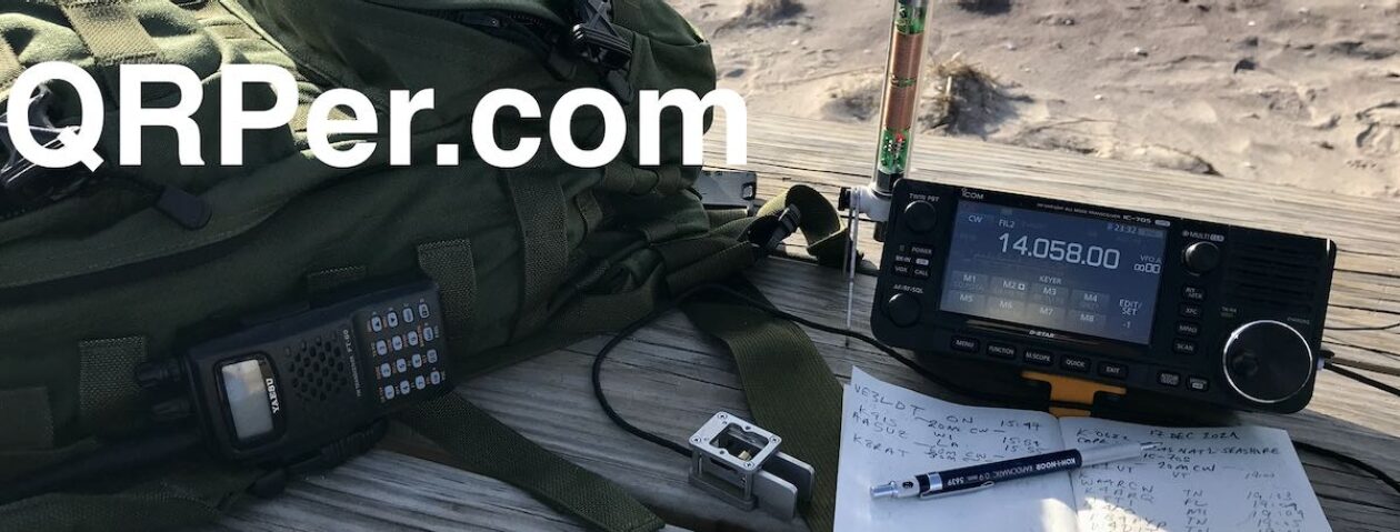
Many thanks to Jeff (VE7EFF) who shares the following guest post:
2.5 km Trek into Wrinkly Face Provincial Park, BC, CA-4307
by Jeff (VE7EFF)
My goal this summer is to do more backpacked-in POTA activations. This is my 3rd POTA outing over the past week. Being in Canada, I don’t have much time left this season to do this before the weather turns too wet, cold or snowy for my liking.
I attempted to activate Wrinkly Face Provincial Park, CA-4307 last summer. However, I couldn’t get there because the FSR forestry service road was washed out about halfway to the park. My Subaru Forester is an amazing SUV on outback FSR roads, but this washout was too much to even attempt.
So, this year I decided to attempt to hike to the park on foot which turned out to be a 2.5 km trek with about 653 ft elevation gain. As always, my wife Alexis (VE7LXE) is my travel companion.
Our trailhead starts about an hour’s drive north of Kelowna, BC which is where we live. We park on the side of a gravel road near the trailhead. We will be following a 2.5 km segment of the Okanagan High Rim Trail, which will take us to our destination in the middle of Wrinkly Face Provincial Park.
We aren’t sure exactly where the trail starts from here. But just around the corner ahead of the car, is an adjoining FSR road. Here we find a sign and map of the Okanagan High Rim Trail (OHRT).
A closer look at the sign shows the OHRT trail starts near the sign. I have circled our starting point and ending point on the map photo, marked in yellow. (We ended up setting down about midway in Wrinkly Face Prov. Park.) So, off we go.
We found the trail!
Apparently, there was a heavy rain downpour early this morning. So, the trail is quite soggy and damp for most of the trek up. It’s also feeling quite cold this morning. We actually felt the need to put gloves on.
The beginning of the trail is a steady uphill trod. However, it also crosses a couple of FSR roads, which gives us some flat areas to walk on. While most of the trail is well marked with small markers, there were a few areas where we got off track for a short distance and had to backtrack. There are also free-range cows up here and they tend to create their own network of trails which often crisscross the OHRT trail, which causes periodic confusion as to which one for us to follow.
Thank goodness, I pre-plan these trips on my Garmin GPS and Google Maps to help with navigation.
I don’t think the OHRT trail is very heavily traveled. In some areas, the pathway is almost overgrown with vegetation.
Along with overgrown vegetation, fallen trees can also create an occasional obstacle. Often, the trail doesn’t amount to much more than a game trail.
Finally, some open views to the south! This could be a viable operating area. One problem though – we haven’t crossed the park boundary yet. Good news – the sky is starting to clear! Onwards and upwards…
Making good progress. We are now crossing into the park boundary.
Welcome to Wrinkly Face Provincial Park, CA-3407. You won’t find any parking stalls, camp sites, picnic tables, or outhouses here. But what I do hope to find here is… POTA heaven!
After trekking about halfway into the park, we finally came across an open meadow. Looks like this could be our POTA ops spot. In the far distance is a glimpse of Kelowna and part of Lake Okanagan.
Cabot Trail Activations on Cape Breton Island Nova Scotia – August 2024
By Bob K4RLC & Alanna K4AAC
In August 2024, K4AAC, my YL Alanna and I took a trip to magical Cape Breton Island in Nova Scotia, Canada. It was Alanna’s suggestion to celebrate my 74th birthday in July. She knew my “Bucket List” had a goal to visit and hopefully activate the two Marconi sites east of Sydney, the Parks Canada Marconi Memorial Site and the original 1905 Marconi House National Historic Site, both POTA sites. Thomas K4SWL kindly published the write up of this adventure a few weeks ago.
After initially activating the Marconi Park station at Glace Bay, we decided to drive the beautiful 300 kilometer Cabot Trail, which circles Cape Breton Island and parallels the rugged Sea coast on both the East and West sides, allowing you to have the steep mountains on your left and the Sea coast on your right – if you make the decision to drive the trail counter-clockwise.
As this was a last minute trip and we had complications with Air Canada delaying our trip by a day, we decided to follow the major points of a clock, and visit sites at the 3:00, 12:00, 9:00, and 6:00 PM positions. The major problem is that there are so many wonderful sites, it’s hard to decide where to visit.
The first day after we left Sydney (see Marconi write-up), we drove to Ingonish Beach Campground on the East, an easy drive from Sydney. You take the the Trans Canada Highway to pick up the northward Cabot Trail in South Haven. The Ingonish area has many places to visit. Alanna had done much Internet research and really wanted to visit Ingonish Beach at the campground. This is a very pleasant white sandy beach, bordered by smooth, rounded glaciated stones and views to the south of Cape Smokey Provincial Park.
As someone who lives part time in North Myrtle Beach SC, I was pleasantly surprised to see a lifeguard but even more surprised to see lots of people enjoying the very cold waters of the north Atlantic, with water temperature almost 20 degrees cooler than SC. It’s not even that cold when we do the Polar Bear Plunge on New Year’s at North Myrtle!
Less than a mile north of the beach, you enter the Cape Breton Highlands National Park, an almost 1000 sq KM park that spans from the east side to the west side of the island and has some of the most pleasant hiking and camping possible, including 27 different hiking trails.
We decided to hike the Middle Head Trail starting near the historic Keltic Inn. The trail is on a mile plus long narrow finger of land that juts into Ingonish Bay, separating its North and South parts. Middle Head is a rocky, up and down trail, very similar to parts of the Appalachian Trail back home in North Carolina. (While the Scots settled in Cape Breton, many also settled in Western North Carolina, as both areas reminded them of their Scottish Highlands home).
The trail ended in a high rock outcropping. We spent time there enjoying the beautiful ocean view and seeing one lone seal, but it is very popular so we went off to the side and set up the radio on a flat-top boulder. The radio was again Rhett KB4HG’s KX2 (as mine was in the shop), with the modified MP1 base loaded coil Vertical on a camera tripod. Unfortunately, our timing was bad as there was another major solar flare. We only had a few contacts on 20 CW. Nevertheless, the beautiful view and hike was well worth it. We spent the night at a country inn there, overlooking the Bay, and enjoying fresh local lobster tacos.
Figure 1 Middle Head Trail Cape Breton Highlands National ParkFigure 2 K4AAC at Middle Head TrailFigure 3 Middle Head Trail End Ingonish Bay
The next morning, we resumed driving north toward Bay St. Lawrence with a few possible activation sites in mind. The first was in the very small fishing village of Neils’ Harbor, where the 1899 Lighthouse is both a POTA site (Neil’s Harbour Lighthouse National Heritage Site) and a Canadian Heritage Lighthouse. There is a small fenced in area around the Lighthouse, keeping you from falling over the cliff to the ocean below, and two picnic tables.
While picturesque, this area had the worst electrical noise I’ve ever heard, ranging from S 6-8. Consequently, I only made two 20CW contacts with Ontario, using the stock KH1. Some may consider this as “failed” activation but, to me, it’s a success to operate in a beautiful, historic site by the ocean. On the positive, inside the Lighthouse is an ice cream shop, selling local flavors, but Cash only.
Figure 4 K4RLC & KH1 Neils’ Lighthouse
Driving 10 KM north off the Trail, we stopped at another POTA site (CA-0454), Cabot’s Landing Provincial Park, on the shore of Aspy Bay. The park has a white sandy beach coastline, and a monument to John Cabot, who allegedly landed there in 1497. The location also marks the 1856 western terminus of the proposed Transatlantic Telegraph cable from Cape Breton to Newfoundland. It was another Kodachrome day by the ocean, with a scenic vista of the steep face of the Pollets Cove-Aspy Fault Wilderness Area to the north of the coastline.
Having gotten there before lunch, I was really happy to see few beach-goers and several high posts around where I hoped to erect an EFHW for 20 meters. Unfortunately, just as we began setting up, the park became filled with sunbathers, of course walking through the planned antenna area. Thankfully, the trusty KX2 and Modified MP1 on the camera tripod by the picnic table did fine. Propagation was decent for a change, and I soon was working a pile-up of other Canadian stations and into the US on 20 CW. But the most amazing aspect was that there was absolutely no electrical noise to interfere with this activation. It was a wonderful experience to operate in a really quiet and picturesque area, so far off the electrical grid. Continue reading Bob and Alanna’s POTA Adventures Along the Cabot Trail!→
Friday, September 13th, I headed to Pinckney Island National Wildlife Refuge (US-0265) for a POTA activation and was without Daisy as dogs are not allowed at this refuge. Pinckney Island is a 4,000+ acre wildlife refuge off Highway US 278 on the way to Hilton Head Island, South Carolina. The refuge consists of four islands and numerous small hammocks with Pinckney Island being the largest of the islands and the only one open to the public.
The refuge is named after Major General Charles Cotesworth Pinckney and is one of seven refuges managed by the Savannah Coastal Refuges Complex in Savannah, Georgia. Prior to my time as a ham radio operator, I volunteered for the US Fish and Wildlife Service and spent time at four – Savannah, Harris Neck, Wassaw Island, and Blackbeard Island – out of the seven refuges they manage. I never made it to Pinckney Island so I was excited to finally see this property.
Portrait by James Earl. Source: Wikipedia
Most of Pinckney Island is accessible by foot or bicycle only. After parking my car in the designated lot, I began hiking to my destination – Ibis Pond, a large pond for waterfowl about a mile from the parking lot.
Just before I reached the information kiosk, I got a great look at an armadillo doing what most gardeners and lawn aficionados hate – tearing up the ground in search of food. This mammal eats mostly invertebrates including insects and especially likes grubs. They have horrible eyesight but keen hearing and I was surprised this guy or gal let me get as close as he or she did.
information kiosk
Pinckney island is an important link in the chain of wildlife refuges along the Atlantic Flyway and attracts thousands of migratory birds each year, according to the US Fish and Wildlife Service. The Atlantic Flyway is a major north-south route for migratory birds and it generally follows the Atlantic Coast of the US.
source: North Dakota Fish & Game Department
I saw and heard many birds while visiting the refuge including a flock of White Ibis feeding in the marsh and tidal flats, a Great Blue Heron fishing with a Snowy Egret walking nearby, American Coots, a molting male Painted Bunting, crows flying overhead, and I swear I heard a pair of Sandhill Cranes calling to one another at Ibis Pond. I could have spent all day watching the comings and goings of the refuge inhabitants let alone do a POTA activation.
White Ibis feeding in the marshAmerican Coots at Ibis PondWhite Ibis in the trees at the pond during my activationTrail into Pinckney Island
However, I was here for POTA and, in short order, arrived at Ibis Pond. It is one of five manmade ponds on the island and exists to preserve feeding and nesting areas for birds. The pond has cattails around its edges and much of the water is covered by duckweed.I figured I would be less likely to have any human visitors if I followed the trail around the pond to the far side. But I was wrong. Ten to twelve people walked by my station while there, more than I usually encounter at any park. Continue reading The POTA Babe Spreads Her Wings at Pinckney Island→
As always there are lots of links within the article. Click one! Click them all! Learn all the things! ?
by Vince (VE6LK)
In August and September 2024 I was travelling around Southern Ontario for some family matters and naturally I brought my radio kit with me to squeeze in some radio therapy stops along the way. This is the report of my stop at CA-5367, McQuesten House / Whitehern National Historic Site.
View from the rear of Whitehern showing nearby office tower
This site is located in downtown Hamilton and among the tall building and features a walled rear garden. It is open to all visitors and there is no fee to visit the facility. This two-storey neoclassical house was the home of a prominent family, the McQuestens, and retains many of its original Victorian and Edwardian fittings and furnishings. It is now a museum open to the public.
This activation was strictly by chance and I had less than an hour before I was due to be someplace else. I did not check the solar conditions in advance nor anything about the site. Sometimes just showing up is fun in and of itself, am I right? So I found my way around to the rear garden and found a bench in an out-of-the-way corner and set up for a low impact activation.
I deployed my AX1 on it’s small tripod and placed it on the ground and ran out a 20m counterpoise wire beside the walking path. I set myself and the radio gear on a park bench along the path. It truly felt like a small enclave!
After calling for 10 minutes with zero replies I checked the solar conditions and see that a small flare had just hit. That might explain the soft conditions, and combined with the compromised antenna and its close proximity to me. I moved the antenna away from me as far as the feedline would allow. Only then was I able to log just a few contacts and those were hard-fought. Then I ran out of time.
The author in his temporary enclaveA partial log. Contacts were not obtained by calling out, but by hunting others.
List of gear used for these activations:
Note: All Amazon links are affiliate links that support QRPer.com at no cost to you.
I’ve spoken before about “getting to 10” with a POTA activation. For me, that’s always one of my goals. But it isn’t the only goal. I also enjoy the new scenery, the journey, the research and the challenge. This visit was high on the scenery and the challenge end of the scale for sure.
72 and dit dit,
…Vince
First introduced to the magic of radio by a family member in 1969, Vince has been active in the hobby since 2002. He is an Accredited examiner in Canada and the USA, operates on almost all of the modes, and is continually working on making his CW proficiency suck less. He participates in public service events around Western Canada and is active on the air while glamping, mobile, at home or doing a POTA activation. You can hear him on the Ham Radio Workbench podcast, follow him on Twitter @VE6LK, check out his YouTube channel, and view the projects and articles on his website.
Many thanks to Jeff (VE7EFF) who shares the following guest post:
Off The Beaten Path – Campbell-Brown Ecological Reserve, CA-3925
by Jeff (VE7EFF)
This is the 2nd backpacked-in POTA activation outing that my wife and I have done this summer. I’m the 2nd person to have ever activated the Campbell-Brown Ecological Reserve (CA-3925). Last year was the first time I activated this eco reserve and that was also my first ever backpacked-in POTA activation.
After studying my GPS and Google Maps/Satellite view of the area, my goal this time is to trek about twice as far and twice as high as last year’s outing. There are no documented trails here. Access is a mixture of old overgrown and abandoned forestry road (or fire break, not sure which) and some crisscrossing animal game trails. The actual mileage/Km’s isn’t really that far, but it’s all uphill and a mixture of bushwhacking and scaling slippery grassy slopes.
The reserve borders along the busy highway 97, between the cities of Vernon and Kelowna, BC. The area overlooks the beautiful Kalamalka Lake, as you will see in some of the photos. There’s no actual parking lot, just a small gravel pull-over spot just off the highway. There is no formal pathway into the reserve either, so we had to scale the gated fence to start our journey.
I’m a little bit familiar with the route we took last year, but I heavily rely on my Garmin 66sr GPS and Google Maps/Satellite view on my Pixel phone.
My wife Alexis (VE7LXE), accompanies me on all my POTA outings. She packs the food and water while I pack the ham gear and other outdoor essentials. We both carry IC-V80 VHF handhelds for comms in the event we ever get separated. And of course we always carry bear spray when doing backcountry treks.
We do have some relatively flat areas in sections, but there are also a lot of deadfall trees to either step over, climb over, or go around.
This grassy meadow is where I activated last year. Actually at the top end of the meadow. But today’s goal is to find another open grassy meadow higher up the mountain. Higher usually means better radio propagation, not to mention spectacular views.
Beyond the grassy meadow, we followed some semblance of a trail. But it wasn’t long before I realized that it wasn’t taking me where I really needed to go. So, according to my GPS and Google Satellite, we needed to head straight up-hill.
This was actually a real slog uphill (especially for us 73 and 72 year olds). 🙂
Many thanks to Rod (VA3MZD) for sharing the following guest post:
Operating POTA from the interior of Quetico Provincial Park CA-0359 with a (tr)uSDX
By Rod Murray (VA3MZD)
In a previous guest post here on QRPer I gave a brief history of my introduction to Ham radio and specifically POTA and my experiences activating local parks by bicycle. My initial excitement about POTA was inspired by the YouTube channels of some noteworthy field operators, Tracy VE3TWM,Julian OH8STN, Adam K6ARK, Stuart VE9CF, and Thomas K4SWL of course, just to name a few.
Tracy VE3TWM’s experiences on a canoe trip to Algonquin Provincial Park, Ontario, a place he and I know well (although we’ve never met) were particularly inspirational. In this video from 2021 Tracey activated Algonquin Provincial Park CA-0138 from a lake that I’d previously paddled to on a canoe trip. I wanted to do that too! But it would take quite a while. Let me tell you.
In 2022, with my regular paddling buddy Tom, we planned to take our wives to one of the premier canoe tripping parks in North America that we’d never visited. We’ve been paddling together since we were teenagers at an Ontario summer camp and had been taking our partners along on canoe trips for over 30 years.
Quetico Provincial Park in North Western Ontario, Canada, one of the province’s crown jewels, stands as a legendary wilderness area that can only be accessed by canoe or kayak in summer and ski or snowshoe in winter, with one exception. There is one road accessible campground and visitor centre in the park’s northeast corner. The Park, which is over 4700 square kilometres, is also surrounded by thousands more square kilometres of wilderness public land, known in Canada as “Crown land.” Numerous First Nation communities are also adjacent to the Park.
To the south is the equally famous Boundary Waters Canoe Area in Minnesota, USA. Indeed, one can start a canoe trip in one country and finish in another, or paddle a route along the International Boundary (hence the name!), crossing the border numerous times as you go, with the required documentation of course.
Location of Quetico Park, Ontario,The Boundary Waters, MN, and Algonquin Park, Ontario in North America from ottertooth.com
We had a successful trip to Quetico in 2022 and I vowed to return when the opportunity arose. Meanwhile, I’d since become very active in POTA, and was more determined to complete a POTA activation from a wilderness park while on a canoe trip.
That determination was finally put in motion in early 2024 when another Quetico canoe trip was planned for August. But the challenge would be to put together a radio, an antenna and battery light enough and compact enough to pack in a canoe trip barrel.
Canoe Trip Barrels and Waterproof Eureka Pack ready to go!
Our plan was to enter the Park at one of the north east access points, travel south across immense Pickerel Lake, then paddle and portage our way as far as Fern or Olifaunt Lakes, depending on our progress and the weather, and return via the same route. Or, if we were feeling adventurous, to complete the circle route made possible by the historic Deux Rivière and Pine Portages. See Map below:
Canoe Route across Pickerel Lake into Bud and Fern Lakes with Start, Campsites and Portages marked and possible Circle Route
Either way would require 8 portages totalling more than 7 km. Everything has to be small and light because a portage is a rugged trail between lakes where you must carry everything on your back.
Because my wife and I have four packs in total for a 10 day trip, plus the canoe, each portage must be walked 3 or more times, back and forth, until all the gear is carried over. Incoming History lesson: From my university days as a researcher for the Kanawa Canoe Museum, now the Canadian Canoe Museum in Peterborough, Ontario, I learned that “portager” is a French verb that translates “to carry” and has its origins with the French Voyageurs who paddled the continent trading furs. Therefore “portage” should always be pronounced in French.
At 67 years young, I now own a Swift Kevlar canoe that weighs under 14 kg, about 30 pounds. The food and equipment barrels are about 20kg each. I wasn’t about to pack or portage much more in the form of radio equipment. It had to be light!
It so happened that a new member of my club, the Elmira Radio Club of Ontario, Hagen VE3QVY, had recently built a (tr)uSDX radio. The radio is a masterpiece of miniature hardware and brilliant software thanks to Manuel DL2MAN and Guido PE1NNZ.
Hagen is an electronics whiz, to say the least, and he knew of my interest in this radio (I was on the original list for the Canada group kit build). He lent me his (tr)uSDX back in April and after making an easy trans-Atlantic QSO with it on 5W, I immediately ordered a Classic band kit. I was already thinking about activating Quetico from the park’s interior when I started my build.
My (tr)uSDX build in progress
Hagen offered considerable help with my (tr)uSDX since the last time I built a kit was in 1970 when I worked on a Heathkit SW receiver I got for Christmas. Hagen installed some improved MOSFETS, precisely rewound all the toroids, tested and improved the radio’s performance and measured all the specifications, to the point where the radio was transmitting a minimum 5W on all bands with very high efficiency. And it only weighed 150 grams, perfect for my needs!
It was time to gather the necessary accessories to complete this rig keeping it lightweight and portable. I added a short length of thin RJ-316 BNC coax to my kit and included the high performance Tim Ortiz N9SAB Nano QRP 20m dipole that I’d been using for POTA with my FT-818. At only 100 grams and a reliable performer, it would fit the bill, but limit my operation to 20m.
I already had a small Bioenno 3Ah battery that could power the radio through more than a few activations, which added another 400 grams. With a few extra accessories and cables and a N6ARA mini paddle, just in case (I’ve never made a CW contact but might try if needed) my lightweight kit was well under 1 kg and complete. The rig and accessories easily fit inside the soft pouch with my fishing reels, so no extra space was required.
I started to think about how I could get spotted while in the wilderness far away from any cell towers. Perhaps, I thought, if I could add a few FT8 contacts while in the Park I could surely make 10 QSOs to confirm an activation without a spot on POTA.app. I solved the spotting quandary for an SSB activation after much deliberation.
I also tested a number of mobile phone apps that run FT8. I tried both iOS and Android apps and settled on FT8CN for Android. After updating the (tr)uSDX firmware to run CAT and audio through a single USB cable to an Android phone, I gathered a few of the USB micro to USB-C cables needed to connect the radio to a phone running the FT8CN App. Eventually, after considerable trial and error, it all worked! To be clear, the FT8CN software has a bit of a learning curve, but that is another story. It works well with some practice.
In early August, the barrels were packed and ready to go. After two full days of driving north and west 1500 km on the Trans-Canada Highway from our QTH in South Western Ontario, we arrived at Quetico Provincial Park. Yes, the province of Ontario is that big!
Map of Ontario showing the 1500 km driving route to Quetico from SW Ontario
We camped overnight at the Park’s Dawson Trail campground and set off on our canoe trip the following morning crossing the expanse of Pickerel Lake in breezy, warm, pleasant summer weather. A few open stretches of the lake required that we paddle behind islands to avoid the bigger waves. But all that would change, dramatically.
In August and September 2024 I was travelling around Southern Ontario for some family matters and, naturally, I brought my radio kit with me to squeeze in some radio therapy stops along the way. This is the report of my stop at Dundurn Castle National Historic Site, CA-5360.
Located in the city where I was born, Hamilton, Dundurn Castle has been a landmark since 1834, when the land was sold to Sir Allan MacNab. The castle is located on Burlington Heights, the site of a fortified military encampment established by the British during the War of 1812.
MacNab was a railway magnate, lawyer and Premier of the United Canadas (1854-1856). Today Dundurn Castle tells the story of the family who lived above stairs and the servants who lived and worked below stairs. He was a defining figure in so many ways in the local history, and performed the original survey of home lots and land in the Hamilton area. Indeed, the home I was born in (on MacNab Street no less) was on land once deeded to its owner from MacNab.
And Dundurn Castle has a personal tie in for me as my father, a finishing carpenter, worked tirelessly on it’s restoration in the mid 1960’s leading up to Canada’s Confederation Centennial in 1967. As kids we spent a lot of time on the grounds.
After an interesting and successful activation at Fort McAllister, I turned my sights southward and further back in time to Fort Morris Historic Site (US-3717).
source: gastateparks.org
Fort Morris Historic Site contains earthen fortifications that date back to the Revolutionary War. The site is simpler than that of Fort McAllister. Fort Morris was built to protect the town of Sunbury. Sunbury was a thriving, cosmopolitan community on the Medway River. In fact, three signers of the Declaration of Independence came from Sunbury. The river has a naturally deep channel that allowed the town to compete with the city of Savannah for commerce.
Fort Morris was attacked by the British in late 1778 and told to surrender. Colonel John McIntosh told the British, “Come and take it.” The British left but returned later with reinforcements and did take the fort, renaming it Fort George.
The capture of Fort Morris was the beginning of the decline of Sunbury. The British burned the town after its capture. Sunbury lost economic significance, suffered from hurricanes in 1804 and 1824 as well as yellow fever and malaria epidemics, and was abandoned by 1860. There are no remaining ruins of the historic town except for a cemetery in which many of the tombstones were destroyed by the 1870s.
I arrived at Fort Morris early, September 2nd, on an overcast day. The trees next to and over the entrance road formed a welcoming green canopy. I left Daisy at home as I planned to walk through the small museum on site and dogs are not allowed inside. What I didn’t know is that the museum is only open Friday through Sunday.
the entrance road with green canopyparking lotthe museum
I had the site to myself nearly my entire visit. I walked to the fort first to see if I would be allowed on top of the embankments. Nope! So I walked out of and to the right of the fort along a path that runs around the entire structure. The path is dotted with live oaks whose Spanish moss flitted in the nonstop breeze.
the fort from the parking lotsweet pea flower on the embankments
These trees were perfect for the Tufteln EFRW I so often use. I wanted to run my antenna northeast which would put it on the path I walked to get to this spot. In short order, the antenna was installed and I added some more flagging tape for visibility.
live oak tree I used – EFRW antenna attaching to Thom Bihn bag on path. you can barely see the flagging tape in the photo
I first thought to set up at the sole picnic table behind the fort. (How convenient for an activation!) But, on second thought, that would put my back to the path and, though I’d have a lovely view of the Medway River, I would not be able to watch for pedestrians who might walk into my antenna. Instead, I set up my Helinox chair on the opposite side of the path. This way I could still view the river but also look up and down the path.
picnic table with a nice viewHelinox chair – note the POTA flag blowing in the steady breeze
The bands were kind to me today. I began with 40 meters and had two callers, both from Georgia, on that band. I moved to 20 meters where the bulk of my QSOs happened – 29 in total! I also logged one QSO on 15 meters and six QSOs on 17 meters, though none of those were DX as I had hoped for. All in all, I was pleased with this activation.
QSO map for Fort Morris Historic Site 9-3-2024 source: http://tools.adventureradio.de/analyzer/
This activation was also my second using an app on my iPhone for logging – Ham2K PoLo. What I like about Ham2K PoLo is that it is easy to use and the name and location of the op remains on the screen while you are logging the QSO. The app provides a way for me to compare the QTH in the record to the one I copy. It also allows me to thank ops by name at the end of the QSO which I have always liked to do but stopped doing when I used paper unless I could recall the name associated with the callsign.
Ham2K PoLo screenshot
There are a few downsides from my perspective on using the app. First of all, I cannot type the callsign as fast I could write it. But that is because I haven’t become accustomed to using the app yet. Also, if I hear a partial call during a pile-up, I can’t note it unless I write it on a piece of paper. Lastly, when I hunt other activators, I like to write down their information since the POTA app moves everyone’s information on the screen as it updates spots. To get around this difficulty, I started taking a screenshot of an activator’s information and saved it to my photos so I could enter the information in PoLo at my leisure while I hunted the activator.
An interesting sidenote – After I wrote this article, I put together a video of the activation itself which I usually don’t do. I found two busted call signs which is not typical for me. I think there are four reasons for what happened.
First, I am still becoming accustomed to using the new app and that is a distraction while trying to copy information in the QSO. Second, I relied on the app to confirm the QTH. In both instances where I copied the call sign incorrectly, the incorrect call sign also had the same QTH so it didn’t help me in those situations. Third, I need to brush up on my Instant Character Recognition. Last but not least, instead of confirming the callsign at the end of the QSO, I used the op’s name after “TU” since I had it available from the app. I think thanking someone by name is a nice touch; however, many ops who hunt POTA are probably not conversant with conversational CW and may therefore not recognize their name in CW.
To avoid a repeat of what happened, I’ll make several changes. First, I will return to pencil and paper. Sure, having the data logged in the app saves me time; however, my activations have maybe 40 or so QSOs at the most which doesn’t take much time to enter back home. Second, at the end of my QSOs, I will return to using the callsign behind “TU” and only include the op’s name if I remember it. Third, I need more work with Instant Character Recognition – both working with the Word List Trainer tool but, more importantly, spending more time in on-the-air QSOs, especially those using conversational CW. I’ve had less in the way of code buddy QSOs over the summer due to propagation and busy schedules. That changes this month as I resume regular QSOs with two code buddies – Caryn KD2GUT and Gary K4IIG.
So there you have it – my activation at Fort Morris Historic Site – #39 on the list as I work toward 60 new valid park activations this year. Will I continue my streak of historic properties or return to wildlife management areas next? Stay tuned…
Activation Video
If you are interested, here is the link for the activation video on POTA Babe YouTube channel: https://youtu.be/naqWlAatnIs
Equipment Used
[Note: All Amazon, CW Morse, ABR, Chelegance, eBay, and Radioddity links are affiliate links that support QRPer.com at no cost to you.]
As always there are lots of links within the article. Click one! Click them all! Learn all the things! ?
by Vince (VE6LK)
In August and September 2024 I was travelling around Southern Ontario for some family matters and naturally I brought my radio kit with me to squeeze in some radio therapy stops along the way. This is the report of my stop at Hamilton Waterworks National Historic Site (CA-5365).
It was a rainy Friday morning as I departed at 0730h to get in some radio therapy before getting to the fishing store and getting some more of the Fishing Butler bungee straps I’d picked up a week prior. And, as it happens, Fishing World in Hamilton was pretty much around the corner from CA-5365. I’d chosen this site as it had never been activated in CW.
The Hamilton Waterworks National Historic Site is “…a gracious complex of mid 19th-century brick industrial buildings…” located in the North-East end of Hamilton near Lake Ontario. It is part of Hamilton’s original water works complex which sprawls along Woodward Avenue.
And it is delightfully radio quiet, however the noise from the local street was the real challenge for me. Next time I’ll use earbuds.
The original wood shed serves as a covered picnic and teaching area for students that visit the Hamilton Museum of Steam and Technology, part of this NHS.
This is one site I drove to without much research and I was prepared with a backup site were I not able to activate it for whatever reason. Thus I was pleasantly surprised when I saw a large covered area with picnic tables and a small grass area outside to stake down my Carbon Fibre mast. Hoisting/throwing the wire turned out to be a challenge given the shape of the giant support timbers (rounded) as the wire would fall into the narrow end of the crevice, so with some creative use of the CF mast, I was able to essentially fish it into place. Later removal was the reverse process for the same reason.
All set up and ready to go with my 20-30-40m EFHW trapped antenna
I checked the solar conditions and it showed low K and moderate A indicies, and then I verified with a spin of the VFO to see what I could hear. I set my power at 5W and began the activation on 20m. Being located in Ontario, I hear a different set of regular callers than I may otherwise when at home in Alberta. Still a fair number of callsigns are immediately recognizable and they put a smile on my face.
I had planned this to be a CW only activation to exercise my brain. I worked my way from 20m to 40m then to 30m. I was surprised with the short distances on 30m working a couple of stations in Ontario that were less than 75 miles away.
After catching 30 in the log my time was up and the rain had started -along with nearby thunder- so I hastily disconnected the coax and took down my antenna and got on with my day.
List of gear used for these activations:
Note: All Amazon links are affiliate links that support QRPer.com at no cost to you.
It was wonderful to spend time among such elegant buildings that have stood there for 167 years. The park is a peaceful place in an otherwise industrial end of an industrial city and is a delight to visit. I hope to do so again soon.
72 and dit dit,
…Vince
First introduced to the magic of radio by a family member in 1969, Vince has been active in the hobby since 2002. He is an Accredited examiner in Canada and the USA, operates on almost all of the modes, and is continually working on making his CW proficiency suck less. He participates in public service events around Western Canada and is active on the air while glamping, mobile, at home or doing a POTA activation. You can hear him on the Ham Radio Workbench podcast, follow him on Twitter @VE6LK, check out his YouTube channel, and view the projects and articles on his website.
Many thanks to Jeff (VE7EFF) who shares the following guest post:
Hiking and Activating the Backcountry – Two Activations on one Day Trip
by Jeff (VE7EFF)
Today’s field report, and three more to come, outlines the outdoor hiking/activation adventures of Jeff – VE7EFF and his wife, Alexis – VE7LXE in the backcountry of south-central British Columbia, Canada.
On today’s hiked-in POTA activation, I will be accomplishing three firsts. This is my first backpacked-in activation this summer. As well, I will be the first person to activate White Lake Grasslands Protected Area, CA-4289, and I will also be the first person to activate Mahoney Lake Ecological Reserve, CA-3766.
Mahoney Lake is essentially located inside the perimeter of White Lake Grasslands and is on-route to my targeted activation area on a small mini-summit, about 45 minutes hike from the trail head. Once I successfully activate White Lake, we will try to activate Mahoney Lake on our trek back to the car.
The drive here is 1.5 hours south of Kelowna, BC where we live. It’s also about 15 minutes drive south of Okanagan Falls, BC. We park just off Green Lake Rd, across the road from the trail head.
This is the trailhead where today’s adventure begins, heading deep into the woods.
Realistically, I could have activated White Lake Grasslands Protected Area just past the fence boundary, right from the start. But, for me, that just isn’t very exciting or interesting. As well, being near a valley bottom and surrounded by mountains doesn’t make for the best radio propagation. My goal is to usually get as much altitude and line of sight to the horizon as practicable. This way I feel I’m more assured of a successful activation. At age 73, this isn’t as easy as it was for me and my wife Alexis, 30 years ago. Back then, I was a regular mountain goat frequently hiking the Canadian Rockies of Alberta, Canada.
Off we go. A short distance in we stop for a quick photo-op.
The beginning of the trek starts out fairly docile. We hiked on an established trail that passes by Mahoney Lake. I hope to stop in Mahoney Lake Ecological Reserve on our trek back. Continuing on, the trail mostly follows the valley bottom and circumvents nearby mountain slopes.
After following the trail for about 30 minutes, I decided it’s time to blaze our own route up a mountain side. Out here, elevation is the path to POTA heaven. And from what I can see from here, it looks like there may be a plateau, meadow, or mini-summit that I can operate from up there (fingers crossed).
The trek up turns out to be a fair bit of work. Not only is it steep but is also a scree slope which makes it even more challenging to make our way up. I don’t think Alexis is too happy with me right about now.
After a short rest, we press on.
`We have made good progress up the mountain side. Gaining some good elevation. I can see the horizon which means good low angle propagation.
After another rest stop and knowing that we are nearing the top, Alexis has gained her 2nd wind and is feeling much better about the situation (me too for that matter).
Finally, we have reached a plateau, meadow, or mini-summit (whatever it’s called). We have arrived (somewhere) !
I’m quite happy with the views and a good propagation path to the SE direction, which is right behind me in this photo. SE propagation tends to give me my preferred coverage towards the USA southeast coast.
Hiking just a short distance further up, I find my optimal activation spot amongst a few Ponderosa Pine trees.
Oh yes, the lake you see down below is Mahoney Lake Ecological Reserve, which I hope to activate on the trek back, if there is enough time (and if I have the energy left).
As far as the trek to this location is concerned, my Backroads Maps app indicates that we traveled only about 1.2 Km distance in, with an elevation gain of only 82m (270ft). Most of that elevation gain was due to the steep scree-laden slope up this mountain side. Either way, the views are great up here (and hopefully the propagation, too).
My antenna plan is to use the pine tree in the center as my antenna mast center support. I will be deploying a 20m dipole, so the pine trees to the left and right will support the dipole guy line ends. Stringing the dipole between these trees should give me my preferred optimal SE propagation that I’m looking for.
Ok, now that I have an antenna deployment plan, it’s time to unload my shack-in-the-pack.
I’ll be using my Elecraft KX2 and running at about 8 Watts into a N9SAB center-fed dipole. I’ll be keying with the Elecraft KXPD2 paddle.
I’ve used this 20m center-fed dipole many times in the past with good results. It’s made and sold by N9SAB on eBay[QRPer.com partner link]. I also use his choke balun at the feed point of the dipole. For my transmission line (when backpacked-in activating), I’m using EnviroFlex 316 (blue in color), a high quality RG-316 equivalent purchased through DigiKey.
And of course, I use the Weaver 8 Oz throw bag to get my antenna support line as high as I can into the treetops (I hope).
This is only my 2nd year of POTA activating. I was partly inspired by watching Thomas’ K4SWL POTA videos. I picked up some good tips from watching his videos. Things like using the Weaver Throw Bag and winding the antenna and coax using the figure-eight method. All good tips, plus many more.


 Apparently, there was a heavy rain downpour early this morning. So, the trail is quite soggy and damp for most of the trek up. It’s also feeling quite cold this morning. We actually felt the need to put gloves on.


