
Activating on the Road: Gems Along the Way – Part 2
by Brian (K3ES)

This article continues my series from our 2024 road trip across the United States (Six Weeks and 7300 Miles: Activating on the Road). I hope to wrap up the series with one or two more articles (not yet written) over the next few weeks. In this report, I plan to cover some of the parks and places we found during the trip that were interesting and spectacular beyond our expectations.
As we traveled across the country from Pennsylvania to California and back, we spent a lot of time looking for parks to activate, and sights to see. While we tried to keep the sights and parks interesting, some of them were unexpectedly amazing, and I would like to share a few of those here. Part 2 covers our east-bound trip homeward to Pennsylvania.
Tehachapi Loop, CA

The Tehachapi Loop is a railroad wonder constructed from 1874 to 1876 to ease the grade for the Southern Pacific rail line, as it crosses over Tehachapi Pass. The Loop is located on the western side of the pass, near Bakersfield, CA, and it consists of a helical track section that enables the head of the train to pass over the trailing end as it moves up the grade. This is, of course, reversed for a train headed down the hill. Through the ¾ mile loop, the train gains or loses 77 ft of elevation, and the loop’s extra distance along the grade permits the train to ascend or descend a more gradual slope.

On the first day of the homeward leg of our journey, we drove away from the main travel route to stop at an overlook that gave a great view of the Tehachapi Loop. The Loop is not a POTA entity, so I made no attempt to activate it. Thankfully, an east-bound Union Pacific mixed-freight train came along for its own type of activation. As a railroad buff, married into a railroad family, I greatly appreciated watching the loop in action. If you are ever in the area, it is well worth a short detour away from California Route 58 to see this iconic railroad engineering marvel.


Winslow, AZ

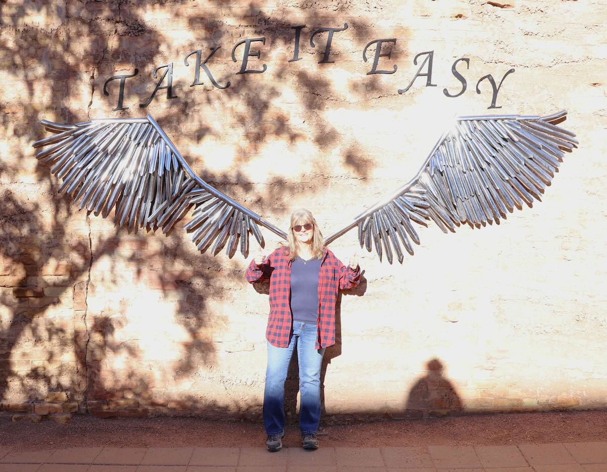
One of the high points of the entire trip for Becky was a chance to stop in Winslow, AZ. Becky is a fan of music, almost any type of music, but the music of her youth really gets her toes tapping. So, being the one standin’ on the corner in Winslow, Arizona was really meaningful for her. She loves the Eagles, and can sing along with Take It Easy without missing a beat. Of all the places we went, things we saw, and memories we made on this trip, Winslow, Arizona will always hold a special place in her heart. Sadly, like the Tehachapi Loop, this particular corner is not a POTA entity.


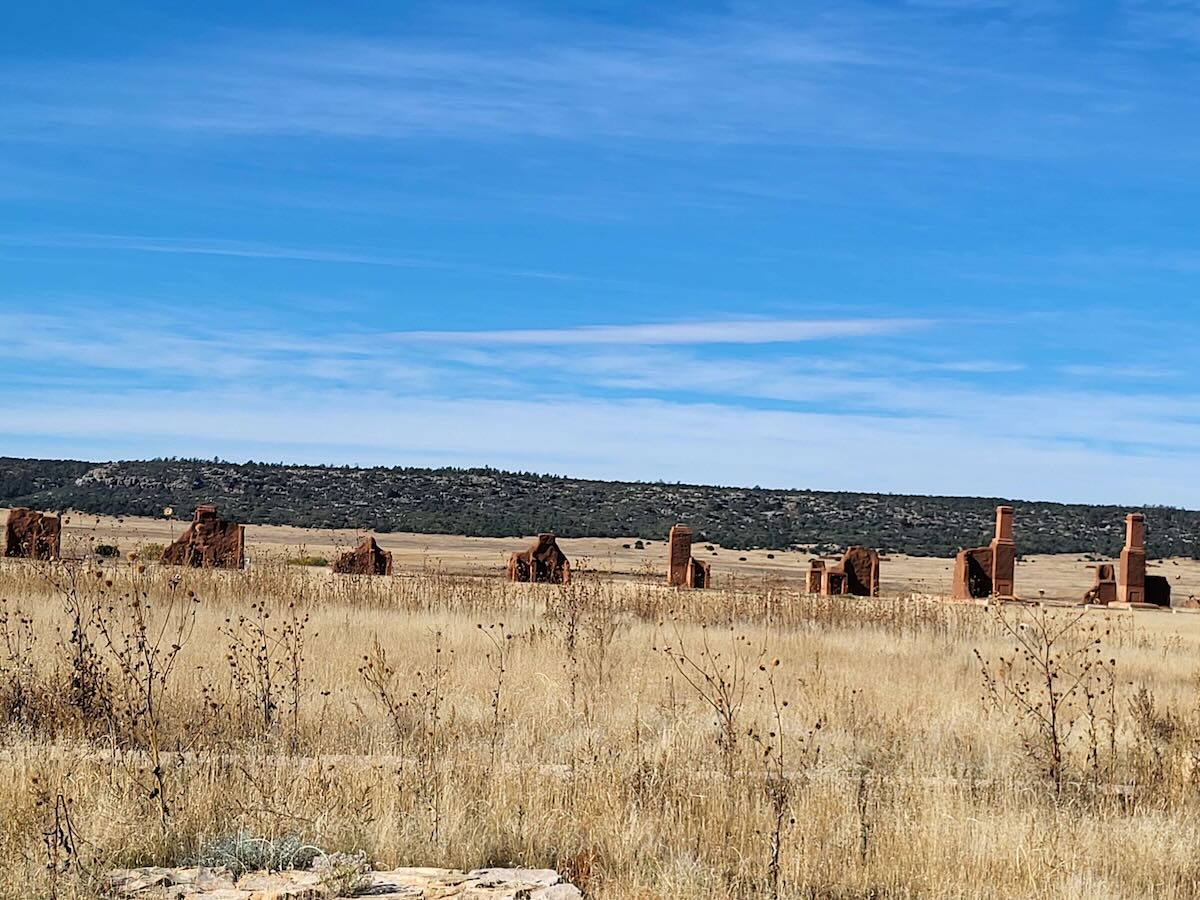
Fort Union NM, NM

The first facilities at Fort Union National Monument (US-0933) were built in 1851, following the annexation of New Mexico by the United States after the Mexican-American War. Rough log structures housed and defended the troops and supplies for protecting the Santa Fe Trail. Over the years, the facility became increasingly important as a regional transportation hub and supply base for United States Army troops.
Early in the Civil War, Fort Union was moved to a occupy a commanding hill top, and rebuilt as a star-shaped earthen structure to make it defensible against troops with longer-range arms and artillery. It was hoped that this would allow the fort to better defend against Confederate Forces moving into New Mexico. Before the fort’s defenses could be tested, the attacking Confederate army was defeated and turned back by Union troops at the Battle of Glorieta Pass, so they never reached Fort Union.

The fort was rebuilt again by 1869, incorporating a large complex of adobe brick structures. The Fort Union garrison’s responsibility to protect the Santa Fe Trail involved escorting traffic along the trail during periods of conflict with Native American tribes. As the Atchison, Topeka and Santa Fe railroad was expanded across the southwest, the mission to protect the Santa Fe Trail became less and less important. Fort Union was finally abandoned in 1891, until its preservation as a National Monument in the early 1950s.

The visitor center has great information about the history and significance of Fort Union, along with a gift shop. Becky and I took turns exploring the visitor center, as one of us needed to stay outside with Molly. The site itself is beautiful, with well-interpreted layout and ruins from the 3rd Fort Union. You can see the remains of officer quarters, troop barracks, stables, a large hospital, and associated facilities. If you are ever in the area, the Fort Union National Monument is well worth visiting.


The Santa Fe National Historic Trail (US-4579) runs through Fort Union, so my activation counted as a 2-fer. While there were a few low trees in the area, I supported my antenna with a 10m collapsible mast lashed to a fence post. This allowed me to run my 35 ft EFRW in a near-vertical configuration, with the feedpoint located atop a shaded picnic table. The 20m band worked great for me, and I collected 17 CW contacts in 15 minutes. Becky and Molly took that time to explore some of the ruins from the Fort, taking pictures as they went.

Pawnee Rock SHS, KS

Our homeward route took us from west-to-east across Kansas. We saw many, many acres of productive farmland, and a lot of work being done to harvest grain. Indelible memories include the FLAT terrain, grain elevators with rail sidings located in towns spaced about 10 miles apart across much of the state, and dust clouds trailing behind huge combines bringing in he harvest. So, when we arrived at the site for our planned activation, Pawnee Rock State Historic Site (US-9191), the hill took us a bit by surprise. Pawnee Rock served as a landmark for the hearty pioneers making the westward trek in wagons. It also served as a lookout to survey the terrain in all directions. The rock is now a bit smaller than in days of old, because it was quarried to provide sturdy building materials (the rock was originally about the same height as the present-day observation platform). Pawnee Rock also has the distinction of sitting on the Santa Fe National Historic Trail (US-4579).
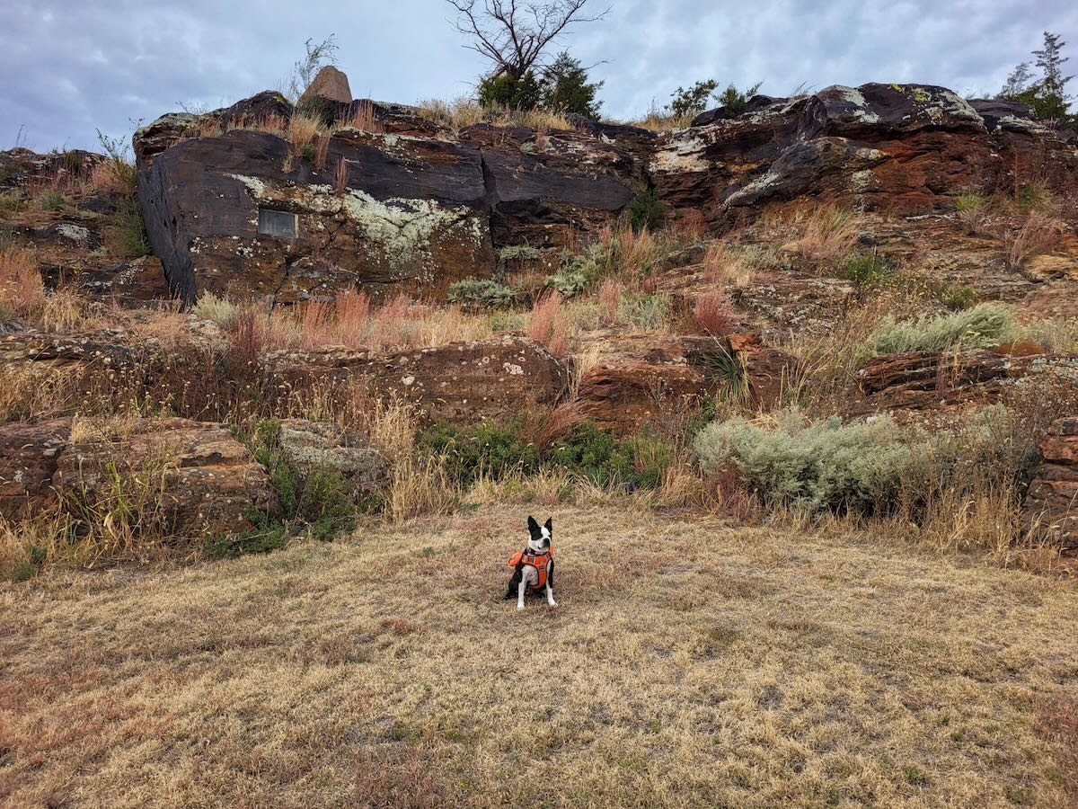


The site contains a number of monuments and plaques commemorating the site’s history, but the most striking feature is an observation deck constructed atop the hill. The top deck can be accessed via a spiral staircase, and the view from the top is panoramic, in every sense of the word. Becky and Molly explored the grounds, while I climbed to the top and took pictures.

I was again able to include US-4579 as part of a 2-fer activation at US-9191. A sheltered picnic table next to a convenient tree provided an excellent operating position. The weather was getting cooler than we had experienced, and there was a strong breeze, but overall conditions were very pleasant for outdoor portable operation. I logged 19 CW contacts in 20 minutes on the 20m band to complete this 2-fer activation. Once the gear was packed, we got back in the truck and continued our trek across Kansas.

Confederate Memorial SHS, MO

As we planned our trip through Missouri, we looked again to find POTA entities near our travel path. Frankly, we chose to activate Confederate Memorial State Historic Site (US-3345), because it was close to the hotel where we planned to stay the night. We had driven through the Kansas City metropolitan area, and found the hotel away from the urban traffic. The next morning, we took the short drive to US-3345, and were amazed by what we found. There were few people, and no evident staff on the grounds, but signs and markers helped us to understand the significance.

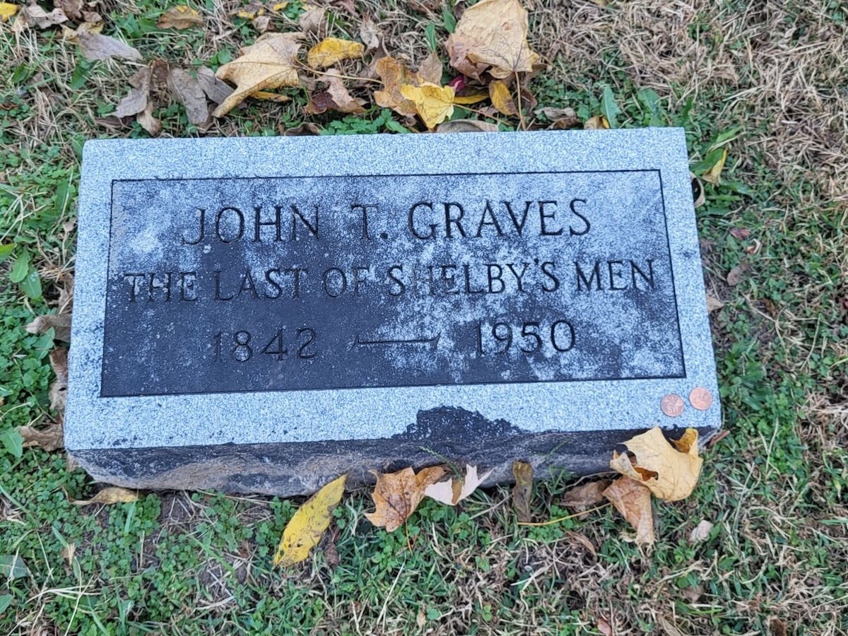
This location was the site of an old age home for Missouri Confederate Veterans of the Civil War, and many of the residents were laid to rest in the Cemetery located on its grounds. The State Historic Site, which also includes acres of park land, was peaceful, picturesque, and well-kept. We explored the cemetery, with its nearby chapel, taking the time to find the headstone of John Graves, the last survivor, who passed away in 1950 at the age of 108.

I have been fascinated by the Civil War since I was a young boy, but my birthplace in Pennsylvania gives me the Yankee perspective on the conflict. My viewpoint has evolved with age and experience, transitioning from a focus on battles, to a focus on the people who lived, struggled, and died during that traumatic time in our country’s history. People are flawed, complex, and must be understood in the context of their times. I think almost all of us are working to do our best as we make our way through life in our times and our world. I think the men who rest in the Confederate Memorial Cemetery were trying to do so, too. Maybe it was that connection that made the visit to their resting place genuinely moving.


Becky and Molly explored, while I set up to activate. I used a throw line to pull up my EFRW antenna into a tree, and I chose a nice bench for my operating position. I was able to put 14 contacts in my log during 12 minutes of QRP CW operation, a thoroughly satisfying result.

Mark Twain Birthplace SHS, MO

As we continued our way across Missouri, Becky was looking at maps. She was determined that we should spend as much time on scenic highways as possible, and to make sure I agreed, she found the Mark Twain Birthplace State Historic Site (US-3356) in Florida, MO, and persuaded me that I should activate it. US-3356 is located in northeast Missouri, and would serve to keep us well away from the Interstate Highway System, at least until we crossed the Mississippi River into Illinois.


We found the Mark Twain Birthplace State Historic Site, and the town of Florida, near the end of a large peninsula jutting out into the aptly-named Mark Twain Lake. The large Visitor Center has a wide variety of Mark Twain memorabilia, from the entire rustic cabin where he was born (preserved whole inside the building’s main exhibit hall), to historical artifacts of his life, to handwritten manuscripts from his writings. The collection is well worth the time for a visit.


The visitor center building is located near the lake shore, and I found a bench with a nearby tree that became my operating location to activate US-3356. With my 35 ft EFRW antenna supported by a throw line over a convenient tree branch, I got on the air with 5 watts to collect CW contacts from the site. I worked the 20m band, and logged 14 contacts in just under 20 minutes, for a successful activation.

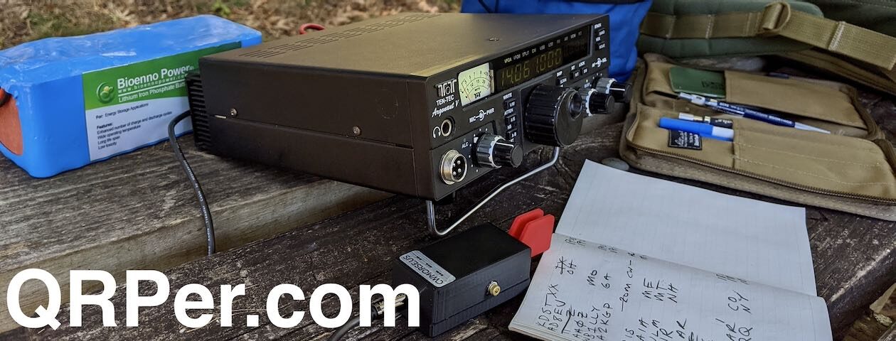
Gear
Note: All Amazon and eBay links are affiliate links that support QRPer.com at no cost to you.
- Elecraft KX2
- SideKX end-panels and cover for the KX2
- Bioenno 3 Ah LiFePO4 battery
- Tufteln EFRW antenna with 35 ft radiator and 17 ft counterpoise
- 15 ft RG316 feedline with BNC male connectors at each end
- 2 ft, 3 ft, and 5 ft homebrew RG316 feedline with BNC male connectors at each end
- Homebrew VK3IL-designed, pressure paddles
- Generic earbuds
- Rite in the Rain No. 946 notepads
- Pentel Twist-Erase mechanical pencil in 0.9mm
- US M7 Army Light Weight Service Mask pouch: WWII vintage, canvas construction
- Packtenna 10m Fiberglass Antenna Mast
- Goture 6.3m Carbon Fiber Telescopic Fishing Pole
- Arborist kit with 2mm Marlow Excel line and Petzel 9 oz (250g) throw bag and Tom Bihn Small Travel Tray stuff sack
Conclusion
When Becky, Molly and I took our trip across the country, we sometimes spent a lot of time looking for nice parks to activate, and we sometimes chose parks for their convenient location along our travel path. We discovered that many of the entities where we stopped truly were hidden gems. Some held fascinating history, and some contained unadulterated natural spendor. I am convinced that most parks you visit contain wonders. As you chase contacts for your activations, take some time to look around you. You may be really surprised at what you discover.
Oh, and when you find a gem of a park, either next door or traveling afar, take a moment to share your discovery with the good folks here on QRPer.com.
Until next time, best 73 de Molly, Becky, and Brian – K3ES
PS: Consider joining our QRPer.net discussion board! It’s an active community of radio operators who enjoy helping and supporting each other. It’s also the best place to ask any questions you might have about radios, field activities, antennas, or pretty much anything amateur radio.
Great tour and so happy you shared it with us.
Now you can ” take it easy”.
Thanks Steve.
Thanks for the great write-up. I lived south of KC 90 miles. I see I need to visit a couple of new Parks thanks to your write-up. De W0HL
Thanks, Dennis. So many parks, so little time!
I think you need to plan a trip to Yoho National Park in Canada, and go to Kicking Horse Pass so you can watch trains navigate the Spiral Tunnels:
https://parks.canada.ca/pn-np/bc/yoho/culture/kickinghorse/visit/spirale-spiral
Thanks, Paul. I will definitely put the spiral tunnels and Yoho NP on my bucket list. Becky and I are connected to one of the earliest railroad engineering grade management projects. The Horseshoe Curve is located near Altoona, PA, and was built in 1854 to reduce the grade on the westward side of the Allegheny Mountains in western Pennsylvania. This allowed the Pennsylvania Railroad to complete its connection across the state and westward. Becky’s dad spent his career working for the PRR and successors (he can tell you about the experience of walking the curve in winter, releasing frozen brakes to keep trains moving). We held our wedding ceremony at the Horseshoe Curve overlook.
This is excellent Brian. Now, I want to visit all these places!
The Pawnee Hill activation looks to be just about dead center of the continental U.S.
And, is there any state that doesn’t have some connection to Mark Twain?
Thanks, Matt! There are so many great parks to activate across the country, and even a trip like we took can barely scratch the surface.
Brian:
Thank you for another interesting and well-researched article. We are blessed in this country to have so many interesting places to visit and play radio. I thoroughly enjoyed reading this report and am looking forward to the next ones in the series.
72,
Teri KO4WFP
The POTA Babe