

Activating on the Road: National Forests and National Grasslands
by Brian (K3ES)
After a short break, with life getting in the way, this article continues my series on our 2024 road trip across the United States (Six Weeks and 7300 Miles: Activating on the Road). I hope to wrap up the series with a couple more articles (not yet written) over the next few weeks.
One of the goals of our great 2024 adventure was to make significant progress toward the Activated All States award for Parks on the Air (POTA). To do this, we planned our route across the American west to pass through all of the Western states that I still needed to activate. Since we still planned to spend time visiting with my parents at their home in California, we kept our travel time limited to about 2 weeks for the outbound trip and 1-1/2 weeks for the return trip. While our route would meander, we had to limit the time we spent in each of the states. Thus, many of the parks where we stopped were chosen because they were located very close to our planned driving route, and could be activated during a short break during the travel day.
To make activation planning work, we became very familiar with maps: Google Maps, the mapping function of POTA.app, a big handful of state highway maps from the American Automobile Association (AAA), and the National Park Road Atlas. While mapping with POTA.app was our go-to resource for choosing parks, it does have one significant drawback: there is only one locator pin for each park, which fails to convey the full extent of some vast entities. This is particularly true for National Forests (NFs) and National Grasslands (NGs). If you are trying to activate entities near your planned travel route through the American west, there is a good chance that you will find yourself within the boundaries of a NF or NG, and chances are equally good that the pin representing that entity on the POTA.app map will not be found anywhere near your current location.
We discovered that the expansive NFs and NGs were represented well on our paper highway maps, and were also well marked with signs along the highways. These entities, operated by the Department of Agriculture, have no general admission fee, are typically not crowded with people, and are generally a permissive environment for POTA operators. By permissive environment, I mean that there were not restrictive rules about antennas, ropes, wires, and use of trees. Some of these entities have picnic areas, campgrounds, and trails that can serve a POTA activator well, but it is also possible to find road-side sites that are suitable for quick activations. The following sections contain brief reports on the six NFs and NGs that we activated during our trip.
Buffalo Gap National Grassland US-7487

We found a trail head parking area in Buffalo Gap NG, located just outside the entrance gate to Badlands National Park in South Dakota. Having finished our drive through Badlands, I decided to do a quick activation of the adjacent entity. Although the trailhead area had few amenities, I was quick to take advantage of one: a couple of small trees that provided a patch of shade for the truck on a hot and bright afternoon.
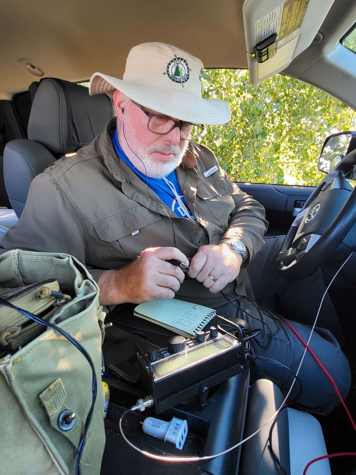

I set up using my Tufteln 35 ft end-fed random wire (EFRW) antenna, with a collapsible fishing pole supporting the apex for the inverted V configuration. I operated for less than 40 minutes on the 20m band, as usual running CW at 5 watts, and logged 34 contacts. That was a spectacular success in my book!

Black Hills National Forest US-4524
 A few miles down the road from Mount Rushmore National Monument, we found the Breezy Point Picnic Area in Black Hills NF. Having already activated Mount Rushmore, we stopped to eat our lunch, use the comfort facilities, and give POTA dog Molly a chance to stretch her legs. In keeping with the name, there was a pleasant breeze. The temperature was comfortable, and there were a number of picnic tables shaded by adjacent trees. Naturally, I took the time to set up my station to activate this new-to-me South Dakota entity while we were there.


I threw a line up into the branches of a tall evergreen tree beside my picnic table, and pulled up my Tufteln 35 ft EFRW antenna into a near vertical configuration. In a bit less than 30 minutes, I logged 22 QRP CW contacts to complete a successful activation.

Oglala National Grassland US-7478

Having spent a few days enjoying spectacular sights in southwestern South Dakota, we were close to the corner of Nebraska, and wanted to make a quick hop across the border for an activation before continuing our travel northwest into Wyoming. Consulting our maps, we found that part of Oglala NG was located just across the border, making it very convenient for a quick activation. We followed a highway across the border, turned onto a gravel road, and followed it a short distance to the sign for Oglala NG.


I drove past, turned around, and pulled off onto the shoulder of the road just beyond the sign. Then I put up my collapsible fishing pole and used it to support the apex of the Tufteln 35 ft EFRW antenna in an inverted V configuration. In 20 minutes on the air, I logged 18 QRP CW contacts, and a successful POTA activation in Nebraska.

Custer Gallatin National Forest US-4502

After spending the night in southeastern Montana, we planned to drive across the southern part of the state, doing an activation on the way. Our original plan was to visit and activate the Little Bighorn National Battlefield, but Becky pointed out that a detour and a rapid activation could let us drive through Yellowstone National Park. So, we decided to pass on exploring the Battlefield and grab a quick activation while driving. Shortly after getting on the road, we began seeing signs for Custer Gallatin National Forest, and decided to find a spot near the road to do a quick activation. The opportune spot turned out to be Camps Pass, which was marked with a sign showing it to be an area for cross country skiing. The weather was warm, the sun was shining, and we had nobody competing with us for space.


We drove uphill for half a mile on a rough dirt road, and found a convenient tree. After turning the truck around, I deployed a throw line over a tree branch to support the center of my Packtenna 71 ft EFRW antenna. After attaching the feedpoint to the side-mirror of the truck, and connecting the free-end of the radiator to a downed tree limb using a length of cord, I got on the air. In 25 minutes, I made 16 QRP CW contacts on 20m, completing a POTA activation in Montana.

Caribou Targhee National Forest US-4475
 After driving through Yellowstone and Grand Teton National Parks, we planned to spend the night in Idaho Falls, Idaho. During the drive, we knew there was an opportunity to complete an activation in Idaho during the afternoon, so Becky spent some time with the maps. She noticed that our route would take us through portions of the Caribou Targhee NF. After seeing Caribou Targhee NF signs along the highway, we pulled off into a roadside parking area for an activation.


After tossing a throwline over a nearby tree branch, I was able to quickly pull up the Tufteln 35 ft EFRW antenna and get on the air. With 13 contacts in 15 minutes on the 20m band running QRP CW, I had completed my POTA activation in Idaho.

Rita Blanca National Grassland US-7481
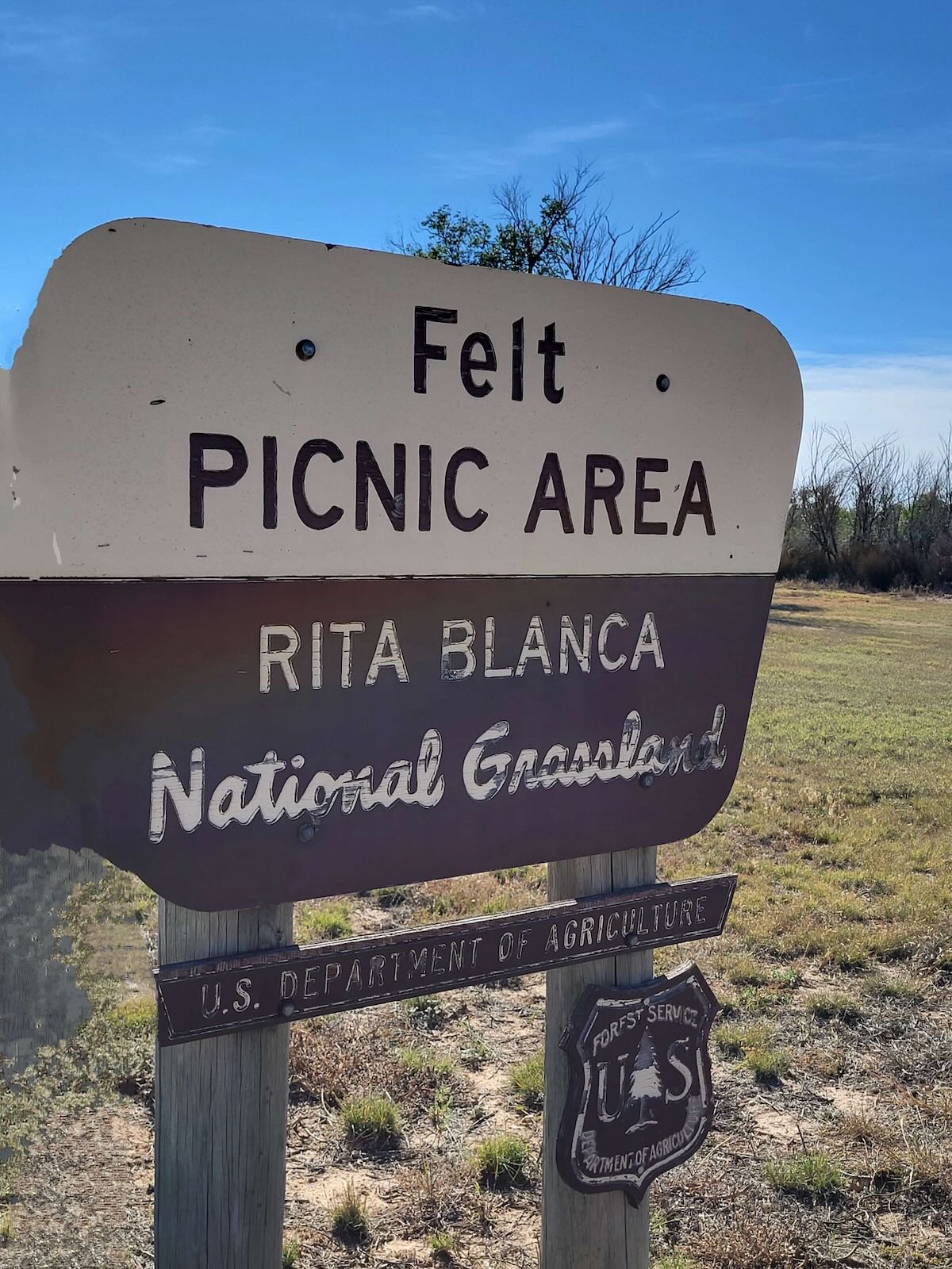 We planned our travel between New Mexico and Kansas to cut through the pan-handle of Oklahoma. The Rita Blanca NG was near our travel path, and we found the Felt Picnic Area within the Grassland, which promised to be a good site for activating. The picnic area had trees, picnic tables, and a grassy area for Molly to walk around.


I tossed a throw line over a tree branch and pulled up the Tufteln 35 ft EFRW, then got on the air. In about 20 minutes, I made 14 contacts on the 20m band while running CW mode at 5 watts, for a successful activation in Oklahoma.

Conclusion
Most National Forests and National Grasslands are huge entities. This means that locating them using the pin on the POTA.app map can be ineffective, both because it is not intuitive to locate the pin, and because the pin does not represent the further reaches of the entity. A paper map can give a better idea of the layout of the entity, some of which include multiple, and widely separated tracts. Once you have an idea that the NF or NG is near your travel path, you can often get more precise information from the web page and official maps. Additionally, these entities are well marked with signs, making it easy to determine that you are, indeed, in a valid area for activation.
We found that it was worth the effort to identify NFs and NGs along our travel route for activation. Picnic areas within NFs and NGs are generally well kept, may have tables, lawn areas, and comfort facilities. Leashed pets are welcome, and trees are often available to provide antenna support. Camping areas, either developed or primitive, can be found within some of these areas, with the best approach being to use the official web site and maps. Finally, NFs and NGs can be very scenic, and they give a good representation of the topography, flora and fauna of the area where they are located.
Gear
Note: All Amazon, and eBay links are affiliate links that support QRPer.com at no cost to you.
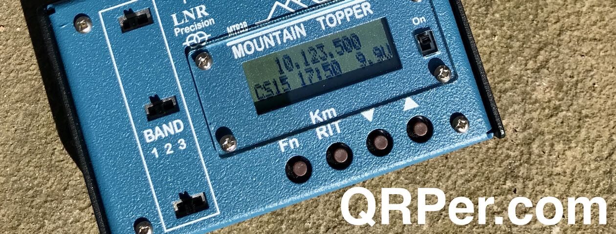
- Elecraft KX2
- SideKX end-panels and cover for the KX2
- Bioenno 3 Ah LiFePO4 battery
- Tufteln EFRW antenna with 35 ft radiator and 17 ft counterpoise
- Packtenna EFRW antenna with 71 ft radiator
- 15 ft RG316 feedline with BNC male connectors at each end
- 2 ft, 3 ft, and 5 ft homebrew RG316 feedline with BNC male connectors at each end
- Homebrew VK3IL-designed, pressure paddles
- Generic earbuds
- Rite in the Rain No. 946 notepads
- Pentel Twist-Erase mechanical pencil in 0.9mm
- US M7 Army Light Weight Service Mask pouch: WWII vintage, canvas construction
- Goture 6.3m Carbon Fiber Telescopic Fishing Pole
- Arborist kit with 2mm Marlow Excel line and Petzel 9 oz (250g) throw bag and Tom Bihn Small Travel Tray stuff sack
Brian — what a terrific trip! Thank you for continuing to write it up. I would love to do a trip like that someday.
A site I have found very helpful for finding the edges of parks is https://potamap.us/ . When activating multiple parks in a day, looking for edges where I can move quickly from one to another, seeking alternate entry points, etc., the site is very helpful.
For example, US-8030 (Absecon WMA, near Atlantic City, NJ) looks nearly inaccessible to me, surrounded by water, marsh, and private property. But it has a few non-contiguous chunks scattered around, one of which I was able to hike into via another local park.
I’m looking forward to your next report!
73 de Todd W2TEF
Thanks Todd. This trip was 40 years in the making. I drove along with my parents as they moved from PA to CA in the mid-80s. That cross country trip was done in 4-1/2 days. I have always wanted to take some time and do it right!
Thanks also for the potamap.us reference. I will check it out. Mapping support for POTA just keeps getting better and better.
Best 73 de Brian – K3ES
Love the idea of using the backpack on the table as the near anchor point for the wire antenna – great idea!
Thanks, Steve. I have to confess to pure laziness on that!
Awesome trip and awesome post! Thanks so much for sharing – I’m still a long ways from even making QSOs on my (tr)uSDX, but I’m getting there. Maybe I’ll post here when I do, who knows 🙂 Keep ’em coming! I love it!
And, by the way, huge thanks to whoever adds the links for the gear. I know it benefits QRPer, but it also really helps ME.
Thanks, Bernard. I think I have at least 2 or 3 more reports from this trip that will be worth publishing. It will take some weeks to finish the write-ups, but I will keep at it.
That (tr)uSDX (and you) will really benefit from letting some RF energy out into the air. To borrow from CW Innovations, “Don’t get good at CW so that you can get on the air, get on the air so that you can get good at CW.”
Best 73 de Brian – K3ES