
Many thanks to Joe (N0LSD) who shares the following guest post:
Independence River Wilderness – Adirondacks, NY
by Joe (N0LSD)
A recent family engagement offered me the perfect opportunity to travel to a part of my state I rarely get the chance to visit.
This trip would be a single over-nighter, but allow for the activation of three POTA entities by hitting two different locations. One stop would be a two-fer, while the other location would be a single-park activation. Additionally, this trip would offer the potential for ‘late-shift’ contacts: always a nice feature of overnight activations.
The Planning
In northern New York lies a vast, 6-million acre (over 2.4 million hectare) area that has been set-aside in the State’s constitution as protected land, and half of this area contains wildernesses that are meant to be kept ‘forever wild’. This area, known as the Adirondack State Park, is fully 20% of the land area of the state of New York, and constitutes the largest area of state-protected land in the United States.
By way of comparison, one could fit Yellowstone, Grand Canyon, Yosemite, Everglades, and Great Smoky National Parks all within the Adirondack State Park boundary – at the same time. (Wood-Tikchik State Park, in Alaska, has more *contiguous* protected land, at 1.6-million acres, and the Alaskan National Wildlife Refuge is the largest Federally-protected area.)
My goal was to probe the very western edge of this region. Situated east-southeast of the town of Lowville, NY are two parks that straddle the Blue Line, which serves as the official border of the Adirondack Park itself.
To the west is the Independence River State Forest (POTA US-5067): this park falls outside the Blue Line. Bordering this park to the east is Independence River Wild State Forest (POTA US-10295) – which falls within the Blue Line, and thus within the border of the Adirondack Park (POTA US-2001).
My Amateur operations over the last number of years have been primarily utilizing digital modes; however, because the destination is a place I can seldom travel, and solar activity has been unkind to the HF bands as of late, I’d not leave anything to chance.
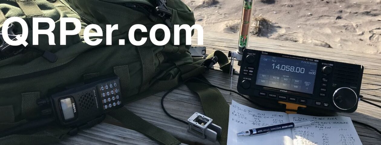
This meant having the ability to activate these parks via SSB Voice, if necessary. I’ve been activating parks with the TruSDX, because it is a light-weight radio. In addition to carrying this, however, I also took the Xeigu G90, and a Bioenno 12Ah battery. A good bit of extra weight, but it provided a bit of insurance against the possibility of a failed activation attempt.
On Arrival
 In Desert Solitaire, Edward Abbey, one of the great writers of the 20th Century, wrote, “In the first place you can’t see anything from a car; you’ve got to get out of the [G.D.] contraption and walk, better yet crawl, on hands and knees, over the sandstone and through the thornbush and cactus. When traces of blood begin to mark your trail you’ll begin to see something, maybe. Probably not.”
 Map reconnaissance showed it would probably be feasible to drive through the Independence River State Forest park on a forestry road, then hike a couple miles further into the Independence River Wild State Forest along established trails to make camp on Little Otter Lake. This would be my overnight location and first activation opportunity – a two-fer, as this place lies entirely within the Adirondack Park border. This would put my vehicle at a midpoint between the two POTA entities.
I tend to pour over maps in preparation for trips like this, but I know better than to trust maps implicitly, especially in the wilderness. A couple enterprising beavers can turn a whole forest into a pond; and a stroke of a pen in a far-away capital can make a road disappear back into the woods within a few short years. Topology rarely changes, but what is on that topology can only be trusted once one sets eyes on it.
As it happened, the map was…mostly correct. I wouldn’t end up leaving my vehicle where I intended, but it was left in a logical place, and relatively close to the trailhead of the trail I needed to utilize to get to my intended target. So, after a four hour drive, it was time to hit the trail.

The hike to Little Otter Lake was absolutely gorgeous, if not, initially, a cruise. This was due to the composition of the trail itself, which was sand. The trails in this part of the park are primarily horse trails. Eventually, they did turn to dirt – and the pace of the hike in quickened as a result. It was in this sandy section that I encountered a couple riding, and I cleared the trail for them, only to have one rider ask me so show myself more fully, as her horse was not an experienced trail horse, and she was afraid I might spook the animal. This was the only human interaction I’d have.
Along the trail I spotted a fallen birch tree. Birches aren’t particularly plentiful in this part of the state, so I took the opportunity to gather some birch bark – which is an excellent tinder for firestarting. I anticipated being able to have a small campfire at some point in the evening, and brought a folding saw and my bushcraft knife along to process wood. This would end up not occurring.
As I approached the end of the hike and spotted my destination lake, I heard…..music. The land drops-off about 20 feet above the lake, so I dropped the pack and picked my way, slowly and quietly, down the embankment. I stayed in the thicket, in order to take in the scene while minimizing my own signature. To my south, I spotted a pick-up truck, backed right up to the edge of the lake in what seemed to be a boat access point.
Disappointed in having neighbors, I made my way back up the embankment to my gear, and consulted the map. Where these neighbors were located fell along the path I wanted to take to a clearing where my map recon said would be a nice place to camp.
Not wanting to draw attention to myself, or worse – disturb anyone – a change of plan was necessary. The map hinted that there was a trail to the north, that would put me on a peninsula, directly opposite my neighbors on the lake. I rucked-up and made my way north along this smaller trail, until I hit the peninsula. Here I found a clearing, a horse hitching log, and….a picnic table, of all things. The neighbors eventually left with their music, and I was left alone on the lake.
 I got to work, immediately establishing my tent location – careful not to locate under any potential widow-makers – and making sure I noted where horse poop was, while it was still light. The delay in finding a different site would preclude wood processing, so no campfire for me this night.
My tent location was in a thicket that I could easily access, but would make noise if disturbed. This is black bear country, and although I’m completely comfortable camping in such areas, I would also like to be awake if I’m about to get clubbed by a curious bear in the middle of the night.
The tent was up, sleeping pad inflated, and my sleeping bag lofting, so I got busy boiling water for dinner. On the menu was a freeze-dried backpacker meal: Texas State Fair Chili from Packit Gourmet. (I highly recommend!)
While the meal was re-hydrating, I got the N9SAB off-center fed dipole hung. As I ate, I boiled additional water for an evening coffee, and got the radio set-up. After dinner, I carefully started a zip-lock bag to pack-out my trash, and found a good spot for a bear hang to keep my food away from camp overnight. Bear canisters are required in the High Peaks Wilderness of the Adirondacks. Even outside that area, it’s a good idea to store food away from camp.
The Operation
Camp chores done and coffee made, it was finally time to get operating. I got to work on 20m FT8 at shortly after 0000Z – right on-time to start the late shift. There’s little – if any – cellular service in this wilderness, so self-spotting on the POTA page is not an option. That’s fine – it adds to the challenge.
Propagation seemed to be smiling on me: 20m was still doing very well, signal reports were good, and I was even able to work a couple European DX stations with my QRP signal. I was able to complete the 10 necessary contacts for the activation in under an hour on the waning 20m band alone.
I then switched to 40m FT8 and settled in for a nice, long string of contacts over the next hour and a half. As the temperature started to drop and the coffee wore-off, I figured it was a good time to get the bear hang up, pack up the radio, and head to bed.
Follow-on Mission
 I awoke to sun starting to peek-in on the tent. Too early. I turned over, and got another half hour of sleep. After that, I got to work boiling water for breakfast – oatmeal and coffee – and while the water was boiling I packed up the antenna. As the oatmeal was re-hydrating, I went down to the lake and snapped some pictures and filtered some water for the hike out. Coffee and food consumed, and all that was left was to pack the tent, strap it to the bottom of the rucksack, and head out. I did one last look around the site, as if to etch the image into my memory, and headed down the trail.
I made it back to the car in good time, hiking back the way I went in. I navigated the forest roads out of the Independence River Wild State Forest, out of the Adirondack Park itself, and made my way back into the Independence River State Forest – just on the other side of the Blue Line. My target: the Assembly Area, where horseback trail riders ready their horses for the trail.
Arriving to find no one there at this early hour, I quickly put the N9SAB OCF dipole up in a tree, got the ends stretched-out in an inverted-vee, and quickly got the radio out and powered-up.
This had to be quick: people would soon arrive, and the deer flies were already getting quite active. 20 meters was again doing well, and within half an hour I had my requisite 10 contacts. I spent some additional time to get a couple insurance contacts, greeted the nice folks arriving at the Assembly Area for their morning ride while I was packing up, and was on the road out before they could even saddle-up.
“… known as the Adirondack State Park, is fully 20% of the land area of the state of New York …”
I did not know that. Wow.
Thanks, Joe, for the great account of a fun trip!
At least the maps were mostly correct!