I just received an email announcement from Chameleon Antenna, and I thought I’d share it here.
I’ve often referred to Chameleon antennas as “military-grade” because I’ve seen numerous military portable antenna systems over the years and Chameleon antennas are engineered to that standard. The quality is simply uncompromising.
Chameleon antennas are at the top of the amateur radio price bracket for portable antennas, but affordable compared to other military field antenna systems.
Their recent email announcement showcased a real-world example of how their antennas are used in military communications exercises. From Chameleon:
For QRPX 2021, the NTC Operations Group, Fort Irwin, CA station had the opportunity to deploy several Chameleon Antenna systems to use in the competition. This article is a summary of how each system performed during the contest, and how each could serve a military operator best.
Every year in mid-March, Army NETCOM hosts an annual HF Low Power Competition where stations across the globe try their best to establish HF communications with each other over a variety of modes, including USB Voice, ALE, 3rd Generation ALE, and Tactical Chat messaging application.
Participants include:
Active Duty, Reserve, and National Guard elements of the US Army
The three Army MARS HF Hubs in Ft. Detrick, MD; Ft. Huachuca, AZ; and Ft. Shafter, HI
Any other military branches including Air Force, Marines, Navy, Space Force, and Coast Guard
Canadian military teams
Army MARS Auxiliarists
As a Signal Coach out here at The National Training Center (NTC), Fort Irwin, CA, I found out about this competition, and competed the last two years. In the 2020 QRPX, I operated my station alone using only an L3Harris AN/PRC-150 with its accompanying antenna, the L3Harris RF-1944 dipole kit. I operated as I was able to, not expecting much, only to find out that my station placed third with 48 points and was only a few contacts shy of the winning score of 53 set by a fully stacked team from Joint Base Lewis-McChord. I was absolutely hooked from there.
I’d recommend you download and read the detailed report.
If you can’t tell, I’m proud to have Chameleon Antenna as a sponsor of QRPer. They’re a brilliant company that designs and builds all of their gear here in the USA. Their gear is built for the long haul. They’ve never heard of the marketing concept “planned obsolescence.” I’m guessing Chameleon’s idea is to impress you enough with their product quality that you buy more and more of their systems.
By the way, if you think I’m supportive of amateur radio manufacturers that build quality products, don’t even get me started about my obsession with US-made backpacks and camping gear. Seriously. Just slowly back away while you can… 🙂
Chameleon Antenna has sent me a number of their antenna systems to evaluate in the field over the past few months at no cost to me. I appreciate not only the opportunity to test these antennas, but to provide the company with my frank feedback.
As I’ve mentioned previously, Chameleon antennas are military grade and build here in the US (check out Josh’s tour of their factory). You pay a premium price–compared to imported options–but their gear is built for performance, easy deployment, and longevity.
What has impressed me most about Chameleon gear is how flexible and modular it is. Their antenna systems are adaptable to almost any situation and always built around the idea of emergency communications.
Recently, Chameleon sent me their new CHA TDL or Tactical Delta Loop antenna. This vertical loop antenna has been designed to be portable, and tunable from 3.5 to 54.0 MHz (80-6M), but, as Chameleon points out, “is most effective on the bands from 10.1 to 54.0 MHz (30-6M). ”
TDL deployment
If I’m being perfectly honest, I wasn’t sure what to expect this antenna to look like–in terms of size–once deployed, so I set it up in the front yard prior to taking it to the field.
Set up couldn’t have been more simple: attach the 17′ telescoping whips to the stainless steel spike (with one whip attached to the Hybrid Micro), extend the whip sections, then attach the loop wire to connect the tips of both whips.
It might have taken me four minutes to set up the TDL on the first go.
This antenna needs a little space for sure: this isn’t one you could easily deploy in a dense forest, but it has a very flat profile vertically. I can’t think of a single park I’ve activated that couldn’t accommodate the CHA TDL.
I like to try to give gear a fair chance when I do evaluations and thought I’d wait until propagation was at least stable before taking the TDL to the field and making a real-time, real-life video (as I used it for the first time). But, frankly, I’m way to impatient to wait for the sun to play fair! Trial by fire…
Lake Norman State Park (K-2740)
On Monday (March 15, 2021) I packed up the CHA TDL and headed to Lake Norman; one of my favorite parks to play radio.
Propagation left much to be desired that afternoon, but the weather was perfect.
I decided to pair the CHA TDL with my Icom IC-705. Since the CHA TDL requires an ATU, I connected the mAT-705 Plus.
NVIS on the low bands
I had no idea what to expect from the CHA TDL in terms of performance, but Chameleon notes that it provides Near-Vertical Incidence Skywave (NVIS) propagation on 40 and 80 meters. NVIS antennas are very popular for the military and for emergency communications since the propagation footprint is much closer to home than it might normally be.
NVIS is also a brilliant option for park and summit activators, especially if they’re activating in an area with a high density of park/summit chasers. For example, if you live and activate sites in the state of Maryland, employing a NVIS antenna might make your site more accessible to the DC metro area, Pennsylvania, Virginia, New York, Delaware, and New Jersey–regions that might otherwise be in the skip zone of your 40 meter signal.
On the air
Operating five watts CW, I started calling CQ POTA on 20 meters and snagged four stations in about seven minutes.
I was very pleased to work a station in California and one in Montana with five watts. (Though I need to check, this might have been my first MT station logged from a park.)
Next, I moved to 40 meters and was very curious if the TDL would provide me with proper NVIS propagation.
It did! One litmus test for me is when I work stations in Tennessee on 40 meters. Typically, I only log TN stations when on 80 meters or when I’ve configured one of my wire antennas for NVIS coverage.
Here are my logs from this 28 minute activation:
Here’s a QSOmap of the activation–the delineation between my four 20 meter contacts and eight 40 meter contacts is pretty evident:
Video
Here’s my real-time, real-life video of the entire activation which also shows how the CHA TDL easily fit in among trees:
In a future video, I’ll show how I deploy the CHA TDL.
Unfortunately, I left my tripod at home, so apologies for the viewing angle as I operated the IC-705.
Summary
This first test of the CHA TDL really couldn’t have gone better.
I was able to easily deploy it on sloping ground, among trees, in a state park, and snag both locals and QRP DX within a brief window of time on the air. All this, while our local star tried its best to interfere.
In terms of construction, the TDL is what I would expect from Chameleon: military grade.
For park activators and Emcomm purposes, the CHA TDL makes for a convenient, portable NVIS antenna on 40 and 80 meters.
While I have lighter, smaller footprint antenna options for SOTA, I must admit I’m very curious how it might perform on 20 and 17 meters from the summit of a mountain. The idea of being able to rotate the antenna and change the propagation footprint is very appealing. I’ll save this experiment for a summit that doesn’t require hours of hiking, though, and one where I know I can jab the stainless steel spike in the ground (i.e. not on top of a rocky mountain).
Any negatives? When I first deployed the TDL at home, we were having 30+ MPH wind gusts. When the gusts shifted, it did move the antenna. This could be remedied pretty easily by using a bit of fishing line filament to tie off one side of the loop. With that said, I’m not sure I’d configure the TDL as a loop if I expected strong winds. Also, as I mentioned earlier, this might not be the best antenna to pack if you plan to include a multi-hour hike in your activation.
And herein lies the brilliant thing about Chameleon Antennas: If I packed in the CHA TDL and found that winds were strong on site, I would simply configure it as a vertical instead of a loop!
The CHA MPAS Lite vertical
The CHA TDL can easily be configured as a CHA MPAS Lite portable vertical: all it’s missing is a counterpoise wire which you can buy separately from Chameleon or, better yet, just use some spare wire you have on hand!
Or, you could configure it as a random wire antenna by directly connecting a length of wire to the Hybrid Micro transformer.
That’s the thing about Chameleon HF Antennas: they can be configured so many different ways.
If you’re interested in the CHA TDL, I’d strongly encourage you to read though the user manual: it’s chock full of info and ideas. Click here to download as a PDF.
Next time I take the CHA TDL out, I think it’ll be to a summit where I’d like to see how it might perform on the higher bands with the ground sloping away from the antenna site.
On Monday, March 8, 2021, I had a very rare opportunity: nearly a full day to play radio!
I debated where to go the night before and I had a lot of ideas. Do a multi-park run? Activate some new-to-me parks a little further afield? Hit a SOTA summit?
While it was very appealing to plan a multi-park run for POTA/WWFF, I really wanted to stretch my legs and activate a summit. The weather was glorious and it dawned upon me that we’ll soon be entering the season of afternoon thunderstorms which will, no doubt, have a negative impact on my summit plans for the next few months since afternoons are typically when I have time to do activations.
After examining the map, I decided to go to Elk Knob State Park. The summit of Elk Knob is a SOTA site and the park is in both the POTA and WWFF programs.
The round trip hike to the summit (adding in a little trail loop around the park) would amount to about 4 total miles and an elevation increase of roughly 1,000 feet.
Monday morning, I left the QTH around 9:00 and arrived at the park around 11:15–it was a proper scenic drive.
The 1.9 mile hike to the summit took me about 45 minutes. The path was amazingly well maintained: 4′ wide with crushed stone most of the way.
One of the nicest trails I’ve been on in ages–Elk Knob State Park is quickly becoming one of my favorite NC State Parks.
There aren’t any antenna-friendly trees on the summit, so I was happy that I packed the Chameleon MPAS 2.0.
At first, I planned to only bring the top section of the MPAS 2.0 vertical to save space, but the hike was so short, I brought the lower aluminum sections as well. I’m glad I did.
Deployment of the MPAS 2.0 was quick and I the Elecraft KX2‘s internal ATU found a match on 20 meters very quickly.
Elk Knob (W4C/EM-005)
I spotted myself using the SOTA Goat app and received quite a 20 meter CW pileup! As you’ll see in my video below, it was testing the limits of my CW skills for sure.
With 5 watts, I quickly worked stations to my east in France, Spain, and Germany, and to my west all over the west coast of North America. It was a hoot!
I eventually moved to 40 meters and operated a bit, but 40 was suffering from poor propagation so stations that are normally quite strong, were weak that day.
I needed four stations for a valid SOTA activation and 10 stations for a valid park activation. I logged a total of 38 stations in 56 minutes. 75% of those contacts were on 20 meters.
Video
Here’s one of my real-time, real-life videos of the entire activation (less a small amount I removed while eating a quick bite):
When people tell me running QRP is like “trying to play radio with both hands tied behind your back” I’ll show them this video. 🙂
AGN?
While the hike, the weather, and the signals were all in my favor, I’ll admit I wasn’t on my “A Game” that day. We all have days like this where we struggle to copy, to keep up with the flow of contacts, and to send correctly.
In recent weeks, I’ve gotten a number of emails from readers and viewers who said they had a less-than-smooth SOTA or POTA activation and felt a wee bit embarrassed on the air when they struggled copying.
But you know what?
No worries!!!
This is all about having radio fun in the field, enjoying a hike, taking in the views, and soaking up the beautiful weather! It’s not a contest and we have nothing to prove to anyone.
I can also promise you that any chaser/hunter who has ever activated a field site will completely understand if they have to send their call a couple extra times or if they (heaven forbid!) have to re-send their call after you incorrectly copy a character.
This is totally normal.
Be easy on yourself and enjoy the ride. Even on days when I don’t feel like I’m 100% in the groove, I find doing a summit or park activation clears my mind and resets my soul.
My policy? When a mistake is made laugh it off and move on!
Photos
Here are a few extra photos from the Elk Knob hike:
I’ll let you in on a little secret. Don’t tell anyone, but I held off making my first Summits On The Air (SOTA) activation until the stars aligned and I could activate one particular summit completely on foot from my QTH.
Last Thursday (February 25, 2021), my daughter and I hiked to Lane Pinnacle (W4C/CM-018) and performed my first Summits On The Air (SOTA) activation.
Why did I wait so long?
We live in the mountains of western North Carolina where (obviously) there are numerous SOTA summits to activate.
But I wanted Lane Pinnacle to be the first.
Why? Well, it’s the one summit I can hike to directly from my house with my daughter Geneva (K4TLI) and enjoy a proper father/daughter day hike.
I had planned to do this hike last year, but I injured my ankle and let’s just say that the hike to Pinnacle isn’t a beginner’s run. I knew my ankle would need to properly heal before the journey.
This is also more of a late fall to very early spring hike due to the amount of thick foliage we knew we would have to mitigate. It’s so much easier to keep your bearings when there are no leaves on the trees nor on the green briar!
Last Thursday, I felt confident that my ankle was up to the task. We had a break in the weather as well with moderate temps and lots of sunshine (this, after several days of rain). We knew things could be muddy and slippery, but we also knew that with my busy schedule this might be our last chance to hit the summit before the mountains green up.
So we packed a lunch, plenty of water, radio gear, and (of course) emergency/first-aid kits while trying to keep our backpacks as light as possible.
Hitting the trail!
The first part of the hike requires trailblazing to a ridge line. The distance is short, but the ascent is steep (about 800 feet). We hike this portion regularly, so knew how to pick our path and avoid the steeper, slippery bits.
K4TLI lead the way!
On the ridge line, we intersected an established single track trail and enjoyed the hike across a couple of smaller summits until we intersected the Blue Ridge Parkway.
If I’m being honest, I had some serious concerns that the trailhead to Lane Pinnacle would be closed. This portion of Blue Ridge Parkway is currently closed to motor vehicles (for the winter season) and I had noticed a number of “trail closed” signs on other portions of the parkway.
Guessing this may be a type of shelf fungus?
If the trail was closed, I planned to simply activate the parkway and Pisgah National Forest for the POTA program. I never hike on trails that have been closed by the park service because I like to obey the rules and I certainly don’t want to paint SOTA activators in a bad light.
When we crossed the parkway, we were incredibly pleased to see that the trailhead was open.
The ascent from the parkway to Lane Pinnacle is about 1,000 feet (305 meters) of elevation gain over a pretty short distance. The trail we were taking–turns out–was primitive. It basically lead us straight up the slope (no switch backs following lines of elevation, for example) and simply fizzled out about one third of the way up. We could tell it isn’t traveled often at all (although we did find a massive fresh bear track in the mud on the trail!).
Obligatory SOTA report “foot in snow” photo. 🙂
I bushwhacked our way to the top–at times, the slope was about 45 degrees and slippery, but we easily found our way to the summit where our goat path intersected the Mountains To Sea trail.
We found an amazing overlook and took in views of the Bee Tree Reservoir as we ate our lunches.
Geneva grabbed her dual-band HT and made the first summit contact with our friend, Vlado (N3CZ) on 2 meters FM.
On the Air
I knew there would be short trees on the summit of Lane Pinnacle, but I also knew that I wanted to get on the air as soon as possible to allow extra time for our hike home.
I did pack a super compact wire antenna, but opted instead for the Chameleon CHA MPAS Lite vertical. I paired it with my Elecraft KX2.
The great thing about the CHA MPAS Lite is how quick it is to deploy–it might have taken me all of three minutes.
Since it was noon, I decided to start on the 20 meter band. I found a clear frequency, started calling “CQ SOTA” with the KX2 memory keyer, and spotted myself to the SOTA network via the excellent SOTA Goat app on my phone.
I had also scheduled my activation on the POTA website in advance because Lane Pinnacle is in Pisgah National Forest (K-4510). My buddies Mike (K8RAT) and Eric (WD8RIF) were also helping to spot me in the unlikely event I wouldn’t have cell phone service on the summit.
Within 20 seconds of submitting the spot to the SOTA network I had a CW pileup.
In all of my hundreds of field activations, I can’t think of a single time that I generated a CW pileup on 20 meters in such short order with five watts and a vertical.
The first station I logged was N1AIA in Maine. The second station was F4WBN in France. The race was on!
It took every bit of CW skill I had to pull apart the stations on 20 meters. It was so much fun!
I eventually worked Spain and all of the west coast states (WA, OR, and CA) and numerous stations throughout the Rockies and Midwest.
I then moved to 40 meters where I worked stations in the Mid-Atlantic, Ohio Valley, and in the Southeast.
In the end, I had to keep my total time on the air short because I wanted to take my time finding a path from the summit back down to the Blue Ridge Parkway.
In 30 minutes I worked 30 stations. I’m not a seasoned CW operator, so this was quite the accomplishment.
Here’s a QSOmap of my contacts:
I was chuffed! What a fabulous activation to kick off my SOTA adventures.
Video
This time, I did not make a video of the actual activation. For one thing, I didn’t want to carry a folding tripod for the camera and I didn’t want to ask my daughter to film it either. I wanted to keep things as simple as possible to make the most of the airtime I had.
I did, however, make a short video before and after. You can check it out on my YouTube channel:
Hiking home
I really wish we could have stayed on the summit for an hour longer making contacts, but I knew it would be wise to allow extra time to descend Lane Pinnacle especially since I knew a front was moving through later that day.
I decided it would be easier to do my own bushwhacking back down the mountain rather than try to retrace our previous steps. We took our time and I followed elevation lines to make it slightly less steep. Since I took a more south westerly descent, when we reached the parkway, we had to hike north to reach the original trailhead.
The rest of the hike was totally uneventful and incredibly fun. The weather held and we took in the views, the wildlife, and invaluable father/daughter time.
That was the first strenuous hike I had done in months due to my ankle, so let’s just say I was feeling “spent” after our 6.5 hour adventure taking in 2,000 feet (610 meters) of elevation to the summit.
I knew it was bad when I even dreaded walking upstairs to take a shower. I think I remember telling my wife, “I’m never building a house with stairs again!”
More SOTA!
Now that I’ve got Lane Pinnacle in the books, I’m ready to start hitting the summits! I’ve got a lot of pent up SOTA energy!
My goal is to activate a total of ten this year. That may sound like a modest number, but since at this point I’m less interested in “drive-up” summits, it’s more difficult to fit SOTA summits into my schedule than, say, typical POTA/WWFF parks.
In fact, I’ve already plotted my next SOTA activation and hope to do it within the next couple of weeks. It’s also a meaningful (to me) summit.
How about you?
Are you a SOTA activator or are you planning your first SOTA activation soon? Please comment!
Last week, we had a glorious break in the weather–it felt almost spring-like.
On my way back home after visiting my parents, I decided I would take in a quick afternoon hike. I originally planned to go to one of my favorite county parks, but I also had a hankering to get on the air and that park wasn’t a part of the POTA network.
Tuttle Educational State Forest (K-4861)
I decided to stop by Tuttle Educational State Forest (K-4861) instead and make February 19, 2021 not only a hiking day, but a Parks On The Air day. Tuttle sports both excellent sites for POTA and a nice little trail system.
I decided to play radio first then go on a hike, so I pulled out an antenna that I thought would give me quick deployment and pack-up: the CHA MPAS Lite.
I also remembered that a reader recently asked if I would include the deployment of the CHA MPAS Lite in one of my real-time, real-life activation videos. So I did just that!
Deployment was quick and the mAT-705 Plus ATU did a fine job finding matches on the CHA MPAS Lite.
I started calling CQ on 40 meters and worked quite a few stations in short order. When the first batch of eight chasers was worked, I moved up to the 20 meter band and started calling CQ. My hope was that I could work at least a couple of stations on 20 meters then pack up and go for a hike.
I started calling CQ on 20 meters and was quickly rewarded six additional contacts.
Without a doubt–if this wasn’t completely obvious in my video–the highlight was working my friend John Harper (AE5X) in Texas. I’ve known John for years now and have followed his excellent blog but we’ve never managed to catch each other on the air!
Turns out, John was using his recently unboxed Icom IC-705 as well. Click here to check out his post which includes a mention of this very activation. In addition, check out his thoughts after taking the IC-705 (all amped-up with the KPA-500) on the ARRL CW contest that weekend.
Another highlight was logging CU3BL in the Azores again. To me, it’s still mind blowing that 5 watts can reach out that far. Here’s a QSOmap of the activation (click to enlarge):
In total, I logged 14 stations with 5 watts and a vertical in very short order, leaving me a full hour of hiking time! Mission accomplished!
Video
Here’s a real-time, real-life video of the entire activation:
The hike afterwards was just what the doctor ordered, too. I’ve mentioned before that my ankle has been healing nicely after twisting it badly in December. This hike was an easy one and gave me a chance to properly test my ankle before the (epic-to-me) SOTA activation I planned with my daughter, K4TLI the following week. (More on that in a future post!)
Here are a few photos from the Tuttle hike:
If you ever find yourself at Tuttle Educational State Forest doing a POTA activation, make time to take in a hike as well. It’s a gentle hike and even the long loop can be completed within an hour at a very leisurely pace.
Thanks for reading this field report and please comment with your experiences on the air and in the great outdoors!
One of the funny things about doing field activations is you never know what to expect when you arrive on site, setup, and hop on the air. It’s part of the fun, really. There are certain things you can control, and then there’s propagation.
On Sunday, February 14, 2021 (yes, Valentine’s Day), we had a modest break in the weather and my wife and daughters encouraged me to hit the field to do a quick activation before an afternoon movie marathon. Sunday was the first day I had seen the sun at our house since the previous Wednesday when the cloud ceiling descended to the altitude of our house (3,300′ ASL) and stayed there. It also wasn’t raining incessantly on Sunday, which was a welcome change.
I checked with my go-to propagation friend Mike (K8RAT) before heading out the door and he informed me that things were dismal. I wasn’t surprised: earlier that morning I worked a couple CW stations calling CQ POTA on 40 meters who had very few takers.
Still…I wasn’t going to let propagation stop me.
“Damn the torpedoes, full steam ahead.”
I chose the Zebulon B. Vance Birthplace (K-6856) as my POTA site because it’s the closest park to me that has a covered shelter. I fully expected rain to move in within an hour and really didn’t want that to cut my radio play short.
Once I arrived on site, I decided to deploy my Chameleon MPAS 2.0 vertical antenna. Why would I use a multi-band vertical instead of a more efficient wire antenna on a day with dodgy prop?
Aren’t you a handsome antenna!
For one thing, I had a limited amount of time and the MPAS 2.0 can be deployed and packed up within a few minutes. Also, I could position the MPAS 2.0 close to the shelter so if heavy rain moved in, I could even keep the base of the antenna protected and pack it up under cover. That and I really didn’t want to fiddle with a wire antenna in the rain if I didn’t have to.
In short: I only made 12 contacts during this brief activation.
But what I lacked in quantity, I made up for in quality!
Let’s skip straight to the QSOmap of the activation. Keep in mind these are contacts made with a vertical antenna and only 5 watts of power (green poly lines are CW, red is SSB):
Click to enlarge.
Days like Sunday we can’t expect large pileups with five watts, but we can expect normal–albeit brief–openings that allow for some serious low-power DX.
My five watts and a vertical caught Raffaelle’s (IK4IDF) attention in Italy. Sure…he has good ears with a nine element HF Yagi, but I worked him with 5 watts over a distance of 7653 km / 4755.36 mi.
951 miles per watt? Yes, please! I’ll take that!
Parks On The Air isn’t really about working DX, but it’s so much fun when it does happen.
Video
I made a video of the full activation which includes setting up the Chameleon CHA MPAS 2.0. As I mention each time, this is a real-time, real-life video so keep expectations low. 🙂 It includes a number of mistakes on my part.
I’m hoping this odd pattern of bad weather will break soon. I shouldn’t complain: I feel pretty fortunate that we haven’t gotten hit hard with some of the heavy winter conditions affecting much of North America right now.
As soon as it dries up a bit, I’m ready to hike to a local summit for a little SOTA (Summits On The Air) fun! I can’t wait…
For the past four days here at my mountain QTH in North Carolina, I haven’t seen the sun. The cloud ceiling has been low and our house has been in the middle of it. It’s been rainy and foggy with temps floating a few degrees above freezing.
Last Tuesday (February 9, 2021), however, we had one day with glorious weather and I’m so pleased I carved out 90 minutes to perform a park activation on my way back home from a short trip.
I picked Lake James State State Park (K-2739) because it’s such a short detour and has numerous spots where I could set up my gear.
The temperature was a truly balmy 60F/15.5C–possibly even a tad higher.
Lake James State State Park (K-2739)
On my way to Lake James, I knew I’d use my Elecraft KX2 (it was the only transceiver I had on this trip) but debated what antenna to deploy. I chose the Chameleon MPAS 2.0 vertical antenna because, to my knowledge, I had never paired it with the KX2 and I enjoy shaking up my transceiver and antenna combos.
The brilliant thing about antennas like the CHA MPAS 2.0 is how quick they are to deploy: it takes me all of three minutes or so.
On the air
Since the Elecraft KX2 has a built-in battery and built-in ATU, I basically connected the radio directly to the antenna and was on the air in moments.
The CHA MPAS 2.0 is the vertical equivalent of a random wire antenna: it’s not resonant on any one frequency and requires an antenna tuner to achieve a good SWR.
As I mentioned in the video (below) I always keep my expectations low when deploying a vertical antenna in areas like western North Carolina where ground conductivity is poor.
Maybe the antenna decided to prove me wrong, because I hopped on 20 meters CW and logged a number of stations across the country including Washington state and British Columbia with a measly five watts.
It also happened that my buddy and fellow POTA activator, Steve (KC5F), was just down the road activating another site in the same county. It’s rare that Steve and I can work each other because, typically, we’re too close for skywave propagation and too far for ground wave. Not this time! We were close enough for ground wave on multiple bands–it was great fun working him park-to-park on every band I tuned.
I moved from 20 meters to 17 meters, to 30 meters, 40 meters and back up to 20 meters SSB.
The great thing about using the MPAS 2.0 is how incredibly easy it is to pick up and move from band-to-band–there’s no manually tuning a coil or changing links on a multi-band diplole. In fact, the MPAS 2.0 covers 160-6 meters, so I’ve lots of options if band conditions are wonky.
Video
Here’s an unedited video of the entire activation:
In the end, here’s how my QSOmap looked with 32 stations logged:
I look back at activations like this and am reminded of the magic of HF radio. It’s truly phenomenal, in my mind, that with less power than it takes to light an LED bulb, I can make contacts across the continent pretty effortlessly–CW or SSB–even during the solar doldrums! Good fun!
In other news, my ankle is healing nicely and once this cycle of nasty weather clears, I’m looking forward to putting some SOTA sites on the air!
How about you? Do you have any field radio plans? Has the weather or C-19 lockdowns gotten in the way? Please comment!
Many thanks to Don (W7SSB) who shares the following video produced by Josh at Ham Radio Crash Course.
In this video, Josh tours the Chameleon Antenna manufacturing facility and gives viewers a close-up view of how their gear is built.
If you’re not familiar, Chameleon Antenna is a specialist antenna manufacturer that makes military-grade, field portable antennas that are low-profile and stealthy. Chameleon products are 100% made in the USA and their customers range from amateur radio operators to the armed forces.
I’m also honored that Chameleon Antennas sponsors QRPer because they love promoting field radio operating. They’ve sent me a number of their antennas to give a thorough evaluation in the field and I’ve been very pleased with their ease of deployment and overall quality.
To be clear, their antennas are not cheap, but they are a prime example when we talk about “you pay for what you get.” In all of my years of evaluating radio products, I’ve never seen better quality field antennas–they’re absolutely top-shelf.
You’ll see in this video how focused the company on producing quality products.
Yesterday, I started the day hoping I might fit in one afternoon activation at a local park. In the morning, however, my schedule opened up and I found I actually had a window of about six hours to play radio!
Instead of hitting a local park, I considered driving to parks I’d been planning to activate for months.
I may have mentioned before that, earlier this year, I created a spreadsheet where I listed of all of the parks I planned to activate in 2020.
From earlier this year–many of the parks listed as “rare” are much less so now!
Each park entry had the park name, POTA designator, priority (high/medium/low), difficulty level for access, and a link to the geo coordinates of where I could park and possibly hike to the site. I spent hours putting that list together as finding park access–especially for game lands–isn’t always easy.
Yesterday morning, I looked at that sheet and decided to knock two, or possibly three off the list.
I had already plotted the park run, driving to Perkins State Game Land (K-6935) near Mocksville, then to the NC Transportation Museum State Historic Site (K-6847) in Spencer, and finally Second Creek Game Land (K-6950) in Mt Ulla.
The circuit required about three hours of driving. Here’s the map: When I plan an activation run, I factor in the travel time, add ten minutes extra if it’s my first time at the site (assuming I’ll need to find a spot to operate) and then assume at least one hour to deploy my gear, work at least ten stations, and pack up.
Using this formula, I’d need to allow three hours for driving, plus an additional three hours of operating time, plus a few minutes to sort out an operating spot at Perkins Game Land. That would total six hours and some change.
Knowing things don’t always go to plan, I decided I’d quickly omit the NC Transportation museum if I was running behind after the Perkins activation. In fact, I felt like the NC Transportation Museum might be out of reach, so I didn’t even schedule the activation on the POTA site.
Perkins State Game Land (K-6935)
I arrived at K-6935 a little before noon (EST).
Since this is the week after Christmas, I had a hunch game lands could be quite busy with folks trying out their new hunting gear and I was correct. I passed by the first small parking area and it was packed with vehicles, so I drove on to the second parking area I identified via Google Maps satellite view.
The second parking area was also busy, but was larger. There was just enough room for my car to park between two trucks.
I donned my blaze orange vest–a necessity at any game land–and walked outside to asses the site. In short? It was a tough one. There were no easy trees to use for antenna support and I simply didn’t have the space. I knew folks would walk through the area where I set up my antenna so a wire antenna would have acted a lot like a spider’s web.
I pulled out my trust Chameleon MPAS Lite vertical antenna and deployed it next to the car. I rolled out the counterpoise into the woods paralleling a footpath so no one would trip on it.
Since I had no room to set up outside, I operated from the backseat of my car–it was actually very comfortable.
I pulled out the Elecraft KX3 and hooked it directly to the MPAS Lite–it easily tuned the antenna on both 40 meters, where I started, then later 20 meters.
I very quickly logged 13 stations on 40 and 20 meters.
While on the air, a number of other hunters discovered the parking area was nearly full–some turned around and left. I decided to cut the activation with 13 logged and skipped doing any SSB work. I accomplished what I set out to do here, was short on time, and I wasn’t actually using the game land for its intended purpose. Better to give others the parking space!
I quickly packed up and started the 30 minute drive to my next site.
NC Transportation Museum State Historic Site (K-6847)
The Cameleon MPAS Lite
I knew what to expect at the NC Transportation Museum because I’ve visited the museum in the past and, earlier this year, scoped out a spot to activate the park in their overflow parking area.
The museum is closed on Mondays. In general, I avoid activating parks and sites that are closed. I never want to give anyone at the park a bad impression of POTA activators.
In this case, however, the overflow parking area is wide open even when the park is closed and there was no one at the site. I felt very comfortable setting up the CHA MPAS Lite which is a pretty stealthy antenna. Indeed, as I was setting up, I’m guessing it was a museum employee that passed by in their car and waved–no doubt, POTA activators are a familiar site!
I set up my portable table behind the car under the hatchback so I took up the least amount of space.
I used the table primarily so I could shoot one of my real-time, real-life videos of a park activation. Readers have been asking for more of these and I’m happy to make them if they’re helpful to even one new ham.
In the end, I logged 13 stations and didn’t try to work more because I was still on track to activate one more park. I didn’t feel bad about only working 13 stations, because this site has been activated many times in the past–in other words, it wasn’t exactly rare.
Again, since I planned to make a video of the activation, I set up my portable table.
I decided en route to the site, that I’d use the Chameleon MPAS 2.0 vertical at Second Creek. Although I’ve used the more compact Chameleon MPAS Lite at a number of parks–including the two previous parks–I had a great spot to deploy the taller MPAS 2.0.
As with the MPAS Lite, deployment was very quick. the MPAS 2.0 vertical is made up of folding pole sections–much like tent poles. As with all Chameleon gear I’ve ever used, the quality is military grade. Full stop.
I started calling CQ on the 20 meter band in CW this time. Within a minute or so I logged my first contact, followed by five more.
I then moved to the 40 meter band and logged twelve more stations in twelve minutes.
I decided to then give SSB a go as well and logged two more stations for a total of twenty stations logged.
I would like to have stayed longer at Second Creek and even used the MPAS 2.0 on 80 meters, but frankly I was pushing my time limit to the edge.
All in all, it was a brilliant three park run!
These days, it’s difficult to pack more than three parks in my available time–in fact, I think this was the first three park run I’d done in months. During National Parks On The Air (NPOTA) in 2016, I’d been known to pack four or five parks in a day–it was so much fun.
Here’s my QSOmap for the day (click to enlarge):
Getting outside on such a beautiful day, driving through some picturesque rural parts of my home state, and playing radio? Yeah, that’s always going to be a formula for some amazing fun!
Note: the following post was originally published on the SWLing Post.
Chameleon Antenna recently sent me a prototype of their latest antenna: the CHA MPAS Lite.
The MPAS Lite is a compact version of their MPAS 2.0 modular antenna system and designed to be even more portable.
Chameleon Antenna is a specialist antenna manufacturer that makes military-grade, field portable antennas that are low-profile and stealthy. Chameleon products are 100% made in the USA and their customers range from amateur radio operators to the armed forces.
Their antennas are not cheap, but they are a prime example when we talk about “you pay for what you get.” In all of my years of evaluating radio products, I’ve never seen better quality field antennas–they’re absolutely top-shelf.
Zeta
I’m currently in my hometown doing a little caregiving for my parents. I’d only planned to be here for a couple of days, but when I saw that the remnants of Hurricane Zeta would pass directly over us with tropical storm force winds and rain, I stuck around to help the folks out.
Zeta struck quite a blow, in fact. No injuries reported, but over 23,000 of us have been without power for over 34+ hours in Catawba county. With saturated grounds, the winds toppled a lot of trees and damaged power lines.
Yesterday, I wanted to take advantage of the power outage and get on the air. I couldn’t really do a POTA activation because I needed to manage things here at my parents’ house. Plus, why not profit from the grid being down and bathe in a noise-free RF space–?
I decided to set it up in their front yard.
CHA MPAS Lite
I had never deployed the MPAS Lite before, so I did a quick scan through the owner’s manual. Although the MPAS Lite (like the MPAS 2.0) can be configured a number of ways, I deployed it as a simple vertical antenna.
Assembly was simple:
Insert the stainless steel spike in the ground,
Attach the counterpoise wire (I unraveled about 25′) to the spike
Screw on the CHA Micro-Hybrid
Screw the 17′ telescoping whip onto the Hybrid-Micro
Extend the whip antenna fully
Connect the supplied coax (with in-line choke) to the Hybrid-Micro
Connect the antenna to the rig
Although I had the Icom IC-705 packed, I wanted to keep things simple by using the Elecraft KX2 I’d also packed since it has a built-in ATU.
Important: the CHA MPAS Lite requires an ATU to get a good match across the bands.
I wasn’t in the mood to ragchew yesterday, but I thought it might be fun to see how easily I could tune the MPAS Lite from 80 meters up.
I checked the Parks On The Air spots page and saw NK8O activating a park in Minnesota in CW:
He was working a bit of a pile-up, but after three calls, he worked me and reported a 559 signal report. Not bad at 5 watts!
I then moved to 40, 18, and 20 meter and called CQ a couple times to see if the Reverse Beacon Network (RBN) could spot me. I like using the RBN to give me a “quick and dirty” signal report. I was very pleased with the bands I tested:
Those dB numbers are quite good for an op running 5 watts into a vertical compromised antenna.
The KX2 very effortlessly got near 1:1 matches on every band I tested.
Of course, after working a few stations in CW and SSB, I tuned to the broadcast bands and enjoyed a little RFI-free SWLing. Noting 13dka’s recent article, I’m thinking on the coast, the MPAS Lite will make for a superb amateur radio and SWLing antenna.
Durability
Although the remnants of Zeta had effectively passed through the area three hours prior, it was still very blustery outside. I was concerned gusts might even be a little too strong for the 17′ whip, but I was wrong. The whip handled the wind gusts with ease and the spike held it in place with no problem.
One of the things I have to watch with my Wolf River Coils TIA vertical is the fact it’s prone to fall in windy conditions and many ops have noted that this can permanently damage the telescoping whip (the weak point in that system).
I’m pretty certain this wouldn’t happen with the Chameleon 17′ whip–it feels very substantial and solid.
Ready to hit the field with the CHA MPAS Lite!
I’m a huge fan of wire antennas because I believe they give me the most “bang-for-buck” in the field, but they’re not always practical to deploy. I like having a good self-supporting antenna option in my tool belt when there are no trees around or when parks don’t allow me to hang antennas in their trees.
I’ve got a park in mind that will make for a good test of the CHA MPAS Lite: it’s a remote game land with no real parking option. I’ll have to activate it on the roadside–an ideal application for the MPAS Lite.
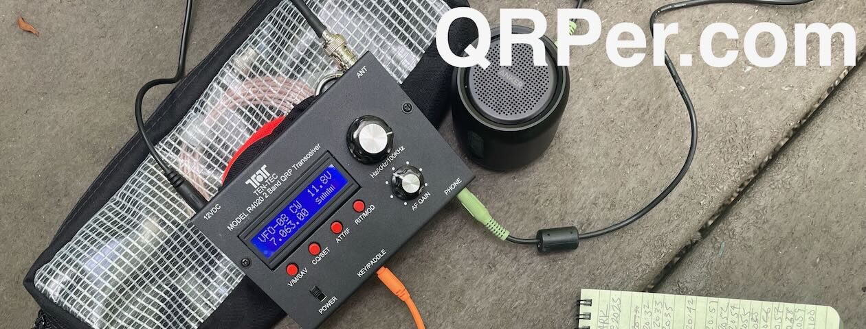
QRP radios, product announcements, reviews, news and more. Low power amateur radio fun!
Please support QRPer by adding us to your whitelist in your ad blocker. Ads are what helps us stay online. All of our ads are ham radio related--no junk, we promise! Thank you!
 I just received an email announcement from Chameleon Antenna, and I thought I’d share it here.


