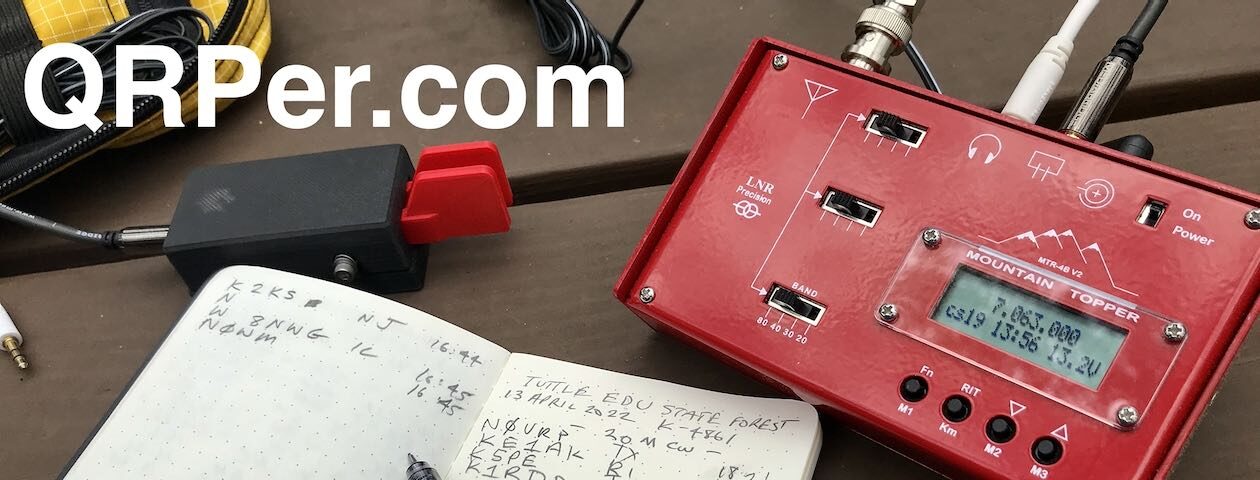
Many thank to Bob (K4RLC) who shares the following guest post:
Visiting VOA Site B: The Edward R. Murrow Transmitting Station
by Bob (K4RLC)
Two week sago, Dale (W4AUV) and I were treated to a “under the hood” visit to the last remaining Voice of America transmitting station in the United States. It is located in eastern North Carolina, and officially known as the “Edward R. Murrow Transmitting Station” part of the “Office of Cuba Broadcasting” in Grimesland, North Carolina. Also, known as “VOA Site B.” This type of shortwave broadcast station is only one of a few remaining worldwide.
[Note: Click on images to enlarge.]
VOA QSL Card showing some of the 38 antennas
This VOA site has been on the air continuously (24/7/365) since the 1963 on-site dedication by President John Kennedy, broadcasting up 8 transmitters at a time on the short wave bands. There are three 250,000 watt and five 500,000 watt GE, Continental and Telefunken transmitters feeding 38 possible antenna configurations, with an Effective Radiated Power of 2,000,000 watts. (There is also a 39th antenna, that is a Dummy Load that will handle 500,000 watts).
The antenna field covers over 6,000 acres of flat, costal plain wetlands, not far from the Atlantic Ocean, so it has a minimal absorption factor and a salt water boost.
Front of VOA Edward R. Murrow Transmitting StationWall plaque in lobby explaining the legacy of Edward R. Murrow, who became known while a CBS Radio correspondent in London, broadcasting during the “Blitz” the infamous bombing of London by the Nazis during WW2 (click image to enlarge)TCI “Curtain” antenna made of 4 dipoles wide & 6 dipoles high, pointed at Cuba. It is controllable in both vertical and horizontal azimuth, depending on the configuration has to up 23dB gain at a 4 degree take off angle
The antennas are fed by over 26 miles of 300 Ohm open line “ladder line” with a minimal SWR and minimal signal loss. The largest antennas are called “Curtain” antennas, given their configuration, of matched horizonal and vertical dipoles suspended between large towers, giving the visual impression of huge curtains.
There are also rhombics, each 6 wave lengths long. The rhombics are not used as often, given their narrow bandwidth and narrow beamwidth. The Curtains can bathe a large geographic area (such as part of a continent) with a very strong signal. The primary broadcast areas for this station are Cuba, Central and South America, and Africa (although the antennas could reach out and touch Russia and eastern Europe, when needed).
Curtain and Rhombic antennas fed from the antenna switching centerGlenn showing Dale features of the GB-6 transmitter console in the large 8 transmitter control bayGB-6 Transmitter Monitor & switchesThe antennas are well constructed & fed with minimal-loss open feed line. Note SWR of 1.1:1 at 75,000 watts !Glenn & Dale studying the transmitter output in the main control room complexLarger control panel for each transmitter. Note image of “Casper the Friendly Ghost” over the meters for GB-7: There are current problems with the transmitter and, in technical terms, “it’s spooked” !Antenna switch controller for matching the 8 transmitters with 38 antenna configs.
Glenn & Dale examining the open feedline from Switching station to antenna field; 8 inch coax to Switching station
Many of the engineers are hams, including Macon (WB4PMQ), the chief engineer. Gary (N2AD) transferred to Greenville when the VOA in Bethany, Ohio closed. (The Bethany VOA site operated during WW2 into Germany, and was referred as the “Ohio Liars” by Hilter !)
Many thanks to Rand (W7UDT) who shares the following guest post:
Velcro, ergo; ergonomics…
by Rand (W7UDT)
Velcro is amazing. It’s so handy. There are so many uses, and creative solutions it provides us. It’ll stick this to that, and that to this. As field operators, it should be part of our kits.
Below are some examples of how I’ve used Velcro.
Question: How do you keep a Android tablet, a 3aH 12v DC pack, a QRP Labs QDX LoBander, all its cords & patches, plus an EmTech ZM2 tuner all nice and tidy? Velcro!
Here’s the old QDX kit…
Here’s the new (velcro’d) QDX kit, complete with EmTech ZM2 tuner, neatly attached on the back of the Tablet, with the QDX and DC Pack. It all fits in a zippered pouch, along with the EFλ/2 antenna, perfect for the QDX.
The new QDX kit even sits at a nice viewing angle, with all of the cords hidden from view. Ergo, ergonomics.
Question: Where & how do you safely place your transceiver on a rugged SOTA/POTA activation, so it won’t get damaged?
How? Velcro! What makes more sense? A precarious rock, or the Molle patch on your pack?
This is my QCX Mini ~ Forty, Velcro’d with two horizontally applied 1” strips, with short cords channeled between them. It secures the perfectly mated 3aH 12v TalentCell battery, to which I applied another velcro strip to hold fast the Palm Pico paddle. Also note the ‘D-shaped’ earpiece/speaker, on the BNC jack. It’s hung and velcro’d just above the paddle.
Since this photo, I’ve added three 2×4” (cut to fit) patches to the front, back and bottom of the QCX Mini & TalentCell, which neatly bundles this little QRP contraption and transforms it into a QRP wonder! Now it all fits in my hand, or attaches firmly to my pack. Dit dit dit daw! Velcro!
A view from Zion NP, in the backcountry… late last Spring. Where my little transceiver tried to commit suicide.
Just sayin’… Velcro may be just the answer you’re looking for.
It has been two and half weeks since the final activation of my winter-break Florida POTA trip. Despite a polar vortex dumping frigid weather into Georgia, I was determined to activate and continue working on my 60 new-to-me park activations goal for 2024.
Google Maps
About an hour and a half from my home QTH is Yuchi Wildlife Management Area (K-3778). The property is managed by the Georgia Department of Wildlife Resources and located next to the Savannah River, the border between the states of Georgia and South Carolina. The site consists mostly of pine uplands and hardwoods with some acreage of openings for wildlife. One can hunt for deer, turkey, small game, and doves as well as utilize the public shooting range located on the property.
Given the time of year, I pulled out my copy of the GA Department of Natural Resources (DNR) Hunting Regulations booklet to see what might be in season right now. Looking at the specific regulations for Yuchi Wildlife Management Area (WMA), only dove season might be an issue while I activated the park. Just to make sure, I contacted the appropriate DNR office and spoke with a helpful employee. He assured me I was not likely run into anyone hunting on a weekday for doves or small game. Of course, Daisy and I would wear blaze orange just to be careful when outside the car.
My time for an activation was tight given my previous commitment as a K3Y/4 operator for the Straight Key Century Club the same afternoon. However, if I got an early enough start, I could make it work.
Daisy and I left the house around 7:30 AM with a quick stop at Lowe’s. I really didn’t want to sit outside in the chilly temperatures; it was 26 degrees according to the weather app. The stop at Lowe’s was to take advantage of an idea generated by a comment from John KK4ITX, an idea I hoped would keep me warm in the car during my activation.
The drive to Yuchi WMA was pleasant. I enjoy driving in rural Georgia. This particular drive went through the towns of Oliver, in which I found another diminutive and cute U.S. Post Office, and Sylvania. Sylvania had that typical small-town feel. I snapped pics of the two murals I saw, something I look for and often find in these communities.
Daisy and I finally arrived at the WMA about one and a half hours after departing Bloomingdale. Before we reached the site, its neighbor, Plant Vogtle, revealed itself.
The plant is a four-unit nuclear power plant managed primarily by Georgia Power. The first two units went online in the late 1980s. Units three and four were the first nuclear units in the United States approved since 2016. Unit Three is operational and Unit Four is supposed to be up and running this year. When all four units are operational, Plant Vogtle will be the largest nuclear power plant in the United States.
Daisy and I found one of the open dirt roads on the property and begin our search for a suitable QTH. Thankfully my Subaru Crosstrek has four-wheel drive as there were soft spots on the road. I wouldn’t want to drive here after a heavy rain.
We drove past plantings of pine as well as areas of hardwoods. After rounding a corner and driving up a slight incline, a wider opening in the canopy appeared. On one side next to a planted pine field, there were several taller deciduous trees now devoid of foliage. It looked to me like a perfect QTH for today’s activation with abundant sunshine. Continue reading Braving the Polar Vortex at Yuchi WMA→
It is Sunday, December 31st, the final day of 2023 and, coincidentally, my winter-break Florida POTA trip. Time to return home. But, as I promised at the end of my last article, the journey is not yet done. A POTA Babe is not going to squander the opportunity to fit in another activation or two on the way home.
Google Maps
Joseph and I loaded up the car one final time after our stay at an Airbnb in Umatilla. I found two parks at which to attempt activations – Lake George State Forest (K-4627) and Pellicer Creek State Conservation Area (K-8367). I chose Lake George because I had yet to activate a state forest and Pellicer because of its proximity to Interstate 95, my route back home.
Lake George State Forest is named (unironically) for Lake George, the second largest lake in Florida. The forest is formed from lands previously used for timber, production of naval stores, cattle grazing, and hunting. It consists of over 20,000 acres of land that offer trails for hiking, cycling, and horseback riding as well as access to hunting, fishing, and birding.
I was unclear as to where to easily access Lake George State Forest. We found the Dexter/Mary Farms Tract entrance at which is a checkpoint for hunters. I learned I needed to purchase a pass before accessing the property and could do so via an off-hours phone number. I really didn’t want to set up shop in proximity to hunting, partially because it seemed like a bad idea (duh) but also I didn’t bring my blaze orange vest on the trip.
We learned of another entrance for the forest and headed that direction. Along the way, we ran into the Barberville Yard Art Emporium who billed itself as offering the largest variety of unique handcrafted outdoor art. I believe it judging from what I saw. Anyone for a giant chicken?
After gawking at the sculptures, we headed to the Fawn Road entrance for Lake George State Forest. This entrance looked more like what I expected.
My brother Joseph donned his bright orange rain poncho and headed up the road for a hike. I, on the other hand, looked for a place to set up and get on the air. I’d need to stick to the road as it was flooded on both sides and I didn’t bring the footwear to tromp through water. Most of the trees were very tall pines. I didn’t think I could get a line on their lowest branches.
Thankfully, I found a few trees of lower height. Once the Tufteln EFRW was installed and my station set up in the road (it was closed to vehicular traffic), I commenced my activation. I ran later than my original estimated start time but the RBN still picked me up.
As usual, I was tight on time. In 30 minutes, I had 20 contacts on 20 meters. Two days ago, I had a contact from Etor F6VMN in France. I figured why not hop onto 17 meters to see if he would hear me again today. Guess what? He did hear me and we logged another contact. The band gave me nine contacts in 10 minutes for a total of 29 contacts at this park.
QSO Map for Lake George State Park http://tools.adventureradio.de/analyzer/
By this time, Joseph had returned from his hike. We packed up and were off to our next destination – Pellicer Creek State Conservation Area. Continue reading The Final Fling in Florida→
Many thanks to Conrad (N2YCH) who shares the following field report:
Conrad’s January Alaska Activation
By: Conrad Trautmann, N2YCH
“Why would you go to Alaska in January?” is what everyone asked me.
I’ve wanted to see the Northern Lights for as long as I can remember. The best time to see the aurora borealis is between late August to late April in Fairbanks, Alaska. Days are short in January, sunrise is at 10:24am local time and sunset is at 3:38pm. It’s twilight before the sun comes up and after it sets so it’s not pitch dark, but it’s mostly dark for about 19 hours a day in Fairbanks at this time of year. Once I began researching, I learned that peak viewing times for the aurora are between 10p and 2a local time even with the extended darkness. Check aurorasaurus.org for more information.
So, the answer to the question is, “The odds are better to catch the Northern Lights in the winter.”
Cold weather and snow doesn’t bother me having lived in Syracuse, New York for ten years. I have experience with winter weather and driving. Fairbanks is one of the best places in the state to see the aurora since it is directly below the “Aurora Oval” and it has over 100 days a year when the aurora is visible. Except for January 12th through the 15th, 2024, when the sky had 98% cloud cover and it was snowing. Aurora viewing was not happening during my visit.
However, this trip was not a total loss by any means. There are things to see and do here, including activating parks! I activated three parks in three days, Denali National Park (K-0022), Chena River State Recreation Area (K-7228) and Creamer’s Field Wildlife Refuge (K-9697). I’ve heard stories from hams in Alaska that propagation can be spotty, that there can be total radio blackouts from solar flares and that bands we don’t usually worry about in the lower 48, like 20 meters, can be useless at times. I packed enough equipment and antennas to activate on any band from 40 meters to 6 meters, up to 100 watts using my Elecraft KX3 with the Elecraft KXPA100 amplifier. On the first day at Denali, I used the amp for the entire activation, but I realized at the end of the day that Thomas, K4SWL, who runs “QRPer.com” wouldn’t be too happy with a field report from “QROer.com” Conrad, N2YCH. To remedy that, I activated my second park using just my KX3, no amp. At K-7228, my first 11 QSO’s were QRP and the park was officially activated using only QRP power. I activated my third park QRO, read on and I’ll explain why.
[Thomas here: For the record, readers, I gave Conrad a Special Use Permit to mention QRO on QRPer! Ha ha! Of course there’s no problem going QRO from time to time!]
Back to propagation, I emailed one of the most active POTA activators in the area prior to my trip to get a sense of what to expect. I highly recommend doing this for anyone planning to travel somewhere and activate. Look at the POTA pages for the parks you want to activate and you’ll surely see a repeat activator with a Kilo award or many visits to those parks. They know the parks the best and also what to expect for propagation. They also share your passion for POTA and are usually very happy to help. The advice I received was that it would be difficult to make contacts on 20 meters and that watching the MUF (maximum usable frequency) charts would serve me well. (Check out hf.dxview.org) The activator said 10 meters would probably be the best band during daylight hours. He was exactly right. Even with QRO power, 20 meter reception in Alaska was noisy and my signal did not get out very far on FT8 watching the pskreporter.com spot map. I moved to 10 meters and quickly had a steady pile up. I stayed on the air until I depleted a 9ah and a 3ah battery I brought. What fun!
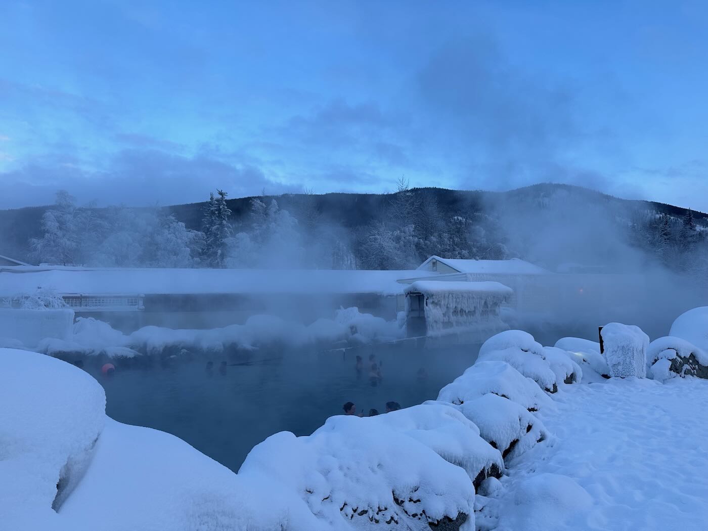
Okay, so for the QRP activation, I was at a trailhead parking area out near the Chena Hot Springs resort. Before the activation, I stopped and did the tour of the Aurora Ice Museum and took a dip in the natural hot springs. I do recommend the hot springs if you ever go to Fairbanks. It was -10F degrees when I was there, quite an experience.
Chena Hot Springs
I intentionally wanted to delay my activation from early morning to closer to sunset to see if operating during the evening gray line passing over would help improve the number of contacts I could get. The short answer is that it was worse…way worse. I went back to activating closer to sunrise on my third day and had similar results as I did the first day, much better. Sunrise wins.
The map above shows my initial ten QRP QSO’s from K-7228.
What really continues to amaze me is just how far my signal can reach with the portable equipment I was using. I brought the Buddipole so I could configure it as a vertical or a dipole. I tried it as a vertical on 20 meters on my first day and as I said, the reception was poor. The beauty of the Buddipole is that I could quickly reconfigure it to a 10 meter dipole. With the tripod, it’s roughly 10’ off the ground. There was no wind to speak of, so I didn’t need to guy it. If there was, I would have used a bungee cord to secure it to the car bumper or side mirror.
It breaks down and fits in the bag I bought with the Buddipole tripod and I tossed it into my checked bag on the plane. With the tripod and mast, it’s just a little too long for the carry-on bag. I could have brought a fiberglass push up mast and wire antennas in my carry-on, but I decided on the checked bag and brought the Buddipole to have as many options as possible. After all, I was traveling all the way to Alaska. Continue reading N2YCH: January POTA Travel in Frozen Alaska!→
It is Friday, December 29th and my winter-break POTA trip is drawing to a close. My brother Joseph and I are spending Friday and Saturday nights at an Airbnb after six days of camping. However, before we do that, I have two more parks to activate today – Green Swamp Wilderness Preserve (K-5330) and Lake Apopka North Shore (K-8353).
Google Maps
Overnight, a cold front began its march through Florida. We woke to temperatures in the low 50’s and a brief glimpse of the rising sun before clouds took over the sky again.
The drive to our first park – Green Swamp Wilderness Preserve – was a pleasant one. The preserve is divided into five management districts. We ended up in the West Tract as that is what I chose in Apple Maps. There are 65 miles of hiking trails though the tract is also used for hunting, canoeing, fishing, camping, and equestrian activities. There is a variety of habitats in the preserve – sandhills, flatwoods, oak hammocks, river swamp, and cypress ponds.
I chose an oak tree just inside the West Tract entrance perfect for the Tufteln EFRW antenna. A sunny location was necessary as the temperature was chilly in the breezy conditions. As I set up, two ladies rode in with their horses. Salty, a red roan, was unsure of Daisy and I at first. However, he eventually settled down enough to walk by and check out my POTA flag. Being a horse owner previously, I have a soft spot for these intelligent and sensitive creatures.
Salty and his owner
When Salty moseyed on, Daisy and I got down to business. I went straight to 20 meters which had no noise at all. In 35 minutes, I had 20 contacts. I needed to wrap up the activation soon to have sufficient time to fit in the second activation today but thought I’d check 17 meters for any DX contacts. I had four contacts on that band including Etor FH4MN in France!
QSO Map for Green Swamp Wilderness Preserve http://tools.adventureradio.de/analyzer/
In short order, I packed up my equipment and we headed to Lake Apopka with a stop at Costco for gas. On the drive, we saw five sandhill cranes. I had heard sandhill cranes at Little Manatee River State Park while walking Daisy one day. But I never spied them. These cranes were wary of me and the pictures I snapped weren’t great.
We finally arrived at Lake Apopka North Shore which features an 11-mile wildlife drive. The park reminded me of the Savannah National Wildlife Refuge back home in which I’ve spent some time. Lake Apopka is the headwaters of the Ocklawaha Chain of Lakes. The North Shore area consists of former farmlands that are now used to clean up Lake Apopka’s waters by circulating the lake water through restored wetlands thereby filtering it before it is returned to the lake. Those former farmlands polluted the lake with phosphorous which caused a host of problems. Continue reading More Surprises in Florida→
Many thanks to Scott (KK4Z) who shares the following post from his blog KK4Z.com:
K4SWL+ Antenna
by Scott (KK4Z)
On a recent post on QRPER.com, Teri KO4WFP was at a park in Florida that did not allow wires (or anything else) in their trees. Many POTA activators use End Fed Half Wave antennas which usually require one end in a tree. While it doesn’t happen at all parks, not being able to hoist your antenna could bust an activation.
I realized this may happen to me even though Georgia appears to be pretty lenient when it comes to such matters, I decided to switch to a park friendly antenna. I have been a fan of QRPER.com for quite some time and occasionally Thomas will repost something from my humble blog. That being said, it was K4SWL that got me started using a random wire antenna. My basis for my antenna was his speaker wire antenna which was a 28.5’ vertical antenna with a 17’ counterpoise. I used it a few times in that configuration and then started to modify it. I call this antenna my K4SWL+.
Some of the differences are I use a push-up pole to get the antenna in the air and at the base I use a 9:1 UnUn and a 1:1 Choke to keep RF out of the radio. A random wire antenna can feed RF back into the coax.
The wire is 14 ga. coated flex weave from The Wireman. This was left over wire from some other antenna projects. When I started this project I was using 22-24 ga. coated wire from SOTABeams but realizing there was no need to save weight, used the heavier wire. This allows me to dual purpose the antenna both for FunComm and EmComm. The insulator at the top is 3D printed with my call-sign and the base is U-type lugs. I find these are the best as I do not have to take the nut off of the antenna studs and if pulled hard will come loose instead of damaging the UnUn. I connect the antenna to the top of the push-up pole with a small Nite-eze “S-biner” size 1.
The 9:1 UnUn comes from Palomar Engineering. I have already created a blog post about how to build it and it can be found here: https://kk4z.com/2022/05/28/91-unun-qro/
Part of this blog post was to bring the different components together into one blog post.
I made two different types but I found the second works much better.
The project is pretty easy, the only caveat is to pay attention to what wire goes where. Putting it all together, you need a push-up pole, a Flag holder and maybe a trailer hitch extender. I will provide links below. The Flag Pole holder I used was not available so the link I used is a probable substitute. I have a trailer hitch on both my truck and my camper, When I pull into a campsite I have a choice of which hitch to use to keep my antenna clear from the trees. With the antenna up, I wrap the antenna wire around the push-up pole from tip to base, to prevent the wire from sagging near the tip. I attach the UnUn and choke to the mast with Stretch Velcro Straps. With my antenna up I have park employees drive by me all day along. Most of the time we exchange a friendly wave and occasionally one will stop by for a chat. I have had zero issues with this antenna at any of the parks I have visited.
How does it play? It has pretty much been a main antenna for just about all of my POTA activations. You can go back through my blog post and see what equipment I used with the antenna and the accompanying QSOMap. You do need an antenna tuner with this antenna and I typically use an LDG Z-11 Pro which I’ve had for 15+ years. The antenna tunes up from 80 to 6 meters and I have run the power as high as 65 watts. I normally run 10-35 watts depending on band conditions. I have tried it on 160 meters and while I can get a match, I don’t think much RF is leaving the antenna. I’ve made a few contact with it on 160. If you like to work 160 meters during a POTA activation, I suggest a Chameleon EmComm II with a 60’ antenna and a 50’ counterpoise. I run it as an inverted L with the apex about 20’ up my push-up pole and the end sloping down to something not a tree. Last time I tied it to the lantern stand at the campsite. It worked pretty well and I was able to make contacts on 160.
If you’re looking for an antenna that you can set up almost anywhere, with little or no hassles, take a look at this one. Don’t forget to check out the short video above. 73 — Scott
It is Thursday, December 28th, the fifth day during my winter-break Florida POTA trip. The day began way too early. The rain was forecast to be a steady downpour where we camped. We woke at 3:30 AM to the light pitter-patter of rain on the tent fly and decided to get on the road before conditions worsened. Before heading to bed, we had put the bulk of our stuff already in the car. It wasn’t long before we had everything packed and were headed north.
Google Maps
I’ll admit it is an obsessive compulsive behavior that I like everything neatly organized. Because it was raining while we decamped, I had hurriedly bundled up the tent & fly and dumped them into the back of the car. That wet tent sitting back there really bothered me. About twenty minutes up the road, I found a shopping center with a covered area just begging to be used to repack that tent neatly as I desired. Now we could resume our trek northward.
Due to the early hour of our departure, we arrived at Alafia River State Park (K-1829) much earlier than time for check-ins. We found our tent site and while driving by, noted the two individuals in it were attempting to do what we did at 3:30 AM. We twiddled our thumbs in the car until 10 AM, grabbed our check-in tag, and headed to our site. Though it was still drizzling a bit, the tent was up and we were installed soon after checking in.
The rain was the harbinger of a cold front headed through Florida. With no sun to warm us, we bundled into our sleeping bags and Daisy into hers and fell asleep for an hour or so.
As I traveled through Florida, I asked myself, “Are there any of these parks to which I’d return?” Alafia River State Park is one for which I’d say “Yes.”
Alafia River State Park is a former phosphate mine, particularly for pebble phosphate. Because phosphate is found relatively close to the surface in the state, Florida is a leader in phosphate mining. The mining at Alafia River State Park created the topography making the park an awesome mountain biking destination with 17 miles of trails from beginner to advanced. The park also offers hiking and equestrian trails.
The campground in this park was the nicest we’d encountered. The sites were well spaced apart and, if so inclined, one could even glamp at this park. The bathrooms were sufficient though from our site, we had to walk the furthest to reach them. However, having that little bit of exercise was good for us and the walk pleasant. The park felt so open because of the topography but the high grasses characteristic of the area also gave the landscape a sense of privacy. The park was not crowded like other locations we had visited. Continue reading The Fun Continues at Alafia River State Park→
It is Wednesday, December 27th, the fourth day of my winter-break Florida POTA trip. The night before, we left the rainfly off the tent and were treated to a gorgeous view of the waxing gibbous moon. My brother Joseph was delighted and, while I worked on my article for that day, he lay back on his new Thermarest sleeping pad and took in the night sky.
Full moon through tent top: Collier-Seminole Photo by Joseph Leffek
I opted to sleep in until 8 AM enjoying the cooler morning air. Then it was time to get a shower and rid myself of four days of grunge. Breakfast was a leisurely affair. The mosquitos were less prevalent so I let Daisy relax on the tarp next to us and watch the comings and goings of our neighbors. But by 11 AM, I was getting antsy – time to head out and attempt two activations.
Google Maps
We drove east on the Tamiami Trail/US Highway 41 heading toward Big Cypress National Preserve (K-0659). The road is straight with guardrails on both sides as there is either wetlands or a canal on either side of it.Occasionally there is a break in the foliage and the mangroves come into view.
Bird life is abundant in the area. We saw egrets, wood storks, cormorants, anhingas, and, my favorite bird, kingfishers. At my previous QTH in Savannah, I heard kingfishers at times but rarely saw them. On this drive, I saw eight or nine perched on the utility wires beside the road and gleefully noted each one.
We stopped at the Nathaniel P. Reed Visitor Center to pick up a map and figure out a place for my activation.
Big Cypress National Preserve Visitor Center
I chose the H.P. Williams Roadside Park as it was the closest place to the visitor center and had the opportunity for wildlife viewing. The parking lot was crowded and it was easy to see why. The site has a boardwalk from which one can view alligators and a nice picnic area in which several families ate lunch.
I found a tree away from the crowd and set-up the Tufteln EFRW. In the process of doing so, a little girl came up and peppered me with questions. Then her father and sister joined us. As soon as I was set up, I let them hear my callsign as well as the two girls’ names in Morse Code. It was nice to share my love of the hobby as well as Daisy, on whom they lavished some attention. What I think was a yellow-rumped warbler also paid Daisy and I a visit during the activation. Continue reading An Awesome Day for Parks On The Air→
Many thanks to Eric (WD8RIF), who shares the following field report via his website WD8RIF.com:
by Eric (WD8RIF)
On Saturday, November 4, 2023, I performed a successful bicycle-portable two-fer activation of Lake Hope State Park (K-1968) and Zaleski State Forest (K-5455) in Ohio as part of the Parks on the Air (POTA) program.
On a beautiful and warm early November afternoon, I bicycled the Moonville Rail Trail, on what used to the Marietta and Cincinnati Railroad (wikipedia article) right-of-way, from the tiny village of Mineral, through Zaleski State Forest, diverting from the rail trail near Lake Hope to ride to the Mountain Bike Trailhead overlooking Lake Hope within the state park, for my two-fer activation of the state park and state forest. I was carrying my KX2 Mini Travel Kit on the bicycle, and I was pulling my little dog Theo in a trailer behind the bicycle.
This 10-mile rail trail takes visitors through the beautiful woodlands of southeast Ohio, including Zaleski State Forest; the communities of Zaleski and Mineral; and the Lake Hope State Park wetland areas. The corridor holds water on both sides of the trail, creating a wetland area that is home to numerous species of flora and fauna.
Additional points of interest along this trail are two unique and historic tunnels. King’s Hollow Tunnel (also known as King Switch Tunnel) is a 120-foot structure carved through the rock and lined by a series of 12×12 wooden beams. The Moonville Tunnel is brick-lined and has a long history of train accidents, earning the tunnel a reputation for being haunted.
After parking my car at Mineral, I began my ride on the leaf-covered Moonville Rail Trail at 1645 UTC and soon encountered the first landmark of the ride: the 120′ long, timber-lined King’s Hollow Tunnel.
Riding through the very dark tunnel and continuing west on the Moonville Rail Trail, I soon came to a succession of ponds. Rumor has it that a pair of nesting bald eagles fish these ponds, but I have yet to see them.
Ponds along the Moonville Rail TrailA small bit of railroad history along the Moonville Rail Trail.More leaf-covered Moonville Rail Trail
Continuing west, and now being well inside Zaleski State Forest, I soon came upon the brick-lined Moonville Tunnel.
Entering Moonville Tunnel
After passing through the Moonville Tunnel, I was forced to divert from the Moonville Rail Trail and follow a gravel road before re-joining the Moonville Rail Trail about a mile further on. (When CSX abandoned the rail line in the early 1990s, they took everything: rails, ties, ballast, and all the bridges. Two of the bridges west of Moonville Tunnel have yet to be replaced.) I was pleased that my new narrow knobby bicycle tires were reassuring on the rough gravel road, but I can’t say Theo in the trailer enjoyed this portion of the ride much.
QRP radios, product announcements, reviews, news and more. Low power amateur radio fun!
Please support QRPer by adding us to your whitelist in your ad blocker. Ads are what helps us stay online. All of our ads are ham radio related--no junk, we promise! Thank you!